Long Clump

Wood, Forest in Hampshire Test Valley

England

Long Clump

Ford and footbridge in Foxes Lane River Blackwater just above the 2 feet mark on the depth gauge.
Ford and footbridge in Foxes Lane Credit: David Martin

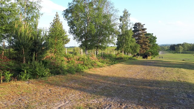
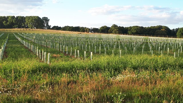
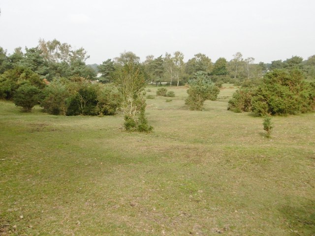
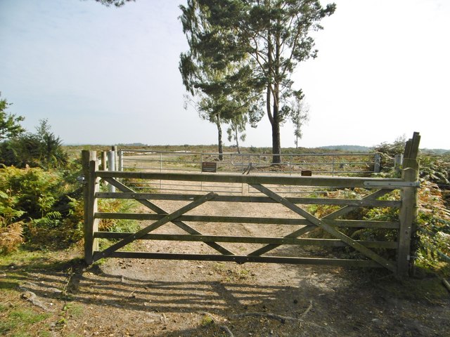
Long Clump is a picturesque woodland located in Hampshire, England. Situated in the heart of the New Forest National Park, Long Clump is a popular destination for nature enthusiasts and outdoor lovers alike. The woodland covers an area of approximately 10 hectares and is characterized by its dense native tree species.

As its name suggests, Long Clump is known for its long and slender shape, stretching over half a mile in length. The woodland is primarily made up of oak and beech trees, creating an enchanting canopy that provides shade and shelter for a variety of wildlife.

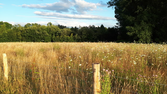
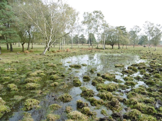
The forest floor is covered in a rich carpet of bluebells during the springtime, creating a stunning display of color and fragrance. In addition to bluebells, Long Clump is also home to a diverse range of flora, including ferns, mosses, and wildflowers.

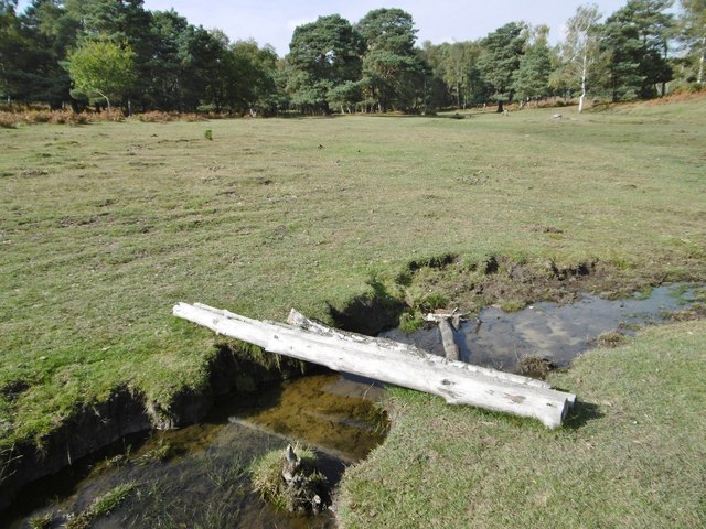
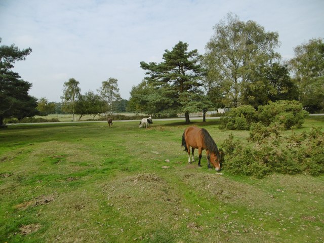
The woodland is a haven for many species of birds, including woodpeckers, owls, and various songbirds. Visitors may also catch a glimpse of deer, rabbits, and squirrels, which are commonly spotted in the area. Long Clump offers several walking trails that allow visitors to explore the woodland and discover its natural beauty at their own pace.

Overall, Long Clump in Hampshire is a captivating woodland that offers a peaceful retreat and a chance to immerse oneself in the stunning natural surroundings of the New Forest National Park.

If you have any feedback on the listing, please let us know in the comments section below.
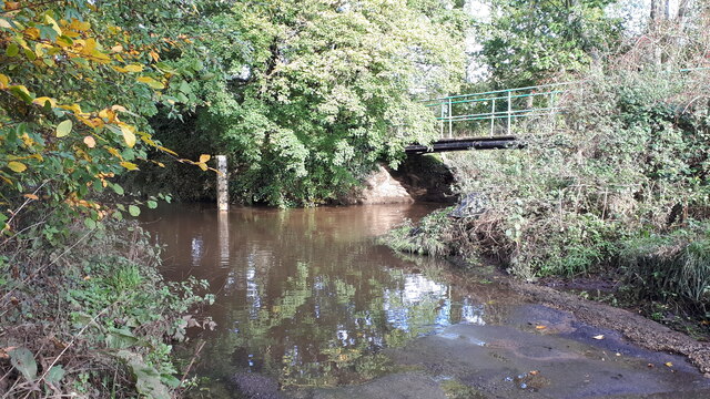
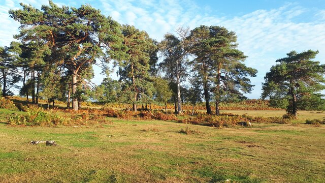
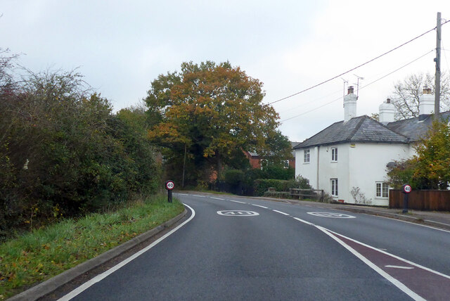
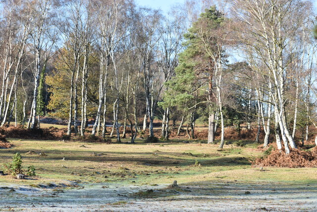
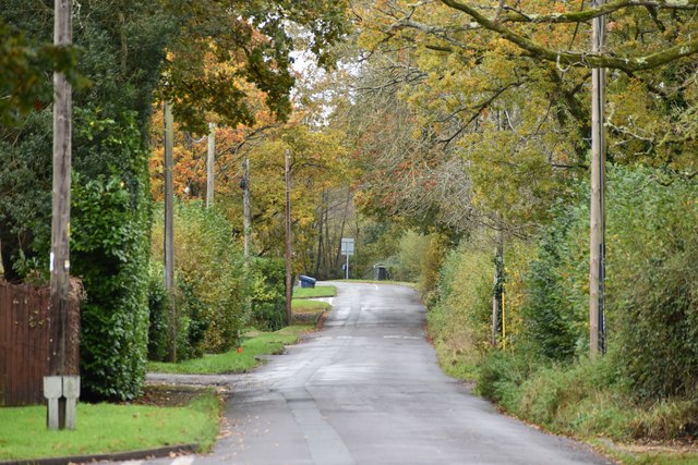
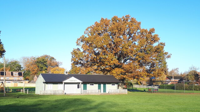
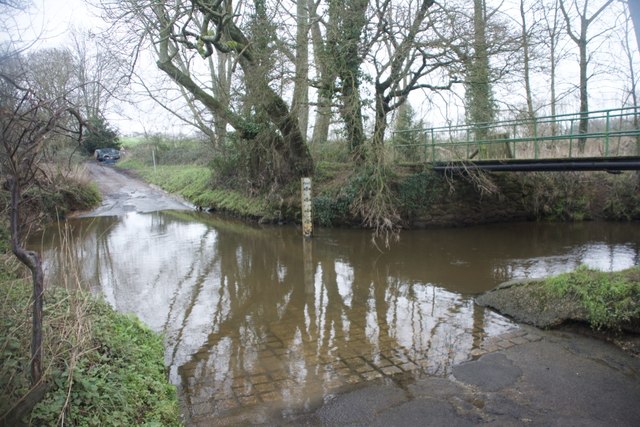
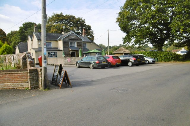
Long Clump Images

Images are sourced within 2km of 50.966256/-1.5680213 or Grid Reference SU3018. Thanks to Geograph Open Source API. All images are credited.

Ford and footbridge in Foxes Lane River Blackwater just above the 2 feet mark on the depth gauge.
Ford and footbridge in Foxes Lane
River Blackwater just above the 2 feet mark on the depth gauge.
Trees near Blackhill with, Foxbury heathland restoration beyond
A36, West Wellow Towards Salisbury.
A36, West Wellow
Towards Salisbury.
A36, West Wellow Towards Salisbury, with the Red Rover pub on the left.
A36, West Wellow
Towards Salisbury, with the Red Rover pub on the left.
Sunlight and frost on Half Moon Common
Summer evening at Blackhill Looking along the fence of the National Trust's Foxbury heathland restoration project.
Summer evening at Blackhill
Looking along the fence of the National Trust's Foxbury heathland restoration project.
Maury's Lane, looking towards the A36
Cricket pavilion on the green at West Wellow Home of Wellow and Plaitford Cricket Club.
Cricket pavilion on the green at West Wellow
Home of Wellow and Plaitford Cricket Club.
West Wellow Ford This ford on the River Blackwater is found on Foxes Lane near West Wellow. A video of the ford can be seen at:
<span class="nowrap"><a title="https://youtu.be/wYqMU-7Vmbs" rel="nofollow ugc noopener" href="https://youtu.be/wYqMU-7Vmbs">Link</a><img style="margin-left:2px;" alt="External link" title="External link - shift click to open in new window" src="https://s1.geograph.org.uk/img/external.png" width="10" height="10"/></span>
West Wellow Ford
This ford on the River Blackwater is found on Foxes Lane near West Wellow. A video of the ford can be seen at: LinkExternal link
New planting between Foxes Lane and Wellow Church Hard to tell what is in the protective tubes as yet: possibly vines? Seen through a new deer fence.
New planting between Foxes Lane and Wellow Church
Hard to tell what is in the protective tubes as yet: possibly vines? Seen through a new deer fence.
Field view from newly-fenced footpath Previously a footpath across an open field, this has recently been fenced in.  For the other side of the path, see <a href="https://www.geograph.org.uk/photo/6542801">SU2920 : New planting between Foxes Lane and Wellow Church</a>.
Field view from newly-fenced footpath
Previously a footpath across an open field, this has recently been fenced in. For the other side of the path, see SU2920 : New planting between Foxes Lane and Wellow Church.
Canada, Rockingham Arms Pub with restaurant on Canada Road; bar to left, with drinking area left, dining right; TV, garden. Cask ales on offer at my visit: Upham Punter, Stakes. <span class="nowrap"><a title="http://whatpub.com/pubs/HAS/00095/rockingham-arms-canada" rel="nofollow ugc noopener" href="http://whatpub.com/pubs/HAS/00095/rockingham-arms-canada">Link</a><img style="margin-left:2px;" alt="External link" title="External link - shift click to open in new window" src="https://s1.geograph.org.uk/img/external.png" width="10" height="10"/></span>
Canada, Rockingham Arms
Pub with restaurant on Canada Road; bar to left, with drinking area left, dining right; TV, garden. Cask ales on offer at my visit: Upham Punter, Stakes. LinkExternal link
Half Moon Common, footbridge An informal bridge over a ditch, comprising four birch trunks.
Half Moon Common, footbridge
An informal bridge over a ditch, comprising four birch trunks.
Half Moon Common An "adjacent common" - sharing similar characteristics with the nearby New Forest, but not Crown land; owned by the National Trust. Land at this end of the common is undulating grassland, with patches of scrub and wet gullies.
Half Moon Common
An "adjacent common" - sharing similar characteristics with the nearby New Forest, but not Crown land; owned by the National Trust. Land at this end of the common is undulating grassland, with patches of scrub and wet gullies.
Half Moon Common, pond
Half Moon Common, ponies New Forest ponies grazing next to Black Hill Road.
Half Moon Common, ponies
New Forest ponies grazing next to Black Hill Road.
Furzley, Swallowfields Farm Farm with shop on Black Hill Road. <span class="nowrap"><a title="http://www.swallowfieldsfarmproduce.co.uk/#contact" rel="nofollow ugc noopener" href="http://www.swallowfieldsfarmproduce.co.uk/#contact">Link</a><img style="margin-left:2px;" alt="External link" title="External link - shift click to open in new window" src="https://s1.geograph.org.uk/img/external.png" width="10" height="10"/></span>
Furzley, Swallowfields Farm
Farm with shop on Black Hill Road. LinkExternal link
Half Moon Common, gates Gates at the entrance to the National Trust's Foxbury land. The former plantation is being cleared and restored to its original heathland condition. <span class="nowrap"><a title="http://www.nationaltrust.org.uk/article-1355782710954/" rel="nofollow ugc noopener" href="http://www.nationaltrust.org.uk/article-1355782710954/">Link</a><img style="margin-left:2px;" alt="External link" title="External link - shift click to open in new window" src="https://s1.geograph.org.uk/img/external.png" width="10" height="10"/></span>
Half Moon Common, gates
Gates at the entrance to the National Trust's Foxbury land. The former plantation is being cleared and restored to its original heathland condition. LinkExternal link
Show me another place!

Long Clump is located at Grid Ref: SU3018 (Lat: 50.966256, Lng: -1.5680213)

Administrative County: Hampshire

District: Test Valley

Police Authority: Hampshire

What 3 Words

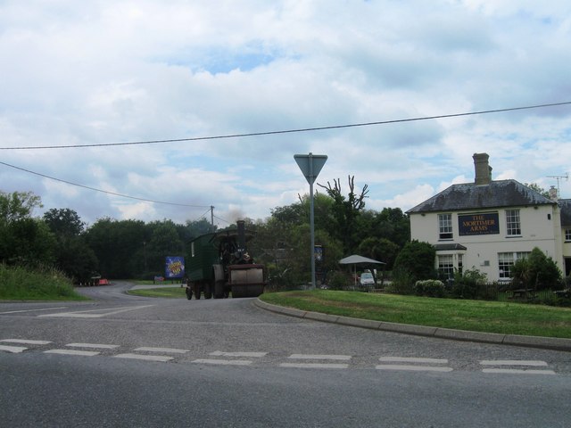
///mount.drape.lordship. Near West Wellow, Hampshire

Related Wikis

Wellow, Hampshire

Wellow is a village and civil parish in Hampshire, England that falls within the Test Valley district. The village lies just outside the New Forest, across...

Paultons Park

Paultons Park is an amusement park located in the New Forest National Park, near the village of Ower, in Hampshire, England, with over 70 rides and attractions...

Storm Chaser (Paultons Park)

Storm Chaser is a steel spinning roller coaster located at Paultons Park in Hampshire, England. The coaster debuted alongside the new £12 million Tornado...

Plaitford

Plaitford is a small village and former civil parish, now in the parish of Melchet Park and Plaitford, in the Test Valley district of Hampshire, England...

Ower

Ower is a hamlet in the New Forest district of Hampshire, England. Its nearest towns are Totton – approximately 3 miles (4.8 km) to the southeast, and...

Embley (school)

Embley School (formerly Hampshire Collegiate School) is an independent day and boarding school for both girls and boys aged 2 to 18 located in Embley Park...

Embley Park

Embley Park, in Wellow (near Romsey, Hampshire), was the family home of Florence Nightingale from 1825 until her death in 1910. It is also where Florence...

Embley, Hampshire

Embley is a small village in the Test Valley district of Hampshire, England in the United Kingdom. Its nearest town is Romsey, which lies approximately...

Nearby Amenities

Located within 500m of 50.966256,-1.5680213
Turning Circle
Lat/Long: 50.9669532/-1.5647488
Speed Camera
Maxspeed: 40 mph
Lat/Long: 50.962974/-1.5663138
Speed Camera
Maxspeed: 40 mph
Lat/Long: 50.9627972/-1.5657335
Bus Stop
Whinwhistle Corner
Bus: yes
Naptan AtcoCode: 1900HA080001
Naptan Bearing: SE
Naptan CommonName: Whinwhistle Corner
Naptan Crossing: Salisbury Road
Naptan NaptanCode: hamajgjg
Naptan Street: Whinwhistle Road
Naptan Verified: no
Source: naptan_import
Lat/Long: 50.9627422/-1.5655581
Bus Stop
Whinwhistle Corner
Bus: yes
Naptan AtcoCode: 1900HA080002
Naptan Bearing: NW
Naptan CommonName: Whinwhistle Corner
Naptan Crossing: Salisbury Road
Naptan NaptanCode: hamajgjm
Naptan Street: Whinwhistle Road
Naptan Verified: no
Source: naptan_import
Lat/Long: 50.9625342/-1.5652325
Bus Stop
Blackhill Road
Bus: yes
Naptan AtcoCode: 1900HA100148
Naptan Bearing: SE
Naptan CommonName: Blackhill Road
Naptan Crossing: Blackhill Road
Naptan NaptanCode: hamajdpg
Naptan Street: Crawley Hill
Naptan Verified: no
Source: naptan_import
Lat/Long: 50.9640618/-1.5697752
Post Box
Collection Plate: CP7
Collection Times: Mo-Fr 16:30; Sa 08:45
Operator: Royal Mail
Post Box Type: lamp
Ref: SO51 73
Royal Cypher: EIIR
Royal Cypher Wikidata: Q33102113
Lat/Long: 50.9676495/-1.5631905
Post Box
Collection Plate: CP7D
Collection Times: Mo-Fr 09:00; Sa 07:00
Operator: Royal Mail
Operator Wikidata: Q638098
Post Box Type: lamp
Ref: SO51 541D
Royal Cypher: EIIR
Royal Cypher Wikidata: Q33102113
Lat/Long: 50.9635291/-1.568543
Barrier: cattle_grid
Lat/Long: 50.963507/-1.5684977
Direction: SSW
Generator Method: photovoltaic
Generator Output Electricity: yes
Generator Solar Modules: 11
Generator Source: solar
Generator Type: solar_photovoltaic_panel
Location: roof
Power: generator
Lat/Long: 50.9687729/-1.564966
Direction: SSW
Generator Method: photovoltaic
Generator Output Electricity: yes
Generator Solar Modules: 12
Generator Source: solar
Generator Type: solar_photovoltaic_panel
Location: roof
Power: generator
Lat/Long: 50.9685554/-1.5628257
Direction: SW
Generator Method: photovoltaic
Generator Output Electricity: yes
Generator Solar Modules: 4
Generator Source: solar
Generator Type: solar_photovoltaic_panel
Location: roof
Power: generator
Lat/Long: 50.965722/-1.5672048
Direction: 145
Generator Method: photovoltaic
Generator Output Electricity: yes
Generator Solar Modules: 3
Generator Source: solar
Generator Type: solar_photovoltaic_panel
Location: roof
Power: generator
Lat/Long: 50.9660475/-1.5659168
Direction: S
Generator Method: photovoltaic
Generator Output Electricity: yes
Generator Solar Modules: 12
Generator Source: solar
Generator Type: solar_photovoltaic_panel
Location: roof
Power: generator
Lat/Long: 50.96575/-1.5673056
Direction: 235
Generator Method: photovoltaic
Generator Output Electricity: yes
Generator Solar Modules: 14
Generator Source: solar
Generator Type: solar_photovoltaic_panel
Location: roof
Power: generator
Lat/Long: 50.9646706/-1.5657574
Direction: 215
Generator Method: photovoltaic
Generator Output Electricity: yes
Generator Solar Modules: 8
Generator Source: solar
Generator Type: solar_photovoltaic_panel
Location: roof
Power: generator
Lat/Long: 50.9683585/-1.56375
Direction: 145
Generator Method: photovoltaic
Generator Output Electricity: yes
Generator Solar Modules: 9
Generator Source: solar
Generator Type: solar_photovoltaic_panel
Location: roof
Power: generator
Lat/Long: 50.9660171/-1.5659813
Drinking Water
Access: customers
Bottle: yes
Fee: no
Operator: Blackhill Cottage Caravan Site
Wheelchair: limited
Lat/Long: 50.9633553/-1.5697652
Barrier: cattle_grid
Lat/Long: 50.9630897/-1.570068
Whinwhistle Corner
Place: hamlet
Lat/Long: 50.9628336/-1.5660202
Noexit: yes
Lat/Long: 50.963124/-1.5672394
The data included in this document is from www.openstreetmap.org. The data is made available under ODbL.

Have you been to Long Clump?

Leave your review of Long Clump below (or comments, questions and feedback).