Dersingham
Settlement in Norfolk King's Lynn and West Norfolk
England
Dersingham
Dersingham is a picturesque village located on the eastern coast of England, in the county of Norfolk. Situated approximately 12 miles north of King's Lynn, Dersingham is nestled within the Norfolk Coast Area of Outstanding Natural Beauty, offering residents and visitors alike stunning natural landscapes and a tranquil atmosphere.
The village is known for its rich history, dating back to Roman times, with evidence of a Roman settlement discovered in the area. Today, Dersingham retains its rural charm, with traditional village architecture and a close-knit community.
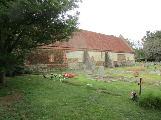
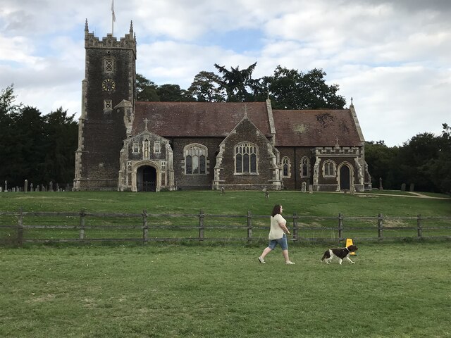
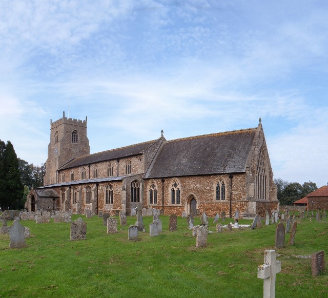
One of the notable landmarks in Dersingham is the St. Nicholas Church, a beautiful medieval church that stands as a testament to the village's heritage. The church's tower dominates the skyline and offers panoramic views of the surrounding countryside.
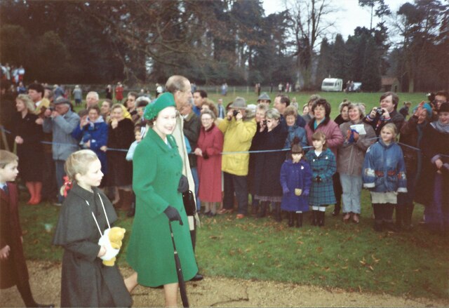
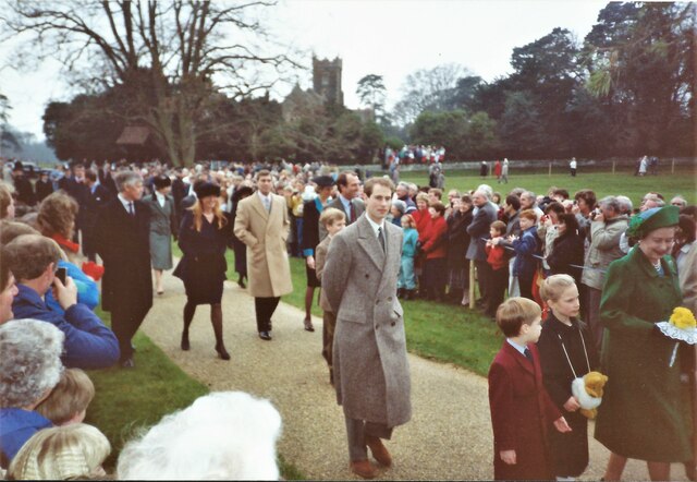
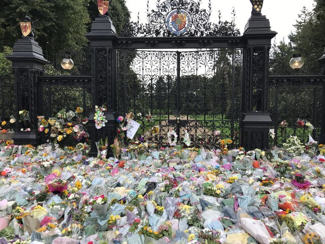
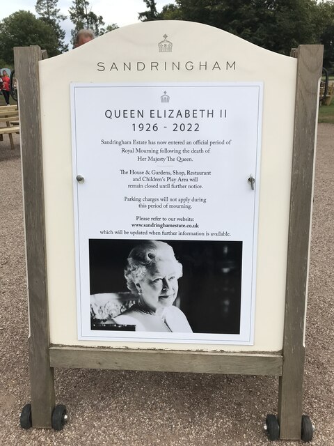
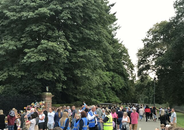
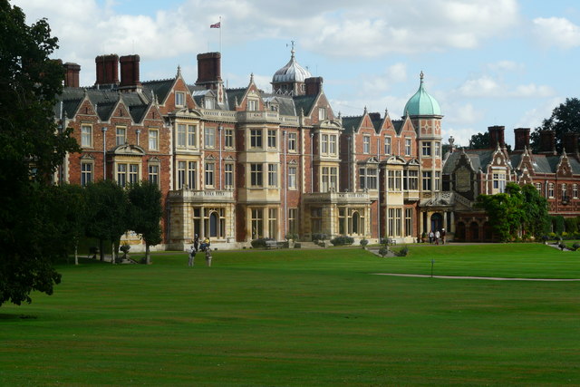
Dersingham also benefits from its proximity to the Royal Sandringham Estate, the private residence of the British royal family. The estate's stunning gardens and woodlands are open to the public, providing an opportunity for visitors to explore the natural beauty that surrounds the village.
The village itself offers a range of amenities, including a primary school, a post office, a library, and several local shops and businesses. There are also a number of pubs and restaurants, where residents and visitors can enjoy traditional English fare.
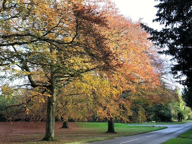
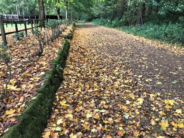
Dersingham's location within the Norfolk Coast Area of Outstanding Natural Beauty provides ample opportunities for outdoor activities, such as hiking, cycling, and birdwatching. The nearby Dersingham Bog Nature Reserve is home to a diverse range of flora and fauna, making it a popular spot for nature enthusiasts.
In summary, Dersingham is a charming village that combines a rich history, natural beauty, and a close-knit community, making it an ideal destination for those seeking a peaceful and idyllic retreat in the heart of Norfolk.
If you have any feedback on the listing, please let us know in the comments section below.
Dersingham Images
Images are sourced within 2km of 52.845404/0.502993 or Grid Reference TF6830. Thanks to Geograph Open Source API. All images are credited.


Dersingham is located at Grid Ref: TF6830 (Lat: 52.845404, Lng: 0.502993)
Administrative County: Norfolk
District: King's Lynn and West Norfolk
Police Authority: Norfolk
What 3 Words
///screen.reduction.carbonate. Near Dersingham, Norfolk
Nearby Locations
Related Wikis
Dersingham
Dersingham is a village and civil parish in the English county of Norfolk. It is situated some 12 kilometres (7.5 mi) north of the town of King's Lynn...
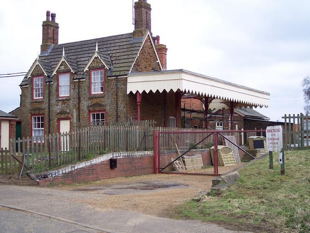
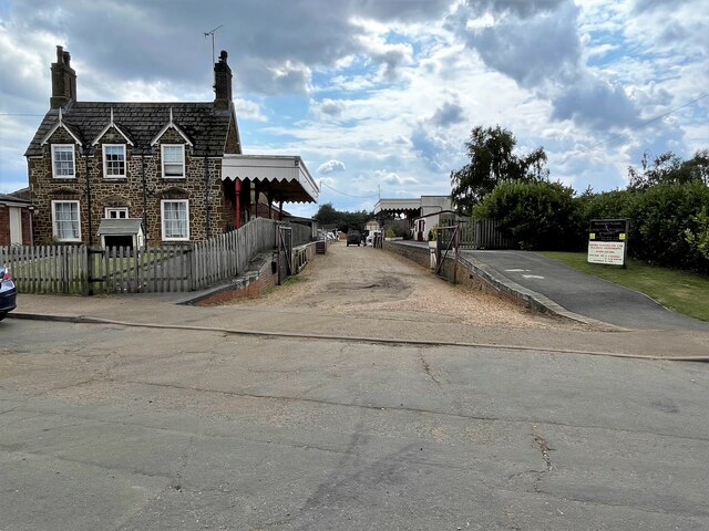
Dersingham railway station
Dersingham was a railway station on the King's Lynn to Hunstanton line which served the village of Dersingham, a few miles north of King's Lynn in North...

Sandringham House
Sandringham House is a country house in the parish of Sandringham, Norfolk, England. It is one of the royal residences of Charles III, whose grandfather...
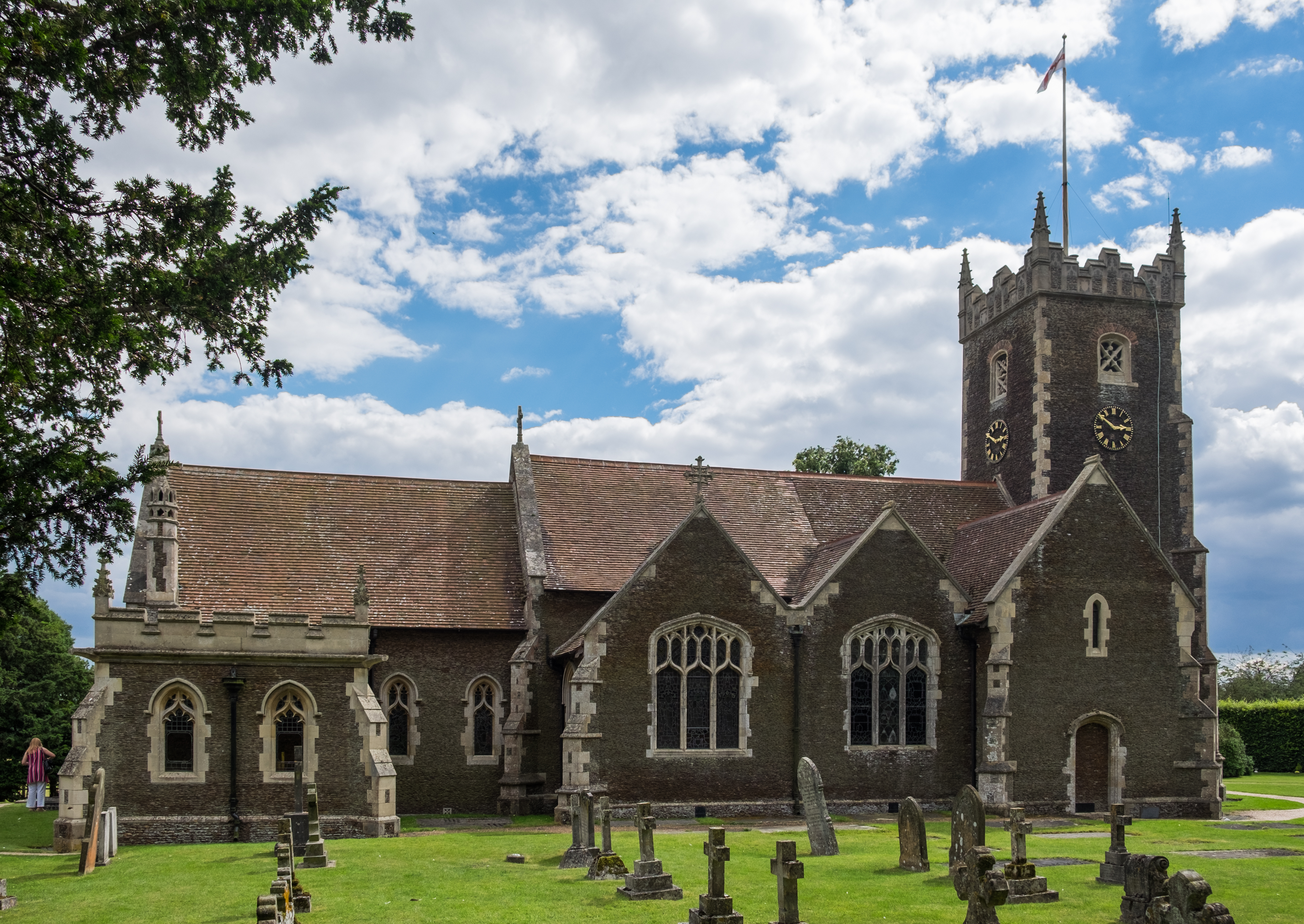
St Mary Magdalene Church, Sandringham
St Mary Magdalene Church is a church in Sandringham, Norfolk, England, located just to the southwest of Sandringham House. Members of the British Royal...

Ingoldisthorpe
Ingoldisthorpe is a village and civil parish in the north-west of the English county of Norfolk. It is located approximately 9 miles (14 km) north-east...
Sandringham, Norfolk
Sandringham is a village and civil parish in the north of the English county of Norfolk. The village is situated 2 kilometres (1.2 mi) south of Dersingham...

York Cottage
York Cottage is a house in the grounds of Sandringham House in Norfolk, England. == History == The cottage was originally called the Bachelor's Cottage...

Dersingham Bog
Dersingham Bog is a 159.1-hectare (393-acre) biological and geological Site of Special Scientific Interest in Norfolk, England. It is a Nature Conservation...
Nearby Amenities
Located within 500m of 52.845404,0.502993Have you been to Dersingham?
Leave your review of Dersingham below (or comments, questions and feedback).