Astley Gorse

Wood, Forest in Warwickshire North Warwickshire

England

Astley Gorse

St Michael's Church, New Arley The Arley Colliery Company began mining coal locally in 1905. In the 1920s it built a company village of six hundred houses, called New Arley, and, in 1928, a company church to serve it, the Church of England parish church of St Michael. The style could perhaps be called colliers' baroque. See the Victoria County History of Warwickshire, Vol. 6 pp8-12, which doesn't give the name of the architect <span class="nowrap"><a title="https://www.british-history.ac.uk/vch/warks/vol6/pp8-12" rel="nofollow ugc noopener" href="https://www.british-history.ac.uk/vch/warks/vol6/pp8-12">Link</a><img style="margin-left:2px;" alt="External link" title="External link - shift click to open in new window" src="https://s1.geograph.org.uk/img/external.png" width="10" height="10"/></span> .
St Michael's Church, New Arley Credit: A J Paxton

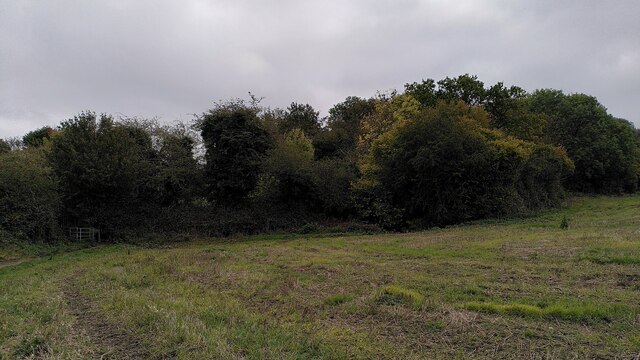
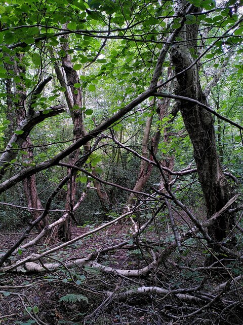
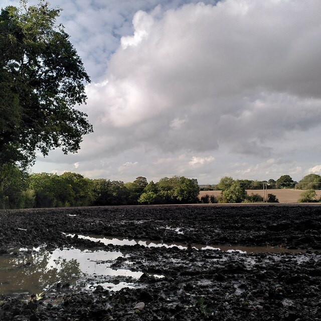
Astley Gorse is a picturesque woodland located in Warwickshire, England. Situated near the village of Astley, it covers an area of approximately 200 acres and is known for its rich biodiversity and natural beauty. The gorse, a spiny evergreen shrub, dominates the landscape with its vibrant yellow flowers that bloom throughout the year.

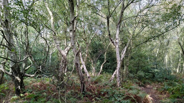
The woodland is home to a diverse range of plant and animal species. Ancient oak trees are scattered across the area, providing shelter and nesting sites for various bird species such as woodpeckers and owls. The forest floor is adorned with a colorful carpet of bluebells, wild garlic, and ferns during the spring season.

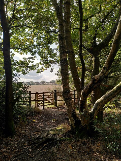
Astley Gorse offers several walking trails and pathways, allowing visitors to explore its tranquil surroundings. The peaceful atmosphere and the sound of birdsong make it a popular spot for nature enthusiasts and walkers alike. It is also a favored destination for photographers, offering countless opportunities to capture the beauty of wildlife and flora.

The woodland is managed by local authorities to preserve its natural habitat and promote sustainable conservation practices. In recent years, efforts have been made to restore and maintain the biodiversity of the area, including the reintroduction of native plant species and the creation of wildlife habitats.

Astley Gorse, with its stunning landscapes and abundant wildlife, offers a serene escape from the hustle and bustle of urban life. Whether visitors seek a peaceful walk, a chance to observe wildlife, or simply a moment of tranquility in nature, this woodland in Warwickshire provides a welcome retreat.

If you have any feedback on the listing, please let us know in the comments section below.
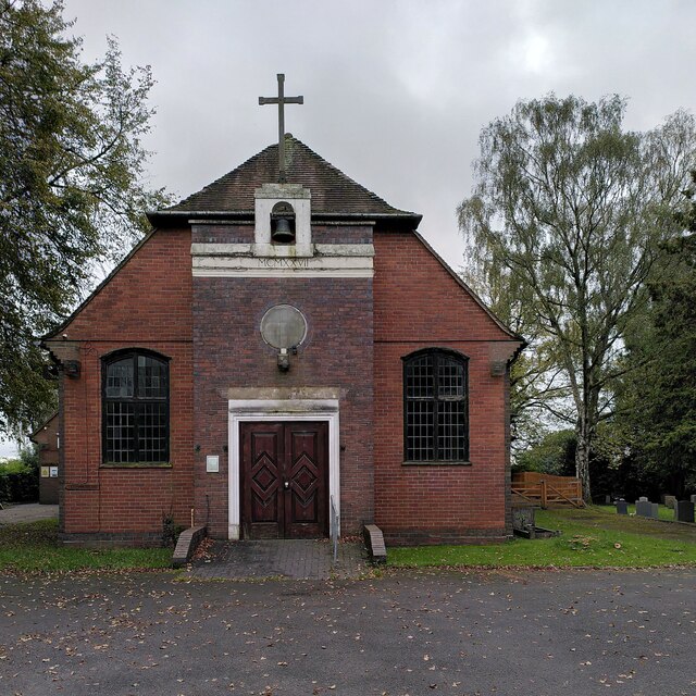
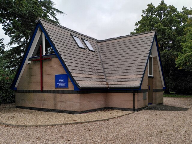
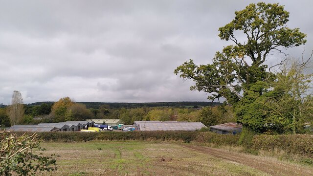
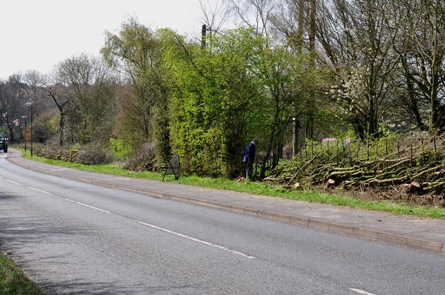
Astley Gorse Images

Images are sourced within 2km of 52.502921/-1.5616118 or Grid Reference SP2989. Thanks to Geograph Open Source API. All images are credited.

St Michael's Church, New Arley The Arley Colliery Company began mining coal locally in 1905. In the 1920s it built a company village of six hundred houses, called New Arley, and, in 1928, a company church to serve it, the Church of England parish church of St Michael. The style could perhaps be called colliers' baroque. See the Victoria County History of Warwickshire, Vol. 6 pp8-12, which doesn't give the name of the architect <span class="nowrap"><a title="https://www.british-history.ac.uk/vch/warks/vol6/pp8-12" rel="nofollow ugc noopener" href="https://www.british-history.ac.uk/vch/warks/vol6/pp8-12">Link</a><img style="margin-left:2px;" alt="External link" title="External link - shift click to open in new window" src="https://s1.geograph.org.uk/img/external.png" width="10" height="10"/></span> .
St Michael's Church, New Arley
The Arley Colliery Company began mining coal locally in 1905. In the 1920s it built a company village of six hundred houses, called New Arley, and, in 1928, a company church to serve it, the Church of England parish church of St Michael. The style could perhaps be called colliers' baroque. See the Victoria County History of Warwickshire, Vol. 6 pp8-12, which doesn't give the name of the architect LinkExternal link .
Catholic church of St Joseph, New Arley The church stands at the western end of the former mining village, an area known as Gun Hill or Spring Hill. It was built in 1996 to designs by John D Holmes. It replaced a nearby timber church of the 1920s. See the Taking Stock site, which describes the new church as 'flexible in character and modest in architectural aspiration.' <span class="nowrap"><a title="https://taking-stock.org.uk/building/arley-st-joseph/" rel="nofollow ugc noopener" href="https://taking-stock.org.uk/building/arley-st-joseph/">Link</a><img style="margin-left:2px;" alt="External link" title="External link - shift click to open in new window" src="https://s1.geograph.org.uk/img/external.png" width="10" height="10"/></span>
Catholic church of St Joseph, New Arley
The church stands at the western end of the former mining village, an area known as Gun Hill or Spring Hill. It was built in 1996 to designs by John D Holmes. It replaced a nearby timber church of the 1920s. See the Taking Stock site, which describes the new church as 'flexible in character and modest in architectural aspiration.' LinkExternal link
Arley industrial estate and Arley Wood The industrial units are viewed from the path from Spring Hill to Daffern's Wood; they occupy the site of Arley Colliery, which closed in 1968. Arley Wood blankets the horizon. This ancient woodland was replanted with conifers in the 1960s, apparently to provide pit props for the mine; see <a href="https://www.geograph.org.uk/photo/7630660">SP2891 : A young oak tree among the conifers, Arley Wood</a>.
Arley industrial estate and Arley Wood
The industrial units are viewed from the path from Spring Hill to Daffern's Wood; they occupy the site of Arley Colliery, which closed in 1968. Arley Wood blankets the horizon. This ancient woodland was replanted with conifers in the 1960s, apparently to provide pit props for the mine; see SP2891 : A young oak tree among the conifers, Arley Wood.
Daffern's Wood, New Arley Situated on the western edge of New Arley, Daffern's Wood is roughly triangular in shape and about three hectares in extent. According to the Warwickshire Wildlife Trust it is an ancient semi-natural wood which has been documented back to around 1600. It is a Local Nature Reserve. <span class="nowrap"><a title="https://www.warwickshirewildlifetrust.org.uk/DaffernsWood" rel="nofollow ugc noopener" href="https://www.warwickshirewildlifetrust.org.uk/DaffernsWood">Link</a><img style="margin-left:2px;" alt="External link" title="External link - shift click to open in new window" src="https://s1.geograph.org.uk/img/external.png" width="10" height="10"/></span>. A public footpath passes below the wood, which can be entered from the stile visible at the left of the picture.
Daffern's Wood, New Arley
Situated on the western edge of New Arley, Daffern's Wood is roughly triangular in shape and about three hectares in extent. According to the Warwickshire Wildlife Trust it is an ancient semi-natural wood which has been documented back to around 1600. It is a Local Nature Reserve. LinkExternal link. A public footpath passes below the wood, which can be entered from the stile visible at the left of the picture.
Birch and hazel in Daffern's Wood For more information on this Local Nature Reserve see <a href="https://www.geograph.org.uk/photo/7635597">SP2889 : Daffern's Wood, New Arley</a>.
Birch and hazel in Daffern's Wood
For more information on this Local Nature Reserve see SP2889 : Daffern's Wood, New Arley.
New Arley seen from Gorsy Spinney From the birch trees of the spinney a footpath runs southwards to Wood End, following the edges of fields and passing the eastern tip of New Arley village.
New Arley seen from Gorsy Spinney
From the birch trees of the spinney a footpath runs southwards to Wood End, following the edges of fields and passing the eastern tip of New Arley village.
Birch trees at Gorsy Spinney, Arley A path runs through the wood on the edge of the football ground at Hill Top. public footpaths lead from here to Astley and Wood End.
Birch trees at Gorsy Spinney, Arley
A path runs through the wood on the edge of the football ground at Hill Top. public footpaths lead from here to Astley and Wood End.
New Arley reflections The path from New Arley to Wood End runs along the edge of a large field, which was very wet after heavy autumn rain.
New Arley reflections
The path from New Arley to Wood End runs along the edge of a large field, which was very wet after heavy autumn rain.
Lost in a muddy field, Wood End Well, I knew where I was on the map, but had lost the footpath. North Warwickshire has some good walking country, but signposting is often poor. The path had crossed a ditch and a field boundary without warning.
Lost in a muddy field, Wood End
Well, I knew where I was on the map, but had lost the footpath. North Warwickshire has some good walking country, but signposting is often poor. The path had crossed a ditch and a field boundary without warning.
Field path, Wood End At last, a signpost, though the sign itself was broken and faded.
Field path, Wood End
At last, a signpost, though the sign itself was broken and faded.
E D Thompson, Wood End Lane A former village store awaits a new use - probably housing, like the converted chapel nearby.
E D Thompson, Wood End Lane
A former village store awaits a new use - probably housing, like the converted chapel nearby.
Birmingham Road, Ansley The 'Slow down think!' sign is labelled 'Warwickshire Police' and 'Warwickshire County Council'. The speed limit here is 30mph.
Birmingham Road, Ansley
The 'Slow down think!' sign is labelled 'Warwickshire Police' and 'Warwickshire County Council'. The speed limit here is 30mph.
Old Arley with church tower So named to distinguish it from the neighbouring mining village of New Arley, Old Arley predates the modern coal industry by centuries. St Wilfrid's church was built in the 14th century and was restored in 1873; see the listing at the Historic England site <span class="nowrap"><a title="https://historicengland.org.uk/listing/the-list/list-entry/1034773?section=official-list-entry" rel="nofollow ugc noopener" href="https://historicengland.org.uk/listing/the-list/list-entry/1034773?section=official-list-entry">Link</a><img style="margin-left:2px;" alt="External link" title="External link - shift click to open in new window" src="https://s1.geograph.org.uk/img/external.png" width="10" height="10"/></span> .
Old Arley with church tower
So named to distinguish it from the neighbouring mining village of New Arley, Old Arley predates the modern coal industry by centuries. St Wilfrid's church was built in the 14th century and was restored in 1873; see the listing at the Historic England site LinkExternal link .
Former village school, Old Arley Arley acquired a free school in 1875, according to Wikipedia <span class="nowrap"><a title="https://en.m.wikipedia.org/wiki/Old_Arley" rel="nofollow ugc noopener" href="https://en.m.wikipedia.org/wiki/Old_Arley">Link</a><img style="margin-left:2px;" alt="External link" title="External link - shift click to open in new window" src="https://s1.geograph.org.uk/img/external.png" width="10" height="10"/></span> ; this was presumably the building, now converted into housing.
Former village school, Old Arley
Arley acquired a free school in 1875, according to Wikipedia LinkExternal link ; this was presumably the building, now converted into housing.
Yew arch, Arley churchyard Two yew trees growing to either side of the gates to St Wilfrid's churchyard form a pointed arch. The tree to the right seems to be having a bad hair day (or perhaps a bad hair epoch, since these are yews and very long-lived).
Yew arch, Arley churchyard
Two yew trees growing to either side of the gates to St Wilfrid's churchyard form a pointed arch. The tree to the right seems to be having a bad hair day (or perhaps a bad hair epoch, since these are yews and very long-lived).
Ash trees by the lane to Arley House Farm A row, almost a small grove, of ash trees flourishes between the lane and a small brook that flows around landscaped former colliery land. For how much longer, though? The threat of ash dieback makes me want to photograph ash trees to record them for posterity.
Ash trees by the lane to Arley House Farm
A row, almost a small grove, of ash trees flourishes between the lane and a small brook that flows around landscaped former colliery land. For how much longer, though? The threat of ash dieback makes me want to photograph ash trees to record them for posterity.
Football pitch at Hill Top The woods at Gorsy Spinney can be seen beyond the recreation ground.
Football pitch at Hill Top
The woods at Gorsy Spinney can be seen beyond the recreation ground.
Hedge Laying the old fashioned way at Hill Top The gentleman almost hidden in the centre of the picture, is doing an outstanding job , laying this very overgrown hedge, the way it has been done for hundreds of years, not just chopping it off with a chainsaw.
Hedge Laying the old fashioned way at Hill Top
The gentleman almost hidden in the centre of the picture, is doing an outstanding job , laying this very overgrown hedge, the way it has been done for hundreds of years, not just chopping it off with a chainsaw.
Show me another place!

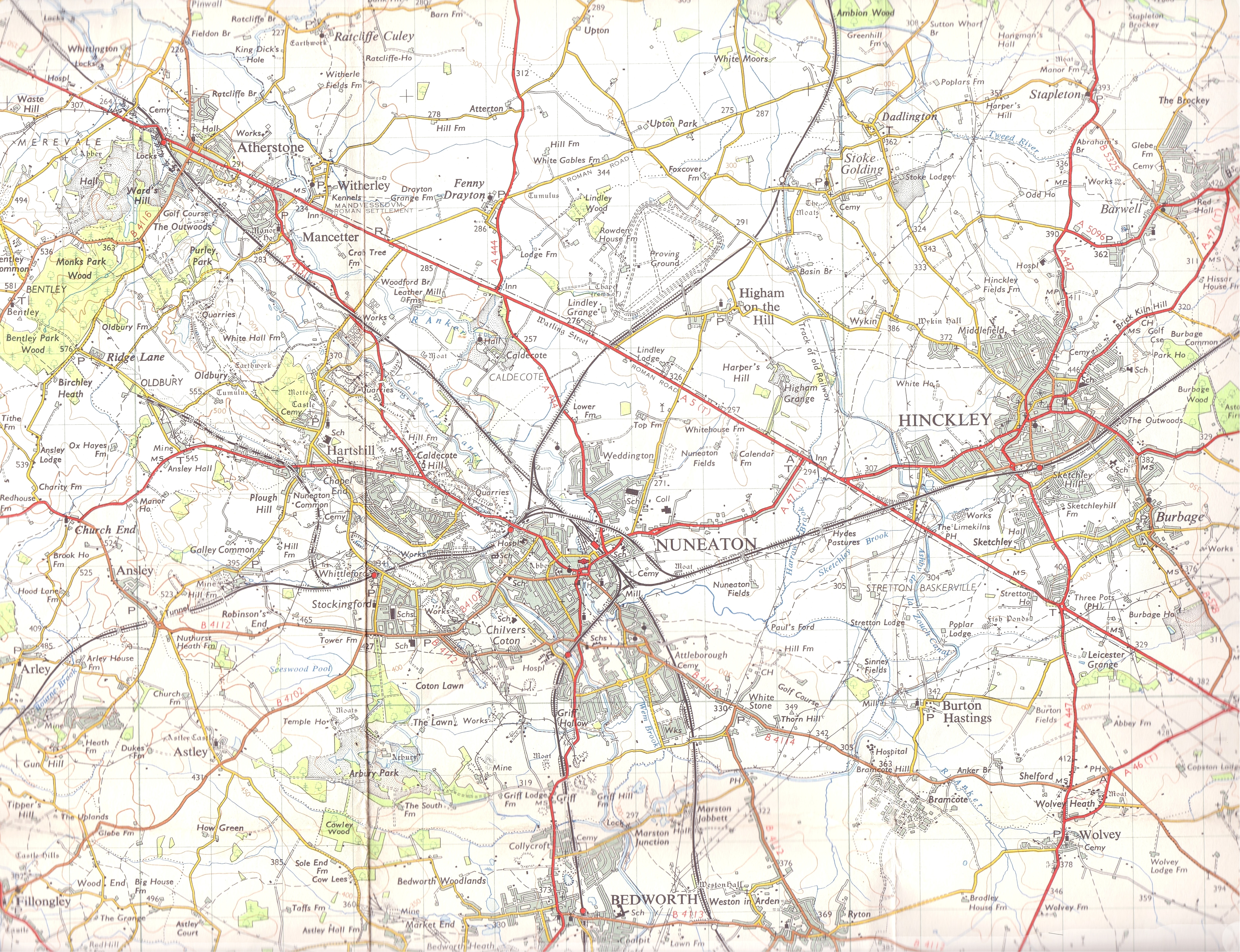
Astley Gorse is located at Grid Ref: SP2989 (Lat: 52.502921, Lng: -1.5616118)

Administrative County: Warwickshire

District: North Warwickshire

Police Authority: Warwickshire

What 3 Words

///fame.cove.cuddled. Near Hartshill, Warwickshire

Related Wikis

Astley, Warwickshire

Astley is a small village and civil parish within the North Warwickshire district of Warwickshire, England. In the 2001 census it had a population of...
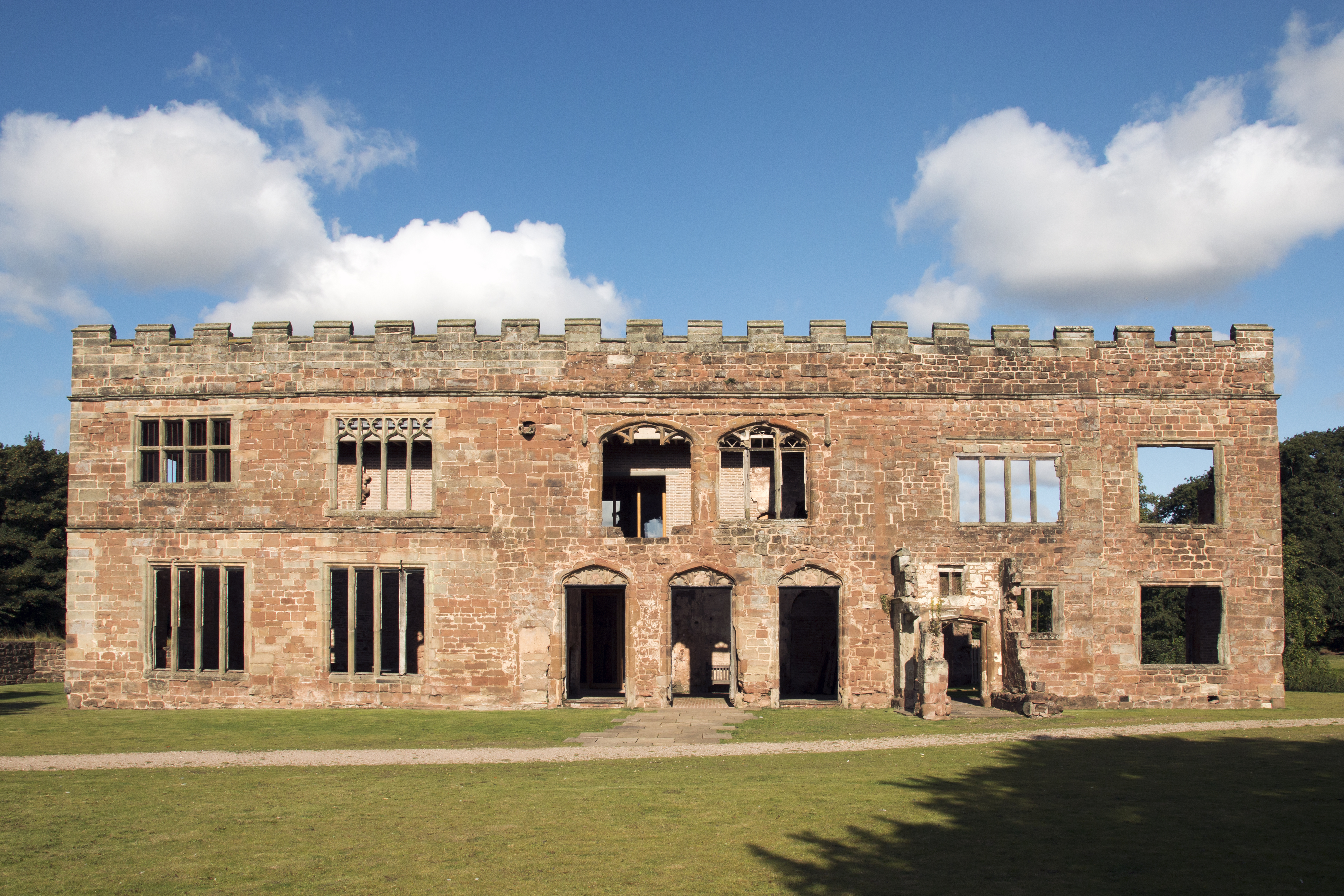
Astley Castle

Astley Castle is a ruinous moated fortified 16th century manor house in North Warwickshire, England. It has been listed as a Grade II* listed building...

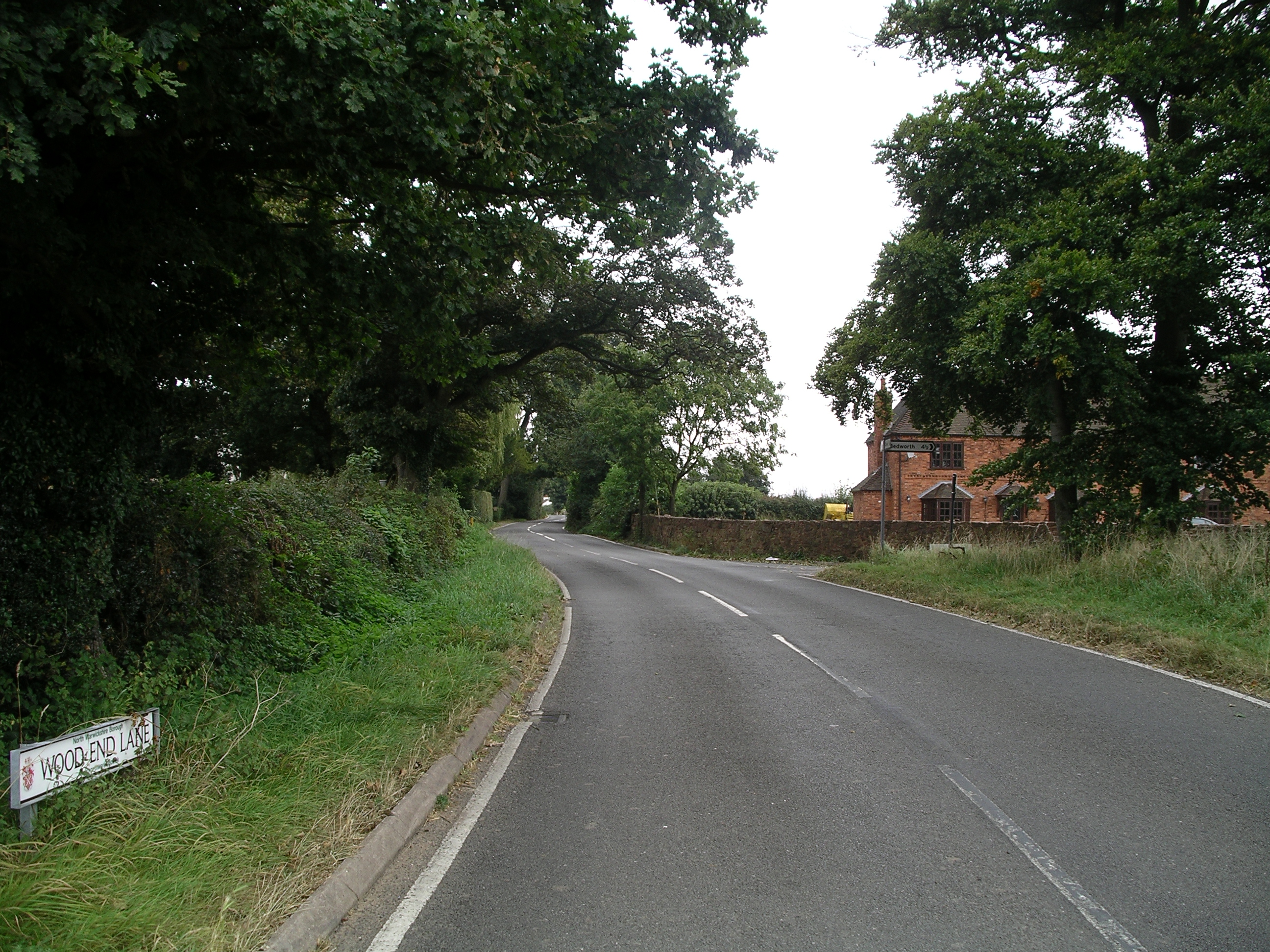
Wood End, Fillongley

Wood End, is a small village in Warwickshire, England. It is situated north of Coventry. The village is part of the civil parish of Fillongley. There is...

Old Arley

Old Arley is a village in the civil parish of Arley, in the north of Warwickshire, England, 5.5 miles (8.9 km) west of Nuneaton and 10 miles (16 km) north...

Arley, Warwickshire

Arley is a civil parish in the North Warwickshire district of Warwickshire, England. The parish includes two settlements, New Arley and Old Arley. Old...

Ansley, Warwickshire

Ansley is a parish in Warwickshire consisting of Ansley, Ansley Common, Church End, Birchley Heath and, previously, Ansley Hall Colliery. Ansley is on...

Arley and Fillongley railway station

Arley and Fillongley railway station was a station on the Midland Railway, which operated in the Midland county of Warwickshire, in England. == History... ==

Ballard's Green

Ballard's Green is a village in Warwickshire, England. Population details may be found under Over Whitacre.

Nearby Amenities

Located within 500m of 52.502921,-1.5616118
Bus Stop
Infant School
Bus: yes
Naptan AtcoCode: 4200F025101
Naptan Bearing: SW
Naptan CommonName: Infant School
Naptan Indicator: Adj
Naptan NaptanCode: wardgjmd
Naptan Street: Gun Hill
Naptan Verified: no
Public Transport: platform
Shelter: no
Source: naptan_import
Lat/Long: 52.5045286/-1.5682127
Bus Stop
Infant School
Bus: yes
Naptan AtcoCode: 4200F025102
Naptan Bearing: NE
Naptan CommonName: Infant School
Naptan Indicator: Opp
Naptan NaptanCode: wardgjmg
Naptan Street: Gun Hill
Naptan Verified: no
Public Transport: platform
Shelter: no
Source: naptan_import
Lat/Long: 52.5047542/-1.5679009
Source: Warwicks CC Aerial Imagery 2013
Traffic Calming: choker
Lat/Long: 52.5066881/-1.5653134
Give Way
Source: Warwicks CC Aerial Imagery 2013
Lat/Long: 52.5049409/-1.5657017
Post Office
Gun Hill Post Office
Addr City: Coventry
Addr Hamlet: Gun Hill
Addr Housenumber: 1
Addr Postcode: CV7 8HB
Addr Street: Nuneaton Road
Addr Village: Arley
Fixme: verify by survey
Opening Hours: Mo-Sa 06:00-21:30; Su 07:00-21:30
Ref Pol Id: 6238
Source: pol_branch_list_2018-02
Lat/Long: 52.505169/-1.5665852
Generator Method: photovoltaic
Generator Output Electricity: yes
Generator Source: solar
Generator Type: solar_photovoltaic_panel
Power: generator
Lat/Long: 52.5056265/-1.5654096
Generator Method: photovoltaic
Generator Output Electricity: yes
Generator Source: solar
Generator Type: solar_photovoltaic_panel
Power: generator
Lat/Long: 52.5060869/-1.5643716
Generator Method: photovoltaic
Generator Output Electricity: yes
Generator Source: solar
Generator Type: solar_photovoltaic_panel
Power: generator
Lat/Long: 52.5050289/-1.5647364
Generator Method: photovoltaic
Generator Output Electricity: yes
Generator Source: solar
Generator Type: solar_photovoltaic_panel
Power: generator
Lat/Long: 52.5042044/-1.5683788
Power: pole
Source: Bing
Lat/Long: 52.4994635/-1.5660985
Power: pole
Source: Bing
Lat/Long: 52.5026017/-1.5554233
Power: pole
Lat/Long: 52.5004956/-1.5585832
Power: pole
Source: Bing
Lat/Long: 52.501782/-1.5581538
Power: pole
Source: Bing
Lat/Long: 52.502089/-1.5571882
Power: pole
Source: Bing
Lat/Long: 52.5003093/-1.5631588
Power: pole
Source: Bing
Lat/Long: 52.4999174/-1.5645428
Power: pole
Lat/Long: 52.4993199/-1.559876
Power: pole
Lat/Long: 52.4989901/-1.5617643
Power: pole
Lat/Long: 52.5006783/-1.5557991
Power: pole
Lat/Long: 52.4990944/-1.5644358
Power: pole
Lat/Long: 52.4994277/-1.5633253
Power: pole
Lat/Long: 52.4996367/-1.5579556
Power: pole
Lat/Long: 52.4997051/-1.56229
Power: pole
Source: Bing
Lat/Long: 52.5012857/-1.559924
Power: pole
Source: Bing
Lat/Long: 52.5007699/-1.5616516
Power: pole
Lat/Long: 52.4987158/-1.5635292
Power: pole
Lat/Long: 52.5000284/-1.5612064
Power: pole
Lat/Long: 52.5002702/-1.5563355
Generator Method: photovoltaic
Generator Output Electricity: yes
Generator Source: solar
Generator Type: solar_photovoltaic_panel
Power: generator
Lat/Long: 52.5042877/-1.5626885
Generator Method: photovoltaic
Generator Output Electricity: yes
Generator Source: solar
Generator Type: solar_photovoltaic_panel
Power: generator
Lat/Long: 52.5042959/-1.5630667
Generator Method: photovoltaic
Generator Output Electricity: yes
Generator Source: solar
Generator Type: solar_photovoltaic_panel
Power: generator
Lat/Long: 52.504402/-1.5626161
Generator Method: photovoltaic
Generator Output Electricity: yes
Generator Source: solar
Generator Type: solar_photovoltaic_panel
Power: generator
Lat/Long: 52.5052444/-1.5651105
The data included in this document is from www.openstreetmap.org. The data is made available under ODbL.

Have you been to Astley Gorse?

Leave your review of Astley Gorse below (or comments, questions and feedback).