Augusta's Plantation
Wood, Forest in Yorkshire Hambleton
England
Augusta's Plantation

Augusta's Plantation, located in Yorkshire, is a sprawling woodland estate known for its picturesque beauty and rich history. Spanning across vast acres, this plantation is nestled within the lush greenery of the Yorkshire countryside, offering a tranquil retreat for nature enthusiasts and history buffs alike.
The plantation gets its name from Augusta, the wife of a prominent landowner who established the estate in the early 19th century. Augusta's Plantation boasts a diverse range of flora and fauna, with dense forests, ancient oak trees, and vibrant wildflowers dotting the landscape. The plantation is home to a variety of wildlife, including deer, rabbits, and numerous bird species, making it a popular spot for birdwatching and wildlife photography.
The plantation's history dates back centuries, with remnants of a medieval castle and ancient burial mounds found within its boundaries. Visitors can explore the ruins and learn about the area's fascinating past through guided tours provided by knowledgeable guides. Additionally, the plantation features well-maintained walking trails that crisscross through the woodland, allowing visitors to immerse themselves in the serene natural beauty while taking in the breathtaking views.
Augusta's Plantation also offers various recreational activities, including horseback riding, cycling, and picnicking. The estate has dedicated picnic areas equipped with tables and benches, providing visitors with the perfect opportunity to relax and enjoy a meal amidst the idyllic surroundings.
Whether it's for a leisurely stroll, a historical adventure, or a peaceful retreat, Augusta's Plantation in Yorkshire offers a captivating experience for all who visit.
If you have any feedback on the listing, please let us know in the comments section below.
Augusta's Plantation Images
Images are sourced within 2km of 54.408587/-1.5528545 or Grid Reference NZ2901. Thanks to Geograph Open Source API. All images are credited.

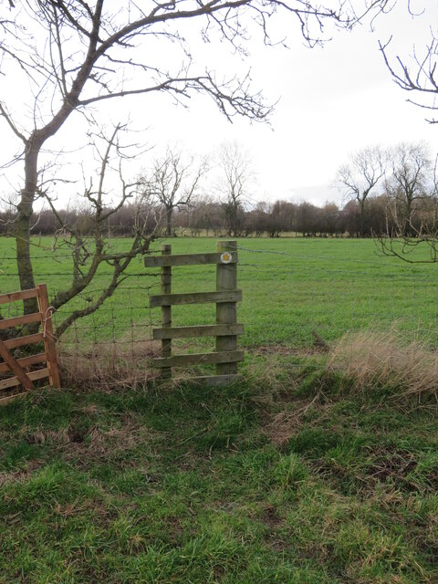
![The end of a bridleway Go through the gate and one is heading roughly north west along path number 10.134/1. Heading east along the adjoining path, one has just crossed the boundary from Richmondshire [area 20] into Hambleton [10].](https://s0.geograph.org.uk/geophotos/07/40/30/7403084_caf3d0aa.jpg)


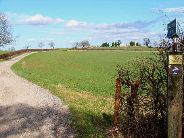
![Where's the path? Trying to follow the line marked on the map across this field of old ridge and furrow as well as remains of a medieval village site. The path is shown crossing the farm track midway between a corner and the farm buildings, but the track is lined by barbed wire fencing with no visible means of crossing. Way down to the left is a flimsy stile [left of photo] from where there is a usable route along a hedge line.](https://s2.geograph.org.uk/geophotos/07/40/33/7403342_36806446.jpg)


Augusta's Plantation is located at Grid Ref: NZ2901 (Lat: 54.408587, Lng: -1.5528545)
Division: North Riding
Administrative County: North Yorkshire
District: Hambleton
Police Authority: North Yorkshire
What 3 Words
///dives.swordfish.cove. Near Scorton, North Yorkshire
Nearby Locations
Related Wikis
South Cowton
South Cowton is a village and civil parish located on the site of an abandoned medieval village in the Hambleton district of North Yorkshire in England...

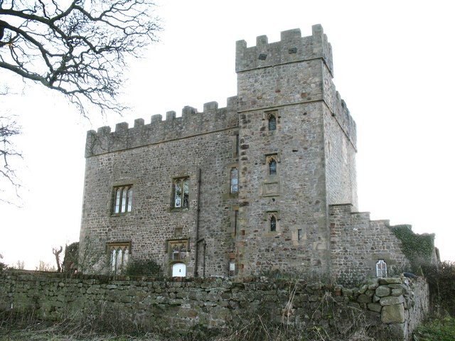
South Cowton Castle
South Cowton Castle is a 15th-century fortified dwelling house in the Richmondshire district of North Yorkshire, England. It is situated on the land that...

Atley Hill
Atley Hill is a hamlet in the Hambleton district of North Yorkshire, England. It is situated on the B1263 road between the A167 and the village of Scorton...
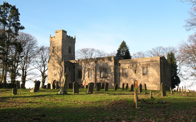
St Mary's Church, South Cowton
St Mary's Church is a redundant Anglican church standing in open countryside in the former village of South Cowton, near Scotch Corner in North Yorkshire...

Forest, North Yorkshire
Forest is a hamlet in North Yorkshire, England, near the town of Richmond. It is near the villages of Scorton and Bolton-on-Swale. The only public amenity...

Temple Cowton Preceptory
Temple Cowton Preceptory was a priory in North Yorkshire, England. The preceptory was in the village of East Cowton, 5 miles (8 km) north west of Northallerton...

North Cowton
North Cowton is a village and civil parish, located in Richmondshire, North Yorkshire, England. It is 8 miles (13 km) north-west of the county town of...

Whitwell, North Yorkshire
Whitwell is a village and civil parish in North Yorkshire, England. It is 6.5 miles (10.5 km) north west of the county town of Northallerton At the 2011...
Nearby Amenities
Located within 500m of 54.408587,-1.5528545Have you been to Augusta's Plantation?
Leave your review of Augusta's Plantation below (or comments, questions and feedback).