Denston

Settlement in Suffolk West Suffolk

England

Denston

St Nicholas Church Denston St Nicholas Church in Denston has been described as a ‘wonderful example of a late Perpendicular Suffolk church’ and it does not disappoint. It is built on the site of a 12th-century church, but the core of the current building is almost entirely late 15th century, with a 14th century west tower.
Inside the church are a series of beautifully carved bench ends and a magnificently carved wall plate frieze running the entire length of the church on both sides.
St Nicholas Church Denston Credit: Richard Rogerson

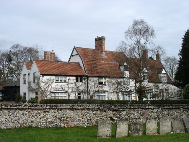
Denston is a small village located in the county of Suffolk, England. Situated in the East Anglian region, the village lies approximately 16 miles northeast of Bury St Edmunds and 30 miles southwest of Ipswich. Denston is a close-knit community with a population of around 200 residents.

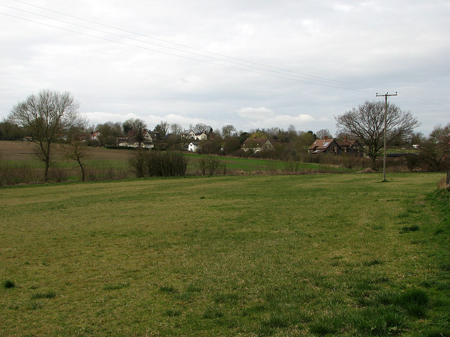
The village is known for its picturesque surroundings, nestled amidst the undulating countryside of Suffolk. The area is characterized by rolling hills, meandering rivers, and expansive fields, offering residents and visitors ample opportunities for outdoor activities such as hiking, cycling, and horse riding.

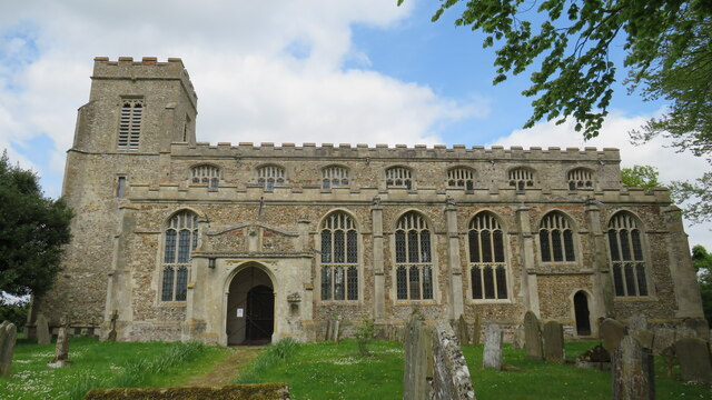
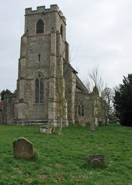
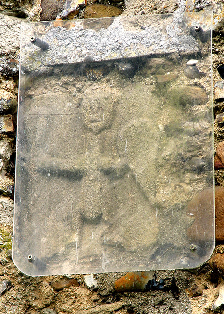
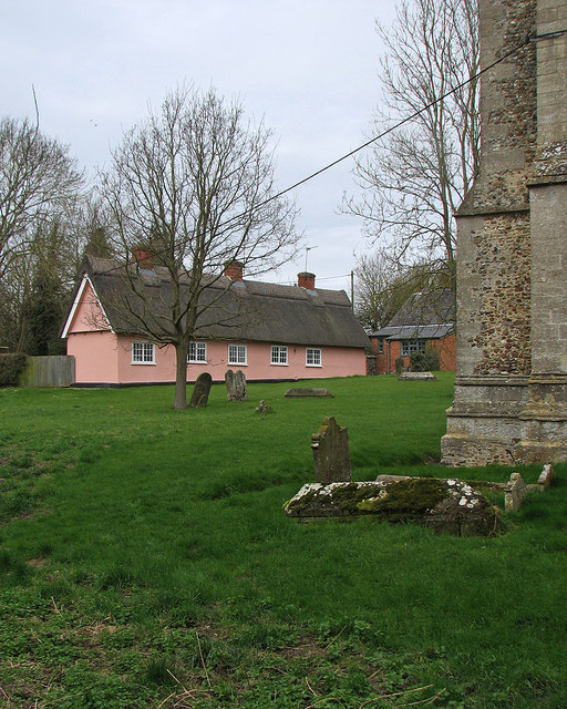
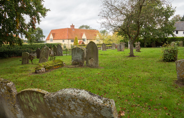
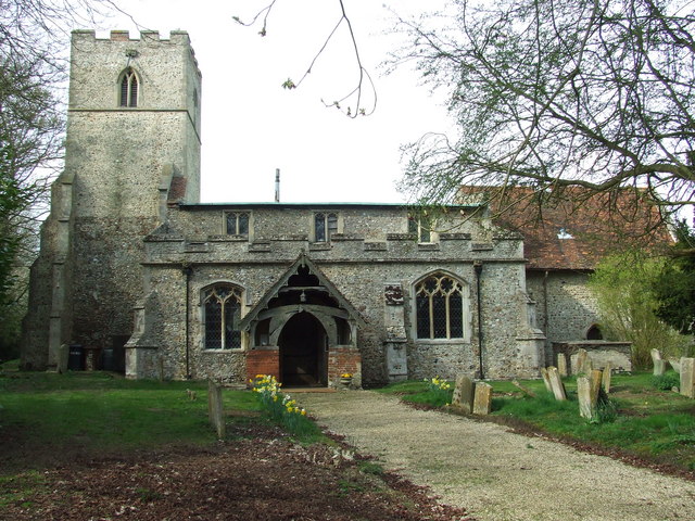
Denston boasts a rich history, with evidence of its existence dating back to the Roman era. The village features several historic buildings and landmarks, including the Grade II listed St Nicholas Church, which dates back to the 14th century. The church is known for its beautiful stained glass windows and intricate architectural details.

While Denston is primarily a residential community, it is within close proximity to larger towns and cities, providing easy access to amenities and services. The village has a local pub, The Fox Inn, which serves as a social hub for residents and visitors alike.

Denston offers a peaceful and idyllic lifestyle, with a strong sense of community and a range of outdoor activities to enjoy. Whether exploring its historic landmarks or immersing oneself in the natural beauty of the surrounding countryside, Denston is a charming destination for those seeking a tranquil retreat in the heart of Suffolk.

If you have any feedback on the listing, please let us know in the comments section below.

Denston Images

Images are sourced within 2km of 52.145849/0.5716005 or Grid Reference TL7652. Thanks to Geograph Open Source API. All images are credited.

St Nicholas Church Denston St Nicholas Church in Denston has been described as a ‘wonderful example of a late Perpendicular Suffolk church’ and it does not disappoint. It is built on the site of a 12th-century church, but the core of the current building is almost entirely late 15th century, with a 14th century west tower.
Inside the church are a series of beautifully carved bench ends and a magnificently carved wall plate frieze running the entire length of the church on both sides.
St Nicholas Church Denston
St Nicholas Church in Denston has been described as a ‘wonderful example of a late Perpendicular Suffolk church’ and it does not disappoint. It is built on the site of a 12th-century church, but the core of the current building is almost entirely late 15th century, with a 14th century west tower. Inside the church are a series of beautifully carved bench ends and a magnificently carved wall plate frieze running the entire length of the church on both sides.
Stradishall WW1 Memorial The Memorial bears 15 names of men lost in WW1. Six men died at Royal Air Force Stradishall during WW2 and are buried in the churchyard.
Stradishall WW1 Memorial
The Memorial bears 15 names of men lost in WW1. Six men died at Royal Air Force Stradishall during WW2 and are buried in the churchyard.
Wickhambrook: All Saints "Mostly Dec ... Tall two-light reticulated window in the W tower" (Nikolaus Pevsner).
Wickhambrook: All Saints
"Mostly Dec ... Tall two-light reticulated window in the W tower" (Nikolaus Pevsner).
Wickhambrook: All Saints - Saxon carving "A small Saxon figure of a man with a shield, outside in the S wall" (Nikolaus Pevsner).
Wickhambrook: All Saints - Saxon carving
"A small Saxon figure of a man with a shield, outside in the S wall" (Nikolaus Pevsner).
"The White House", Wickhambrook Taken from the churchyard of All Saints church.
"The White House", Wickhambrook
Taken from the churchyard of All Saints church.
Wickhambrook churchyard and almshouses The Suffolk-pink building is the Grade II listed almshouses. The listing text reads "A range of C17 timber-framed and plastered almshouses built by Anthony Sparrow in 1615. A tablet states that they were restored in 1897 and the doors and windows are of that period. Casement windows with glazing bars. Roof thatched".
Wickhambrook churchyard and almshouses
The Suffolk-pink building is the Grade II listed almshouses. The listing text reads "A range of C17 timber-framed and plastered almshouses built by Anthony Sparrow in 1615. A tablet states that they were restored in 1897 and the doors and windows are of that period. Casement windows with glazing bars. Roof thatched".
Wickhambrook Glebe Field A view from the churchyard. Wickhambrook is a straggling village and the church is at its southern edge.
Wickhambrook Glebe Field
A view from the churchyard. Wickhambrook is a straggling village and the church is at its southern edge.
Lane towards Denston
View over River Glem valley The near field has some sort of beet growing.
View over River Glem valley
The near field has some sort of beet growing.
Stradishall, St Margaret
Walkers on field headland The route of a public footpath is being followed, northwards, along a comfortably broad field headland.
Walkers on field headland
The route of a public footpath is being followed, northwards, along a comfortably broad field headland.
Avenue of trees alongside drive to Denston Hall The approach to Denston Hall from the village of Denston itself.
Avenue of trees alongside drive to Denston Hall
The approach to Denston Hall from the village of Denston itself.
Graves on south side of St. Nicholas Church, Denston The church building is to the right of the image.
Graves on south side of St. Nicholas Church, Denston
The church building is to the right of the image.
Walkers descending along field headland The route of a public footpath is being followed with ease. It's not always so; quite often the space left at field margins to accommodate footpaths is so limited that it's necessary to walk on the ploughed or planted surface!
Walkers descending along field headland
The route of a public footpath is being followed with ease. It's not always so; quite often the space left at field margins to accommodate footpaths is so limited that it's necessary to walk on the ploughed or planted surface!
Footpath And Farmers Track Footpath and farmers track near to Stradishall, Suffolk.
Footpath And Farmers Track
Footpath and farmers track near to Stradishall, Suffolk.
A143 towards Bury St Edmunds In the parish of Stradishall with the village ahead.
A143 towards Bury St Edmunds
In the parish of Stradishall with the village ahead.
Farm track towards Burntfield Plantation Off Mill Lane.
Farm track towards Burntfield Plantation
Off Mill Lane.
A143 towards Bury St Edmunds Approaching Wickham Street.
A143 towards Bury St Edmunds
Approaching Wickham Street.
Show me another place!

Denston is located at Grid Ref: TL7652 (Lat: 52.145849, Lng: 0.5716005)

Administrative County: Suffolk

District: West Suffolk

Police Authority: Suffolk

What 3 Words

///laptops.croutons.batches. Near Clare, Suffolk

Nearby Locations

Denston Denston

Related Wikis

Denston

Denston is a village and civil parish in the West Suffolk district of Suffolk in eastern England. Located around eight miles south-west of Bury St Edmunds...

Gifford's Hall, Wickhambrook

Gifford's Hall is a manor house in the civil parish of Wickhambrook, in the West Suffolk district, in the county of Suffolk, England. It is Grade I listed...

Stradishall

Stradishall is a village and civil parish in West Suffolk in the English county of Suffolk. The civil parish includes a number of hamlets including Farley...

Attleton Green

Attleton Green is a hamlet in Suffolk, England. == External links == Media related to Attleton Green at Wikimedia Commons

Clare Rural District

Clare Rural District was a rural district in the county of West Suffolk, England. It was created in 1894, comprising those parishes in the Risbridge rural...

Stansfield

Stansfield is a village and civil parish in the West Suffolk district of Suffolk in eastern England. Located seven miles south-west of Bury St Edmunds...

Stansfield Windmill

Stansfield Mill is a Grade II listed tower mill at Stansfield, Suffolk, England which is derelict. == History == Stansfield Mill was built in 1840, replacing...

Coltsfoot Green

Coltsfoot Green is a small hamlet within the village of Wickhambrook, Suffolk, England. It constitutes one of its eleven village greens and consists of...

Nearby Amenities

Located within 500m of 52.145849,0.5716005
Post Box
Collection Times: Mo-Fr 16:15; Sa 09:15
Operator: Royal Mail
Post Box Type: lamp
Ref: CB8 46
Royal Cypher: EIIR
Royal Cypher Wikidata: Q33102113
Source: survey
Lat/Long: 52.1460354/0.5711052
Bus Stop
St Nicholas's Church
Naptan AtcoCode: 390050102
Naptan Bearing: SE
Naptan BusStopType: CUS
Naptan CommonName: St Nicholas's Church
Naptan Indicator: adj
Naptan Landmark: St Nicholas's Church
Naptan NaptanCode: sufgdjga
Naptan Street: Water Lane
Naptan Verified: no
Source: naptan_import
Lat/Long: 52.1465536/0.5708643
Bus Stop
St Nicholas's Church
Naptan AtcoCode: 390050103
Naptan Bearing: NW
Naptan BusStopType: CUS
Naptan CommonName: St Nicholas's Church
Naptan Indicator: opp
Naptan Landmark: St Nicholas's Church
Naptan NaptanCode: sufgdjgd
Naptan Street: Water Lane
Naptan Verified: no
Source: naptan_import
Lat/Long: 52.1464908/0.5708607
Historic: memorial
Memorial: war_memorial
Lat/Long: 52.1458492/0.5713181
Power: pole
Lat/Long: 52.1453011/0.5654351
Power: pole
Lat/Long: 52.1450451/0.5671021
Power: pole
Lat/Long: 52.1447702/0.5687879
Power: pole
Lat/Long: 52.1450657/0.570015
Power: pole
Lat/Long: 52.1454895/0.5727844
Power: pole
Lat/Long: 52.1456196/0.5742529
Power: pole
Lat/Long: 52.1457315/0.5755591
Power: pole
Lat/Long: 52.145622/0.5771993
Telephone
Booth: K6
Covered: booth
Listed Status: Grade II
Man Made: telephone_box
Lat/Long: 52.1460075/0.5710635
Place Of Worship
Lat/Long: 52.1450374/0.575564
The data included in this document is from www.openstreetmap.org. The data is made available under ODbL.

Have you been to Denston?

Leave your review of Denston below (or comments, questions and feedback).