Dennington

Settlement in Suffolk East Suffolk

England

Dennington

Dennington, St. Mary's Church: Medieval bench end with poppy head 1
Dennington, St. Mary's Church: Medieval bench end with poppy head 1 Credit: Michael Garlick

Dennington is a village located in the county of Suffolk, England. Situated in the East of England region, it is part of the Mid Suffolk district. The village is positioned about 5 miles northeast of the town of Framlingham and roughly 12 miles northwest of the coastal town of Aldeburgh.

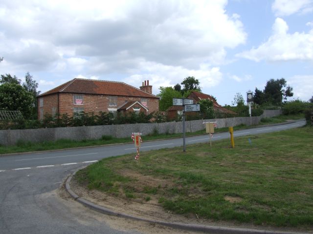
Dennington is a small, traditional English village with a population of around 400 residents. It is renowned for its picturesque rural setting, characterized by rolling countryside, meandering lanes, and charming thatched cottages. The village is predominantly agricultural, with farming playing a significant role in the local economy.

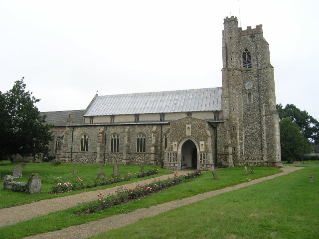
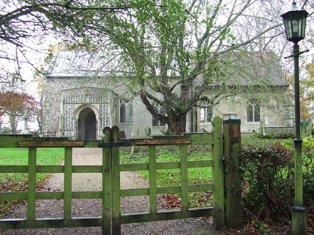
At the heart of Dennington lies the impressive St. Mary's Church, a historic building dating back to the 14th century. The church is known for its stunning architecture and houses a collection of medieval stained glass windows, making it a popular attraction for visitors interested in the region's cultural heritage.

Dennington also boasts a vibrant community spirit, with various local events and activities taking place throughout the year. These include the Dennington Flower Show, an annual event that showcases the village's horticultural talents, and the Dennington Jubilee Hall, a community center that hosts a wide range of social and recreational activities.

The village benefits from its proximity to several areas of natural beauty, including the Suffolk Coast and Heaths Area of Outstanding Natural Beauty, which offers opportunities for outdoor pursuits such as hiking, cycling, and birdwatching.

Overall, Dennington is a charming and tranquil village that offers a glimpse into the idyllic English countryside while providing a close-knit community and access to the natural wonders of Suffolk.

If you have any feedback on the listing, please let us know in the comments section below.

Dennington Images

Images are sourced within 2km of 52.251037/1.3400235 or Grid Reference TM2866. Thanks to Geograph Open Source API. All images are credited.

Dennington, St. Mary's Church: Medieval bench end with poppy head 1
Dennington, St. Mary's Church: Medieval bench end with poppy head 2
Dennington, St. Mary's Church: Medieval bench end with poppy head 3
Dennington, St. Mary's Church: Medieval bench end with poppy head 4
Dennington, St. Mary's Church: Medieval bench end with poppy head 5
Dennington, St. Mary's Church: Medieval bench end with poppy head 6
Dennington, St. Mary's Church: Medieval bench end with poppy head 7
Dennington, St. Mary's Church: Medieval bench end with poppy head 8
Dennington, St. Mary's Church: Medieval bench end with poppy head 9
Dennington, St. Mary's Church: Medieval bench end with poppy head 10
Dennington, St. Mary's Church: Medieval bench end with poppy head 11
Dennington, St. Mary's Church: Medieval bench end with poppy head 12
Dennington, St. Mary's Church: Medieval bench end with poppy head 13
Dennington, St. Mary's Church: Medieval bench end with poppy head 14
Dennington, St. Mary's Church: Bardolph Chapel parclose screen (c.1450)
Dennington, St. Mary's Church: Medieval benches in the nave
Dennington, St. Mary's Church: The north doorway and church entrance
Dennington, St. Mary's Church: Carved corbel head and foliage beneath the chancel arch To the left is a statue of Our Lady given in 1952.
Dennington, St. Mary's Church: Carved corbel head and foliage beneath the chancel arch
To the left is a statue of Our Lady given in 1952.
Show me another place!

Dennington is located at Grid Ref: TM2866 (Lat: 52.251037, Lng: 1.3400235)

Administrative County: Suffolk

District: East Suffolk

Police Authority: Suffolk

What 3 Words

///surface.shatters.tugging. Near Framlingham, Suffolk

Nearby Locations

Dennington

Related Wikis

Dennington

Dennington is a village and civil parish in the English county of Suffolk. It is 2 miles (3.2 km) north of Framlingham and 15 miles (24 km) north-east...

Saxtead

Saxtead is a village and civil parish in the East Suffolk district, in the county of Suffolk, England. Saxtead gives its name to the settlements of Saxtead...

Hulver Street

Hulver Street, also known simply as Hulver, is a hamlet near the market town of Beccles, in the civil parish of Henstead with Hulver Street, in the East...

Thomas Mills High School

Thomas Mills High School is a co-educational secondary school and sixth form with academy status in Framlingham, Suffolk, England. The current headteacher...

Nearby Amenities

Located within 500m of 52.251037,1.3400235
Dennington
Place: village
Wikidata: Q2553169
Wikipedia: en:Dennington
Lat/Long: 52.2545581/1.342157
Bus Stop
Queens Head
Naptan AtcoCode: 390060351
Naptan Bearing: S
Naptan CommonName: Queens Head
Naptan Indicator: o/s
Naptan Landmark: Queens Head
Naptan NaptanCode: sufgpgwg
Naptan Street: A1120
Naptan Verified: no
Source: naptan_import
Lat/Long: 52.2542434/1.341384
Queens Head
Naptan AtcoCode: 390060352
Naptan Bearing: N
Naptan BusStopType: CUS
Naptan CommonName: Queens Head
Naptan Indicator: opp
Naptan Landmark: Queens Head
Naptan NaptanCode: sufgpgwj
Naptan Street: A1120
Naptan Verified: no
Source: naptan_import
Lat/Long: 52.2542839/1.3412258
Sheeranville
Place: hamlet
Lat/Long: 52.2537286/1.3346484
Give Way
Lat/Long: 52.2547416/1.341649
Give Way
Lat/Long: 52.2539543/1.3409691
The data included in this document is from www.openstreetmap.org. The data is made available under ODbL.

Have you been to Dennington?

Leave your review of Dennington below (or comments, questions and feedback).