Alwoodley Crags Plantation

Wood, Forest in Yorkshire

England

Alwoodley Crags Plantation

Dalesway A stile on the Dalesway close to Eccup Reservoir Leeds
Dalesway Credit: Mick Melvin

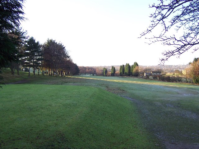
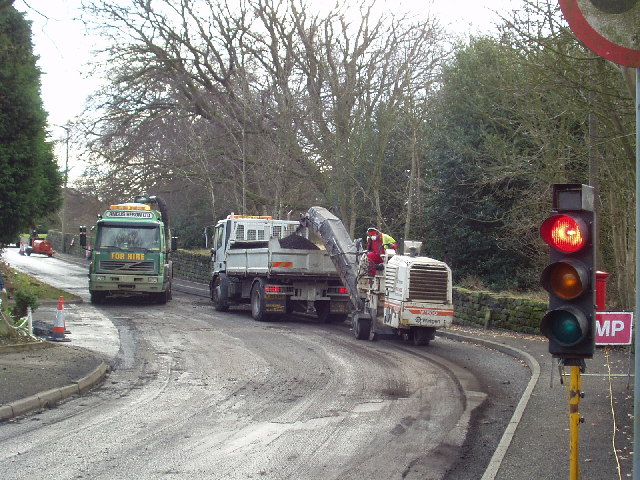
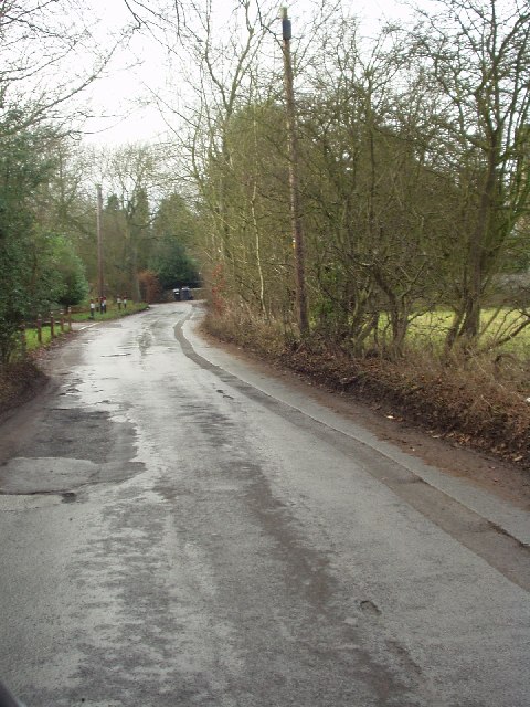
Alwoodley Crags Plantation, located in Yorkshire, England, is a picturesque woodland area that spans over an expansive area. Situated near the Alwoodley Crags, a rocky outcrop that offers breathtaking views of the surrounding landscape, the plantation is a popular destination for nature enthusiasts and hikers alike.

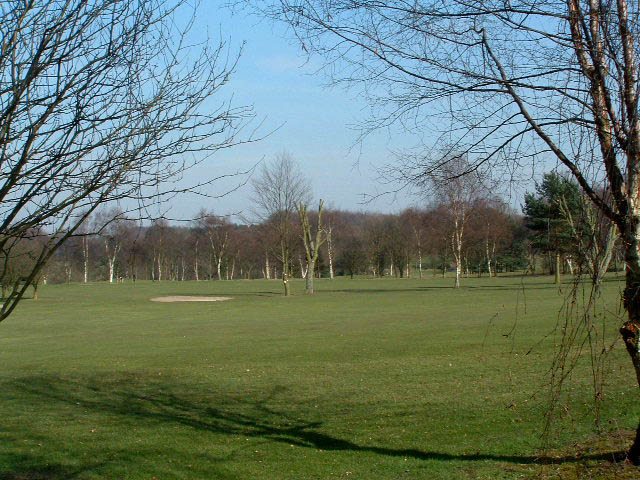
Covering a diverse range of flora and fauna, Alwoodley Crags Plantation boasts a rich ecosystem. The woodland comprises a variety of tree species, including oak, beech, birch, and pine, which provide a stunning backdrop throughout the year. The forest floor is adorned with an array of wildflowers, such as bluebells, primroses, and wood anemones, adding bursts of color to the landscape.

The plantation is also home to an array of wildlife, making it a haven for birdwatchers and animal lovers. Visitors may spot various bird species, including woodpeckers, owls, and thrushes, as well as small mammals like rabbits, squirrels, and foxes. The presence of these creatures adds to the enchanting atmosphere of the woodland.

For those seeking outdoor activities, Alwoodley Crags Plantation offers several walking trails and paths that wind through the forest. These routes cater to different levels of difficulty, accommodating both leisurely strolls and more challenging hikes. The plantation is also a popular spot for picnicking and family outings, with designated areas providing scenic spots to relax and enjoy the surroundings.

Alwoodley Crags Plantation, with its natural beauty and diverse ecosystem, provides a serene escape from the hustle and bustle of everyday life. Whether it is for a leisurely walk, birdwatching, or simply enjoying the tranquility of nature, this woodland destination offers a delightful experience for visitors of all ages.

If you have any feedback on the listing, please let us know in the comments section below.

Alwoodley Crags Plantation Images

Images are sourced within 2km of 53.858596/-1.5753987 or Grid Reference SE2840. Thanks to Geograph Open Source API. All images are credited.

Dalesway A stile on the Dalesway close to Eccup Reservoir Leeds
Dalesway
A stile on the Dalesway close to Eccup Reservoir Leeds
Eccup Reservoir Lodge Goodrick Lodge at Eccup reservoir a fine building
Eccup Reservoir Lodge
Goodrick Lodge at Eccup reservoir a fine building
Golden Acre Park The lake at Golden Acre Park near Leeds.
Golden Acre Park
The lake at Golden Acre Park near Leeds.
The Bridge Golden Acre Park The bridge over Marsh Beck in Golden Acre Park Leeds
The Bridge Golden Acre Park
The bridge over Marsh Beck in Golden Acre Park Leeds
Frosty morning on Headingley Golf Course Not actually in Headingley - but situated between Adel, Alwoodley and Eccup Lane
Frosty morning on Headingley Golf Course
Not actually in Headingley - but situated between Adel, Alwoodley and Eccup Lane
Farmland near Eccup. Just E of Eccup Whin.
Farmland near Eccup.
Just E of Eccup Whin.
St John The Baptist Church, Church Lane, Adel, Leeds This is one of the oldest churches in the Leeds area, dating back to Norman times (11th-12th century). Unusually for such an old church, it was not developed, enlarged or extended in Victorian times.
St John The Baptist Church, Church Lane, Adel, Leeds
This is one of the oldest churches in the Leeds area, dating back to Norman times (11th-12th century). Unusually for such an old church, it was not developed, enlarged or extended in Victorian times.
Adel Methodist Church, Holt Lane, Adel, Leeds
St John the Baptist Church, Church Lane, Adel, Leeds This church has a lovely Norman doorway.
St John the Baptist Church, Church Lane, Adel, Leeds
This church has a lovely Norman doorway.
Road repairs, Long Causeway, Adel, Leeds At the north end of Long Causeway, by its junction with Stairfoot Lane and Back Church Lane
Road repairs, Long Causeway, Adel, Leeds
At the north end of Long Causeway, by its junction with Stairfoot Lane and Back Church Lane
Stairfoot Lane, Alwoodley, Leeds Looking west towards Adel, near the junction of King Lane.
Stairfoot Lane, Alwoodley, Leeds
Looking west towards Adel, near the junction of King Lane.
Alwoodley Park. Looking SW down The Avenue, near the junction with The Drive and The Fairway.
Alwoodley Park.
Looking SW down The Avenue, near the junction with The Drive and The Fairway.
Sand Moor Golf Club Escaping from the suburbs of Leeds you pass the manicured fairways (and manicured trees) of Sand Moor
Sand Moor Golf Club
Escaping from the suburbs of Leeds you pass the manicured fairways (and manicured trees) of Sand Moor
Five Lane Ends The junction of five roads! Two lead north-east to Eccup, one south-east to Alwoodley, one south-west to Adel and one north-west to Bramhope.
Five Lane Ends
The junction of five roads! Two lead north-east to Eccup, one south-east to Alwoodley, one south-west to Adel and one north-west to Bramhope.
The stream at Golden Acre Park The reed bed on the right is a recent development - I remememebr about 15 years ago there was open water, then a small sandbank which has grown (or been deliberately built up) over the years.
Seen just after coming through the tunnel from the car park.
The stream at Golden Acre Park
The reed bed on the right is a recent development - I remememebr about 15 years ago there was open water, then a small sandbank which has grown (or been deliberately built up) over the years. Seen just after coming through the tunnel from the car park.
Flower beds and monkey puzzle, Golden Acre Park Some of the flower beds near the cafe, with a monkey puzzle (Araucaria araucana)
Flower beds and monkey puzzle, Golden Acre Park
Some of the flower beds near the cafe, with a monkey puzzle (Araucaria araucana)
The lake and bird feeding hut, Golden Acre Park This metal hut is probably the 3rd one here in the past 15 years. The oldest one was made of wood, and got dilapidated over the years and was replace with a new one in 2004 or 2005 which can be seen in this picture <a href="https://www.geograph.org.uk/photo/20716">SE2641 : Golden Acre Park</a> . Sadly it was burnt down in 2005, and has been replaced by a more durable but less elegant metal one.
The lake and bird feeding hut, Golden Acre Park
This metal hut is probably the 3rd one here in the past 15 years. The oldest one was made of wood, and got dilapidated over the years and was replace with a new one in 2004 or 2005 which can be seen in this picture SE2641 : Golden Acre Park . Sadly it was burnt down in 2005, and has been replaced by a more durable but less elegant metal one.
Feeding the birds, Golden Acre Park A view which is in the opposite direction from <a href="https://www.geograph.org.uk/photo/20716">SE2641 : Golden Acre Park</a>, which was probably taken from the patch of grass on the far bank.
Feeding the birds, Golden Acre Park
A view which is in the opposite direction from SE2641 : Golden Acre Park, which was probably taken from the patch of grass on the far bank.
Show me another place!

Alwoodley Crags Plantation is located at Grid Ref: SE2840 (Lat: 53.858596, Lng: -1.5753987)

Division: West Riding

Unitary Authority: Leeds

Police Authority: West Yorkshire

What 3 Words

///splash.power.toys. Near Bramhope, West Yorkshire

Nearby Locations

Alwoodley Crags Plantation

Related Wikis

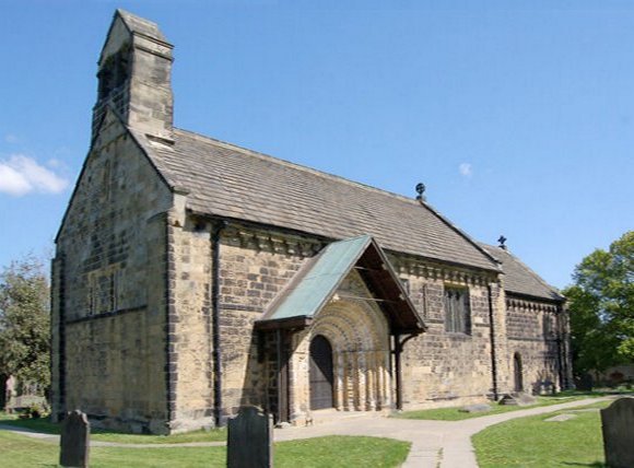
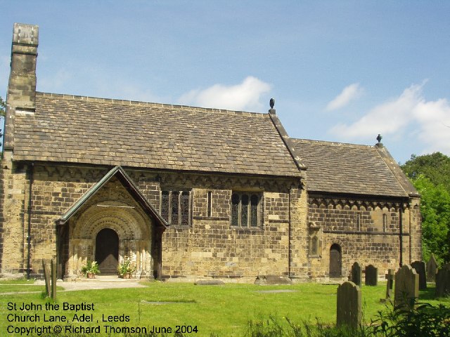
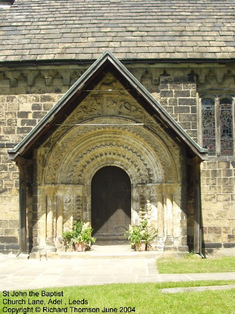
St John the Baptist Church, Adel

The Grade I listed, mainly Norman Church of Saint John the Baptist in Adel, Leeds, West Yorkshire, England has been described by Nicholas Pevsner as 'one...
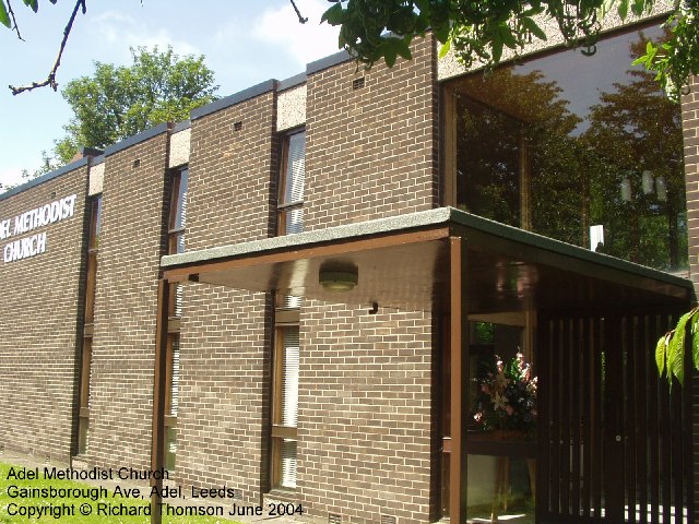
Adel, Leeds

Adel is a suburb of Leeds, West Yorkshire, England. To its immediate south is Weetwood, to the west are Cookridge and Holt Park, to the east are Alwoodley...

Golden Acre Park

Golden Acre Park is a public park in Bramhope, Leeds, West Yorkshire, England (grid reference SE267417), administered by Leeds City Council. It is on...

Holt Park

Holt Park is a medium-sized low-rise 1970s housing estate in the northwest suburbs of Leeds, West Yorkshire, England. It is approximately 6 miles (10...

Nearby Amenities

Located within 500m of 53.858596,-1.5753987
Turning Circle
Lat/Long: 53.8545905/-1.5737981
Turning Circle
Lat/Long: 53.8547125/-1.5750719
Turning Circle
Lat/Long: 53.8557773/-1.5768448
Turning Circle
Lat/Long: 53.8551679/-1.5792333
Turning Circle
Lat/Long: 53.8546291/-1.5778855
Post Box
Brand: Royal Mail
Brand Wikidata: Q638098
Brand Wikipedia: en:Royal Mail
Collection Times: Mo-Fr 09:00; Sa 07:00; Su off
Operator: Royal Mail
Operator Wikidata: Q638098
Post Box Type: pillar
Ref: LS16 427
Royal Cypher: EIIR
Royal Cypher Wikidata: Q33102113
Lat/Long: 53.8568006/-1.5799089
Adel Crags
Natural: rock
Sport: climbing
Lat/Long: 53.8575349/-1.5732492
Barrier: kissing_gate
Lat/Long: 53.8578855/-1.5773404
The data included in this document is from www.openstreetmap.org. The data is made available under ODbL.

Have you been to Alwoodley Crags Plantation?

Leave your review of Alwoodley Crags Plantation below (or comments, questions and feedback).