Arpafeelie

Settlement in Ross-shire

Scotland

Arpafeelie

Cattle Grazing Fields at Glackmore
Cattle Grazing Credit: Dave Fergusson

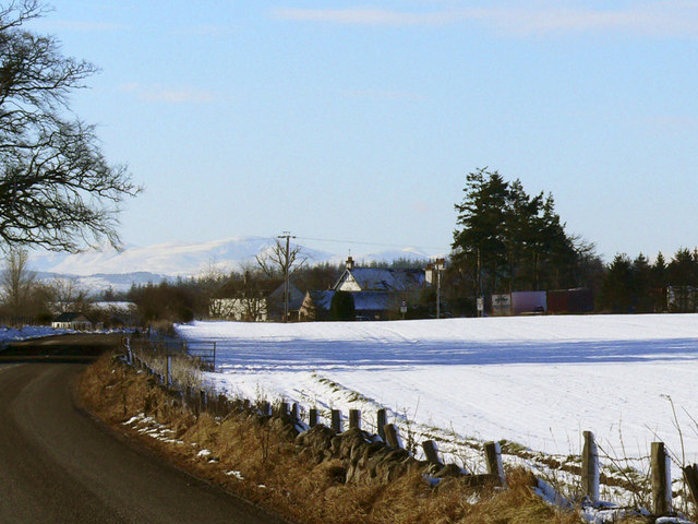
Arpafeelie is a small village located in the county of Ross-shire, in the Scottish Highlands. Situated about 12 miles northwest of Inverness, it is nestled amidst stunning natural landscapes and offers a quiet and picturesque setting. The village is part of the larger community of Munlochy, and its name is derived from the Gaelic words "áirigh" and "phuill," meaning "sheiling" and "pool" respectively.

The village of Arpafeelie is characterized by its charming rural atmosphere and traditional Scottish architecture. The houses are predominantly built with local materials, such as stone and slate, giving the village a quaint and timeless feel. The surrounding countryside offers breathtaking views of rolling hills, lush green fields, and nearby forests, making it an ideal location for nature lovers and outdoor enthusiasts.

Despite its small size, Arpafeelie benefits from its close proximity to Inverness, which provides access to a range of amenities and services. The city is well-connected by road and public transport, allowing residents to easily commute to work or access recreational facilities. Additionally, the village is within reach of several historical and cultural attractions, including the iconic Loch Ness, Urquhart Castle, and the Culloden Battlefield.

Arpafeelie's tranquil setting and friendly community make it an idyllic place to reside or visit for those seeking a peaceful retreat away from the bustling city life. Whether exploring the local countryside, immersing in Scottish history, or simply enjoying the serenity of the surroundings, Arpafeelie offers a unique and charming experience in the heart of the Scottish Highlands.

If you have any feedback on the listing, please let us know in the comments section below.
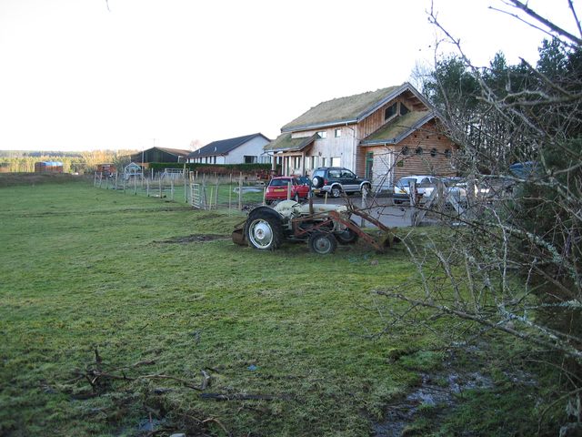
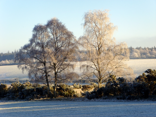
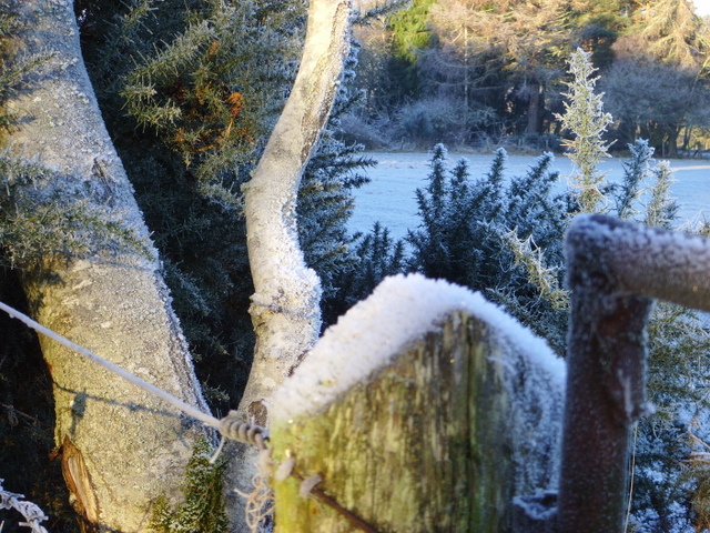
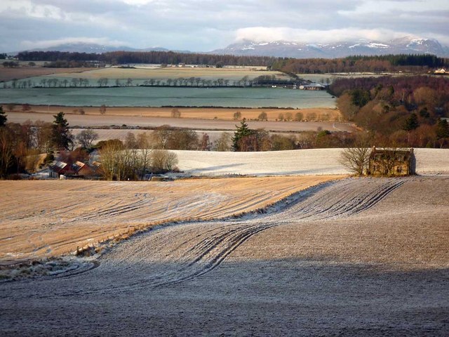
Arpafeelie Images

Images are sourced within 2km of 57.522932/-4.31643 or Grid Reference NH6150. Thanks to Geograph Open Source API. All images are credited.

Cattle Grazing Fields at Glackmore
Cattle Grazing
Fields at Glackmore
Glackmore Farm In the district of Glackmore
Glackmore Farm
In the district of Glackmore
Allangrange All that remains of a 13th century church.
Allangrange
All that remains of a 13th century church.
Forestry at Broomhill A small area of forest recovering from being cleared, probably a few years ago. A few tall trees have been left behind and the ground is returning to its natural state among the stumps of the felled trees.
Forestry at Broomhill
A small area of forest recovering from being cleared, probably a few years ago. A few tall trees have been left behind and the ground is returning to its natural state among the stumps of the felled trees.
Stubble A field of stubble next to the A9, which runs in the trees on the far side.
Stubble
A field of stubble next to the A9, which runs in the trees on the far side.
Barn at Cotterton Used today as a shelter for horses.
Barn at Cotterton
Used today as a shelter for horses.
Glachbeg Croft Glachbeg Croft is an education centre that is part of a six hectare croft on the Black Isle. It offers community events, training for adults with special needs and programmes around farming, the countryside and environmental education. Note the turf roof.
Glachbeg Croft
Glachbeg Croft is an education centre that is part of a six hectare croft on the Black Isle. It offers community events, training for adults with special needs and programmes around farming, the countryside and environmental education. Note the turf roof.
Black Isle Brewery Small organic brewery southeast of Munlochy village.
Black Isle Brewery
Small organic brewery southeast of Munlochy village.
House near the Black Isle Brewery One half (the nearest) is in NH6251, while the other is in NH6351.
House near the Black Isle Brewery
One half (the nearest) is in NH6251, while the other is in NH6351.
Black Isle Brewery Opened in 1998 at Old Allangrange, Black Isle.
Black Isle Brewery
Opened in 1998 at Old Allangrange, Black Isle.
Near Glachbeg, on a frosty morning.
Frosty corner, Glachbeg
Fields around Parkton Farm A Black Isle scene with Beinn Wyvis dominating the skyline.  The view was taken from a circular walk between Arpafeelie and Redcastle that circumnavigates Gallowhill Wood.
Fields around Parkton Farm
A Black Isle scene with Beinn Wyvis dominating the skyline. The view was taken from a circular walk between Arpafeelie and Redcastle that circumnavigates Gallowhill Wood.
Track alongside Gallowhill Wood This is a section of the circular walk between Arpafeelie and Redcastle.
Track alongside Gallowhill Wood
This is a section of the circular walk between Arpafeelie and Redcastle.
Forestry track through Gallowhill Wood This track ends abruptly, but enterprising walkers have created a way to link up with another forestry track to create a circular walk from Arpafeelie to Redcastle.
Forestry track through Gallowhill Wood
This track ends abruptly, but enterprising walkers have created a way to link up with another forestry track to create a circular walk from Arpafeelie to Redcastle.
Farmland near Tore A typical Black Isle mix of farmland and woods with scattered settlement.
Farmland near Tore
A typical Black Isle mix of farmland and woods with scattered settlement.
Black Isle Brewery The small brewery , soon to be relocated to Allengrange Mains.
Black Isle Brewery
The small brewery , soon to be relocated to Allengrange Mains.
The Black Isle Brewery A lovely Organic Brewery the only one on the Black Isle.
The Black Isle Brewery
A lovely Organic Brewery the only one on the Black Isle.
Show me another place!

Arpafeelie is located at Grid Ref: NH6150 (Lat: 57.522932, Lng: -4.31643)

Unitary Authority: Highland

Police Authority: Highlands and Islands

What 3 Words

///gripes.sounding.entitles. Near Inverness, Highland

Nearby Locations

Arpafeelie

Related Wikis

Arpafeelie

Arpafeelie (Scottish Gaelic: Arpa Phìlidh) is a hamlet on the Black Isle, in Ross and Cromarty, in the Highland council area of Scotland. It is situated...

Allangrange railway station

Allangrange railway station was a station on the single track branch of the Highland Railway, in north east Scotland. The line connected villages in The...

Artafallie

Artafallie (Scottish Gaelic: Àirde Fàillidh) is a hamlet on the Black Isle, in the Highland council area of Scotland. It is about two km (1.2 mi) to the...

Tore, Scotland

Tore (Scottish Gaelic: An Todhar) is a small village on the Black Isle, in Ross and Cromarty, Highland, Scotland. == Settlements == It is located 7 miles...

Croftnacreich

Croftnacreich () is a hamlet on the Black Isle, in Ross and Cromarty in the Highland council area of Scotland. It is one mile (1.6 km) north-west of North...
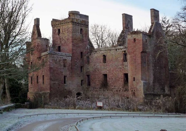
Redcastle

Redcastle (Scottish Gaelic: an Caisteal ruadh), historically known as Edirdovar and Ederdour, is a medieval castle in Killearnan on the Black Isle, northern...

Knockbain

Knockbain is a parish on the Black Isle, in the county of Ross and Cromarty in Highland council area, Scotland. It includes the villages of North Kessock...

Redcastle railway station

Redcastle railway station served the parish of Killearnan, Ross and Cromarty, Scotland, from 1894 to 1951 on the Fortrose Branch. == History == The station...

Nearby Amenities

Located within 500m of 57.522932,-4.31643
Bus Stop
Arpafellie Junction
Naptan AtcoCode: 670090024
Naptan Bearing: NW
Naptan CommonName: Arpafellie Junction
Naptan Indicator: Road Junction With A9
Naptan Landmark: Arpafellie Junction
Naptan NaptanCode: 45323285
Naptan Street: A9
Naptan Verified: no
Source: naptan_import
Lat/Long: 57.5228682/-4.3159123
Parking
Lat/Long: 57.5231432/-4.3226256
Redfield
Name Gd: An Raon Dearg
Note Retag: CS #48756035
Place: hamlet
Source: survey 13th September 2014
Lat/Long: 57.5267032/-4.3174854
Arpafeelie
Name Gd: Arpa Phìlidh
Place: hamlet
Wikidata: Q2356165
Wikipedia: en:Arpafeelie
Lat/Long: 57.5234135/-4.3218907
Power: pole
Lat/Long: 57.5210172/-4.311584
Power: pole
Lat/Long: 57.5207721/-4.3102346
Power: pole
Lat/Long: 57.5221723/-4.3165129
Power: pole
Lat/Long: 57.5230723/-4.3143538
Power: pole
Lat/Long: 57.5234144/-4.3149687
Power: pole
Lat/Long: 57.5237478/-4.3155653
Power: pole
Lat/Long: 57.524175/-4.3163242
Power: pole
Lat/Long: 57.5246108/-4.3171054
Power: pole
Lat/Long: 57.5250313/-4.3178745
Power: pole
Lat/Long: 57.5254367/-4.3185726
Power: pole
Lat/Long: 57.5260773/-4.3189825
Power: pole
Lat/Long: 57.5266874/-4.3193518
Power: pole
Lat/Long: 57.5238002/-4.3210266
Power: pole
Lat/Long: 57.5242014/-4.3204677
Power: pole
Lat/Long: 57.5245542/-4.320007
Power: pole
Lat/Long: 57.5250482/-4.3192882
Power: pole
Lat/Long: 57.5232487/-4.3160186
Power: pole
Lat/Long: 57.5227042/-4.3165072
Power: pole
Lat/Long: 57.5215679/-4.3126293
Power: pole
Lat/Long: 57.522062/-4.3135811
Power: pole
Lat/Long: 57.5225128/-4.3133569
The data included in this document is from www.openstreetmap.org. The data is made available under ODbL.

Have you been to Arpafeelie?

Leave your review of Arpafeelie below (or comments, questions and feedback).