Barcheston Spinney

Wood, Forest in Warwickshire Stratford-on-Avon

England

Barcheston Spinney

View to Shipston-on-Stour View to Shipston-on-Stour from Brailes Hill.
View to Shipston-on-Stour Credit: Philip Halling

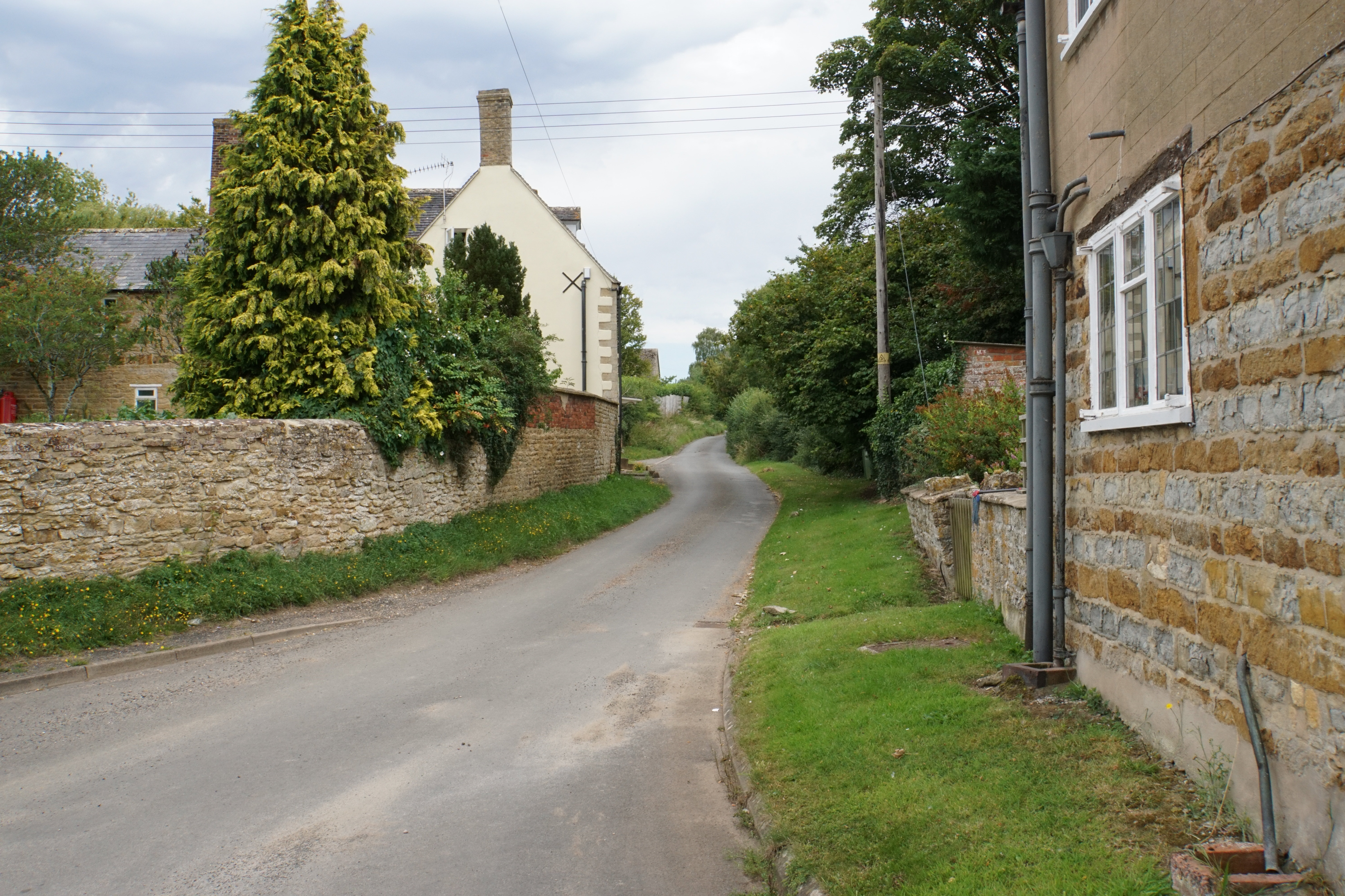
Barcheston Spinney is a charming woodland area located in the county of Warwickshire, England. Spanning approximately 20 acres, it is situated near the village of Barcheston, just a few miles south of Shipston-on-Stour. The spinney is a popular spot for nature enthusiasts, hikers, and birdwatchers due to its diverse range of flora and fauna.

The wood is predominantly composed of deciduous trees, with oak, ash, and beech being the most prevalent species. These towering trees provide a stunning canopy, offering shade and shelter to a variety of wildlife. The forest floor is covered in a lush carpet of bluebells in spring, creating a breathtaking sight for visitors.

Barcheston Spinney is also home to an array of bird species, making it a haven for birdwatchers. Common sightings include the great spotted woodpecker, nuthatch, and various species of tits. The tranquil atmosphere of the spinney, coupled with the melodic chirping of birds, creates a peaceful and relaxing ambiance.

For those who enjoy walking, there are several well-maintained footpaths that wind their way through the spinney, allowing visitors to explore the wood at their own pace. These paths offer glimpses of the surrounding countryside, with views of rolling hills and meadows.

Overall, Barcheston Spinney is a hidden gem in Warwickshire, offering a serene escape into nature. Whether you are seeking a peaceful stroll, a birdwatching adventure, or simply a place to connect with the natural world, this wood is sure to leave you refreshed and rejuvenated.

If you have any feedback on the listing, please let us know in the comments section below.

Barcheston Spinney Images

Images are sourced within 2km of 52.061144/-1.5938505 or Grid Reference SP2740. Thanks to Geograph Open Source API. All images are credited.

View to Shipston-on-Stour View to Shipston-on-Stour from Brailes Hill.
View to Shipston-on-Stour
View to Shipston-on-Stour from Brailes Hill.
Bridleway on Brailes Hill Bridleway on the northern slopes of Brailes Hill.
Bridleway on Brailes Hill
Bridleway on the northern slopes of Brailes Hill.
View to Shipston-on-Stour View to Shipston-on-Stour from a bridleway on the western slopes of Brailes Hill.  Ilmington Down, the highest point in Warwickshire can be seen in the distance.
View to Shipston-on-Stour
View to Shipston-on-Stour from a bridleway on the western slopes of Brailes Hill. Ilmington Down, the highest point in Warwickshire can be seen in the distance.
Bridleway to Famington Farm Bridleway to Famington Farm below the western slopes of May Hill.
Bridleway to Famington Farm
Bridleway to Famington Farm below the western slopes of May Hill.
Approaching Famington Farm Approaching Famington Farm near Willington, below the western slopes of Brailes Hill.
Approaching Famington Farm
Approaching Famington Farm near Willington, below the western slopes of Brailes Hill.
Bridleway to Upper Brailes Bridleway to Upper Brailes, pictured here near Famington Farm.
Bridleway to Upper Brailes
Bridleway to Upper Brailes, pictured here near Famington Farm.
Sheep near Willington I'm not sure what breed this sheep is, probably a crossbreed, but it does look a little like a Welsh Mountain Badger Face Sheep, though a little too thick-set.
Sheep near Willington
I'm not sure what breed this sheep is, probably a crossbreed, but it does look a little like a Welsh Mountain Badger Face Sheep, though a little too thick-set.
Ridge and furrow field Ridge and furrow field near Willington, with Brailes Hill in the background.  Too near the hill to see the clump of beech trees on the summit.
Ridge and furrow field
Ridge and furrow field near Willington, with Brailes Hill in the background. Too near the hill to see the clump of beech trees on the summit.
Drive to Famington Farm Drive to Famington Farm near Willington.  The willow trees on the course of a stream appear to be regularly pollarded.
Drive to Famington Farm
Drive to Famington Farm near Willington. The willow trees on the course of a stream appear to be regularly pollarded.
Footpath across a field Footpath across a field of ridge and furrow near Famington Field.
Footpath across a field
Footpath across a field of ridge and furrow near Famington Field.
Ridge and furrow field Ridge and furrow field near Famington Farm near Willington.  The town of Shipston-on-Stour can be seen in the distance, with Ilmington Down the hill in the background.
Ridge and furrow field
Ridge and furrow field near Famington Farm near Willington. The town of Shipston-on-Stour can be seen in the distance, with Ilmington Down the hill in the background.
House at Famington Farm View of the farmhouse to Famington Farm from the passing footpath.  Dating from the late 17th century the house is Grade II listed, see: <span class="nowrap"><a title="https://historicengland.org.uk/listing/the-list/list-entry/1024409?section=official-listing" rel="nofollow ugc noopener" href="https://historicengland.org.uk/listing/the-list/list-entry/1024409?section=official-listing">Link</a><img style="margin-left:2px;" alt="External link" title="External link - shift click to open in new window" src="https://s1.geograph.org.uk/img/external.png" width="10" height="10"/></span>  There appears to be a kine of summer house in front the farmhouse.
House at Famington Farm
View of the farmhouse to Famington Farm from the passing footpath. Dating from the late 17th century the house is Grade II listed, see: LinkExternal link There appears to be a kine of summer house in front the farmhouse.
Footpath across a field below Brailes Hill The town of Ship-on-Stour can be seen in the middle distance with Ilmington Down the hill in the background.
Footpath across a field below Brailes Hill
The town of Ship-on-Stour can be seen in the middle distance with Ilmington Down the hill in the background.
Road near Willington Country road from Willington to Cherington.
Road near Willington
Country road from Willington to Cherington.
Barcheston church St Martin's church, Barcheston.  The tower has a significant incline as can be seen here.  The church which dates from 12th century is Grade II* listed, see: <span class="nowrap"><a title="https://historicengland.org.uk/listing/the-list/list-entry/1024407?section=official-listing" rel="nofollow ugc noopener" href="https://historicengland.org.uk/listing/the-list/list-entry/1024407?section=official-listing">Link</a><img style="margin-left:2px;" alt="External link" title="External link - shift click to open in new window" src="https://s1.geograph.org.uk/img/external.png" width="10" height="10"/></span>
Barcheston church
St Martin's church, Barcheston. The tower has a significant incline as can be seen here. The church which dates from 12th century is Grade II* listed, see: LinkExternal link
Detail of stone on Barcheston church Barcheston is in the northern Cotswolds and the stone here has a hint of iron in it.  These stones are in the tower's west wall.
Detail of stone on Barcheston church
Barcheston is in the northern Cotswolds and the stone here has a hint of iron in it. These stones are in the tower's west wall.
Base of a Medieval cross Base of a Medieval preaching cross in Barcheston churchyard.  The cross is Grade II listed, see: <span class="nowrap"><a title="https://historicengland.org.uk/listing/the-list/list-entry/1355462?section=official-listing" rel="nofollow ugc noopener" href="https://historicengland.org.uk/listing/the-list/list-entry/1355462?section=official-listing">Link</a><img style="margin-left:2px;" alt="External link" title="External link - shift click to open in new window" src="https://s1.geograph.org.uk/img/external.png" width="10" height="10"/></span>
Base of a Medieval cross
Base of a Medieval preaching cross in Barcheston churchyard. The cross is Grade II listed, see: LinkExternal link
Old water pump Former water pump near Barcheston church.
Old water pump
Former water pump near Barcheston church.
Show me another place!

Barcheston Spinney is located at Grid Ref: SP2740 (Lat: 52.061144, Lng: -1.5938505)

Administrative County: Warwickshire

District: Stratford-on-Avon

Police Authority: Warwickshire

What 3 Words

///freshest.frames.stability. Near Shipston on Stour, Warwickshire

Related Wikis

Shipston-on-Stour Rural District

Shipston on Stour was a rural district in England from 1894 to 1974. [1] The district covered an area around Shipston-on-Stour. Originally it was a detached...

Evolution of Worcestershire county boundaries since 1844

The administrative boundaries of Worcestershire, England have been fluid for over 150 years since the first major changes in 1844. There were many detached...

Willington, Warwickshire

Willington is a village in Warwickshire, England. Population details are included within Barcheston. The origin of the place-name is from Old English tun...
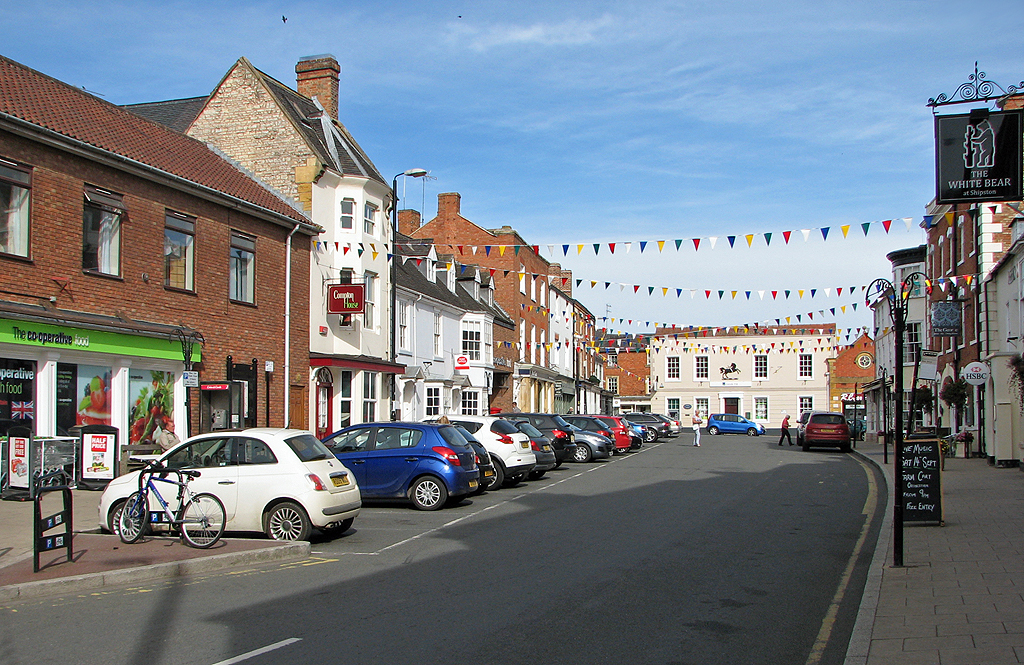
Shipston-on-Stour

Shipston-on-Stour is a town and civil parish in the Stratford-on-Avon District in southern Warwickshire, England. It is located on the banks of the River...

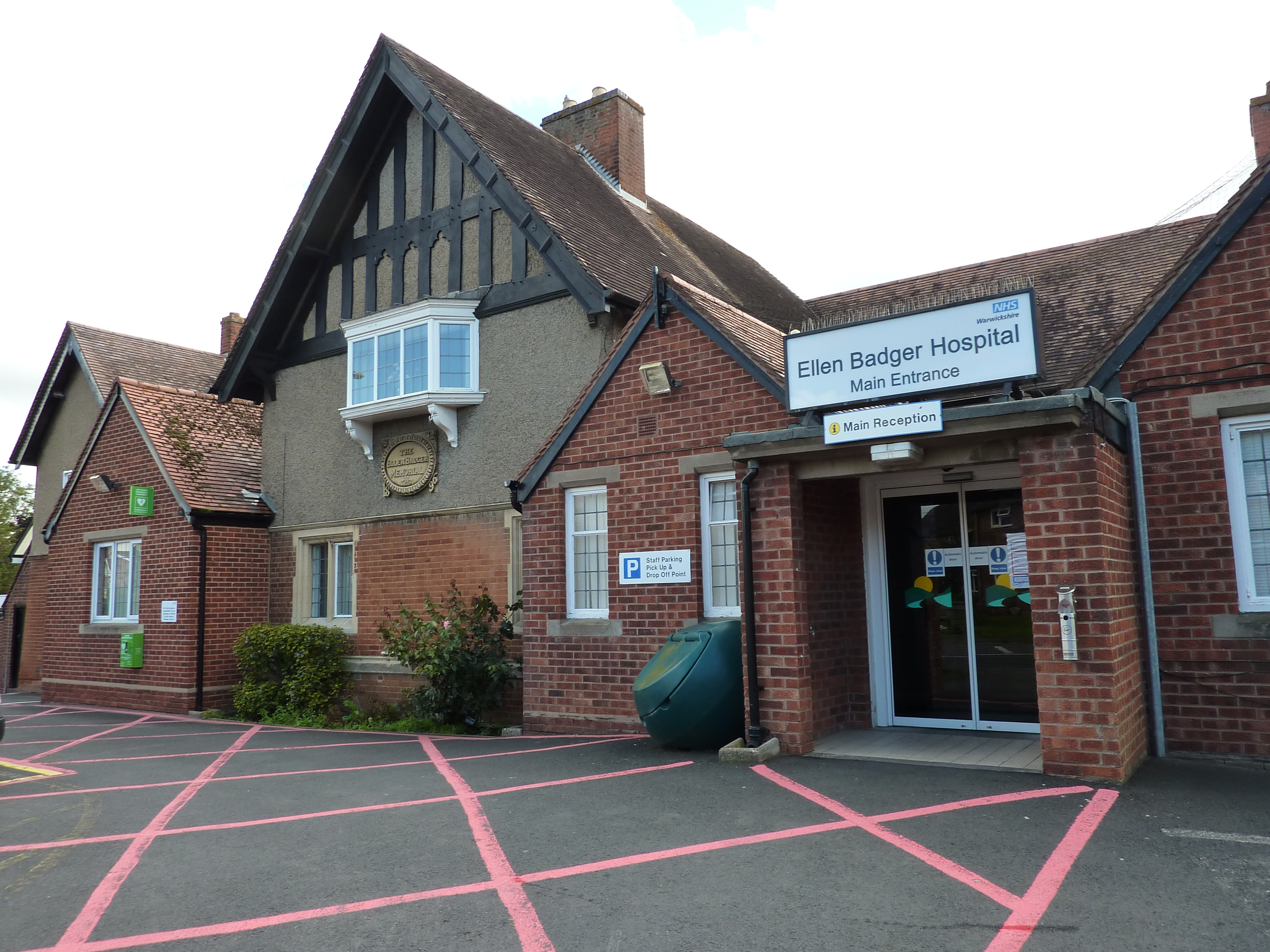
Ellen Badger Hospital

The Ellen Badger is a small community NHS hospital located within the town of Shipston-on-Stour in Warwickshire, England. It is operated by South Warwickshire...

Shipston-on-Stour RFC

Shipston-on-Stour Rugby Football Club is an English rugby union team based in Shipston-on-Stour in Warwickshire. They currently play in Regional 2 South...

Shipston-on-Stour railway station

Shipston-on-Stour railway station was a railway station which served the town of Shipston-on-Stour, Warwickshire. It was the terminus of the Shipston-on...

Honington, Warwickshire

Honington, Warwickshire is a hamlet and civil parish in the Stratford-on-Avon District of Warwickshire, England. It is in the Brailes division of the hundred...

Nearby Amenities

Located within 500m of 52.061144,-1.5938505
Barrier: stile
Lat/Long: 52.062043/-1.594237
Power: pole
Source: bing
Lat/Long: 52.064771/-1.5900967
Power: pole
Source: bing
Lat/Long: 52.0646696/-1.5913305
Power: pole
Ref: 772871
Source: wpd_opendata
Transformer: distribution
Lat/Long: 52.0647257/-1.5924436
Power: pole
Source: bing
Lat/Long: 52.0638262/-1.5962577
Power: pole
Source: bing
Lat/Long: 52.0643349/-1.5953498
Power: pole
Source: bing
Lat/Long: 52.0648427/-1.5945733
Power: pole
Source: bing
Lat/Long: 52.0647892/-1.593499
Tusbrook Barn
Power: pole
Transformer: distribution
Voltage Primary: 11000
Lat/Long: 52.0591164/-1.5968639
Borough Hill Farm
Power: pole
Transformer: distribution
Voltage Primary: 11000
Lat/Long: 52.0608876/-1.6011527
Power: pole
Lat/Long: 52.0614953/-1.6001228
Power: pole
Lat/Long: 52.0621351/-1.599074
Power: pole
Lat/Long: 52.0628458/-1.5978885
Power: pole
Lat/Long: 52.0632944/-1.5971133
The data included in this document is from www.openstreetmap.org. The data is made available under ODbL.

Have you been to Barcheston Spinney?

Leave your review of Barcheston Spinney below (or comments, questions and feedback).