Little Wood

Wood, Forest in Warwickshire Warwick

England

Little Wood

A452 Birmingham Road at Red Lane
A452 Birmingham Road at Red Lane Credit: Ian S

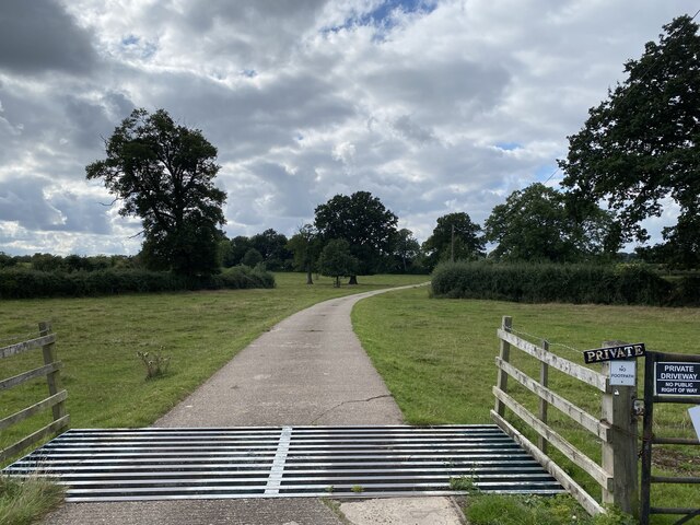
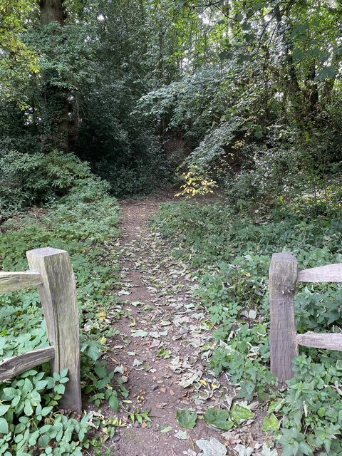
Little Wood is a small forest located in Warwickshire, England. Covering an area of approximately 50 acres, it is known for its picturesque landscapes and diverse vegetation. The woodland is situated on gently sloping terrain, offering visitors a charming and tranquil environment to explore.

The forest is primarily composed of deciduous trees such as oak, birch, and beech, which create a dense canopy of foliage during the summer months. This provides a habitat for a variety of wildlife, including birds, squirrels, and deer, making it a popular destination for nature enthusiasts and birdwatchers.

Little Wood is crisscrossed by a network of well-maintained footpaths, allowing visitors to easily navigate through its enchanting trails. These pathways offer breathtaking views of the surrounding countryside and provide opportunities for leisurely walks, jogging, or cycling.

The forest is particularly renowned for its vibrant display of bluebells in the spring, attracting countless visitors who come to witness the stunning carpet of purple flowers that blankets the forest floor. This natural spectacle has become an annual event, drawing both locals and tourists to witness the beauty of nature in full bloom.

Little Wood also offers a range of recreational activities, including picnic areas and designated camping spots. It is a popular destination for families, providing a safe and enjoyable environment for children to explore and play.

Overall, Little Wood in Warwickshire is a charming and idyllic forest, offering a peaceful retreat from the hustle and bustle of daily life. Whether you seek a leisurely stroll, a closer connection with nature, or a picturesque picnic spot, this woodland is sure to satisfy all your outdoor desires.

If you have any feedback on the listing, please let us know in the comments section below.
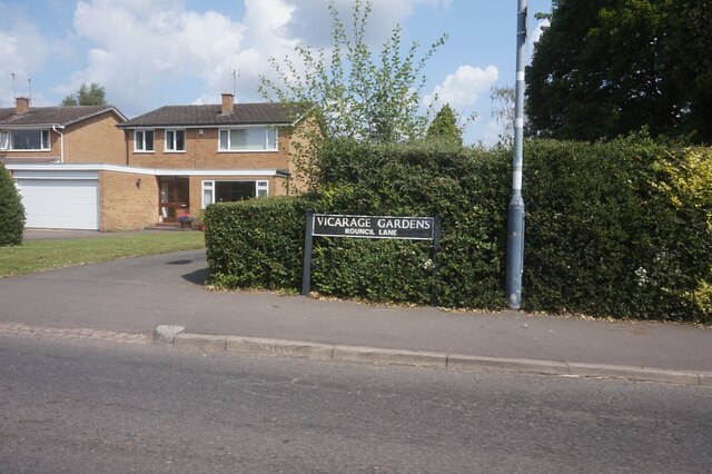
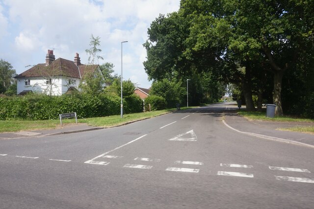
Little Wood Images

Images are sourced within 2km of 52.345098/-1.5913873 or Grid Reference SP2771. Thanks to Geograph Open Source API. All images are credited.

A452 Birmingham Road at Red Lane
The Green Man public house, Kenilworth
Clarke's Avenue, Kenilworth
Mortimer Road, Kenilworth
Vicarage Gardens off Rouncil Lane, Kenilworth
Rounds Hill off Mortimer Road
Making a deck, The Engine public house, Mill End, Kenilworth In the later phase of the pandemic, pubs that had had to close invested in creating outdoor space so that they could safely serve socially-distanced patrons.
Making a deck, The Engine public house, Mill End, Kenilworth
In the later phase of the pandemic, pubs that had had to close invested in creating outdoor space so that they could safely serve socially-distanced patrons.
Odibourne Allotments, Manor Road, Kenilworth The allotments were open to the public for the Heritage Open Days 2021 and Edible England events; members of the Kenilworth Allotment Tenants' Association (KATA) can be seen welcoming visitors. 

The Odibourne site was established in 1919, when Kenilworth Urban District Council bought land from the estate of the deceased William Thomas Pears. The council had recently decided to build on the 'Noah's Ark' allotments nearby, but was obliged under the 1908 Smallholding & Allotments Act to provide sufficient land for local people who wanted plots for growing food. The site is owned today by Kenilworth Town Council, but has been managed since 1983 by KATA (information taken from a notice board on the site).
Odibourne Allotments, Manor Road, Kenilworth
The allotments were open to the public for the Heritage Open Days 2021 and Edible England events; members of the Kenilworth Allotment Tenants' Association (KATA) can be seen welcoming visitors. The Odibourne site was established in 1919, when Kenilworth Urban District Council bought land from the estate of the deceased William Thomas Pears. The council had recently decided to build on the 'Noah's Ark' allotments nearby, but was obliged under the 1908 Smallholding & Allotments Act to provide sufficient land for local people who wanted plots for growing food. The site is owned today by Kenilworth Town Council, but has been managed since 1983 by KATA (information taken from a notice board on the site).
Plot 58a, Odibourne Allotments, Kenilworth These allotments, which to this city dweller appear impossibly idyllic, were open to the public for the Heritage Open Days 2021. Behind the idyll, of course, lies hard work and long term commitment, the challenge of group politics, the uncertainty of the weather and the threat, even here, of theft and vandalism. The Odibourne allotments were established in 1919.
Plot 58a, Odibourne Allotments, Kenilworth
These allotments, which to this city dweller appear impossibly idyllic, were open to the public for the Heritage Open Days 2021. Behind the idyll, of course, lies hard work and long term commitment, the challenge of group politics, the uncertainty of the weather and the threat, even here, of theft and vandalism. The Odibourne allotments were established in 1919.
I'm in the Green Zone A scarecrow, probably more decorative than functional, at the Odibourne allotments in Kenilworth, which were open to the public for the Heritage Open Days 2021.
I'm in the Green Zone
A scarecrow, probably more decorative than functional, at the Odibourne allotments in Kenilworth, which were open to the public for the Heritage Open Days 2021.
Apple Pressing at Odibourne Allotments, Kenilworth The allotment site was open to the public as part of the Heritage Open Days 2021 and Edible England events.
Apple Pressing at Odibourne Allotments, Kenilworth
The allotment site was open to the public as part of the Heritage Open Days 2021 and Edible England events.
'My Shed, My Rules' The sheds of the Odibourne Allotments, Kenilworth, are the subject of their own book, 'Odibourne Sheds: rural retreats in a Kenilworth allotment', by Peter James, published by the Bothy Press in 2020.
'My Shed, My Rules'
The sheds of the Odibourne Allotments, Kenilworth, are the subject of their own book, 'Odibourne Sheds: rural retreats in a Kenilworth allotment', by Peter James, published by the Bothy Press in 2020.
The Rules: Water butt on Odibourne Allotments, Kenilworth A water butt and rules governing its use, on the Odibourne Allotments, open to the public for the Heritage Open Days 2021 and Edible England events.
The Rules: Water butt on Odibourne Allotments, Kenilworth
A water butt and rules governing its use, on the Odibourne Allotments, open to the public for the Heritage Open Days 2021 and Edible England events.
Odibourne Allotments, Kenilworth, looking towards Lower Ladyes Hills Not normally open to the public, the allotments were welcoming visitors for the day as part of the Heritage Open Days 2021 and Edible England events. A scarecrow in the form of a Tokyo Olympics mascot can be seen to the right of the picture.
Odibourne Allotments, Kenilworth, looking towards Lower Ladyes Hills
Not normally open to the public, the allotments were welcoming visitors for the day as part of the Heritage Open Days 2021 and Edible England events. A scarecrow in the form of a Tokyo Olympics mascot can be seen to the right of the picture.
Bridge over the Finham Brook, Odibourne Allotments, Kenilworth No doubt flooding is another hazard of allotment life here, but the stream must have enriched the fertility of the valley over the years. Not normally accessible to the public, the allotments were open as part of the Heritage Open Days 2021 and Edible England events.
Bridge over the Finham Brook, Odibourne Allotments, Kenilworth
No doubt flooding is another hazard of allotment life here, but the stream must have enriched the fertility of the valley over the years. Not normally accessible to the public, the allotments were open as part of the Heritage Open Days 2021 and Edible England events.
Lower Ladyes Hills, Kenilworth, seen from the entrance to the Odibourne Allotments The allotments, which were established in the valley of the Finham Brook in 1919, were open to the public as part of the Heritage Open Days.
Lower Ladyes Hills, Kenilworth, seen from the entrance to the Odibourne Allotments
The allotments, which were established in the valley of the Finham Brook in 1919, were open to the public as part of the Heritage Open Days.
Farm Road to Oaks Farm
Path to castle earthworks Kenilworth Castle remains.
Path to castle earthworks
Kenilworth Castle remains.
Show me another place!

Little Wood is located at Grid Ref: SP2771 (Lat: 52.345098, Lng: -1.5913873)

Administrative County: Warwickshire

District: Warwick

Police Authority: Warwickshire

What 3 Words

///budget.third.await. Near Kenilworth, Warwickshire

Nearby Locations

Little Wood

Related Wikis

Nearby Amenities

Located within 500m of 52.345098,-1.5913873
Crossing
Crossing: marked
Crossing Island: no
Tactile Paving: no
Lat/Long: 52.3449886/-1.5860122
Barrier: cycle_barrier
Cycle Barrier: double
Cycle Barrier Installation: fixed
Lat/Long: 52.3473776/-1.5888539
Post Box
Brand: Royal Mail
Brand Wikidata: Q638098
Brand Wikipedia: en:Royal Mail
Collection Times: Mo-Fr 09:00; Sa 07:00
Operator: Royal Mail
Operator Wikidata: Q638098
Post Box Type: pillar
Ref: CV8 244D
Royal Cypher: GR
Royal Cypher Wikidata: Q33102273
Source: survey
Lat/Long: 52.3492458/-1.5915446
Telephone
Booth: K6
Covered: booth
Listed Status: Grade II
Operator: BT
Operator Wikidata: Q593786
Phone: +44 1926 851149
Source: survey
Lat/Long: 52.3492561/-1.5915378
Old Kenilworth
Tourism: attraction
Lat/Long: 52.3484858/-1.5889961
Toilets
Check Date: 2021-07-30
Fee: no
Wheelchair: yes
Lat/Long: 52.3486618/-1.5917616
Tourism: picnic_site
Lat/Long: 52.3482459/-1.5909641
Kenilworth Castle and Elizabethan Garden
Addr City: Kenilworth
Addr Housename: Castle Green
Addr Postcode: CV8 1NG
Addr Street: Castle Road
Tourism: museum
Website: https://www.english-heritage.org.uk/visit/places/kenilworth-castle/
Wheelchair: yes
Lat/Long: 52.3478833/-1.5907848
Cafe
Stables Café
Wheelchair: yes
Lat/Long: 52.348097/-1.5908019
Source: extrapolation
Lat/Long: 52.3483151/-1.5907874
Queen & Castle
Naptan AtcoCode: 4200F030301
Naptan Bearing: NE
Naptan BusStopType: CUS
Naptan CommonName: Queen & Castle
Naptan Indicator: Adj
Naptan NaptanCode: waragtgd
Naptan Street: Castle Hill
Naptan Verified: no
Source: naptan_import
Lat/Long: 52.3487071/-1.5900053
Bus Stop
Clarendon Arms
Bus: yes
Covered: no
Naptan AtcoCode: 4200F030302
Naptan Bearing: SW
Naptan CommonName: Clarendon Arms
Naptan Indicator: Opp
Naptan Landmark: Clarendon Arms
Naptan NaptanCode: waragtgj
Naptan Street: Castle Hill
Passenger Information Display: no
Public Transport: platform
Shelter: no
Source: naptan_import;survey
Lat/Long: 52.3486851/-1.589576
Barrier: kissing_gate
Lat/Long: 52.3486666/-1.5909269
Barrier: cattle_grid
Source: survey
Lat/Long: 52.3446592/-1.5913735
Bench
Backrest: yes
Source: survey
Lat/Long: 52.3462181/-1.5902109
Bench
Backrest: yes
Source: survey
Lat/Long: 52.3462855/-1.5902733
Barrier: kissing_gate
Source: survey
Lat/Long: 52.3457733/-1.5908002
Give Way
Direction: backward
Lat/Long: 52.3449888/-1.5850872
Information: guidepost
Lat/Long: 52.3486187/-1.5900846
Bench
Backrest: yes
Source: survey
Lat/Long: 52.3486196/-1.590234
Public Transport: stop_position
Lat/Long: 52.34867/-1.5899829
Post Box
Brand: Royal Mail
Brand Wikidata: Q638098
Brand Wikipedia: en:Royal Mail
Collection Times: Mo-Fr 09:00; Sa 07:00
Operator: Royal Mail
Operator Wikidata: Q638098
Post Box Type: pillar
Ref: CV8 378D
Royal Cypher: EIIR
Royal Cypher Wikidata: Q33102113
Source: survey
Lat/Long: 52.3449982/-1.5864885
Entrance: main
Lat/Long: 52.3487649/-1.5896289
Vending Machine
Check Date: 2022-06-25
Vending: parking_tickets
Lat/Long: 52.3459756/-1.5895127
Vending Machine
Vending: parking_tickets
Lat/Long: 52.3457246/-1.590321
Entrance: yes
Lat/Long: 52.3479233/-1.5931226
Addr Housenumber: 36A
Addr Street: Castle Hill
Entrance: main
Lat/Long: 52.3488215/-1.5893893
Communication: outdoor_dslam
Man Made: street_cabinet
Street Cabinet: telecom
Lat/Long: 52.3485885/-1.5898554
Man Made: street_cabinet
Ref: 2
Street Cabinet: telecom
Lat/Long: 52.3486024/-1.5898286
Entrance: main
Lat/Long: 52.3488247/-1.5893739
Barrier: sally_port
Lat/Long: 52.3471599/-1.5913414
Barrier: cattle_grid
Lat/Long: 52.3448026/-1.5870941
Bench
Backrest: yes
Lat/Long: 52.3427787/-1.586349
Castle Green WWII Air Raid Shelter
Historic: archaeological_site
Source: https://www.kenilworth-ww2.co.uk/index.php/sites-of-interest/air-raid-shelters
Lat/Long: 52.348855/-1.5916886
Bench
Backrest: yes
Lat/Long: 52.3411893/-1.5918272
Abbey Fields
Place: suburb
Source: OS Open Names
Wikidata: Q17985380
Wikipedia: en:Abbey Fields
Lat/Long: 52.3449117/-1.5849628
Give Way
Direction: forward
Lat/Long: 52.3448698/-1.5849869
Generator Method: photovoltaic
Generator Output Electricity: yes
Generator Source: solar
Generator Type: solar_photovoltaic_panel
Location: roof
Power: generator
Lat/Long: 52.3454059/-1.5873112
Turning Loop
Lat/Long: 52.341857/-1.5871236
Addr Housename: Scout and Guide Centre
Entrance: yes
Lat/Long: 52.3418609/-1.5872972
The data included in this document is from www.openstreetmap.org. The data is made available under ODbL.

Have you been to Little Wood?

Leave your review of Little Wood below (or comments, questions and feedback).