Denholm

Settlement in Roxburghshire

Scotland

Denholm

Ruberslaw Parish Church, Minto Minto was a planned village, designed and laid out by William Playfair for the 2nd Earl of Minto. The Church – a Victorian building in the Gothic style – was built as part of the plan and was completed in 1831, replacing a much earlier mediaeval building which stood a short distance to the east and which was recorded as far back as 1275.
Ruberslaw Parish Church, Minto Credit: Colin Kinnear

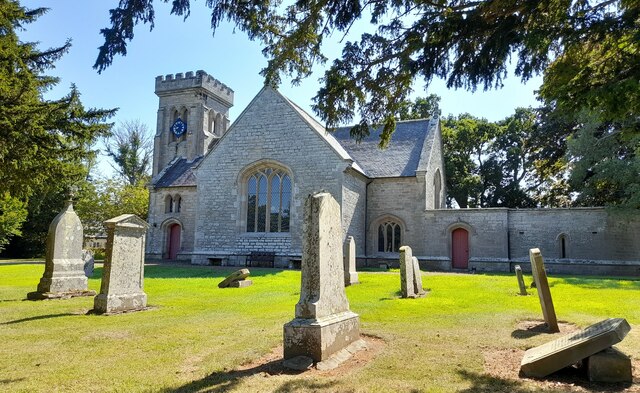
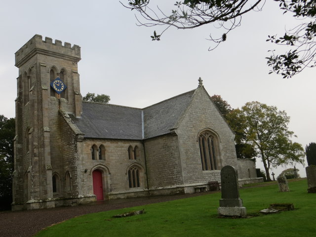
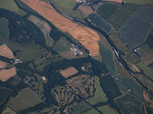
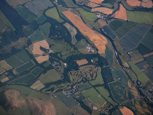
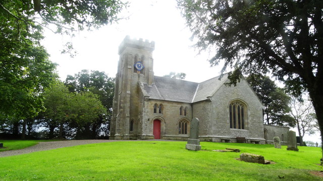
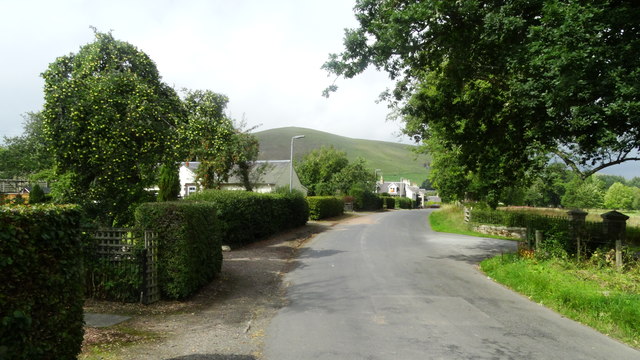
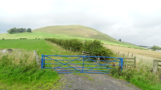
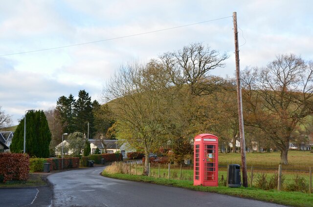
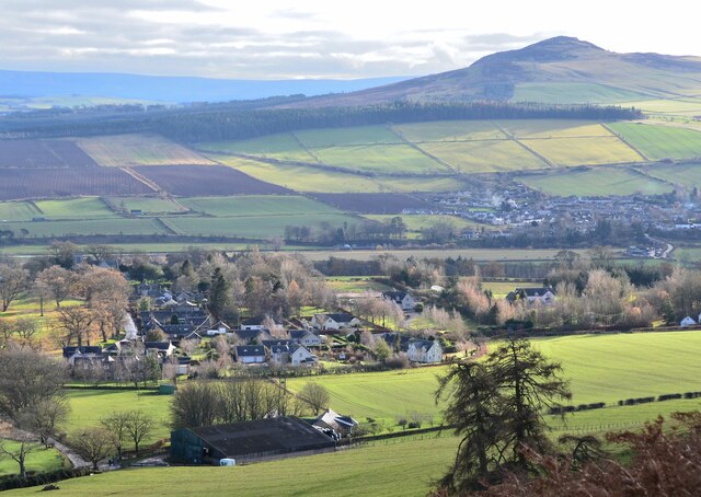
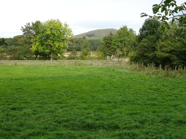
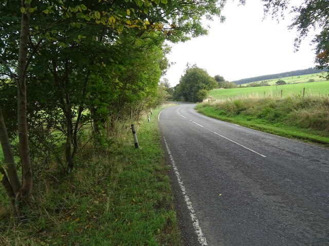
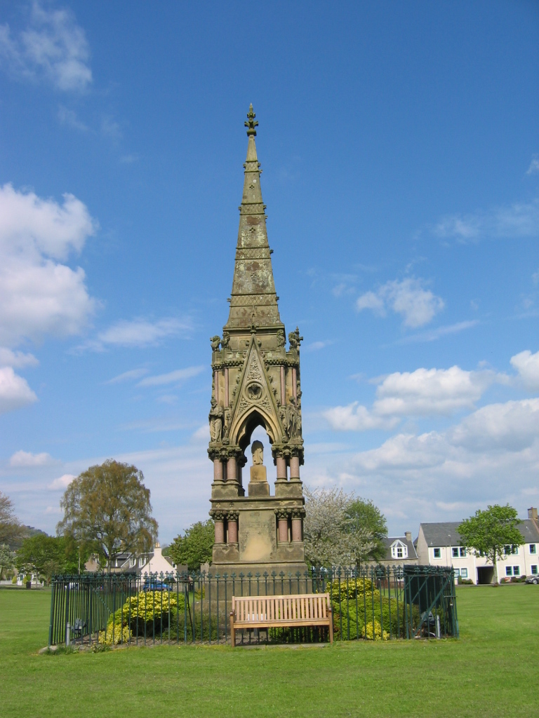
Denholm is a charming village located in the Scottish Borders region of Roxburghshire. Situated along the River Teviot, Denholm is known for its picturesque setting surrounded by rolling hills and lush countryside. The village is steeped in history, with many historic buildings and landmarks dotting its landscape.

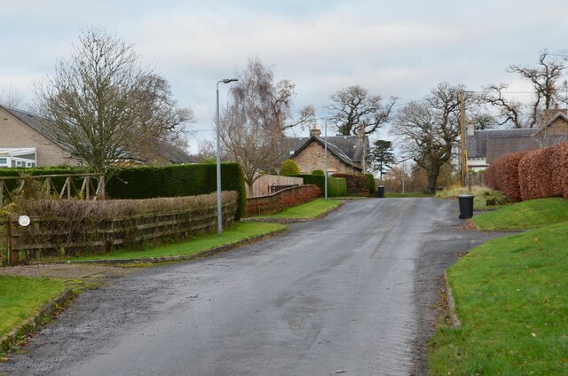
Denholm has a close-knit community with a population of around 600 residents. The village is home to a variety of amenities including a primary school, post office, village shop, and several pubs and restaurants. Denholm also hosts various events and activities throughout the year, such as the Denholm Folk Festival and the Denholm Fair.

Outdoor enthusiasts will find plenty to enjoy in Denholm, with various walking and cycling routes in the surrounding area. The village is also a popular destination for anglers, with the River Teviot offering excellent fishing opportunities.

Overall, Denholm is a quaint and idyllic village that offers a peaceful retreat for both residents and visitors alike. Its rich history, beautiful scenery, and welcoming community make it a truly special place to visit.

If you have any feedback on the listing, please let us know in the comments section below.
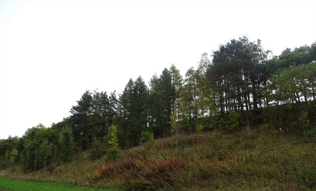
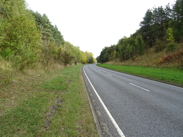
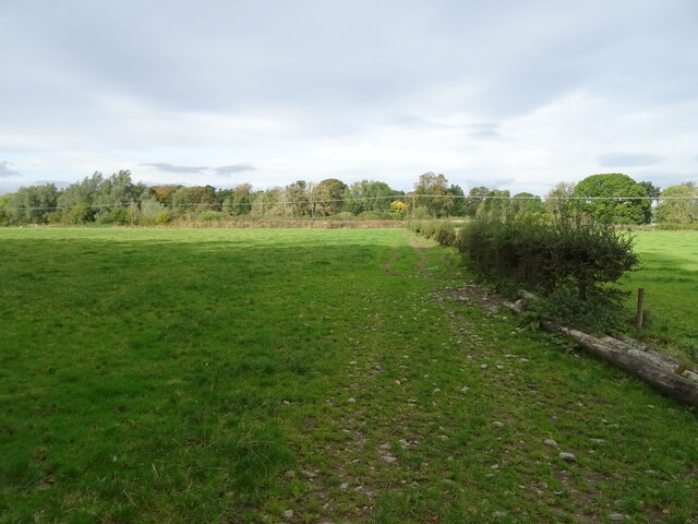
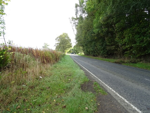
Denholm Images

Images are sourced within 2km of 55.458748/-2.6842449 or Grid Reference NT5618. Thanks to Geograph Open Source API. All images are credited.

Ruberslaw Parish Church, Minto Minto was a planned village, designed and laid out by William Playfair for the 2nd Earl of Minto. The Church – a Victorian building in the Gothic style – was built as part of the plan and was completed in 1831, replacing a much earlier mediaeval building which stood a short distance to the east and which was recorded as far back as 1275.
Ruberslaw Parish Church, Minto
Minto was a planned village, designed and laid out by William Playfair for the 2nd Earl of Minto. The Church – a Victorian building in the Gothic style – was built as part of the plan and was completed in 1831, replacing a much earlier mediaeval building which stood a short distance to the east and which was recorded as far back as 1275.
Ordnance Survey Cut Mark with Bolt This can be found on the wall of Minto Parish Church.
For more detail see: <span class="nowrap"><a title="http://www.bench-marks.org.uk/bm72134" rel="nofollow ugc noopener" href="http://www.bench-marks.org.uk/bm72134">Link</a><img style="margin-left:2px;" alt="External link" title="External link - shift click to open in new window" src="https://s1.geograph.org.uk/img/external.png" width="10" height="10"/></span>
Ordnance Survey Cut Mark with Bolt
This can be found on the wall of Minto Parish Church. For more detail see: LinkExternal link
Minto Parish Church Looking from the north-east.
Minto Parish Church
Looking from the north-east.
A symbolic gravestone at the site of the former Minto Old Parish Church This Memento Mori (remember you must die) portrait stone shows the deceased holding a book which denotes religious devotion. A winged soul above is a symbol of immortality representing the human soul rising to await Judgement Day, while the hammer, tongs and horseshoe below indicates that this is the grave of a blacksmith. Minto Old Parish Church was demolished in 1831, the same year that the present church was built. The stone is in a small group by an ancient yew tree <a href="https://www.geograph.org.uk/photo/766382">NT5720 : Old headstones at Minto</a>.
A symbolic gravestone at the site of the former Minto Old Parish Church
This Memento Mori (remember you must die) portrait stone shows the deceased holding a book which denotes religious devotion. A winged soul above is a symbol of immortality representing the human soul rising to await Judgement Day, while the hammer, tongs and horseshoe below indicates that this is the grave of a blacksmith. Minto Old Parish Church was demolished in 1831, the same year that the present church was built. The stone is in a small group by an ancient yew tree NT5720 : Old headstones at Minto.
Minto Golf Club from the air Viewed from a Prague bound flight from Edinburgh.
Minto Golf Club from the air
Viewed from a Prague bound flight from Edinburgh.
Minto and Minto Golf Club from the air The River Teviot runs through the scene. Viewed from a Prague bound flight from Edinburgh.
Minto and Minto Golf Club from the air
The River Teviot runs through the scene. Viewed from a Prague bound flight from Edinburgh.
Minto Church near Hawick
Lane N through Minto near Hawick
View towards Minto Hill from W of village of Minto
Minto village A small community beneath the twin hills of the same name.
Minto village
A small community beneath the twin hills of the same name.
Minto and Rubers Law A fine view of the village, Denholm beyond and Rubers Law (424m) making an imposing background, seen from South Minto Hill.
Minto and Rubers Law
A fine view of the village, Denholm beyond and Rubers Law (424m) making an imposing background, seen from South Minto Hill.
Road into Minto village Approaching Minto on the minor road from Hassendean.
Road into Minto village
Approaching Minto on the minor road from Hassendean.
Wooded embankment beside the A698, Teviotdale
A698 towards Denholm
Grazing and hedgerow, Teviot Bank
A698 beside woodland, Teviotdale Towards Denholm.
A698 beside woodland, Teviotdale
Towards Denholm.
Grazing, Denholm Bridge Towards the River Teviot.
Grazing, Denholm Bridge
Towards the River Teviot.
A698 approaching Denholm
Show me another place!

Denholm is located at Grid Ref: NT5618 (Lat: 55.458748, Lng: -2.6842449)

Unitary Authority: The Scottish Borders

Police Authority: The Lothians and Scottish Borders

What 3 Words

///roofer.connector.squeaking. Near Hawick, Scottish Borders

Nearby Locations

Denholm

Related Wikis

Denholm

Denholm is a small village located between Jedburgh and Hawick in the Scottish Borders region of Scotland, UK. The estimated population of Denholm is 600...

Westgate Hall, Denholm

Westgate Hall is located in Westgate in the village of Denholm, Roxburghshire, in the Scottish Borders. It stands at the western and south-western approaches...

Minto, Scottish Borders

Minto is a village and parish in the Scottish Borders area of Scotland in Roxburghshire county. It is located 6 miles (10 kilometres) north-east of Hawick...

Spittal-on-Rule

Spittal-on-Rule is a farm in the council area of Scottish Borders in Scotland. As the name suggests it is situated on the river Rule Water, and the Spittal...

Nearby Amenities

Located within 500m of 55.458748,-2.6842449
Denholm
Name Ang: Denum
Place: village
Population: 670
Wikidata: Q1020223
Wikimedia Commons: Category:Denholm
Wikipedia: en:Denholm
Lat/Long: 55.4580383/-2.6836244
Note: National speed limit sign in NE-direction, 30 mph speed limit sign in SW-direction
Lat/Long: 55.4589415/-2.679378
Bus Stop
Cross Keys Inn
Bus: yes
Check Date Shelter: 2021-05-22
Naptan AtcoCode: 69001025
Naptan Bearing: W
Naptan CommonName: Cross Keys Inn
Naptan Indicator: adj
Naptan Landmark: Village Green
Naptan NaptanCode: 72725828
Naptan Street: Main Street
Naptan Verified: yes
Operator: Scottish Borders Council
Public Transport: platform
Ref: 69001025
Route Ref: 20;397
Shelter: no
Source: survey;NaPTAN
Lat/Long: 55.4572541/-2.6843135
Bus Stop
Cross Keys Inn
Bus: yes
Local Ref: AT
Naptan AtcoCode: 69001026
Naptan Bearing: E
Naptan CommonName: Cross Keys Inn
Naptan Indicator: opp
Naptan Landmark: Village Green
Naptan NaptanCode: 72725829
Naptan Street: Main Street
Operator: Scottish Borders Council
Public Transport: platform
Ref: 69001026
Shelter: yes
Source: NaPTAN
Lat/Long: 55.457297/-2.6846622
Bus Stop
Eastlea Drive
Bus: yes
Local Ref: AT
Naptan AtcoCode: 69001027
Naptan Bearing: SW
Naptan CommonName: Eastlea Drive
Naptan Indicator: at
Naptan Landmark: Eastlea Drive
Naptan NaptanCode: 72725832
Naptan Street: Main Street
Operator: Scottish Borders Council
Public Transport: platform
Ref: 69001027
Source: NaPTAN
Lat/Long: 55.458353/-2.6806163
Bus Stop
Eastlea Drive
Bus: yes
Naptan AtcoCode: 6900229
Naptan Bearing: E
Naptan CommonName: Eastlea Drive
Naptan Indicator: opp
Naptan Landmark: Eastlea Drive
Naptan NaptanCode: 72723292
Naptan Street: Main Street
Operator: Scottish Borders Council
Public Transport: platform
Ref: 6900229
Shelter: no
Source: NaPTAN
Lat/Long: 55.45835/-2.6811539
Noexit: yes
Lat/Long: 55.4571281/-2.6780233
Noexit: yes
Lat/Long: 55.4593697/-2.6813089
Noexit: yes
Lat/Long: 55.4564909/-2.6804831
Turning Circle
Lat/Long: 55.4559618/-2.6813727
Noexit: yes
Lat/Long: 55.4606703/-2.6827186
Turning Circle
Lat/Long: 55.4563347/-2.6819773
Turning Circle
Lat/Long: 55.4568648/-2.6772349
Noexit: yes
Lat/Long: 55.4600007/-2.6837531
Noexit: yes
Lat/Long: 55.4610722/-2.681818
Turning Circle
Lat/Long: 55.4586582/-2.686373
Cafe
Cream Puff Cafe
Addr Housename: Elm House
Addr Postcode: TD9 8PG
Addr Street: Kirkside
Fhrs Id: 46700
Source Addr: FHRS Open Data
Lat/Long: 55.4581348/-2.682965
Douglas and Son
Shop: butcher
Source: survey
Survey Date: 2021-07-02
Lat/Long: 55.4579753/-2.6826766
Grit Bin
Source: survey
Lat/Long: 55.4563429/-2.6789287
Bench
Source: survey
Lat/Long: 55.4545759/-2.6838488
Note: 30 mph speed limit sign northbound
Lat/Long: 55.4546548/-2.6837122
Addr Country: GB
Addr Housename: Rosecroft
Source: survey
Lat/Long: 55.456058/-2.6837915
The Auld Bakery
Addr City: Denholm
Addr Postcode: TD9 8LX
Shop: convenience
Source: survey
Lat/Long: 55.4570823/-2.6850251
Fuel
Thomas B. Oliver
Brand: Thames
Source: survey
Survey Date: 2021-07-02
Lat/Long: 55.4592601/-2.6837928
Power: substation
Source: survey
Lat/Long: 55.4563839/-2.6845261
Post Box
Post Box Design: type_b
Post Box Type: pillar
Ref: TD9 70
Royal Cypher: scottish_crown
Source: survey
Lat/Long: 55.4571161/-2.6849642
Post Office
Denholm Post Office
Addr City: Denholm
Addr Housenumber: 1
Addr Postcode: TD9 8LX
Addr Street: Westside
Brand: Post Office
Brand Wikidata: Q1783168
Opening Hours: Mo,Tu,Th,Fr 08:00-13:00,14:00-17:30; We 08:00-13:00,14:00-17:00; Sa 08:00-12:30
Ref Pol Id: 2832
Website: https://www.postoffice.co.uk/branch-finder/150830x/denholm
Lat/Long: 55.457054/-2.6850028
Restaurant
Denholm Meet
Addr City: Denholm
Addr Postcode: TD9 8LX
Lat/Long: 55.45699/-2.6851453
Defibrillator
Emergency: defibrillator
Lat/Long: 55.4583484/-2.6835298
Denholm War Memorial
Historic: memorial
Memorial: war_memorial
Wikimedia Commons: File:Denholm_War_Memorial_-_geograph.org.uk_-_773892.jpg
Lat/Long: 55.456863/-2.6848633
Bench
Backrest: yes
Material: wood
Seats: 3
Survey Date: 2021-07-02
Lat/Long: 55.4580399/-2.6834157
Give Way
Direction: backward
Lat/Long: 55.4574968/-2.6808747
Give Way
Direction: forward
Lat/Long: 55.4579374/-2.6814676
Give Way
Direction: forward
Lat/Long: 55.4580361/-2.6830672
Bench
Lat/Long: 55.4581657/-2.6834836
Public Bookcase
Booth: K6
Disused Amenity: telephone
Man Made: telephone_box
Public Bookcase Type: phone_box
Lat/Long: 55.4576278/-2.6839469
Give Way
Direction: forward
Lat/Long: 55.4587167/-2.6842155
The Hawick Paper
Addr City: Denholm
Addr Housename: Cragview
Addr Postcode: TD9 8NQ
Addr Street: Eastgate
Office: newspaper
Phone: +44 1450 870648
Website: https://thehawickpaper.co.uk
Lat/Long: 55.4581417/-2.6822074
Tak Tent in Time
Artwork Type: mural
Tourism: artwork
Wikimedia Commons: File:Main_Street,_Denholm_-_geograph.org.uk_-_773908.jpg
Lat/Long: 55.4571484/-2.6845463
Noexit: yes
Lat/Long: 55.4586483/-2.6788913
Noexit: yes
Lat/Long: 55.4587395/-2.6786727
Noexit: yes
Lat/Long: 55.4587599/-2.6786227
Noexit: yes
Lat/Long: 55.4586107/-2.679874
Noexit: yes
Lat/Long: 55.4587396/-2.6795563
Noexit: yes
Lat/Long: 55.458758/-2.679503
Noexit: yes
Lat/Long: 55.4588592/-2.6792641
Noexit: yes
Lat/Long: 55.4589328/-2.6791668
Noexit: yes
Lat/Long: 55.4589973/-2.679016
Noexit: yes
Lat/Long: 55.4590354/-2.678921
Noexit: yes
Lat/Long: 55.459088/-2.678805
Give Way
Direction: backward
Lat/Long: 55.4620833/-2.6857972
Power: pole
Lat/Long: 55.4587173/-2.6914679
Power: pole
Lat/Long: 55.4590536/-2.6905084
Power: pole
Lat/Long: 55.4594432/-2.6894369
Power: pole
Lat/Long: 55.4595731/-2.6884825
Power: pole
Lat/Long: 55.4597217/-2.687523
Power: pole
Lat/Long: 55.4601358/-2.6866857
Power: pole
Lat/Long: 55.4605226/-2.6859145
Power: pole
Lat/Long: 55.4609771/-2.6851586
Power: pole
Lat/Long: 55.4611055/-2.6846852
Power: pole
Lat/Long: 55.4614057/-2.6839624
Power: pole
Lat/Long: 55.4618241/-2.6829546
Power: pole
Lat/Long: 55.4622411/-2.6819544
Power: pole
Lat/Long: 55.462687/-2.6808829
Power: pole
Lat/Long: 55.4585384/-2.6894675
Power: pole
Lat/Long: 55.4576653/-2.6894904
Power: pole
Lat/Long: 55.4571314/-2.6888643
Power: pole
Lat/Long: 55.4566133/-2.6882382
Power: pole
Lat/Long: 55.4560721/-2.6876121
Power: pole
Lat/Long: 55.4555713/-2.6867391
Power: pole
Lat/Long: 55.4550778/-2.6858967
Power: pole
Lat/Long: 55.4546491/-2.6851535
Power: pole
Lat/Long: 55.4573377/-2.6886759
Power: pole
Lat/Long: 55.460677/-2.6839828
Power: pole
Lat/Long: 55.461208/-2.6785948
Power: pole
Lat/Long: 55.4604345/-2.6792795
Power: pole
Lat/Long: 55.459798/-2.6798265
Power: pole
Lat/Long: 55.4595875/-2.6800074
Power: pole
Lat/Long: 55.4595471/-2.6800455
Power: pole
Lat/Long: 55.4604345/-2.6801244
Power: pole
Lat/Long: 55.461156/-2.6804909
Power: pole
Lat/Long: 55.4616394/-2.6807276
The data included in this document is from www.openstreetmap.org. The data is made available under ODbL.

Have you been to Denholm?

Leave your review of Denholm below (or comments, questions and feedback).