Beeley Plantation
Wood, Forest in Derbyshire Derbyshire Dales
England
Beeley Plantation
Beeley Plantation, located in Derbyshire, England, is a picturesque woodland area known for its natural beauty and diverse range of plant and animal species. Spanning over 200 acres, the plantation is nestled in the heart of the Peak District National Park, offering visitors a tranquil escape into nature.
The woodland consists primarily of deciduous trees, such as oak, beech, and birch, which create a dense and lush canopy. These trees provide a habitat for numerous wildlife species, including birds, mammals, and insects, making it a popular spot for birdwatching and wildlife photography.
Tranquil walking trails wind their way through the plantation, allowing visitors to explore its beauty at their own pace. The well-maintained paths take visitors through various habitats, including open meadows, babbling brooks, and shaded groves. Along the way, benches are strategically placed, providing opportunities for rest and contemplation.
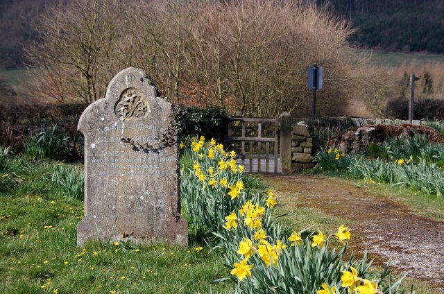
During the spring and summer months, the woodland bursts with vibrant colors as wildflowers carpet the forest floor. Bluebells, primroses, and daffodils are just a few of the species that create a stunning display of nature's beauty.
Beeley Plantation is also home to a rich array of wildlife. Bird enthusiasts can spot species such as woodpeckers, nuthatches, and warblers, while lucky visitors may even catch a glimpse of deer, foxes, or badgers. The plantation's diverse ecosystem ensures that there is always something new to discover with each visit.
Overall, Beeley Plantation is a haven for nature enthusiasts, offering a peaceful retreat from the hustle and bustle of everyday life. Its natural beauty, well-maintained trails, and abundance of wildlife make it a must-visit destination for anyone seeking a connection with nature in Derbyshire.
If you have any feedback on the listing, please let us know in the comments section below.
Beeley Plantation Images
Images are sourced within 2km of 53.206252/-1.5857931 or Grid Reference SK2767. Thanks to Geograph Open Source API. All images are credited.


Beeley Plantation is located at Grid Ref: SK2767 (Lat: 53.206252, Lng: -1.5857931)
Administrative County: Derbyshire
District: Derbyshire Dales
Police Authority: Derbyshire
What 3 Words
///stunning.refer.inspects. Near Baslow, Derbyshire
Nearby Locations
Related Wikis
Beeley
Beeley is a village and civil parish in northern Derbyshire, England. Located near Bakewell in the Derbyshire Dales, it is situated on the B6012 road,...

Beeley Moor
Beeley Moor is a small gritstone upland area in the Derbyshire Peak District of central and northern England, near the villages of Beeley and Baslow. Its...

Hob Hurst's House
Hob Hurst's House is a Bronze Age barrow on Beeley Moor near Bakewell in Derbyshire. It is unique in that instead of the normal round shape, Hob Hurst...

Chatsworth, Derbyshire
Chatsworth is a civil parish in Derbyshire, England, within the area of the Derbyshire Dales and the Peak District National Park. The population is largely...

Column of the Temple of Poseidon at Chatsworth
The column of the Temple of Poseidon is one of the surviving features from the period of the sixth Duke of Devonshire in the Chatsworth House garden. Surmounted...
Rowsley
Rowsley () is a village on the A6 road in the English county of Derbyshire. The population as at the 2011 census was 507.It is at the point where the River...
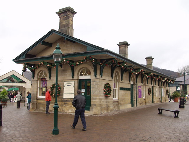
Rowsley railway station
The original Rowsley railway station was opened in 1849 by the Manchester, Buxton, Matlock and Midlands Junction Railway to serve the village of Rowsley...
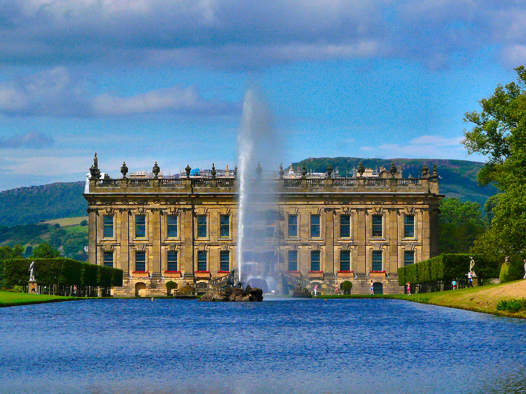
Emperor Fountain
The Emperor Fountain is a 19th-century fountain in the grounds of Chatsworth House, Derbyshire, England. The Canal Pond in which the fountain stands is...
Nearby Amenities
Located within 500m of 53.206252,-1.5857931Have you been to Beeley Plantation?
Leave your review of Beeley Plantation below (or comments, questions and feedback).