Gibbet Wood

Wood, Forest in Derbyshire Derbyshire Dales

England

Gibbet Wood

Parallel roads near Robin Hood The A619 is just over the hedge to the right, as both roads climb up the valley of Heathy Lea Brook.
Parallel roads near Robin Hood Credit: Bill Boaden

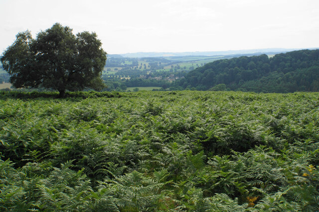
Gibbet Wood is a picturesque woodland located in Derbyshire, England. Covering an area of approximately 100 acres, it is a popular destination for nature enthusiasts and outdoor adventurers alike. The wood is situated near the village of Oakerthorpe, surrounded by rolling hills and countryside scenery.

The name "Gibbet Wood" is derived from the historical use of the area as a site for public executions. In the past, criminals were hanged from a gibbet, a wooden structure used for displaying the bodies of executed individuals as a warning to others. Although this grim history is now long gone, the name has stuck, adding an eerie element of intrigue to the woodland.

Today, Gibbet Wood is primarily known for its diverse and vibrant flora and fauna. The wood is home to a rich variety of trees, including oak, birch, beech, and pine, which provide a lush canopy and create a peaceful atmosphere. Wildflowers bloom in abundance during the spring and summer months, attracting butterflies and other pollinators.

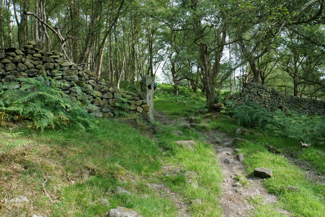
The woodland also boasts an intricate network of walking trails, allowing visitors to explore the area at their own pace. These trails lead visitors through the wood, offering glimpses of wildlife such as deer, foxes, and a wide range of bird species. The tranquil setting makes Gibbet Wood an ideal spot for nature walks, photography, and quiet contemplation.

In conclusion, Gibbet Wood in Derbyshire is a captivating woodland that combines natural beauty with a fascinating historical past. It offers visitors the chance to immerse themselves in nature, explore winding trails, and appreciate the diverse wildlife that thrives within its boundaries.

If you have any feedback on the listing, please let us know in the comments section below.

Gibbet Wood Images

Images are sourced within 2km of 53.237771/-1.5895345 or Grid Reference SK2771. Thanks to Geograph Open Source API. All images are credited.

Parallel roads near Robin Hood The A619 is just over the hedge to the right, as both roads climb up the valley of Heathy Lea Brook.
Parallel roads near Robin Hood
The A619 is just over the hedge to the right, as both roads climb up the valley of Heathy Lea Brook.
Path below Birchen Edge The edge is up to the right, but this path does not make any attempt to get to the top.
Path below Birchen Edge
The edge is up to the right, but this path does not make any attempt to get to the top.
Rough farmland above Robin Hood Farm The land under Birchen Edge can only be used for grazing. The valley continues down towards Baslow.
Rough farmland above Robin Hood Farm
The land under Birchen Edge can only be used for grazing. The valley continues down towards Baslow.
Path below Birchen Edge There is quite a lot of foliage restricting views.
Path below Birchen Edge
There is quite a lot of foliage restricting views.
Farmland below Birchen Edge Moorside Farm is mostly hidden behind a wall.
Farmland below Birchen Edge
Moorside Farm is mostly hidden behind a wall.
Birchen Edge Seen from a path which runs below the edge.
Birchen Edge
Seen from a path which runs below the edge.
Boulder below Birchen Edge An erratic a short distance from the rocks of Birchen Edge.
Boulder below Birchen Edge
An erratic a short distance from the rocks of Birchen Edge.
Trig point on Birchen Edge There are views from the edge to Froggatt Edge and White Edge.
Trig point on Birchen Edge
There are views from the edge to Froggatt Edge and White Edge.
Birchen Edge Near the northern end of Birchen Edge.
Birchen Edge
Near the northern end of Birchen Edge.
See of ferns below Gardom's Edge Looking down towards Baslow.
See of ferns below Gardom's Edge
Looking down towards Baslow.
Old gateway below Gardom's Edge The path is a steady climb up from Bar Brook.
Old gateway below Gardom's Edge
The path is a steady climb up from Bar Brook.
Entrance gate to Chatsworth House The visitor entrance is just beyond the extreme left of the view.

Camera: Olympus Mju II
Film: Fuji Superia Reala 100
Scanner: Nikon D7200
Conversion software: Grain2Pixel (unedited)
Entrance gate to Chatsworth House
The visitor entrance is just beyond the extreme left of the view. Camera: Olympus Mju II Film: Fuji Superia Reala 100 Scanner: Nikon D7200 Conversion software: Grain2Pixel (unedited)
Chatsworth House Gardens Viewed from near the Kitchen gardens, showing the Orangery on the left and the Display Greenhouse (1970) on the right.

Camera: Olympus Mju II
Film: Fuji Superia Reala 100
Scanner: Nikon D7200
Conversion software: Grain2Pixel (unedited)
Chatsworth House Gardens
Viewed from near the Kitchen gardens, showing the Orangery on the left and the Display Greenhouse (1970) on the right. Camera: Olympus Mju II Film: Fuji Superia Reala 100 Scanner: Nikon D7200 Conversion software: Grain2Pixel (unedited)
Greenhouses in the Kitchen Garden, Chatsworth House Showing the Stables in the background.

Camera: Olympus Mju II
Film: Fuji Superia Reala 100
Scanner: Nikon D7200
Conversion software: Grain2Pixel (unedited)
Greenhouses in the Kitchen Garden, Chatsworth House
Showing the Stables in the background. Camera: Olympus Mju II Film: Fuji Superia Reala 100 Scanner: Nikon D7200 Conversion software: Grain2Pixel (unedited)
The Conservative Wall, Chatsworth House Also showing "Flora's Temple" on the left. The Conservative wall is a very shallow cascading glasshouse; a truly striking feature.

Camera: Olympus Mju II
Film: Fuji Superia Reala 100
Scanner: Nikon D7200
Conversion software: Grain2Pixel (unedited)
The Conservative Wall, Chatsworth House
Also showing "Flora's Temple" on the left. The Conservative wall is a very shallow cascading glasshouse; a truly striking feature. Camera: Olympus Mju II Film: Fuji Superia Reala 100 Scanner: Nikon D7200 Conversion software: Grain2Pixel (unedited)
Chatsworth House Gardens Showing the "100 Steps" and the Maze.

Camera: Olympus Mju II
Film: Fuji Superia Reala 100
Scanner: Nikon D7200
Conversion software: Grain2Pixel (unedited)
Chatsworth House Gardens
Showing the "100 Steps" and the Maze. Camera: Olympus Mju II Film: Fuji Superia Reala 100 Scanner: Nikon D7200 Conversion software: Grain2Pixel (unedited)
Chatsworth House Cascade A more civilised scene to that of 1983, surprisingly! <a href="https://www.geograph.org.uk/photo/1558060">SK2670 : The cascade, Chatsworth</a>

Camera: Olympus Mju II
Film: Fuji Superia Reala 100
Scanner: Nikon D7200
Conversion software: Grain2Pixel (unedited)
Chatsworth House Cascade
A more civilised scene to that of 1983, surprisingly! SK2670 : The cascade, Chatsworth Camera: Olympus Mju II Film: Fuji Superia Reala 100 Scanner: Nikon D7200 Conversion software: Grain2Pixel (unedited)
Chatsworth House Gardens Showing the Orangery and part of the House in the background.

Camera: Olympus Mju II
Film: Fuji Superia Reala 100
Scanner: Nikon D7200
Conversion software: Grain2Pixel (unedited)
Chatsworth House Gardens
Showing the Orangery and part of the House in the background. Camera: Olympus Mju II Film: Fuji Superia Reala 100 Scanner: Nikon D7200 Conversion software: Grain2Pixel (unedited)
Show me another place!

Gibbet Wood is located at Grid Ref: SK2771 (Lat: 53.237771, Lng: -1.5895345)

Administrative County: Derbyshire

District: Derbyshire Dales

Police Authority: Derbyshire

What 3 Words

///dime.brightens.positive. Near Baslow, Derbyshire

Related Wikis

Gibbet Moor

Gibbet Moor is a small gritstone upland area in the Derbyshire Peak District of central and northern England, near the village of Baslow. Its highest point...
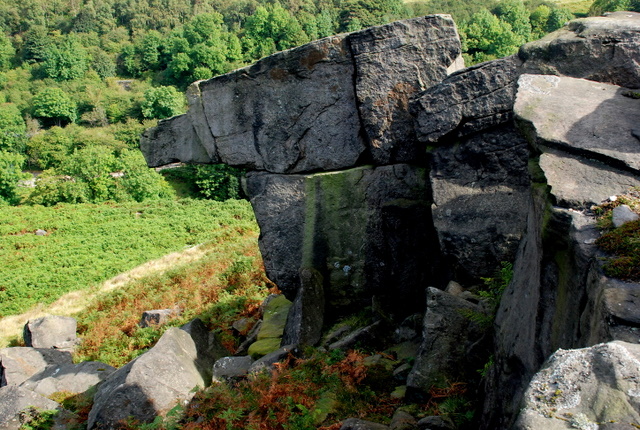
Birchen Edge

Birchen Edge is a gritstone rock face in the Peak District, England, popular with walkers and novice climbers as most of the climbing routes are in the...
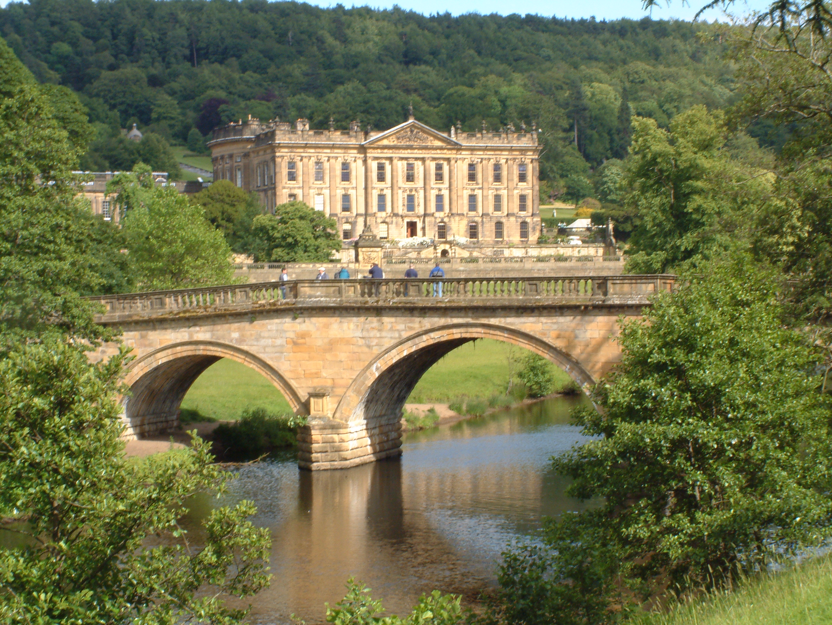
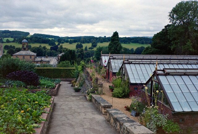
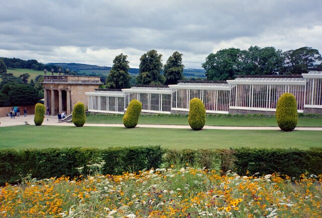
Chatsworth House

Chatsworth House is a stately home in the Derbyshire Dales, 4 miles (6.4 km) north-east of Bakewell and 9 miles (14 km) west of Chesterfield, England....

Emperor Fountain

The Emperor Fountain is a 19th-century fountain in the grounds of Chatsworth House, Derbyshire, England. The Canal Pond in which the fountain stands is...

Gardom's Edge

Gardom's Edge is a rocky outcrop near Baslow in Derbyshire, England. The shelf between Gardom's Edge and Birchen Edge is now moorland used for grazing...

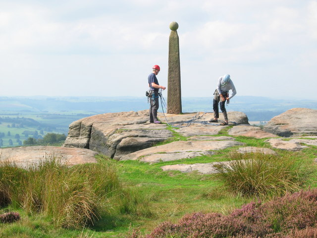
Column of the Temple of Poseidon at Chatsworth

The column of the Temple of Poseidon is one of the surviving features from the period of the sixth Duke of Devonshire in the Chatsworth House garden. Surmounted...

Hob Hurst's House

Hob Hurst's House is a Bronze Age barrow on Beeley Moor near Bakewell in Derbyshire. It is unique in that instead of the normal round shape, Hob Hurst...

Chatsworth, Derbyshire

Chatsworth is a civil parish in Derbyshire, England, within the area of the Derbyshire Dales and the Peak District National Park. The population is largely...

Nearby Amenities

Located within 500m of 53.237771,-1.5895345
The data included in this document is from www.openstreetmap.org. The data is made available under ODbL.

Have you been to Gibbet Wood?

Leave your review of Gibbet Wood below (or comments, questions and feedback).