Beacon Lough Plantation

Wood, Forest in Durham

England

Beacon Lough Plantation

Terraced houses on Durham Road
Terraced houses on Durham Road Credit: Roger Cornfoot

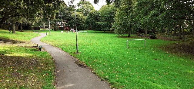
Beacon Lough Plantation is a woodland area located in Durham, England. With an approximate size of 15 hectares, it serves as a beautiful green space for both locals and visitors to enjoy. Situated in the Beacon Lough area, the plantation is easily accessible, making it a popular destination for nature enthusiasts and hikers.

The plantation features a diverse range of trees, including oak, birch, and pine, creating a picturesque landscape throughout the year. These trees not only provide a scenic view but also offer a habitat for various species of birds and other wildlife. Visitors can often spot woodpeckers, owls, and squirrels as they explore the woodland.

There are several walking trails within the plantation, allowing visitors to wander through the trees and immerse themselves in nature. These trails are well-maintained and suitable for people of all ages and fitness levels. Additionally, the plantation is equipped with picnic areas, making it a great spot for families and friends to gather and enjoy a meal surrounded by the natural beauty of the forest.

Beacon Lough Plantation is not only valued for its recreational opportunities but also for its environmental significance. The woodland contributes to air purification and acts as a carbon sink, helping to combat climate change. The plantation is also part of a wider conservation effort in the region, aiming to protect and enhance natural habitats.

In conclusion, Beacon Lough Plantation in Durham offers a serene and scenic escape for individuals seeking to connect with nature. With its diverse range of trees, wildlife, walking trails, and picnic areas, the plantation provides a wonderful outdoor experience for all who visit.

If you have any feedback on the listing, please let us know in the comments section below.

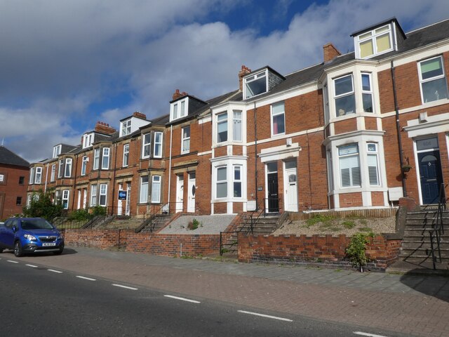
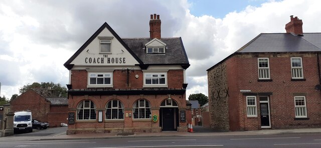
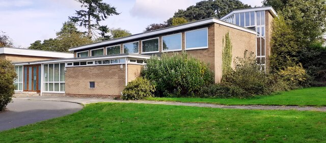
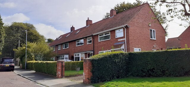
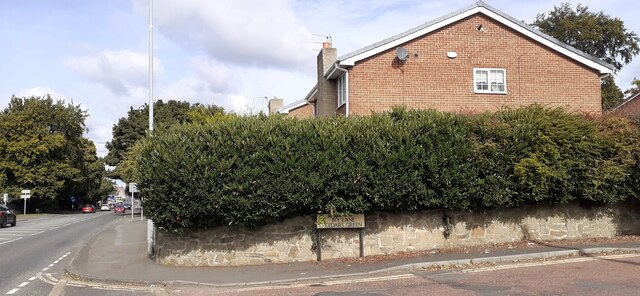
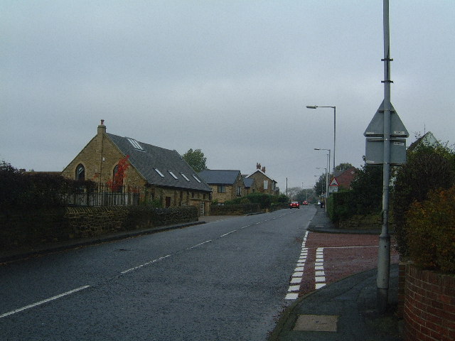
Beacon Lough Plantation Images

Images are sourced within 2km of 54.934892/-1.5795478 or Grid Reference NZ2760. Thanks to Geograph Open Source API. All images are credited.

Terraced houses on Durham Road
The Coach House on west side of Durham Road
Chowdene Church, #660 Durham Road
St Ninian's Church on NW side of Ivy Lane
Nos 1-4 Cedars Green
Junction of Ivy Lane and Durham Road Ordnance Survey documents describe a benchmark levelled at 88.800m above Newlyn Datum on a wall at this location
Junction of Ivy Lane and Durham Road
Ordnance Survey documents describe a benchmark levelled at 88.800m above Newlyn Datum on a wall at this location
#771 Durham Road Ordnance Survey documents indicate that a benchmark was levelled at 76.023m above Newlyn Datum on the far corner of the house
#771 Durham Road
Ordnance Survey documents indicate that a benchmark was levelled at 76.023m above Newlyn Datum on the far corner of the house
Play area and goalposts in Calderwood Park
Esso filling station on east side of A167
Footbridge over Durham Road (A167)
George V GPO Cable marker against the wall fronting #657 Durham Road See <span class="nowrap"><a title="https://gpo-markers.derektp.co.uk/detail?post=264" rel="nofollow ugc noopener" href="https://gpo-markers.derektp.co.uk/detail?post=264">Link</a><img style="margin-left:2px;" alt="External link" title="External link - shift click to open in new window" src="https://s1.geograph.org.uk/img/external.png" width="10" height="10"/></span> for more information
George V GPO Cable marker against the wall fronting #657 Durham Road
See LinkExternal link for more information
#657 Durham Road in row of houses There is a GPO cable marker <a href="https://www.geograph.org.uk/photo/7319511">NZ2559 : George V GPO Cable marker against the wall fronting #657 Durham Road</a> against the wall fronting the house left of a stone gatepost
#657 Durham Road in row of houses
There is a GPO cable marker NZ2559 : George V GPO Cable marker against the wall fronting #657 Durham Road against the wall fronting the house left of a stone gatepost
Grace College
Grace College
Large, semi-detached houses along Durham Road The houses are on the east side of Durham Road, the A167 in Low Fell, Gateshead. Formerly the road was the A1, 'Great North Road', which continued to the left to pass through the centres of both Gateshead and Newcastle.
Large, semi-detached houses along Durham Road
The houses are on the east side of Durham Road, the A167 in Low Fell, Gateshead. Formerly the road was the A1, 'Great North Road', which continued to the left to pass through the centres of both Gateshead and Newcastle.
Wasteland North of the Angel looking South
Eighton Banks A view of the main road through Eighton Banks towards Wrekenton.
Eighton Banks
A view of the main road through Eighton Banks towards Wrekenton.
Wrekenton High St
Wrekenton High St
The Joseph Swan College
Show me another place!

Beacon Lough Plantation is located at Grid Ref: NZ2760 (Lat: 54.934892, Lng: -1.5795478)

Unitary Authority: Gateshead

Police Authority: Northumbria

What 3 Words

///petal.deflection.admire. Near Felling, Tyne & Wear

Related Wikis

Gateshead Fell

Gateshead Fell was a district in County Durham, England. It was located on the immediate border of the town of Gateshead, 2.3 miles from the city of Newcastle...

Queen Elizabeth Hospital, Gateshead

The Queen Elizabeth Hospital is based in Sheriff Hill in Gateshead, England. It is managed by Gateshead Health NHS Foundation Trust. == History == The...

Cardinal Hume Catholic School

Cardinal Hume Catholic School is a coeducational secondary school and sixth form located in the Beacon Lough area of Gateshead, Tyne and Wear, England...

Sheriff Hill Colliery

Sheriff Hill Colliery or Ellison Main Colliery was a coal mine at Gateshead Fell in County Durham, England. The colliery had two shafts and provided...

Nearby Amenities

Located within 500m of 54.934892,-1.5795478
Traffic Signals
Traffic Signals: signal
Lat/Long: 54.9374555/-1.5847612
Traffic Signals
Lat/Long: 54.9340401/-1.5819953
Traffic Signals
Traffic Signals: signal
Lat/Long: 54.9371968/-1.5845558
Bus Stop
Cardinal Hume RC. School
Local Ref: S
Naptan AtcoCode: 410000000103
Naptan Bearing: S
Naptan CommonName: CARDINAL HUME R.C SCHOOL
Naptan Indicator: S
Naptan Landmark: OUTSIDE CARDINAL HUME COMPREHENSIVE SCHOOL
Naptan NaptanCode: twrgtpwp
Naptan PlusbusZoneRef: NWCSTLE
Naptan Street: RUGBY GARDENS
Naptan Verified: no
Operator: Nexus
Source: naptan_import
Lat/Long: 54.9317593/-1.5775142
Bus Stop
QUEEN ELIZABETH HOSPITAL F
Bench: yes
Bin: yes
Bus: yes
Local Ref: S
Naptan AtcoCode: 410000015028
Naptan Bearing: S
Naptan CommonName: QUEEN ELIZABETH HOSPITAL F
Naptan Indicator: S
Naptan Landmark: OUTSIDE BEACON RISE
Naptan NaptanCode: twrdatgw
Naptan PlusbusZoneRef: NWCSTLE
Naptan Street: OLD DURHAM ROAD
Naptan Verified: no
Public Transport: platform
Ref: F
Shelter: yes
Source: naptan_import
Lat/Long: 54.9358468/-1.5832994
Bus Stop
Old Durham Road
Bench: yes
Bin: yes
Bus: yes
Covered: yes
Departures Board: timetable
Local Ref: S
Naptan AtcoCode: 410000015029
Naptan Bearing: S
Naptan CommonName: OLD DURHAM ROAD-BEACON LOUGH-S/B
Naptan Indicator: S
Naptan Landmark: OPPOSITE BEACON LOUGH ROAD
Naptan NaptanCode: twrdatja
Naptan PlusbusZoneRef: NWCSTLE
Naptan Street: OLD DURHAM ROAD
Naptan Verified: no
Public Transport: platform
Shelter: yes
Source: naptan_import
Lat/Long: 54.9337447/-1.5815709
Bus Stop
Old Durham Road
Bench: yes
Bus: yes
Departures Board: timetable
Local Ref: N
Naptan AtcoCode: 410000015030
Naptan Bearing: NW
Naptan Indicator: NW-Bound
Naptan Landmark: Opposite Beacon Court
Naptan NaptanCode: twrdatjd
Naptan PlusbusZoneRef: NWCSTLE
Naptan Street: Old Durham Road
Naptan Verified: no
Public Transport: platform
Shelter: yes
Source: naptan_import
Lat/Long: 54.934718/-1.5826716
Bus Stop
QUEEN ELIZABETH HOSPITAL A
Bench: yes
Bus: yes
Departures Board: timetable
Local Ref: N
Naptan AtcoCode: 410000015031
Naptan Bearing: N
Naptan CommonName: QUEEN ELIZABETH HOSPITAL A
Naptan Indicator: N
Naptan Landmark: 60M SOUTH OF AMBULANCE STATION OPPOSITE
Naptan NaptanCode: twrdatjg
Naptan PlusbusZoneRef: NWCSTLE
Naptan Street: OLD DURHAM ROAD
Naptan Verified: no
Passenger Information Display: no
Public Transport: platform
Shelter: yes
Source: naptan_import
Tactile Paving: yes
Lat/Long: 54.9363437/-1.583984
Bus Stop
BEACON LOUGH EAST
Bench: yes
Covered: yes
Local Ref: W
Naptan AtcoCode: 410000015178
Naptan Bearing: W
Naptan CommonName: BEACON LOUGH EAST
Naptan Indicator: W
Naptan Landmark: OPPOSITE CAR PARK / 30M WEST OF POST OFFICE
Naptan NaptanCode: twrdgdgd
Naptan PlusbusZoneRef: NWCSTLE
Naptan Street: SUNDEW ROAD
Naptan Verified: no
Shelter: yes
Source: naptan_import
Lat/Long: 54.934487/-1.5750758
Bus Stop
BEACON LOUGH EAST
Bench: no
Covered: no
Local Ref: SW
Naptan AtcoCode: 410000015179
Naptan Bearing: SW
Naptan CommonName: BEACON LOUGH EAST
Naptan Indicator: SW
Naptan Landmark: OPPOSITE CAR PARK AND POST OFFICE
Naptan NaptanCode: twrdgdgj
Naptan PlusbusZoneRef: NWCSTLE
Naptan Street: SUNDEW ROAD
Naptan Verified: no
Shelter: no
Source: naptan_import
Lat/Long: 54.9348751/-1.5750873
Bus Stop
SOUTHEND ROAD-GLENDALE GARDENS-S/B
Local Ref: S
Naptan AtcoCode: 410000015197
Naptan Bearing: S
Naptan CommonName: SOUTHEND ROAD-GLENDALE GARDENS-S/B
Naptan Indicator: S
Naptan Landmark: OPPOSITE GLENDALE GARDENS
Naptan NaptanCode: twrdgdmw
Naptan PlusbusZoneRef: NWCSTLE
Naptan Street: SOUTHEND ROAD
Naptan Verified: no
Source: naptan_import
Lat/Long: 54.9364826/-1.5851844
Bus Stop
SOUTHEND ROAD-GLYNWOOD-S/B
Local Ref: S
Naptan AtcoCode: 410000015198
Naptan Bearing: S
Naptan CommonName: SOUTHEND ROAD-GLYNWOOD-S/B
Naptan Indicator: S
Naptan Landmark: OPPOSITE GLYNWOOD PRIMARY SCHOOL
Naptan NaptanCode: twrdgdpa
Naptan PlusbusZoneRef: NWCSTLE
Naptan Street: SOUTHEND ROAD
Naptan Verified: no
Source: naptan_import
Lat/Long: 54.93452/-1.586781
Bus Stop
SOUTHEND ROAD-GLYNWOOD-N/B
Local Ref: N
Naptan AtcoCode: 410000015199
Naptan Bearing: N
Naptan CommonName: SOUTHEND ROAD-GLYNWOOD-N/B
Naptan Indicator: N
Naptan Landmark: OUTSIDE GLYNWOOD PRIMARY SCHOOL
Naptan NaptanCode: twrdgdpd
Naptan PlusbusZoneRef: NWCSTLE
Naptan Street: SOUTHEND ROAD
Naptan Verified: no
Source: naptan_import
Lat/Long: 54.9351389/-1.5864469
Bus Stop
SOUTHEND ROAD-GLENDALE GARDENS-N/B
Local Ref: N
Naptan AtcoCode: 410000015200
Naptan Bearing: N
Naptan CommonName: SOUTHEND ROAD-GLENDALE GARDENS-N/B
Naptan Indicator: N
Naptan Landmark: SOUTH OF GLENDALE GARDENS
Naptan NaptanCode: twrdgdpg
Naptan PlusbusZoneRef: NWCSTLE
Naptan Street: SOUTHEND ROAD
Naptan Verified: no
Source: naptan_import
Lat/Long: 54.9363666/-1.5854353
Bus Stop
Queen Elizabeth Hospital
Bus: yes
Departures Board: timetable
Local Ref: N
Naptan AtcoCode: 410000015201
Naptan Bearing: N
Naptan CommonName: QUEEN ELIZABETH HOSPITAL C
Naptan Indicator: N
Naptan Landmark: OUTSIDE QUEEN ELIZABETH HOSPITAL
Naptan NaptanCode: twrdgdpj
Naptan PlusbusZoneRef: NWCSTLE
Naptan Street: QUEEN ELIZABETH AVENUE
Naptan Verified: no
Public Transport: platform
Shelter: yes
Source: naptan_import
Lat/Long: 54.9386339/-1.5835702
Bus Stop
Old Durham Road
Bus: yes
Departures Board: timetable
Local Ref: NW
Naptan AtcoCode: 410000022001
Naptan Bearing: NW
Naptan CommonName: OLD DURHAM ROAD-WHITEHOUSE LANE-NW/B
Naptan Indicator: NW
Naptan Landmark: OUTSIDE BRAMBLELAW
Naptan NaptanCode: twrdpjpg
Naptan PlusbusZoneRef: NWCSTLE
Naptan Street: OLD DURHAM ROAD
Naptan Verified: no
Public Transport: platform
Shelter: yes
Source: naptan_import
Lat/Long: 54.9314836/-1.5795787
Bus Stop
Old Durham Road
Bench: yes
Bus: yes
Departures Board: timetable
Lit: yes
Local Ref: N
Naptan AtcoCode: 410000022030
Naptan Bearing: N
Naptan CommonName: OLD DURHAM ROAD-ASPENLAW-N/B
Naptan Indicator: N
Naptan Landmark: OPPOSITE ASPENLAW
Naptan NaptanCode: twrdpmdj
Naptan PlusbusZoneRef: NWCSTLE
Naptan Street: OLD DURHAM ROAD
Naptan Verified: no
Public Transport: platform
Shelter: yes
Source: naptan_import
Lat/Long: 54.9306604/-1.5790416
Bus Stop
BEACON LOUGH ROAD-KENDAL CRESCENT-E/B
Local Ref: E
Naptan AtcoCode: 410000022105
Naptan Bearing: E
Naptan CommonName: BEACON LOUGH ROAD-KENDAL CRESCENT-E/B
Naptan Indicator: E
Naptan Landmark: 90M E.OF LYNDHURST COMPREHNSIVE SCHOOL
Naptan NaptanCode: twrdptmj
Naptan PlusbusZoneRef: NWCSTLE
Naptan Street: BEACON LOUGH ROAD
Naptan Verified: no
Source: naptan_import
Lat/Long: 54.9330244/-1.5856726
Bus Stop
BEACON LOUGH ROAD-WYTHBURN-W/B
Bus: yes
Local Ref: W
Naptan AtcoCode: 410000022106
Naptan Bearing: W
Naptan CommonName: BEACON LOUGH ROAD-WYTHBURN-W/B
Naptan Indicator: W
Naptan Landmark: OPPOSITE BEACON VIEW HOME FOR THE ELDERLY
Naptan NaptanCode: twrdptmp
Naptan PlusbusZoneRef: NWCSTLE
Naptan Street: BEACON LOUGH ROAD
Naptan Verified: no
Public Transport: platform
Source: naptan_import
Lat/Long: 54.9336249/-1.58327
Bus Stop
Beacon Lough Road
Bus: yes
Departures Board: timetable
Local Ref: SW
Naptan AtcoCode: 410000022107
Naptan Bearing: SW
Naptan CommonName: BEACON LOUGH ROAD-CARNFORTH GARDENS-SW/B
Naptan Indicator: SW
Naptan Landmark: OUTSIDE LYNDHURST COMPREHENSIVE SCHOOL
Naptan NaptanCode: twrdptmt
Naptan PlusbusZoneRef: NWCSTLE
Naptan Street: BEACON LOUGH ROAD
Naptan Verified: no
Public Transport: platform
Shelter: yes
Source: naptan_import
Lat/Long: 54.9327392/-1.5862195
Bus Stop
SUNDEW ROAD-BRAMBLELAW-N/B
Local Ref: NE
Naptan AtcoCode: 410000022206
Naptan Bearing: NE
Naptan CommonName: SUNDEW ROAD-BRAMBLELAW-N/B
Naptan Indicator: NE
Naptan Landmark: OUTSIDE BRAMBLELAW AND BROOMLAW ENTRANCE
Naptan NaptanCode: twrdtama
Naptan PlusbusZoneRef: NWCSTLE
Naptan Street: SUNDEW ROAD
Naptan Verified: no
Source: naptan_import
Lat/Long: 54.9332537/-1.5791622
Bus Stop
SUNDEW ROAD-CRANESVILLE-N/B
Local Ref: NE
Naptan AtcoCode: 410000022207
Naptan Bearing: NE
Naptan CommonName: SUNDEW ROAD-CRANESVILLE-N/B
Naptan Indicator: NE
Naptan Landmark: OUTSIDE CRANESVILLE
Naptan NaptanCode: twrdtamd
Naptan PlusbusZoneRef: NWCSTLE
Naptan Street: SUNDEW ROAD
Naptan Verified: no
Source: naptan_import
Lat/Long: 54.9335292/-1.5782853
Entrance: yes
Lat/Long: 54.9381009/-1.5822545
Crossing
Crossing: zebra
Lat/Long: 54.9390585/-1.5779613
Crossing
Crossing: marked
Crossing Ref: zebra
Lat/Long: 54.9372375/-1.5802383
Entrance: yes
Lat/Long: 54.9376948/-1.5822481
Traffic Signals
Crossing: no
Traffic Signals Direction: forward
Lat/Long: 54.9377613/-1.5850042
Post Office
Beacon Lough Post Office
Addr City: Gateshead
Addr Postcode: NE9 6ST
Addr Street: Sundew Road
Brand: Post Office
Brand Wikidata: Q1783168
Opening Hours: Mo-Fr 07:00-18:00; Sa 07:30-17:30; Su 07:30-12:30
Ref Pol Id: 14655
Source: OS OpenData StreetView
Website: https://www.postoffice.co.uk/branch-finder/4083296/beacon-lough
Lat/Long: 54.9345454/-1.5743689
Man Made: tower
Tower Type: communication
Lat/Long: 54.93263/-1.5736493
Sheriff Hill
Ele: 167
Natural: peak
Lat/Long: 54.9359492/-1.5812768
Crossing
Crossing: unmarked
Crossing Island: no
Tactile Paving: yes
Lat/Long: 54.9310909/-1.5791914
Waste Basket
Lat/Long: 54.9339774/-1.5817761
Post Box
Ref: NE9 132
Lat/Long: 54.9382994/-1.5816928
Crossing
Crossing: zebra
Lat/Long: 54.9379679/-1.5828383
Crossing
Crossing: marked
Crossing Ref: zebra
Lat/Long: 54.9377849/-1.58262
Crossing
Crossing: marked
Crossing Ref: zebra
Lat/Long: 54.9378447/-1.5825703
Crossing
Crossing: zebra
Lat/Long: 54.9391574/-1.5771117
Recycling
Lat/Long: 54.9348542/-1.5747066
Atm
Lat/Long: 54.9345698/-1.5744774
Post Box
Ref: NE9 164
Lat/Long: 54.9346465/-1.5744059
Fast Food
Golden Fish Inn
Addr City: Gateshead
Addr Housenumber: 7
Addr Postcode: NE9 6ST
Addr Street: Boxlaw
Addr Suburb: Beacon Lough
Cuisine: fish_and_chips
Drive Through: no
Fhrs Id: 339794
Phone: +44 191 487 9890
Source Addr: FHRS Open Data
Takeaway: only
Lat/Long: 54.9345262/-1.5745183
Premier
Addr City: Gateshead
Addr Housenumber: 3
Addr Postcode: NE9 6ST
Addr Street: Boxlaw
Addr Suburb: Beacon Lough
Brand: Premier
Brand Wikidata: Q7240340
Fhrs Id: 339494
Shop: convenience
Source Addr: FHRS Open Data
Website: https://www.premier-stores.co.uk/our-stores/zulfqar-convenience-store
Lat/Long: 54.9344205/-1.5748138
Telephone
Lat/Long: 54.9340174/-1.582481
Post Box
Brand: Royal Mail
Brand Wikidata: Q638098
Drive Through: no
Operator: Royal Mail
Operator Wikidata: Q638098
Post Box Type: pillar
Ref: NE9 115
Lat/Long: 54.9340466/-1.5823738
Doctors
Beacon View Medical Centre
Addr City: Gateshead
Addr Postcode: NE9 6YS
Addr Street: Beacon Lough Road
Phone: +44 191 4824000
Website: https://www.beaconviewmedicalcentre.co.uk/
Lat/Long: 54.9338028/-1.5845987
Pharmacy
Beacon View Pharmacy
Addr City: Gateshead
Addr Housenumber: 6
Addr Postcode: NE9 6YS
Addr Street: Beacon Lough Road
Phone: +44 191 487 2121
Website: https://www.nhs.uk/Services/pharmacies/Overview/DefaultView.aspx?id=4716
Lat/Long: 54.9337286/-1.5848252
Post Box
Collection Times: Mo-Fr 09:00; Sa 07:00
Post Box Type: pillar
Ref: NE9 95
Lat/Long: 54.9371424/-1.5849118
Childcare
Kids 1st - QE
Addr City: Gateshead
Addr Housename: Queen Elizabeth Hospital
Addr Postcode: NE9 6SX
Phone: +44 191 4618877
Website: http://kids1st.net/index.php/our-nurseries/qe/
Lat/Long: 54.9368568/-1.5820742
Man Made: mast
Tower Construction: lattice
Tower Type: communication
Lat/Long: 54.9364815/-1.582901
Operator: Northern Powergrid
Operator Wikidata: Q7058871
Power: substation
Lat/Long: 54.9322067/-1.5808159
Generator Method: photovoltaic
Generator Orientation: southwest
Generator Solar Modules: 35
Generator Source: solar
Generator Type: solar_photovoltaic_panel
Location: roof
Power: generator
Lat/Long: 54.936923/-1.5839356
Generator Method: photovoltaic
Generator Output Electricity: yes
Generator Source: solar
Generator Type: solar_photovoltaic_panel
Location: roof
Power: generator
Lat/Long: 54.9313183/-1.5839588
Generator Method: photovoltaic
Generator Output Electricity: yes
Generator Source: solar
Generator Type: solar_photovoltaic_panel
Location: roof
Power: generator
Lat/Long: 54.9313237/-1.5840352
Generator Method: photovoltaic
Generator Output Electricity: yes
Generator Source: solar
Generator Type: solar_photovoltaic_panel
Location: roof
Power: generator
Lat/Long: 54.9331305/-1.5817352
Generator Method: photovoltaic
Generator Output Electricity: yes
Generator Source: solar
Generator Type: solar_photovoltaic_panel
Location: roof
Power: generator
Lat/Long: 54.9330966/-1.5818103
Generator Method: photovoltaic
Generator Output Electricity: yes
Generator Source: solar
Generator Type: solar_photovoltaic_panel
Location: roof
Power: generator
Lat/Long: 54.9336637/-1.5821724
Generator Method: photovoltaic
Generator Output Electricity: yes
Generator Source: solar
Generator Type: solar_photovoltaic_panel
Location: roof
Power: generator
Lat/Long: 54.9336359/-1.5822529
Bus: yes
Bus Bay: left
Public Transport: stop_position
Lat/Long: 54.9336536/-1.5816601
Barrier: lift_gate
Lat/Long: 54.9380649/-1.5832084
Barrier: lift_gate
Lat/Long: 54.938097/-1.5831663
Barrier: lift_gate
Lat/Long: 54.9381199/-1.5836266
Barrier: lift_gate
Lat/Long: 54.938114/-1.5835535
Barrier: yes
Lat/Long: 54.9335803/-1.5783325
Crossing
Crossing: traffic_signals
Crossing Ref: toucan
Lat/Long: 54.9309078/-1.5791414
Cycleway: asl
Direction: forward
Lat/Long: 54.9377015/-1.5849567
Cycleway: asl
Direction: backward
Lat/Long: 54.9375041/-1.5845948
Cycleway: asl
Direction: backward
Lat/Long: 54.9370066/-1.5844048
Crossing
Crossing: unmarked
Crossing Island: no
Tactile Paving: yes
Lat/Long: 54.9311407/-1.5792424
Camera Mount: pole
Camera Type: dome
Man Made: surveillance
Surveillance Type: camera
Lat/Long: 54.9315164/-1.5803651
Crossing
Crossing: traffic_signals
Lat/Long: 54.9370279/-1.5844218
Crossing
Crossing: traffic_signals
Lat/Long: 54.9371246/-1.5846862
Crossing
Crossing: traffic_signals
Lat/Long: 54.937497/-1.5846193
Traffic Signals
Crossing: no
Traffic Signals Direction: backward
Lat/Long: 54.937521/-1.5845369
Traffic Signals
Crossing: no
Traffic Signals Direction: forward
Lat/Long: 54.9370953/-1.5847392
Traffic Signals
Crossing: no
Traffic Signals Direction: forward
Lat/Long: 54.937069/-1.5844544
Traffic Signals
Crossing: no
Traffic Signals Direction: backward
Lat/Long: 54.9369668/-1.5843732
Crossing
Crossing: traffic_signals
Lat/Long: 54.9376675/-1.5849297
The data included in this document is from www.openstreetmap.org. The data is made available under ODbL.

Have you been to Beacon Lough Plantation?

Leave your review of Beacon Lough Plantation below (or comments, questions and feedback).