Baydale Wood
Wood, Forest in Durham
England
Baydale Wood

Baydale Wood, located in Durham, is a stunning forest that spans over a vast area. With its enchanting beauty and diverse ecosystem, it attracts nature enthusiasts, hikers, and photographers alike. The wood is situated on the outskirts of the charming village of High Coniscliffe, offering a peaceful escape from the bustling city life.
Covering an area of approximately 70 hectares, Baydale Wood is predominantly composed of broadleaf trees such as oak, ash, and beech. These majestic trees create a dense canopy, providing shade and shelter for a variety of wildlife. The forest floor is adorned with a rich carpet of bluebells and wildflowers during spring, creating a picturesque scene.
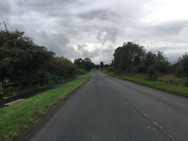
The wood is crisscrossed with well-maintained paths, making it accessible for visitors of all ages. There are several designated walking trails, ranging from short strolls to longer hikes, allowing visitors to explore the wood at their own pace. Along these trails, one can encounter a plethora of wildlife, including deer, squirrels, and various species of birds.
Baydale Wood is not just a haven for nature lovers, but also a significant historical site. It is believed to have been part of the medieval forest of Sadberge, which was extensively used for hunting by the local nobility. Remnants of ancient drovers' roads can still be found within the wood, adding to its historical charm.
In conclusion, Baydale Wood in Durham is a captivating forest that offers a serene retreat for individuals seeking solace in nature. With its breathtaking scenery, diverse wildlife, and historical significance, it has become a cherished destination for both locals and tourists alike.
If you have any feedback on the listing, please let us know in the comments section below.
Baydale Wood Images
Images are sourced within 2km of 54.51695/-1.5848532 or Grid Reference NZ2613. Thanks to Geograph Open Source API. All images are credited.


![Tees Cottage Pumping Station, Darlington [1] The 1852 filter bed and the 1852 engine house. The pumping station was built on the north bank of the River Tees in 1849 to provide clean drinking water to Darlington and other parts of Teesside. It became a museum in 1980. The engine house now houses a gas engine, installed in 1914. Water is pumped up from the River Tees by the gas engine and then filtered through sand in this pond.](https://s1.geograph.org.uk/geophotos/07/58/66/7586633_7e1e2c19.jpg)
![Tees Cottage Pumping Station, Darlington [2] The 1849 filter beds and the 1904 beam engine house. The pumping station was built on the north bank of the River Tees in 1849 to provide clean drinking water to Darlington and other parts of Teesside. It became a museum in 1980. The beam engine pumps up water from river water into the filter beds, where it filters slowly through sand.](https://s3.geograph.org.uk/geophotos/07/58/66/7586643_0857575d.jpg)
![Tees Cottage Pumping Station, Darlington [3] Pumped river water entering both 1849 filter beds. The pumping station was built on the north bank of the River Tees in 1849 to provide clean drinking water to Darlington and other parts of Teesside. It became a museum in 1980.](https://s3.geograph.org.uk/geophotos/07/58/66/7586651_d3de71d9.jpg)
![Stockton and Darlington Model Engineers [1] Based at Tees Cottage pumping station.](https://s1.geograph.org.uk/geophotos/07/58/66/7586657_613142af.jpg)
![Tees Cottage Pumping Station, Darlington [4] The 1852 clear water tank. Filtered water was stored here before being pumped to a service reservoir. The pumping station was built on the north bank of the River Tees in 1849 to provide clean drinking water to Darlington and other parts of Teesside. It became a museum in 1980.](https://s0.geograph.org.uk/geophotos/07/58/66/7586664_8d25414c.jpg)
![Stockton and Darlington Model Engineers [2] Their railway track runs inside the southern boundary of the Tees Cottage pumping station [now a museum].](https://s3.geograph.org.uk/geophotos/07/58/66/7586667_518e7348.jpg)
![Tees Cottage Pumping Station, Darlington [5] The red cylinders outside the 1904 beam engine house were used to help smooth out differences in water pressure. Similar cylinders are outside the 1852 engine house. The pumping station was built on the north bank of the River Tees in 1849 to provide clean drinking water to Darlington and other parts of Teesside. It became a museum in 1980.](https://s3.geograph.org.uk/geophotos/07/58/66/7586671_71ad99de.jpg)
![Stockton and Darlington Model Engineers [3] Four tracks heading east from the western turntable.](https://s2.geograph.org.uk/geophotos/07/58/66/7586674_a6053af3.jpg)
![Broken Scar Pumping and Filtration Works [1] Northumbrian Water&#039;s successor to Tees Cottage pumping station. Seen through a security fence.](https://s0.geograph.org.uk/geophotos/07/58/66/7586680_73337744.jpg)
![Broken Scar Pumping and Filtration Works [2] Northumbrian Water&#039;s successor to Tees Cottage pumping station. Seen through a security fence.](https://s1.geograph.org.uk/geophotos/07/58/66/7586681_4246fcc2.jpg)

Baydale Wood is located at Grid Ref: NZ2613 (Lat: 54.51695, Lng: -1.5848532)
Unitary Authority: Darlington
Police Authority: Durham
What 3 Words
///lungs.grows.certified. Near Darlington, Co. Durham
Nearby Locations
Related Wikis

Hummersknott Academy
Hummersknott Academy is a secondary school in Darlington in the north east of England. It schools approximately 1,250 pupils aged eleven to sixteen. It...
Hummersknott
Hummersknott is an area in the western end of Darlington, County Durham England. It is a ward in the unitary authority of Darlington. It consists of mainly...
Carmel College, Darlington
Carmel College (formerly Carmel RC College) is a secondary school on The Headlands in Hummersknott, Darlington, England. It also has a sixth form, Carmel...
Carmel College Sixth Form
Carmel College Sixth Form is a sixth form college on The Headlands in Hummersknott, Darlington, England. It is a post-16 extension of Carmel College, A...
Nearby Amenities
Located within 500m of 54.51695,-1.5848532Have you been to Baydale Wood?
Leave your review of Baydale Wood below (or comments, questions and feedback).