Blaid's Wood

Wood, Forest in Durham

England

Blaid's Wood

Track to Low Butterby Farm
Track to Low Butterby Farm Credit: David Robinson

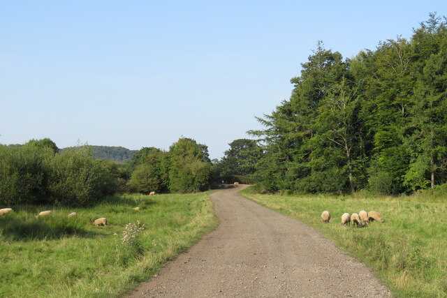
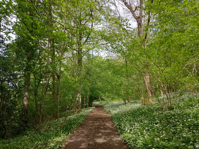
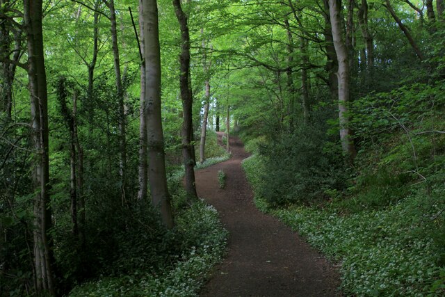
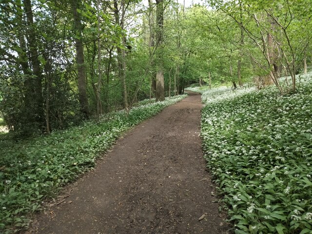
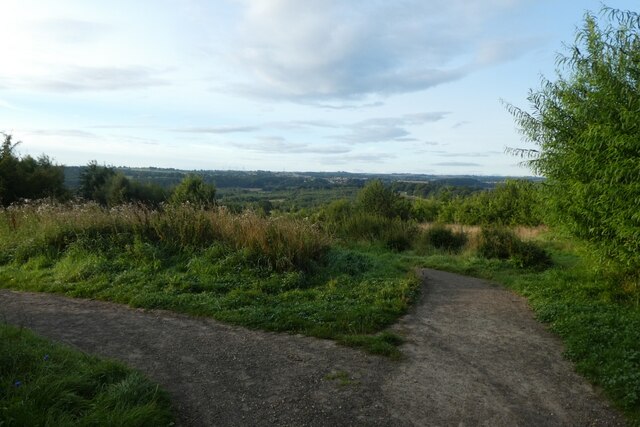
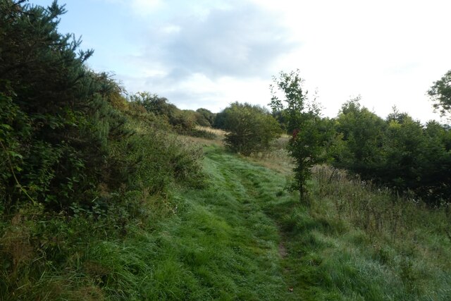
Blaid's Wood is a charming woodland located in Durham, England. Covering an area of approximately 50 acres, it is a popular destination for nature lovers and outdoor enthusiasts. This ancient forest boasts a diverse range of flora and fauna, making it a haven for wildlife and a delightful place for visitors to explore.

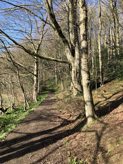
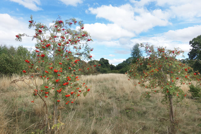
The wood is predominantly composed of native broadleaf trees such as oak, beech, and ash, which create a lush and vibrant canopy overhead. The forest floor is carpeted with a variety of wildflowers, adding bursts of color to the landscape throughout the year. Walking through Blaid's Wood, visitors can enjoy the tranquil atmosphere and soak in the natural beauty that surrounds them.

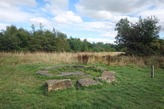
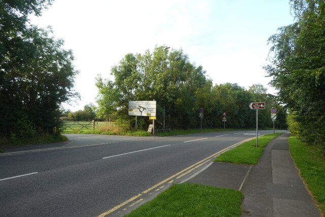
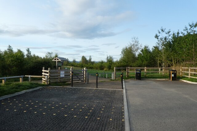
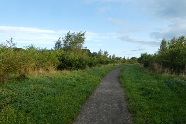
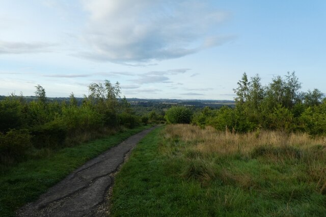
The woodland is crisscrossed by a network of well-maintained footpaths, allowing visitors to easily navigate the area. These paths lead to picturesque spots, including a small pond where ducks and other waterfowl can often be spotted. There are also designated picnic areas, providing the perfect opportunity for a leisurely lunch amidst the peaceful surroundings.

Blaid's Wood is not only a place of natural beauty but also an important habitat for a range of wildlife species. Birdwatchers will be delighted by the variety of avian species that call this woodland home, including woodpeckers, owls, and various songbirds. Small mammals such as squirrels and foxes are also commonly seen.

Overall, Blaid's Wood offers a serene and idyllic escape from the hustle and bustle of everyday life. Its enchanting woodland setting, diverse wildlife, and well-maintained paths make it a must-visit destination for nature enthusiasts and those seeking a peaceful retreat in the heart of Durham.

If you have any feedback on the listing, please let us know in the comments section below.
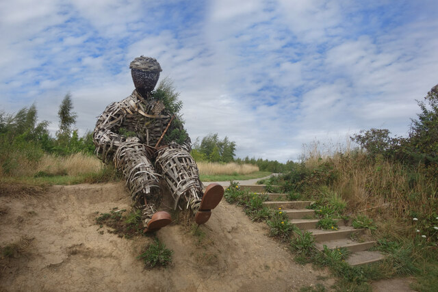
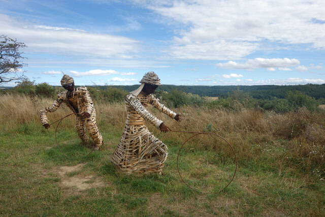
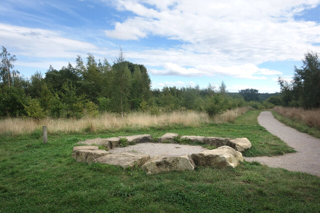
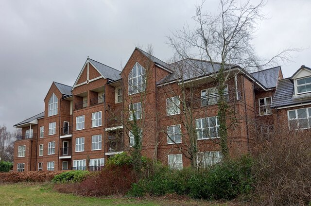
Blaid's Wood Images

Images are sourced within 2km of 54.756561/-1.5838673 or Grid Reference NZ2640. Thanks to Geograph Open Source API. All images are credited.

Track to Low Butterby Farm
Path through Shincliffe Wood
Stone Spiral in Gary's Wood Gary's Wood is part of the Woodland Trust land at Lower Burnhall, a relatively new woodland area with extensive footpath access. It has various sculptures and stone features at intervals along the tracks.
Stone Spiral in Gary's Wood
Gary's Wood is part of the Woodland Trust land at Lower Burnhall, a relatively new woodland area with extensive footpath access. It has various sculptures and stone features at intervals along the tracks.
Rowan Trees, Low Burnhall Low Burnhall is a fairly recently established bit of forest managed by the Woodland Trust.
Rowan Trees, Low Burnhall
Low Burnhall is a fairly recently established bit of forest managed by the Woodland Trust.
Wicker Man, Low Burnhall A wickerwork figure of a miner sits beside a path in Low Burnhall Wood. There are several sculptures and features at intervals around the wood.
Wicker Man, Low Burnhall
A wickerwork figure of a miner sits beside a path in Low Burnhall Wood. There are several sculptures and features at intervals around the wood.
Wickerwork Figures, Low Burnhall Wood Some more of the wicker sculptures which can be seen in Low Burnhall Wood.
Wickerwork Figures, Low Burnhall Wood
Some more of the wicker sculptures which can be seen in Low Burnhall Wood.
Stone Circle, Low Burnhall Wood There are a lot of tracks and trails around Low Burnhall Wood with various features at intervals. Some stone, like this, some wickerwork, and some old industrial relics.
Stone Circle, Low Burnhall Wood
There are a lot of tracks and trails around Low Burnhall Wood with various features at intervals. Some stone, like this, some wickerwork, and some old industrial relics.
Durham, Cock of the North Hotel According to the OS benchmark database the OS Flush Bracket 8969 was embedded into the pub and hotel which was at this location. The pub has been demolished and replaced with new housing. It is likely the Flush Bracket has been destroyed.
Durham, Cock of the North Hotel
According to the OS benchmark database the OS Flush Bracket 8969 was embedded into the pub and hotel which was at this location. The pub has been demolished and replaced with new housing. It is likely the Flush Bracket has been destroyed.
Wild garlic lining the path through a haunted Shincliffe Wood The garlic protecting us from something? Shincliffe apparently means a "Cliff or bank haunted by a phantom or demon" <span class="nowrap"><a title="https://www.oxfordreference.com/display/10.1093/acref/9780199609086.001.0001/acref-9780199609086-e-11814?rskey=WWHHoj&result=11961" rel="nofollow ugc noopener" href="https://www.oxfordreference.com/display/10.1093/acref/9780199609086.001.0001/acref-9780199609086-e-11814?rskey=WWHHoj&result=11961">Link</a><img style="margin-left:2px;" alt="External link" title="External link - shift click to open in new window" src="https://s1.geograph.org.uk/img/external.png" width="10" height="10"/></span>
Wild garlic lining the path through a haunted Shincliffe Wood
The garlic protecting us from something? Shincliffe apparently means a "Cliff or bank haunted by a phantom or demon" LinkExternal link
Weardale Way in Shincliffe Wood A strong pungent aroma of wild garlic permeated this section of Shincliffe Wood - quite pleasing to the nostrils
Weardale Way in Shincliffe Wood
A strong pungent aroma of wild garlic permeated this section of Shincliffe Wood - quite pleasing to the nostrils
Wild Garlic in Shincliffe Wood The woodland is carpeted in dazzling white flowers, permeating the surroundings with that pleasant garlic aroma.
Wild Garlic in Shincliffe Wood
The woodland is carpeted in dazzling white flowers, permeating the surroundings with that pleasant garlic aroma.
Roundhaven from the A177 A street off South Road in Durham.
Roundhaven from the A177
A street off South Road in Durham.
Entrance to Low Burnhall An entrance to the Woodland Trust car park off the A177 South Road near Cock o' the North roundabout.
Entrance to Low Burnhall
An entrance to the Woodland Trust car park off the A177 South Road near Cock o' the North roundabout.
Car park at Low Burnhall Low Burnhall is a Woodland Trust site to the south of Durham.
Car park at Low Burnhall
Low Burnhall is a Woodland Trust site to the south of Durham.
Track towards the car park Low Burnhall is a Woodland Trust site to the south of Durham.
Track towards the car park
Low Burnhall is a Woodland Trust site to the south of Durham.
Path in Low Burnhall Low Burnhall is a Woodland Trust site to the south of Durham.
Path in Low Burnhall
Low Burnhall is a Woodland Trust site to the south of Durham.
Junction of paths at Low Burnhall Low Burnhall is a Woodland Trust site to the south of Durham.
Junction of paths at Low Burnhall
Low Burnhall is a Woodland Trust site to the south of Durham.
Path near the Wear in Low Burnhall Low Burnhall is a Woodland Trust site to the south of Durham.
Path near the Wear in Low Burnhall
Low Burnhall is a Woodland Trust site to the south of Durham.
Show me another place!

Blaid's Wood is located at Grid Ref: NZ2640 (Lat: 54.756561, Lng: -1.5838673)

Unitary Authority: County Durham

Police Authority: Durham

What 3 Words

///notice.sleepy.shops. Near Durham, Co. Durham

Related Wikis

Durham High School for Girls

Durham High School is a single-sex independent day school for girls aged 3 to 18 years old in Durham, United Kingdom. == History and current status... ==

Stephenson College, Durham

Stephenson College is a college of the University of Durham in England. It was founded in 2001 as part the university's Queen's Campus in Thornaby-on...

Mount Oswald

Mount Oswald is a manor house in Durham, County Durham, England. The property, which is being developed for academic and residential use, is a Grade II...

Oakthorpe Invitational

Oakthorpe Invitational Rugby Football Club, also known as Oakthorpe, is an invitational rugby club based in Oxfordshire. The club was founded by a group...

Josephine Butler College, Durham

Josephine Butler College is a constituent college of Durham University. The college was opened in 2006. It is named after Josephine Elizabeth Butler, a...

South College, Durham

South College is a college of Durham University, which accepted its first students in autumn 2020.It is located in new buildings at Mount Oswald on Elvet...

John Snow College, Durham

John Snow College is a constituent college of Durham University. The college was founded in 2001 on the University's Queen's Campus in Stockton-on-Tees...

Durham University Botanic Garden

The Durham University Botanic Garden is a botanical garden located in Durham, England. The site is set in 25 acres (10 ha) of mature woodlands in the southern...

Nearby Amenities

Located within 500m of 54.756561,-1.5838673
Crossing
Crossing: uncontrolled
Crossing Ref: zebra
Lat/Long: 54.760456/-1.5813799
Crossing
Crossing: uncontrolled
Crossing Ref: zebra
Lat/Long: 54.7605545/-1.5819038
Mini Roundabout
Direction: clockwise
Lat/Long: 54.7600004/-1.5813319
Crossing
Crossing: unmarked
Kerb: lowered
Tactile Paving: yes
Lat/Long: 54.7538157/-1.589374
Post Box
Ref: DH1 220
Lat/Long: 54.7562887/-1.5883769
Turning Circle
Lat/Long: 54.7550295/-1.5893456
Bus Stop
South Road
Naptan AtcoCode: 13005577F
Naptan Bearing: SW
Naptan BusStopType: MKD
Naptan CommonName: South Road
Naptan Indicator: SW-bound
Naptan NaptanCode: durgdmdg
Naptan RevisionNumber: 2
Naptan Street: South Road
Naptan Verified: no
Source: naptan_import
Lat/Long: 54.7605878/-1.58226
Bicycle Parking
Capacity: 20
Covered: yes
Description: Sheffield racks covered by transparent canopy.
Lat/Long: 54.7596208/-1.5816397
Bicycle Parking
Capacity: 10
Covered: no
Lat/Long: 54.7588141/-1.5804606
Bicycle Parking
Bicycle Parking: stands
Capacity: 4
Covered: no
Description: Wall-mounted stands.
Lat/Long: 54.7588989/-1.5803443
Bicycle Parking
Bicycle Parking: anchors
Capacity: 16
Covered: yes
Lat/Long: 54.7588678/-1.5800063
Bench
Ele: 68.62
Lat/Long: 54.7568325/-1.5799267
Bench
Ele: 67.66
Lat/Long: 54.7571212/-1.5797368
Bench
Ele: 66.46
Lat/Long: 54.7563516/-1.5811555
Bench
Ele: 76.79
Lat/Long: 54.7565318/-1.5829469
Bench
Ele: 77.51
Lat/Long: 54.7565368/-1.5829984
Waste Basket
Ele: 84.72
Waste: dog_excrement
Lat/Long: 54.7566903/-1.583891
Turning Loop
Lat/Long: 54.7572339/-1.5835382
Waste Basket
Ele: 78.23
Lat/Long: 54.7576908/-1.5867062
Parking
Created By: Potlatch 0.10f
Lat/Long: 54.7577205/-1.5868007
Created By: Potlatch 0.10f
Note: Wood mixed decid/conif from here on S/W
Lat/Long: 54.7553109/-1.5764861
Bench
Ele: 75.11
Lat/Long: 54.7606009/-1.5816785
Waste Basket
Lat/Long: 54.7605954/-1.5816621
Waste Basket
Ele: 77.51
Lat/Long: 54.760478/-1.5816498
Bench
Created By: Potlatch 0.10f
Lat/Long: 54.7604898/-1.5816816
Bench
Ele: 77.51
Lat/Long: 54.7585336/-1.5853208
Grit Bin
Ele: 81.36
Lat/Long: 54.7583255/-1.5849603
Waste Basket
Ele: 86.88
Lat/Long: 54.7582017/-1.5832866
Waste Basket
Ele: 80.4
Lat/Long: 54.7578699/-1.5825485
Parking
Ele: 78.95
Lat/Long: 54.7577857/-1.582351
Bench
Ele: 67.66
Lat/Long: 54.756701/-1.5815614
Bench
Ele: 67.66
Lat/Long: 54.7566317/-1.5816215
Bench
Ele: 67.66
Lat/Long: 54.7565425/-1.5817502
Bench
Ele: 67.66
Lat/Long: 54.7564584/-1.5818618
Bench
Ele: 80.4
Lat/Long: 54.7571815/-1.5820764
Bench
Ele: 80.4
Lat/Long: 54.75733/-1.5821193
Barrier: stile
Note: Really just a single step
Lat/Long: 54.7605187/-1.5826753
Bus Stop
High School
Naptan AtcoCode: 13005571A
Naptan Bearing: N
Naptan CommonName: High School
Naptan Indicator: north bound
Naptan Landmark: Landmark not known
Naptan NaptanCode: durdmdjp
Naptan Notes: opp entrance to Durham high school for girls a177- Durham
Naptan PlusbusZoneRef: DRHM
Naptan Street: A177 South Road
Naptan Verified: yes
Shelter: yes
Source: naptan_import; survey
Lat/Long: 54.7552442/-1.5886189
Bus Stop
High School
Naptan AtcoCode: 13005571E
Naptan Bearing: S
Naptan CommonName: High School
Naptan Indicator: south bound
Naptan Landmark: Landmark not known
Naptan NaptanCode: durdmdjt
Naptan Notes: opp 13- cedar drive but on a177- Durham
Naptan PlusbusZoneRef: DRHM
Naptan Street: A177 South Road
Naptan Verified: yes
Shelter: yes
Source: naptan_import; survey
Lat/Long: 54.7554942/-1.5883582
Bus Stop
Mount Oswald
Naptan AtcoCode: 13005572B
Naptan Bearing: NE
Naptan CommonName: Mount Oswald
Naptan Indicator: north east bound
Naptan Landmark: Landmark not known
Naptan NaptanCode: durdmdjw
Naptan Notes: 100m ne of mount oakswood golf course entrance- a177- Durham
Naptan PlusbusZoneRef: DRHM
Naptan Street: A177 South Road
Naptan Verified: yes
Source: naptan_import; survey
Lat/Long: 54.7596239/-1.5839106
Bus Stop
Mount Oswald
Naptan AtcoCode: 13005572F
Naptan Bearing: SW
Naptan CommonName: Mount Oswald
Naptan Indicator: south west bound
Naptan Landmark: Landmark not known
Naptan NaptanCode: durdmdma
Naptan Notes: 50m sw of cremetorium entrance- a177- Durham
Naptan PlusbusZoneRef: DRHM
Naptan Street: A177 South Road
Source: naptan_import; survey
Lat/Long: 54.7581982/-1.5860301
Bus Stop
Howlands Park & Ride
Bench: yes
Naptan AtcoCode: 13005997D
Naptan Bearing: SE
Naptan CommonName: Howlands Park & Ride
Naptan Indicator: south east bound
Naptan Landmark: Park & Ride Site
Naptan NaptanCode: durgapda
Naptan PlusbusZoneRef: DRHM
Naptan Street: Bus Link
Source: naptan_import
Lat/Long: 54.7605381/-1.5816976
Barrier: entrance
Lat/Long: 54.7529189/-1.5807728
Crossing
Crossing: uncontrolled
Crossing Ref: zebra
Lat/Long: 54.7606927/-1.5820017
Bicycle Parking
Bicycle Parking: stands
Capacity: 7
Covered: yes
Description: Sheffield racks with a transparent canopy
Lat/Long: 54.7595902/-1.5794112
Bicycle Parking
Bicycle Parking: stands
Capacity: 7
Covered: yes
Description: Sheffield stands with a transparent canopy on. An eighth bicycle may fit at the edge between a stand and the side of the canopy.
Lat/Long: 54.7593466/-1.5793652
Stone Circle
Material: stone
Source: survey
Tourism: artwork
Lat/Long: 54.7530448/-1.584888
Bench
Answer: X
Marker: plate
Orienteering: marker
Ref: 2
Source: survey
Sport: orienteering
Lat/Long: 54.7523832/-1.5841521
Barrier: kissing_gate
Lat/Long: 54.7531696/-1.5885949
Barrier: kissing_gate
Lat/Long: 54.753202/-1.5888085
Bicycle Parking
Bicycle Parking: stands
Capacity: 2
Covered: no
Fee: no
Lat/Long: 54.7534686/-1.5884829
Bicycle Parking
Bicycle Parking: stands
Capacity: 7
Covered: yes
Description: Sheffield stands with a transparent canopy. Accuracy of position: +/- 10 metres.
Lat/Long: 54.7594199/-1.5793549
Bicycle Parking
Bicycle Parking: stands
Capacity: 6
Covered: yes
Lat/Long: 54.7592072/-1.5794629
Bicycle Parking
Bicycle Parking: stands
Capacity: 8
Covered: yes
Lat/Long: 54.7591467/-1.579543
Bicycle Parking
Bicycle Parking: stands
Capacity: 10
Covered: no
Description: Position accurate to +/- 10 metres.
Lat/Long: 54.759035/-1.5798709
Bicycle Parking
Bicycle Parking: stands
Capacity: 12
Covered: no
Description: Position accurate to +/- 10 metres.
Lat/Long: 54.7590638/-1.5797297
Bicycle Parking
Bicycle Parking: stands
Capacity: 2
Covered: no
Description: Wall-mounted rack. Position accurate to +/- 10 metres.
Lat/Long: 54.7590051/-1.5810876
Bicycle Parking
Bicycle Parking: stands
Capacity: 2
Covered: no
Description: Wall-mounted stand. Position accurate to +/- 10 metres.
Fixme: Please improve accuracy of location.
Lat/Long: 54.7590143/-1.5816141
Bicycle Parking
Capacity: 2
Covered: no
Description: Wall-mounted stand. Position accurate to +/- 5 metres.
Lat/Long: 54.7592158/-1.5814292
Bicycle Parking
Bicycle Parking: stands
Capacity: 26
Covered: no
Lat/Long: 54.7592915/-1.5816869
Bicycle Parking
Bicycle Parking: stands
Capacity: 10
Covered: no
Description: Sheffield stands. Position accurate to +/- 10 metres.
Lat/Long: 54.759447/-1.5808037
Toilets
Female: yes
Lat/Long: 54.7583647/-1.5842972
Toilets
Lat/Long: 54.7605674/-1.5816811
Entrance: yes
Lat/Long: 54.7605264/-1.581688
Entrance: yes
Lat/Long: 54.7605523/-1.5815837
Entrance: main
Lat/Long: 54.75988/-1.5818063
Entrance: main
Lat/Long: 54.7598746/-1.5816321
Bench
Inscription: In memory of Sousen Mansour Aljadid
Lat/Long: 54.7585568/-1.5817502
Pull up
Leisure: fitness_station
Lat/Long: 54.7583329/-1.580474
Seated Row
Leisure: fitness_station
Lat/Long: 54.7583038/-1.5804367
The Bench
Leisure: fitness_station
Lat/Long: 54.7583971/-1.5790292
Pavilion I
Entrance: yes
Lat/Long: 54.7590066/-1.5782579
Pavilion H
Entrance: yes
Lat/Long: 54.7591371/-1.5782036
Pavilion F & G
Entrance: yes
Lat/Long: 54.7592014/-1.5782922
Pavilion D
Entrance: yes
Lat/Long: 54.7593667/-1.578508
Pavilion E
Entrance: yes
Lat/Long: 54.7593104/-1.5784476
Pavilion B & C
Entrance: yes
Lat/Long: 54.7593516/-1.5787865
Pavilion A
Entrance: yes
Lat/Long: 54.7592867/-1.579174
Bench
Lat/Long: 54.7590259/-1.579769
Bench
Lat/Long: 54.7590159/-1.5798468
Bench
Lat/Long: 54.7589834/-1.5798227
Bench
Lat/Long: 54.7589864/-1.5797543
Waste Basket
Lat/Long: 54.7590607/-1.5797596
Pavilion A
Entrance: yes
Lat/Long: 54.7588983/-1.5799235
Information: board
Tourism: information
Lat/Long: 54.7604772/-1.5815197
Bar
The Bar at Josephine Butler
Lat/Long: 54.7598791/-1.579601
Barrier: swing_gate
Note: Signage implies gate closed at dusk - not clear this is currently correct
Lat/Long: 54.7534777/-1.5886845
Barrier: kissing_gate
Foot: yes
Note: Pair of kissing gates appear redundant - prior to Woodland Trust ownership?
Lat/Long: 54.7534708/-1.5887326
Hiking: yes
Information: route_marker
Note: Salt Sulphur Trail right, other trails continue ahead
Tourism: information
Lat/Long: 54.7530443/-1.5885906
Answer: T
Marker: post
Orienteering: marker
Ref: 1
Sport: orienteering
Lat/Long: 54.7530743/-1.5848328
Barrier: stile
Foot: yes
Stile: squeezer
Lat/Long: 54.7537537/-1.5842711
Barrier: entrance
Lat/Long: 54.7572509/-1.5764852
Barrier: entrance
Lat/Long: 54.7571777/-1.5765406
Crossing
Crossing: unmarked
Crossing Island: yes
Kerb: lowered
Lat/Long: 54.7560719/-1.5882553
Bus Stop
South Road
Naptan AtcoCode: 13005577B
Naptan Bearing: NE
Naptan BusStopType: MKD
Naptan CommonName: South Road
Naptan Indicator: NE-bound
Naptan NaptanCode: durgdmda
Naptan RevisionNumber: 0
Naptan Street: South Road
Naptan Verified: no
Source: naptan_import
Lat/Long: 54.7607787/-1.5822408
Bicycle Parking
Bicycle Parking: stands
Capacity: 6
Covered: no
Fee: no
Lat/Long: 54.7534441/-1.5887312
Barrier: kissing_gate
Lat/Long: 54.7534737/-1.5884527
Parking Space
Capacity: 6
Parking Space: disabled
Lat/Long: 54.7606838/-1.5817061
Parking Space
Capacity: 6
Parking Space: disabled
Lat/Long: 54.7606805/-1.5812846
The data included in this document is from www.openstreetmap.org. The data is made available under ODbL.

Have you been to Blaid's Wood?

Leave your review of Blaid's Wood below (or comments, questions and feedback).