Defford

Settlement in Worcestershire Wychavon

England

Defford

The old main road The old A4104 has now become a parking lot and storage space at this end. Still a right of way, but barely accessible over a large mound of earth.
The old main road Credit: Trevor Rickard

Defford is a small village located in the county of Worcestershire, England. Situated approximately five miles southeast of the town of Pershore, Defford is nestled amidst the picturesque countryside of the county. The village is part of the Wychavon district and falls under the Malvern Hills Area of Outstanding Natural Beauty.

Historically, Defford has predominantly been an agricultural community, with farming playing a vital role in its economy. However, in recent years, it has also seen a rise in residential development, attracting new inhabitants seeking a peaceful and rural lifestyle.

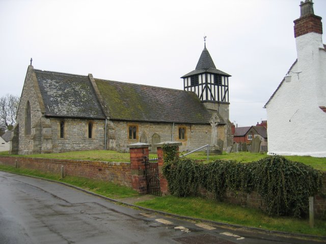
The village itself is characterized by its charming and quaint atmosphere, with a mix of traditional cottages and more modern houses. It boasts a close-knit community that takes pride in maintaining the beauty and tranquility of the area. Defford is also home to the St. James' Church, a beautiful historic building that serves as a focal point for the village.

Despite its small size, Defford offers various amenities to its residents. These include a primary school, a village hall, and a local pub, providing a sense of community and opportunities for social gatherings.

The surrounding countryside provides ample opportunities for outdoor activities, such as walking, cycling, and horse riding. Additionally, Defford's location offers easy access to nearby towns and cities, including Worcester, Malvern, and Cheltenham, ensuring residents have access to a wider range of amenities and services.

Overall, Defford is a charming village that offers a peaceful and idyllic lifestyle amidst the beautiful Worcestershire countryside.

If you have any feedback on the listing, please let us know in the comments section below.
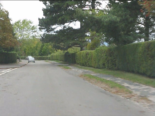
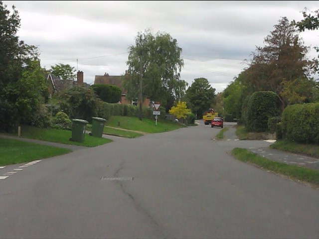
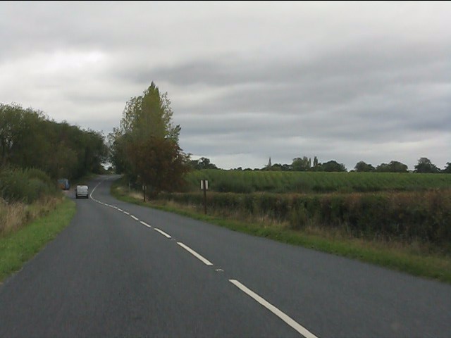
Defford Images

Images are sourced within 2km of 52.088736/-2.117839 or Grid Reference SO9243. Thanks to Geograph Open Source API. All images are credited.

The old main road The old A4104 has now become a parking lot and storage space at this end. Still a right of way, but barely accessible over a large mound of earth.
The old main road
The old A4104 has now become a parking lot and storage space at this end. Still a right of way, but barely accessible over a large mound of earth.
Landing strip near Woodmancote This marker denotes the eastern end of the private grass landing strip to the north of the village. Large barns serving as hangars on the left. The Malvern Hills in the distance (the Worcestershire Beacon is just above the wind sock).
See <a href="https://www.geograph.org.uk/photo/2448255">SO9043 : Landing strip near Woodmancote</a> for the reverse view.
Landing strip near Woodmancote
This marker denotes the eastern end of the private grass landing strip to the north of the village. Large barns serving as hangars on the left. The Malvern Hills in the distance (the Worcestershire Beacon is just above the wind sock). See SO9043 : Landing strip near Woodmancote for the reverse view.
Farm track near Defford Heading east with Bredon Hill on the right. The landowner here kindly allows access along several permitted pathways, not just the public rights of ways like this one.
Farm track near Defford
Heading east with Bredon Hill on the right. The landowner here kindly allows access along several permitted pathways, not just the public rights of ways like this one.
Path to woodland near Porter's Ashbed Looking north-west to an isolated wood near the Defford airfield. The landowner kindly allows access to this wood and several other private paths nearby. The public footpath ends at the corner of the wood, but a sign there reads "Visitors are permitted to enjoy this space, so long as dogs are kept under control and no wildlife, timber or flora are disturbed. No horse riding or motor vehicles please". I found the area most relaxing and at this time of year there are bluebells flowering in the wood.
Path to woodland near Porter's Ashbed
Looking north-west to an isolated wood near the Defford airfield. The landowner kindly allows access to this wood and several other private paths nearby. The public footpath ends at the corner of the wood, but a sign there reads "Visitors are permitted to enjoy this space, so long as dogs are kept under control and no wildlife, timber or flora are disturbed. No horse riding or motor vehicles please". I found the area most relaxing and at this time of year there are bluebells flowering in the wood.
Seat at the end of the landing strip At the west end of the light aircraft landing strip is a seat with a view across flat farmland to the Malvern Hills.
Seat at the end of the landing strip
At the west end of the light aircraft landing strip is a seat with a view across flat farmland to the Malvern Hills.
Landing strip near Woodmancote View east from the end of the grass runway. The large barns serving as hangars are beyond the oilseed rape crop on the right. 
See <a href="https://www.geograph.org.uk/photo/2446965">SO9143 : Landing strip near Woodmancote</a> for the other end of the strip.
Landing strip near Woodmancote
View east from the end of the grass runway. The large barns serving as hangars are beyond the oilseed rape crop on the right. See SO9143 : Landing strip near Woodmancote for the other end of the strip.
Track north of Woodmancote Heading north to the landing strip hangars just behind the farmhouse.
Track north of Woodmancote
Heading north to the landing strip hangars just behind the farmhouse.
Nafford Road enters Eckington
Nafford Road, Eckington
Eckington - western end of Nafford Road
Eckington - view west from the railway bridge
Eckington - Hammock Road
Eckington - northern end of Boon Street
Eckington - view east from the railway bridge
Eckington - crossroads and war memorial
Eckington Bridge A close-up of this old structure.  Pleasing to the eye, but woefully inadequate for modern traffic.
Eckington Bridge
A close-up of this old structure. Pleasing to the eye, but woefully inadequate for modern traffic.
View north from Eckington Bridge
B4080 north of Eckington Bridge
Show me another place!

Defford is located at Grid Ref: SO9243 (Lat: 52.088736, Lng: -2.117839)

Administrative County: Worcestershire

District: Wychavon

Police Authority: West Mercia

What 3 Words

///perfumes.during.defended. Near Eckington, Worcestershire

Nearby Locations

Defford

Related Wikis

Defford

Defford is a small village in the county of Worcestershire, England, located between the towns of Pershore and Upton-upon-Severn. It was once part of...

Defford railway station

Defford railway station was a station in Defford, Worcestershire, England. The station was opened in 1840 and closed in 1965. == References == == Further... ==

Bow Brook

The Bow Brook is a substantial brook that flows for 28.8 miles (46.3 km) through Worcestershire, England. It is a lower tributary of the River Avon which...

Eckington Bridge

Eckington Bridge is a stone bridge over the River Avon in Eckington in the English county of Worcestershire. It is a Grade II* listed building and has...

Nearby Amenities

Located within 500m of 52.088736,-2.117839
Pub
Defford Arms
Addr City: Pershore
Addr Postcode: WR8 9BD
Addr Street: Upton Road
Addr Village: Defford
Fhrs Id: 673993
Source Addr: FHRS Open Data
Lat/Long: 52.0880052/-2.1157668
Church
Naptan AtcoCode: 2000G061600
Naptan Bearing: SW
Naptan BusStopType: CUS
Naptan CommonName: Church
Naptan Indicator: opp
Naptan Landmark: Church
Naptan NaptanCode: wocgjdwj
Naptan Street: Harpley Road
Naptan Verified: no
Source: naptan_import
Lat/Long: 52.0869163/-2.1222168
Defford Arms Inn
Naptan AtcoCode: 2000G061601
Naptan Bearing: N
Naptan BusStopType: CUS
Naptan CommonName: Defford Arms Inn
Naptan Indicator: opp
Naptan Landmark: Defford Arms Inn
Naptan NaptanCode: wocgjdwm
Naptan Street: Main street
Naptan Verified: no
Source: naptan_import
Lat/Long: 52.0879204/-2.116148
Defford Arms
Naptan AtcoCode: 2000G061698
Naptan Bearing: SW
Naptan BusStopType: CUS
Naptan CommonName: Defford Arms
Naptan Indicator: adj
Naptan Landmark: Defford Arms Inn
Naptan NaptanCode: wocdatdm
Naptan Street: Main Street
Naptan Verified: no
Source: naptan_import
Lat/Long: 52.0880825/-2.1158565
Church
Naptan AtcoCode: 2000G061699
Naptan Bearing: NE
Naptan BusStopType: CUS
Naptan CommonName: Church
Naptan Indicator: adj
Naptan Landmark: Church
Naptan NaptanCode: wocdatdp
Naptan Street: Harpley Road
Naptan Verified: no
Source: naptan_import
Lat/Long: 52.0869879/-2.1225089
Defford First School
Naptan AtcoCode: 2000G671009
Naptan Bearing: N
Naptan BusStopType: CUS
Naptan CommonName: Defford First School
Naptan Indicator: adj
Naptan Landmark: Defford First School
Naptan NaptanCode: wocdpjmg
Naptan Street: Hill View
Naptan Verified: no
Source: naptan_import
Lat/Long: 52.0884375/-2.1204695
Post Box
Collection Times: Mo-Fr 16:30; Sa 08:00
Post Box Type: lamp
Ref: WR8 271
Royal Cypher: EIIR
Royal Cypher Wikidata: Q33102113
Source: GPS Survey
Lat/Long: 52.0870013/-2.1217652
Post Box
Collection Times: Mo-Fr 16:30; Sa 07:30
Post Box Mounting: pier
Post Box Type: lamp
Ref: WR8 467
Royal Cypher: EIIR
Royal Cypher Wikidata: Q33102113
Source: GPS Survey
Lat/Long: 52.0918809/-2.1184779
Historic: memorial
Lat/Long: 52.087105/-2.1220895
Historic: memorial
Lat/Long: 52.0875384/-2.1220059
Maxspeed: 30 mph
Lat/Long: 52.0866441/-2.124005
Post Box
Collection Times: Mo-Fr 16:15; Sa 10:15
Post Box Type: lamp
Ref: WR8 420
Royal Cypher: EIIR
Royal Cypher Wikidata: Q33102113
Source: GPS Survey
Lat/Long: 52.087344/-2.1162799
Power: pole
Lat/Long: 52.0925133/-2.1139829
Power: pole
Lat/Long: 52.0884625/-2.112953
Power: pole
Lat/Long: 52.091162/-2.113248
Power: pole
Lat/Long: 52.0896887/-2.1130442
Power: pole
Lat/Long: 52.0870517/-2.1131139
Power: pole
Lat/Long: 52.0853179/-2.1134143
Barrier: stile
Foot: yes
Stile: stepover
Lat/Long: 52.0870801/-2.1164157
Generator Method: photovoltaic
Generator Output Electricity: yes
Generator Source: solar
Generator Type: solar_photovoltaic_panel
Location: roof
Power: generator
Lat/Long: 52.0878906/-2.1203426
Generator Method: photovoltaic
Generator Output Electricity: yes
Generator Source: solar
Generator Type: solar_photovoltaic_panel
Location: roof
Power: generator
Lat/Long: 52.0873879/-2.1180278
Generator Method: photovoltaic
Generator Output Electricity: yes
Generator Source: solar
Generator Type: solar_photovoltaic_panel
Location: roof
Power: generator
Lat/Long: 52.088685/-2.1176121
Generator Method: photovoltaic
Generator Output Electricity: yes
Generator Source: solar
Generator Type: solar_photovoltaic_panel
Location: roof
Power: generator
Lat/Long: 52.0892272/-2.1174645
Generator Method: photovoltaic
Generator Output Electricity: yes
Generator Source: solar
Generator Type: solar_photovoltaic_panel
Location: roof
Power: generator
Lat/Long: 52.0894695/-2.1174833
Generator Method: photovoltaic
Generator Output Electricity: yes
Generator Source: solar
Generator Type: solar_photovoltaic_panel
Location: roof
Power: generator
Lat/Long: 52.0895799/-2.1174243
Generator Method: photovoltaic
Generator Output Electricity: yes
Generator Source: solar
Generator Type: solar_photovoltaic_panel
Location: roof
Power: generator
Lat/Long: 52.0875083/-2.1215951
Generator Method: photovoltaic
Generator Output Electricity: yes
Generator Source: solar
Generator Type: solar_photovoltaic_panel
Location: roof
Power: generator
Lat/Long: 52.0870254/-2.123006
Generator Method: photovoltaic
Generator Output Electricity: yes
Generator Source: solar
Generator Type: solar_photovoltaic_panel
Location: roof
Power: generator
Lat/Long: 52.0871523/-2.1217346
Generator Method: photovoltaic
Generator Output Electricity: yes
Generator Source: solar
Generator Type: solar_photovoltaic_panel
Location: roof
Power: generator
Lat/Long: 52.0871556/-2.121571
Generator Method: photovoltaic
Generator Output Electricity: yes
Generator Source: solar
Generator Type: solar_photovoltaic_panel
Location: roof
Power: generator
Lat/Long: 52.0868589/-2.1213457
Location Transition: yes
Power: pole
Lat/Long: 52.0855849/-2.1136236
Power: pole
Lat/Long: 52.0852717/-2.1147394
Avonbank Defford
Power: pole
Transformer: distribution
Voltage Primary: 11000
Lat/Long: 52.0866414/-2.1165539
Power: pole
Lat/Long: 52.086226/-2.116169
Power: pole
Lat/Long: 52.0854901/-2.1155722
Power: pole
Lat/Long: 52.0851242/-2.1152517
Power: pole
Lat/Long: 52.0848984/-2.1160591
Power: pole
Lat/Long: 52.084407/-2.1169408
Besford Road
Power: pole
Transformer: distribution
Voltage Primary: 11000
Lat/Long: 52.0919501/-2.1181324
Power: transformer
Transformer: distribution
Voltage Primary: 11000
Lat/Long: 52.0890737/-2.1179872
Power: transformer
Transformer: distribution
Voltage Primary: 11000
Lat/Long: 52.0868163/-2.1200465
Power: pole
Lat/Long: 52.0859714/-2.1122718
Location Transition: yes
Power: pole
Lat/Long: 52.0857571/-2.1130141
The data included in this document is from www.openstreetmap.org. The data is made available under ODbL.

Have you been to Defford?

Leave your review of Defford below (or comments, questions and feedback).