Badbury Forest

Wood, Forest in Berkshire Vale of White Horse

England

Badbury Forest

Dolphin and Putti sculpture, The Water Garden, Buscot Park This bronze sculpture can be found in the Water Garden designed by Harold Peto in 1904. Does the iconography mean anything? Another example can be found at Hidcote <a href="https://www.geograph.org.uk/photo/6969809">SP1742 : Dolphin and Putti sculpture, Hidcote Manor, Hidcote Bartrim</a>
Dolphin and Putti sculpture, The Water Garden, Buscot Park Credit: Brian Robert Marshall

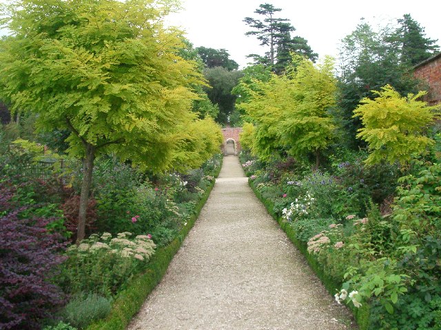
Badbury Forest is a stunning woodland located in Berkshire, England. Covering an area of approximately 350 hectares, it is nestled within the rolling countryside of the Lambourn Downs. The forest is part of the wider Badbury Hill and Coombesbury Downs Site of Special Scientific Interest (SSSI), which highlights its ecological importance.

This ancient forest is predominantly composed of broadleaf trees such as oak, beech, and birch, creating a rich and diverse habitat for a variety of plant and animal species. Bluebells carpet the forest floor in the spring, providing a breathtaking display of color, while the canopy above provides a welcome shade during the summer months.

Badbury Forest is renowned for its wildlife, attracting nature enthusiasts and birdwatchers from far and wide. It is home to numerous bird species, including woodpeckers, buzzards, and tawny owls. The forest's diverse habitats also support a range of mammals, such as deer, foxes, and badgers. Additionally, the forest is a haven for butterflies, with species such as the purple hairstreak and the white admiral fluttering among the trees.

Visitors to Badbury Forest can enjoy a network of well-maintained trails that meander through the woodland, offering scenic walks and opportunities for exploration. The forest is managed by the Forestry Commission, which ensures the preservation and sustainable use of the forest's resources.

Overall, Badbury Forest is a tranquil and enchanting woodland, providing a haven for wildlife and a place for people to connect with nature. Its natural beauty and ecological significance make it a cherished destination for locals and visitors alike.

If you have any feedback on the listing, please let us know in the comments section below.

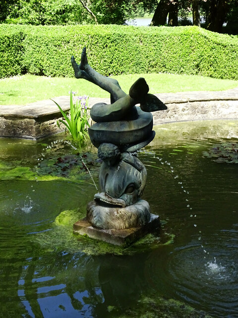
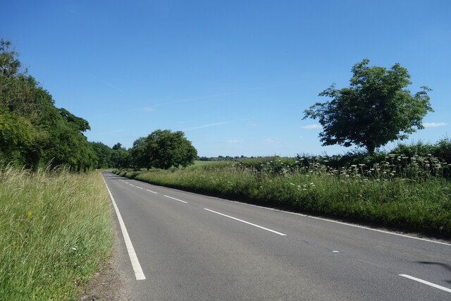
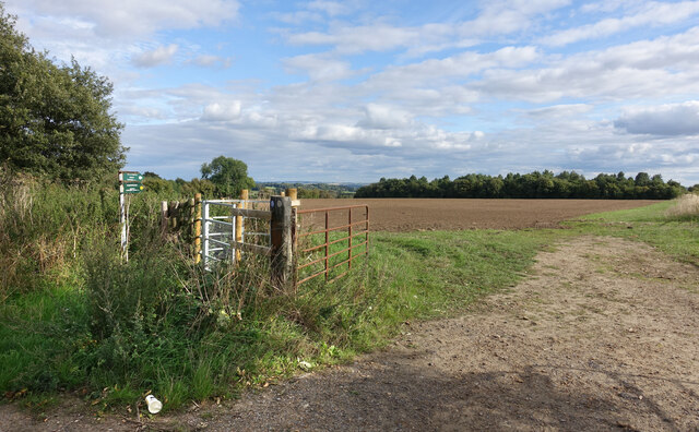
Badbury Forest Images

Images are sourced within 2km of 51.660874/-1.6231848 or Grid Reference SU2695. Thanks to Geograph Open Source API. All images are credited.

Dolphin and Putti sculpture, The Water Garden, Buscot Park This bronze sculpture can be found in the Water Garden designed by Harold Peto in 1904. Does the iconography mean anything? Another example can be found at Hidcote <a href="https://www.geograph.org.uk/photo/6969809">SP1742 : Dolphin and Putti sculpture, Hidcote Manor, Hidcote Bartrim</a>
Dolphin and Putti sculpture, The Water Garden, Buscot Park
This bronze sculpture can be found in the Water Garden designed by Harold Peto in 1904. Does the iconography mean anything? Another example can be found at Hidcote SP1742 : Dolphin and Putti sculpture, Hidcote Manor, Hidcote Bartrim
Great Coxwell Tithe Barn
Bluebells and beech trees, Badbury Castle, Faringdon There is a very good show of native bluebells in this National Trust holding. Once this was an Iron Age hillfort. For reasons best known to themselves, our 19th century forebears levelled most of it.
Bluebells and beech trees, Badbury Castle, Faringdon
There is a very good show of native bluebells in this National Trust holding. Once this was an Iron Age hillfort. For reasons best known to themselves, our 19th century forebears levelled most of it.
Gateway into Easton Wood Last Geographed 10 years ago when the vegetation was cut back into a neat hedge <a href="https://www.geograph.org.uk/photo/2787414">SU2696 : New Lodges, near Faringdon</a>. Now it's hard to see the lodge house behind all the foliage.
This must have been a side entrance into Buscot Park via a woodland drive. It's quite a distance from the house.
Gateway into Easton Wood
Last Geographed 10 years ago when the vegetation was cut back into a neat hedge SU2696 : New Lodges, near Faringdon. Now it's hard to see the lodge house behind all the foliage. This must have been a side entrance into Buscot Park via a woodland drive. It's quite a distance from the house.
Road to Crabtree Farm Named rather anciently on the map as Crabbe-Tree Farm, the name on the gate uses the normal spelling.
Road to Crabtree Farm
Named rather anciently on the map as Crabbe-Tree Farm, the name on the gate uses the normal spelling.
A417 towards Faringdon Quiet just now, but this is quite a busy country A road between Lechlade and Faringdon.
A417 towards Faringdon
Quiet just now, but this is quite a busy country A road between Lechlade and Faringdon.
Festival at the Barn Great Coxwell Tithe Barn is along a narrow lane on the edge of a quiet village. Even when it's open visitors tend to arrive in twos and threes and often there's nobody about at all.
But today there was a village festival going on, with stalls and food and music etc. and the place was unusually crowded.
Festival at the Barn
Great Coxwell Tithe Barn is along a narrow lane on the edge of a quiet village. Even when it's open visitors tend to arrive in twos and threes and often there's nobody about at all. But today there was a village festival going on, with stalls and food and music etc. and the place was unusually crowded.
Footpath on Badbury Hill A short path downhill through fields to Great Coxwell Tithe Barn.
Footpath on Badbury Hill
A short path downhill through fields to Great Coxwell Tithe Barn.
Left part of Information Board at Badbury Hill This photo shows the left part of the National Trust information board in the car park at Badbury Hill. It has the following wording:

                    Badbury Hill

   Welcome
      Badbury Hill is the site of an Iron Age hill fort. It is likely that it was 
      built from around 600BC and occupied until the first century AD.
      The woods are famed for their bluebells and are great for you to
      explore and enjoy.

      Make the most of Badbury Hill
      Take a walk - Whether you have dogs or small children, there is a 
      route here for everyone. Link up with footpaths and follow the
      Buscot and Coleshill Circular Walks.
      Explore the hill fort - This circular Iron Age fort still has its ditch
      and banks and is an ideal distance for toddlers. Enjoy the wonderful
      views.
      Play - There are plenty of places to build dens and explore, seek out
      the natural Wild Play areas on the edge of the Hill Fort and further in
      the woods.
      Visit Coxwell Barn - Follow the footpath to the 13th century barn,
      only 15 minutes away.
      Come back in the spring - See the magnificent display of bluebells
      below the beech trees.
      Contact the Community Learning Officer - Discover events and
      activities for schools and other groups.
Left part of Information Board at Badbury Hill
This photo shows the left part of the National Trust information board in the car park at Badbury Hill. It has the following wording: Badbury Hill Welcome Badbury Hill is the site of an Iron Age hill fort. It is likely that it was built from around 600BC and occupied until the first century AD. The woods are famed for their bluebells and are great for you to explore and enjoy. Make the most of Badbury Hill Take a walk - Whether you have dogs or small children, there is a route here for everyone. Link up with footpaths and follow the Buscot and Coleshill Circular Walks. Explore the hill fort - This circular Iron Age fort still has its ditch and banks and is an ideal distance for toddlers. Enjoy the wonderful views. Play - There are plenty of places to build dens and explore, seek out the natural Wild Play areas on the edge of the Hill Fort and further in the woods. Visit Coxwell Barn - Follow the footpath to the 13th century barn, only 15 minutes away. Come back in the spring - See the magnificent display of bluebells below the beech trees. Contact the Community Learning Officer - Discover events and activities for schools and other groups.
National Trust Information Board at Badbury Hill This information board is located in the car park off Highworth Road SN7 7NL and would appear to have replaced the previous board as at <a title="https://www.geograph.org.uk/photo/4235169" href="https://www.geograph.org.uk/photo/4235169">Link</a>. It shows the following details:

 Left side
  Details on Badbury Hill as at <a title="https://www.geograph.org.uk/photo/7438498" href="https://www.geograph.org.uk/photo/7438498">Link</a>

 Middle
 Map of Badbury Hill and the surrounding area with the wording below.
  
 i) Facilities
 Natural play area
 ii) Hazards and restrictions
  a)Please keep dogs under control
  b) Help keep the hill beautiful  by clearing up after your dog and using the bins provided.
  c) There are steep slopes and rough ground on the routes so please take care.
      Both walkers and cyclists use these woods, please be aware of each other.
  
   Partners at Badbury Hill
   Badbury Hill is a Scheduled Ancient Monument

   National Trust
   Contact us:
   nationaltrust.org.uk/buscotandcoleshill
   01793 762209
   buscotandcoleshill@nationaltrust.org.uk

   Share photos of your time here today using
   #national trust
   Facebook, Twitter and Instagram
   Thank you, your support looks after places like this.
    Registered charity no.205846

 Right side
  Top right notice
  Avian Influenza (bird flu)
  
  Bird flu has been detected in this area, please help us limit its spread by:
  i) Keeping to footpaths
  ii)  Keeping dogs on a lead
  iii) Not feeding wild waterfowl
  iv) Not touching wild bird feathers or surfaces contaminated with droppings
  v) Reporting any dead wild birds to Defra on 03459 335577 or helpline@defra.gov.uk
  
  Lower right notice
   Come and join our Easter adventures
   Join the fun from 7th to 10th April at White Horse Hill
   Find out more at nationaltrust.org.uk/easter

  On the far right of the photo are racks containing National Trust leaflets on walks around the Buscot and Coleshill Estates, and White Horse Hill.
National Trust Information Board at Badbury Hill
This information board is located in the car park off Highworth Road SN7 7NL and would appear to have replaced the previous board as at Link. It shows the following details: Left side Details on Badbury Hill as at Link Middle Map of Badbury Hill and the surrounding area with the wording below. i) Facilities Natural play area ii) Hazards and restrictions a)Please keep dogs under control b) Help keep the hill beautiful by clearing up after your dog and using the bins provided. c) There are steep slopes and rough ground on the routes so please take care. Both walkers and cyclists use these woods, please be aware of each other. Partners at Badbury Hill Badbury Hill is a Scheduled Ancient Monument National Trust Contact us: nationaltrust.org.uk/buscotandcoleshill 01793 762209 buscotandcoleshill@nationaltrust.org.uk Share photos of your time here today using #national trust Facebook, Twitter and Instagram Thank you, your support looks after places like this. Registered charity no.205846 Right side Top right notice Avian Influenza (bird flu) Bird flu has been detected in this area, please help us limit its spread by: i) Keeping to footpaths ii) Keeping dogs on a lead iii) Not feeding wild waterfowl iv) Not touching wild bird feathers or surfaces contaminated with droppings v) Reporting any dead wild birds to Defra on 03459 335577 or helpline@defra.gov.uk Lower right notice Come and join our Easter adventures Join the fun from 7th to 10th April at White Horse Hill Find out more at nationaltrust.org.uk/easter On the far right of the photo are racks containing National Trust leaflets on walks around the Buscot and Coleshill Estates, and White Horse Hill.
The Hollow Road The Hollow Road, near to Great Coxwell Barn. The lay-by provides parking for visitors to the barn.
The Hollow Road
The Hollow Road, near to Great Coxwell Barn. The lay-by provides parking for visitors to the barn.
Great Coxwell Barn no cars sign Signs on the gatepost at the entrance to Great Coxwell Barn.
Great Coxwell Barn no cars sign
Signs on the gatepost at the entrance to Great Coxwell Barn.
Great Coxwell Barn Great Coxwell Barn (or The Great Barn) is a medieval tithe barn built in the 13th century (around 1230) to provide income to Beaulieu Abbey. It is the only remaining part of the grange on this site.

It was last restored in 1960-62 by the National Trust when the barn was re-roofed in stone slates with new rafters, and some of the timbers were replaced with oak beams.

It is a Grade I listed building, list entry number 1183045 <span class="nowrap"><a title="https://historicengland.org.uk/listing/the-list/list-entry/1183045" rel="nofollow ugc noopener" href="https://historicengland.org.uk/listing/the-list/list-entry/1183045">Link</a><img style="margin-left:2px;" alt="External link" title="External link - shift click to open in new window" src="https://s1.geograph.org.uk/img/external.png" width="10" height="10"/></span>

It is now a favourite spot for roosting pigeons and crows.
Great Coxwell Barn
Great Coxwell Barn (or The Great Barn) is a medieval tithe barn built in the 13th century (around 1230) to provide income to Beaulieu Abbey. It is the only remaining part of the grange on this site. It was last restored in 1960-62 by the National Trust when the barn was re-roofed in stone slates with new rafters, and some of the timbers were replaced with oak beams. It is a Grade I listed building, list entry number 1183045 LinkExternal link It is now a favourite spot for roosting pigeons and crows.
Great Coxwell Barn Great Coxwell Barn (or The Great Barn) is a medieval tithe barn built in the 13th century (around 1230) to provide income to Beaulieu Abbey. It is the only remaining part of the grange on this site.

It was last restored in 1960-62 by the National Trust when the barn was re-roofed in stone slates with new rafters, and some of the timbers were replaced with oak beams.

It is a Grade I listed building, list entry number 1183045 <span class="nowrap"><a title="https://historicengland.org.uk/listing/the-list/list-entry/1183045" rel="nofollow ugc noopener" href="https://historicengland.org.uk/listing/the-list/list-entry/1183045">Link</a><img style="margin-left:2px;" alt="External link" title="External link - shift click to open in new window" src="https://s1.geograph.org.uk/img/external.png" width="10" height="10"/></span>

It is now a favourite spot for roosting pigeons and crows. This photograph was taken from the steps to the side of a small farm building.
Great Coxwell Barn
Great Coxwell Barn (or The Great Barn) is a medieval tithe barn built in the 13th century (around 1230) to provide income to Beaulieu Abbey. It is the only remaining part of the grange on this site. It was last restored in 1960-62 by the National Trust when the barn was re-roofed in stone slates with new rafters, and some of the timbers were replaced with oak beams. It is a Grade I listed building, list entry number 1183045 LinkExternal link It is now a favourite spot for roosting pigeons and crows. This photograph was taken from the steps to the side of a small farm building.
Great Coxwell Barn roof Great Coxwell Barn (or The Great Barn) is a medieval tithe barn built in the 13th century (around 1230) to provide income to Beaulieu Abbey. It is the only remaining part of the grange on this site.

It was last restored in 1960-62 by the National Trust when the barn was re-roofed in stone slates with new rafters, and some of the timbers were replaced with oak beams.

It is a Grade I listed building, list entry number 1183045 <span class="nowrap"><a title="https://historicengland.org.uk/listing/the-list/list-entry/1183045" rel="nofollow ugc noopener" href="https://historicengland.org.uk/listing/the-list/list-entry/1183045">Link</a><img style="margin-left:2px;" alt="External link" title="External link - shift click to open in new window" src="https://s1.geograph.org.uk/img/external.png" width="10" height="10"/></span>

It is now a favourite spot for roosting pigeons and crows.
Great Coxwell Barn roof
Great Coxwell Barn (or The Great Barn) is a medieval tithe barn built in the 13th century (around 1230) to provide income to Beaulieu Abbey. It is the only remaining part of the grange on this site. It was last restored in 1960-62 by the National Trust when the barn was re-roofed in stone slates with new rafters, and some of the timbers were replaced with oak beams. It is a Grade I listed building, list entry number 1183045 LinkExternal link It is now a favourite spot for roosting pigeons and crows.
Great Coxwell Barn contribution box One of two contribution boxes at Great Coxwell Barn, the other being in the rear of the gate post at the entrance off The Hollow Road. Suggested contributions are given on a sign.
Great Coxwell Barn contribution box
One of two contribution boxes at Great Coxwell Barn, the other being in the rear of the gate post at the entrance off The Hollow Road. Suggested contributions are given on a sign.
The walled garden at Buscot Park
Tithe Barn at Great Coxwell 13th century church and monastic stone tithe barn
Tithe Barn at Great Coxwell
13th century church and monastic stone tithe barn
Show me another place!

Badbury Forest is located at Grid Ref: SU2695 (Lat: 51.660874, Lng: -1.6231848)

Administrative County: Oxfordshire

District: Vale of White Horse

Police Authority: Thames Valley

What 3 Words

///mystery.flushes.weeds. Near Faringdon, Oxfordshire

Related Wikis

Badbury Hill

Badbury Hill is a hill in the civil parish of Great Coxwell near Faringdon in the English county of Oxfordshire. In 1974 it was transferred from Berkshire...
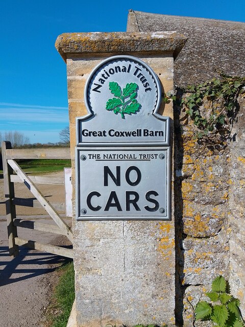
Great Coxwell Barn

Great Coxwell Barn is a Medieval tithe barn at Great Coxwell, Oxfordshire (formerly Berkshire), England. It is on the northern edge of the village of Great...
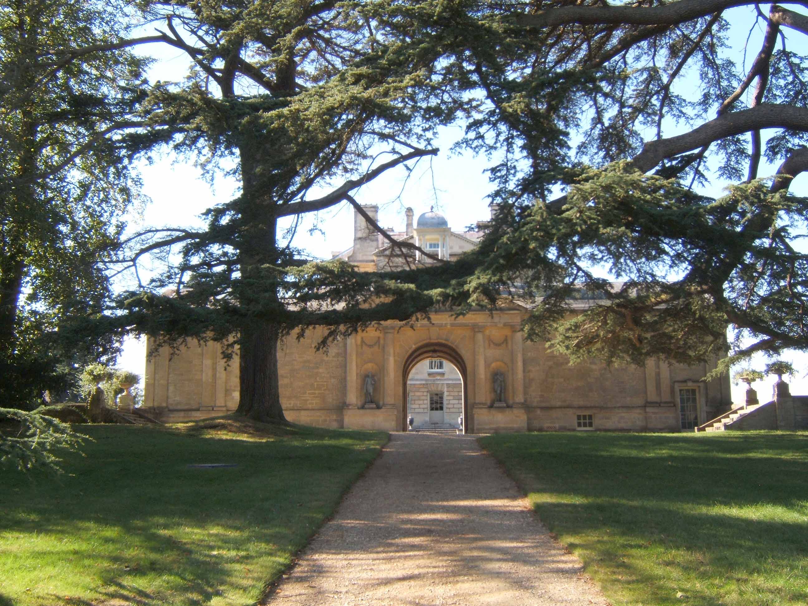
Buscot Park

Buscot Park is a country house at Buscot near the town of Faringdon in Oxfordshire within the historic boundaries of Berkshire. It is a Grade II* listed...

Faringdon

Faringdon is a historic market town in the Vale of White Horse, Oxfordshire, England, 18 miles (29 km) south-west of Oxford, 10 miles (16 km) north-west...
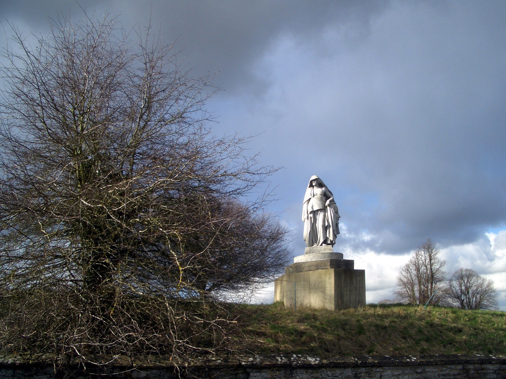
Faringdon House

Faringdon House is a Grade I listed 14,510 square feet house in Faringdon, Oxfordshire, England. It was built in about 1770–1785 for the Poet Laureate...

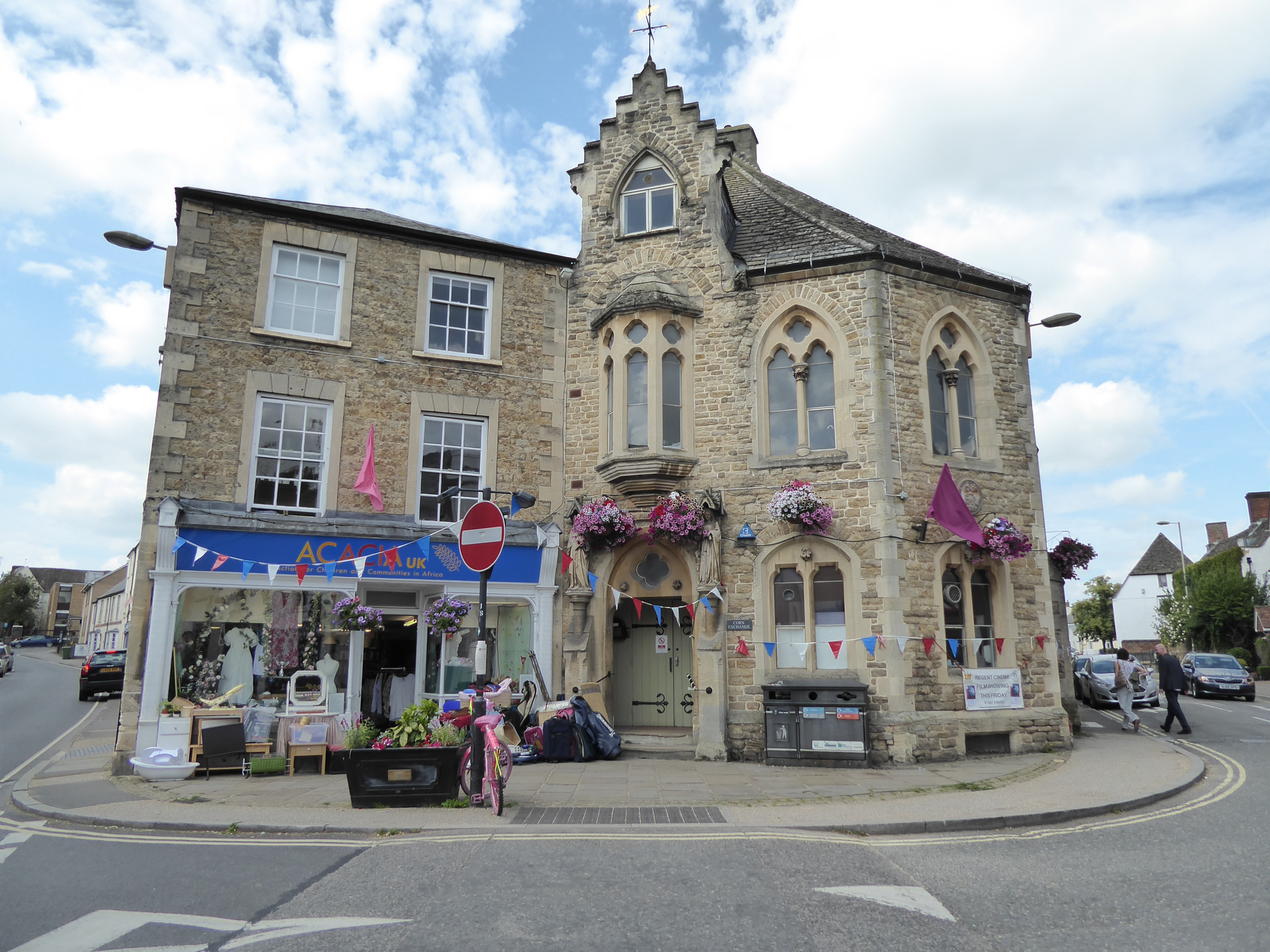
Corn Exchange, Faringdon

The Corn Exchange is a commercial building in Gloucester Street in Faringdon, Oxfordshire, England. The structure, which is currently used as a community...

Great Coxwell

Great Coxwell is a village and civil parish 2 miles (3 km) southwest of Faringdon in the Vale of White Horse, England. It was in Berkshire until the 1974...

Longworth Hospital

Longworth Hospital was a 50 bedded geriatric hospital in Faringdon Oxfordshire, England. It was administered by the Littlemore and Isis hospital management...

Related Videos

Great Coxwell Tithe Barn, Faringdon, Oxfordshire VR 360 Walking Video Tour

13th Century Great Coxwell Tithe Barn, near Faringdon, Oxfordshire. 360 Walking Video Tour. Great Coxwell Barn is an ancient ...

Walking Around Buscot Park (Vlog)

Hello and welcome to this video. I hope you enjoy it. If you enjoyed the video please tell me in the comments below. Channels you ...

Walking Football Faringdon Highlights - 04/12/23

Highlights from our weekly session on the 4th December 2023.

Nearby Amenities

Located within 500m of 51.660874,-1.6231848
Power: pole
Source: Bing
Lat/Long: 51.6577522/-1.6183193
Power: pole
Source: Bing
Lat/Long: 51.6579385/-1.6208969
Power: pole
Source: Bing
Lat/Long: 51.6578521/-1.6196175
Power: pole
Source: Bing
Lat/Long: 51.6569418/-1.6254486
Power: pole
Source: Bing
Lat/Long: 51.6580131/-1.6221732
Power: pole
Source: Bing
Lat/Long: 51.6573063/-1.624365
Power: pole
Source: Bing
Lat/Long: 51.6576704/-1.6232649
The data included in this document is from www.openstreetmap.org. The data is made available under ODbL.

Have you been to Badbury Forest?

Leave your review of Badbury Forest below (or comments, questions and feedback).