Riding Plantation

Wood, Forest in Northumberland

England

Riding Plantation

Arable farmland, Bothal Bothal Castle in the background.
Arable farmland, Bothal Credit: Richard Webb

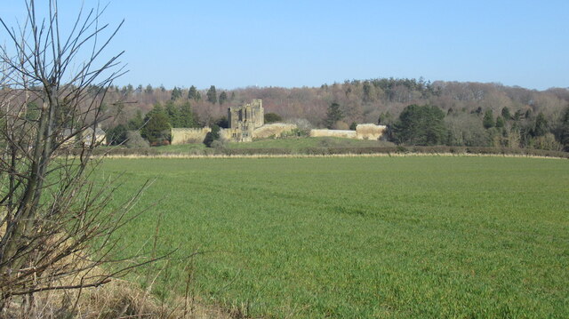
Riding Plantation, located in Northumberland, is a sprawling woodland area known for its picturesque beauty and abundant natural resources. Covering a vast expanse, this forested region serves as a haven for outdoor enthusiasts and nature lovers alike.

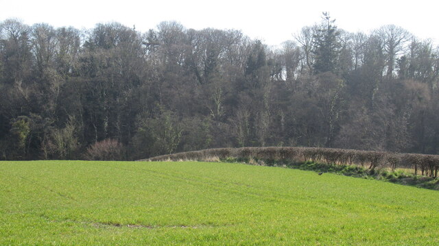
The plantation is characterized by a diverse range of tree species, including oak, birch, beech, and pine, which create a rich and vibrant ecosystem. The lush undergrowth, consisting of ferns, bluebells, and wildflowers, adds to the enchanting appeal of the woodland. The forest floor is adorned with a thick carpet of moss, creating a tranquil and serene atmosphere.

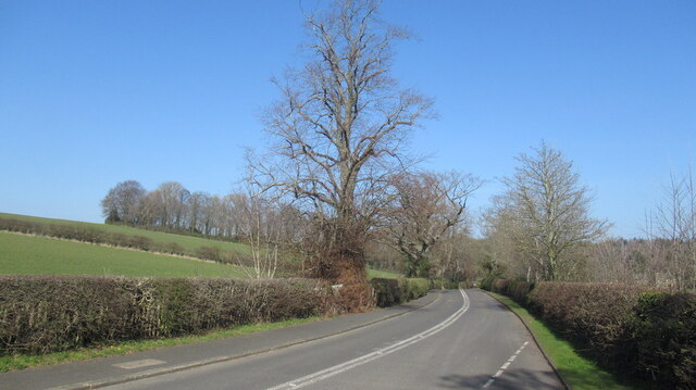
Riding Plantation offers various recreational activities for visitors to enjoy. Walking and hiking trails meander through the forest, allowing visitors to explore its beauty at their own pace. These trails are well-maintained and provide opportunities for both leisurely strolls and more challenging hikes. Cyclists can also take advantage of the plantation's biking trails, which offer a thrilling experience amidst the stunning natural surroundings.

The woodland is home to a diverse array of wildlife, including deer, squirrels, rabbits, and a variety of bird species. Birdwatchers will delight in the chance to spot rare and migratory birds nesting and feeding in the plantation.

Riding Plantation, with its natural splendor and recreational offerings, provides a tranquil retreat for those seeking an escape from the bustling city life. Its beauty and biodiversity make it a cherished destination for both locals and tourists, offering a truly immersive and rejuvenating experience in the heart of Northumberland.

If you have any feedback on the listing, please let us know in the comments section below.

Riding Plantation Images

Images are sourced within 2km of 55.164625/-1.6042908 or Grid Reference NZ2585. Thanks to Geograph Open Source API. All images are credited.
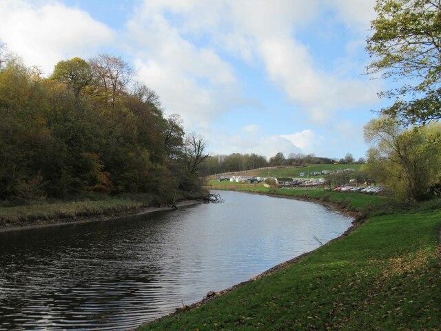
Arable farmland, Bothal Bothal Castle in the background.
Arable farmland, Bothal
Bothal Castle in the background.
Road to Bothal
Road to Bothal
Farmland, Bothal
Farmland, Bothal
Road bridge over the River Wansbeck near Morpeth A one lane single carriageway 1970s vintage bridge. Not the nicest. Functional.
Road bridge over the River Wansbeck near Morpeth
A one lane single carriageway 1970s vintage bridge. Not the nicest. Functional.
River Wansbeck Country Park Caravan site and cafe beyond car park.
River Wansbeck Country Park
Caravan site and cafe beyond car park.
River Wansbeck Country Park
Canoeists on the River Wansbeck I'm taking a photo of two canoeist one videoing the other.
Canoeists on the River Wansbeck
I'm taking a photo of two canoeist one videoing the other.
A196 Road Bridge over the River Wansbeck
Ruin at Bothal Mill An ancillary building, not the mill itself. Built between 1859 and 1898, according to the large-scale OS maps.
Ruin at Bothal Mill
An ancillary building, not the mill itself. Built between 1859 and 1898, according to the large-scale OS maps.
Public footpath at Bothal Mill The stone structure is part of Bothal Mill - a disused water-powered corn mill.
Public footpath at Bothal Mill
The stone structure is part of Bothal Mill - a disused water-powered corn mill.
River Wansbeck, from Bothal Mill bridge Looking upstream [locally west]. In the distance is the ruined weir that once fed Bothal Mill's mill stream.
River Wansbeck, from Bothal Mill bridge
Looking upstream [locally west]. In the distance is the ruined weir that once fed Bothal Mill's mill stream.
Piles of salt on the steep road up Northstead Banks Ready for icy roads in the next hard winter,
Piles of salt on the steep road up Northstead Banks
Ready for icy roads in the next hard winter,
Sports field, Ashington Off Briardene. Taken from an earth mound above the road.
Sports field, Ashington
Off Briardene. Taken from an earth mound above the road.
Old Bridge Marker on Bothal Castle Bridge Bridge Marker inscribed in the parapet of Bothal Castle Bridge, Bothal Burn, on the east side of the road in Bothal village. Ashington parish. Inscribed BOTHAL CASTLE / BRIDGE / 1824.

Milestone Society National ID: NB_ASH01br
Old Bridge Marker on Bothal Castle Bridge
Bridge Marker inscribed in the parapet of Bothal Castle Bridge, Bothal Burn, on the east side of the road in Bothal village. Ashington parish. Inscribed BOTHAL CASTLE / BRIDGE / 1824. Milestone Society National ID: NB_ASH01br
Old Folks Home, Stakeford Typical early 90's sheltered housing.
Old Folks Home, Stakeford
Typical early 90's sheltered housing.
River Wansbeck Towards Riverside Park Scenic unspoilt riverbanks.
River Wansbeck Towards Riverside Park
Scenic unspoilt riverbanks.
Riverside Park Leafy footpaths near Wansbeck.
Riverside Park
Leafy footpaths near Wansbeck.
Bothal Village
Bothal Village
Show me another place!

Riding Plantation is located at Grid Ref: NZ2585 (Lat: 55.164625, Lng: -1.6042908)

Unitary Authority: Northumberland

Police Authority: Northumbria

What 3 Words

///hypnotist.bookcases.boomers. Near Choppington, Northumberland

Related Wikis

Sheepwash, Northumberland

Sheepwash is a village and former civil parish, now in the parish of Ashington, in the county of Northumberland, England. It is adjacent to Stakeford and...

Guide Post

Guide Post is a village in South East Northumberland, England, about 17 miles (27 km) north of Newcastle upon Tyne. It lies south of the River Wansbeck...

Northumberland Coalfield

The Northumberland Coalfield is a coalfield in north-east England. It is continuous with the Durham Coalfield to its south. It extends from Shilbottle...

Stakeford

Stakeford is a large village in south east Northumberland, England. Its about 17 miles (27 km) north of Newcastle upon Tyne. It lies south of the River...

Nearby Amenities

Located within 500m of 55.164625,-1.6042908
Traffic Signals
Lat/Long: 55.1654385/-1.5990143
Traffic Signals
Lat/Long: 55.1662239/-1.599961
Noexit: yes
Lat/Long: 55.1612004/-1.6077209
Noexit: yes
Lat/Long: 55.1612829/-1.6072662
Bus Stop
Lat/Long: 55.161768/-1.606954
Noexit: yes
Lat/Long: 55.1604277/-1.6056707
Noexit: yes
Lat/Long: 55.1603048/-1.6059159
Noexit: yes
Lat/Long: 55.1622417/-1.6059461
Noexit: yes
Lat/Long: 55.1615095/-1.6050134
Noexit: yes
Lat/Long: 55.1614501/-1.6048979
Post Box
Collection Times: Mo-Fr 09:00, Sa 07:00
Postal Code: NE62 5PB
Ref: NE62 138
Royal Cypher: EIIR
Royal Cypher Wikidata: Q33102113
Lat/Long: 55.1627335/-1.6032231
Power: pole
Lat/Long: 55.163014/-1.6114443
Power: pole
Lat/Long: 55.1653757/-1.6109425
Power: pole
Lat/Long: 55.1652064/-1.6106922
Power: pole
Lat/Long: 55.1665624/-1.6104189
Power: pole
Lat/Long: 55.1678336/-1.609581
Power: pole
Lat/Long: 55.1638723/-1.6111166
Power: pole
Lat/Long: 55.1640492/-1.611361
Power: pole
Lat/Long: 55.1665375/-1.6101225
Noexit: yes
Lat/Long: 55.1605311/-1.6025965
Noexit: yes
Lat/Long: 55.1615569/-1.602443
Noexit: yes
Lat/Long: 55.1615423/-1.60227
Post Box
Collection Times: Mo-Fr 09:00; Sa 07:00
Drive Through: no
Operator: Royal Mail
Post Box Type: pillar
Ref: NE62 216D
Royal Cypher: EIIR
Royal Cypher Wikidata: Q33102113
Source: survey
Lat/Long: 55.163003/-1.5981237
Noexit: yes
Lat/Long: 55.161854/-1.598696
Noexit: yes
Lat/Long: 55.1605132/-1.6029685
Noexit: yes
Lat/Long: 55.1606793/-1.6028689
Noexit: yes
Lat/Long: 55.161151/-1.6029886
Noexit: yes
Lat/Long: 55.1632977/-1.600434
Give Way
Direction: forward
Lat/Long: 55.1605203/-1.6034139
Give Way
Direction: forward
Lat/Long: 55.1618288/-1.5995146
Give Way
Direction: forward
Lat/Long: 55.160668/-1.6032812
Give Way
Direction: backward
Lat/Long: 55.1626971/-1.6031584
Give Way
Direction: backward
Lat/Long: 55.1631317/-1.6014017
Give Way
Direction: forward
Lat/Long: 55.1634792/-1.6019698
Give Way
Direction: forward
Lat/Long: 55.163356/-1.6019914
Noexit: yes
Lat/Long: 55.1620871/-1.6019104
Noexit: yes
Lat/Long: 55.1620933/-1.6030598
Noexit: yes
Lat/Long: 55.1640254/-1.6012305
Noexit: yes
Lat/Long: 55.1638155/-1.6013069
Bus Stop
Bench: no
Bus: yes
Naptan AtcoCode: 3100Z256853
Naptan NaptanCode: nldatptm
Public Transport: platform
Shelter: no
Lat/Long: 55.1623189/-1.5985761
Grit Bin
Lat/Long: 55.1617382/-1.5993799
Grit Bin
Lat/Long: 55.16121/-1.6061148
Noexit: yes
Lat/Long: 55.1615072/-1.601657
Noexit: yes
Lat/Long: 55.1614666/-1.6019198
Noexit: yes
Lat/Long: 55.161295/-1.6016892
Generator Method: photovoltaic
Generator Output Electricity: yes
Generator Source: solar
Generator Type: solar_photovoltaic_panel
Power: generator
Lat/Long: 55.1638668/-1.5969872
Generator Method: photovoltaic
Generator Output Electricity: yes
Generator Source: solar
Generator Type: solar_photovoltaic_panel
Power: generator
Lat/Long: 55.1602867/-1.6030987
The data included in this document is from www.openstreetmap.org. The data is made available under ODbL.

Have you been to Riding Plantation?

Leave your review of Riding Plantation below (or comments, questions and feedback).