Baywell Wood

Wood, Forest in Gloucestershire Cotswold

England

Baywell Wood

A436 at Cornwell Holt The junction can be seen at <a title="https://www.geograph.org.uk/search.php?i=58157253" href="https://www.geograph.org.uk/search.php?i=58157253">Link</a>. Taken from the end of the lane from Chastleton.
A436 at Cornwell Holt Credit: Derek Harper

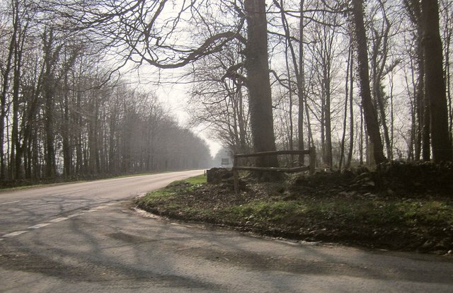
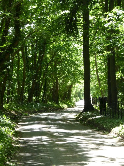
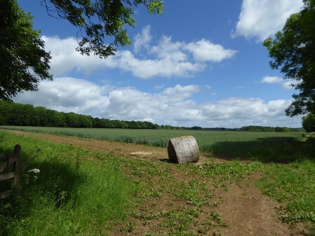
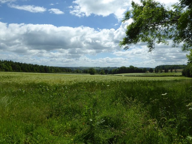
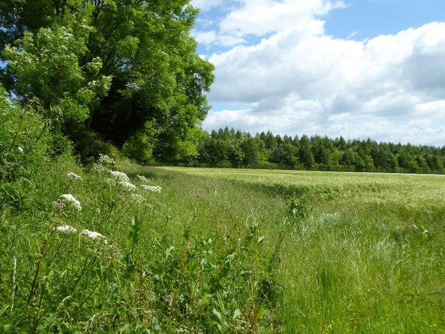
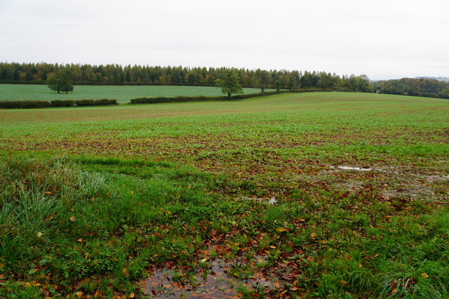
Baywell Wood is a picturesque forest located in the county of Gloucestershire, England. Spread across an area of approximately 100 acres, this ancient woodland is a haven for nature enthusiasts and those seeking a peaceful retreat.

The wood is characterized by a diverse range of tree species, creating a vibrant and lush environment. Oak, ash, beech, and birch trees dominate the landscape, their canopies providing shade and shelter for a variety of flora and fauna. Bluebells, primroses, and wild garlic carpet the forest floor during the spring, creating a stunning display of colors.

A network of well-maintained trails weaves through Baywell Wood, allowing visitors to explore its beauty at their own pace. These paths offer easy access to various points of interest, including a tranquil pond and several clearings ideal for picnics or relaxation. The wood is also home to a small stream, which adds to the natural charm of the area.

Wildlife is abundant in Baywell Wood, with numerous bird species, including woodpeckers and owls, making it their habitat. Squirrels, rabbits, and deer can often be spotted darting through the undergrowth, adding to the enchanting atmosphere of the forest.

Nature conservation is of great importance in Baywell Wood, with efforts made to preserve its natural beauty and protect its fragile ecosystem. The wood is managed by a dedicated team of forest rangers who ensure the well-being of the trees and wildlife.

Overall, Baywell Wood offers visitors a peaceful and serene setting to connect with nature. Its diverse flora and fauna, combined with its well-maintained trails, make it a popular destination for hiking, wildlife observation, and simply enjoying the beauty of the natural world.

If you have any feedback on the listing, please let us know in the comments section below.

Baywell Wood Images

Images are sourced within 2km of 51.936766/-1.6382618 or Grid Reference SP2426. Thanks to Geograph Open Source API. All images are credited.

A436 at Cornwell Holt The junction can be seen at <a title="https://www.geograph.org.uk/search.php?i=58157253" href="https://www.geograph.org.uk/search.php?i=58157253">Link</a>. Taken from the end of the lane from Chastleton.
A436 at Cornwell Holt
The junction can be seen at Link. Taken from the end of the lane from Chastleton.
Site of Adlestrop Railway Station The presumed station house survives behind the trees to the left.
Site of Adlestrop Railway Station
The presumed station house survives behind the trees to the left.
Signpost on the A436 A traditional signpost on a crossroads on the A436 near Cornwell.
Signpost on the A436
A traditional signpost on a crossroads on the A436 near Cornwell.
Road to Cornwell A shady tree shrouded country road from the A436 to Cornwell.
Road to Cornwell
A shady tree shrouded country road from the A436 to Cornwell.
A straw bale in a field entrance An old straw bale from last years crop in a field entrance near Cornwell.
A straw bale in a field entrance
An old straw bale from last years crop in a field entrance near Cornwell.
A barley field near Cornwell Early June and the countryside is an abundance of green.
A barley field near Cornwell
Early June and the countryside is an abundance of green.
Cow parsley in a field headland Cow parsley in the headland of a barley field.
Cow parsley in a field headland
Cow parsley in the headland of a barley field.
Cow parsley and arable land Cow parsley in the headland of an arable field near Cornwell.
Cow parsley and arable land
Cow parsley in the headland of an arable field near Cornwell.
Footpath to Cornwell A footpath follows this field headland to Cornwell.
Footpath to Cornwell
A footpath follows this field headland to Cornwell.
Field entrance Entrance to farmland crossing what appears to be a belt planted with tree saplings.  The Cotswold town of Stow-on-the-Wold is on the top of the hill beyond the broad valley.
Field entrance
Entrance to farmland crossing what appears to be a belt planted with tree saplings. The Cotswold town of Stow-on-the-Wold is on the top of the hill beyond the broad valley.
Ash tree in the hedgerow If the disease ash deadback becomes widespread an ash tree such as this one near Cornwell may become a rare sight.
Ash tree in the hedgerow
If the disease ash deadback becomes widespread an ash tree such as this one near Cornwell may become a rare sight.
Chicken sheds Chicken sheds housing free range chickens.
Chicken sheds
Chicken sheds housing free range chickens.
View to Slade Farm View across farmland to Slade Farm near Kingham.
View to Slade Farm
View across farmland to Slade Farm near Kingham.
Farmland at Kingham Farmland to the west of Kingham.
Farmland at Kingham
Farmland to the west of Kingham.
Field entrance near Cornwell
Field entrance near Cornwell Looking towards Kingham Hill. The ground is still quite soggy.
Field entrance near Cornwell
Looking towards Kingham Hill. The ground is still quite soggy.
Soggy field near Cornwell The field is quite waterlogged from recent rain.
Soggy field near Cornwell
The field is quite waterlogged from recent rain.
Puddly lane near Whitequarry Hill The effect of recent rain.
Puddly lane near Whitequarry Hill
The effect of recent rain.
Show me another place!

Baywell Wood is located at Grid Ref: SP2426 (Lat: 51.936766, Lng: -1.6382618)

Administrative County: Gloucestershire

District: Cotswold

Police Authority: Gloucestershire
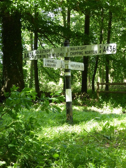
What 3 Words

///remodels.chariots.horns. Near Stow on the Wold, Gloucestershire

Nearby Locations

Baywell Wood

Related Wikis

Daylesford House

Daylesford House is a Georgian country house near Daylesford, Gloucestershire, England, on the north bank of the River Evenlode near the border with Oxfordshire...

Daylesford, Gloucestershire

Daylesford is a small, privately owned village and former civil parish, now in the parish of Adlestrop, in the Cotswold district, in the county of Gloucestershire...

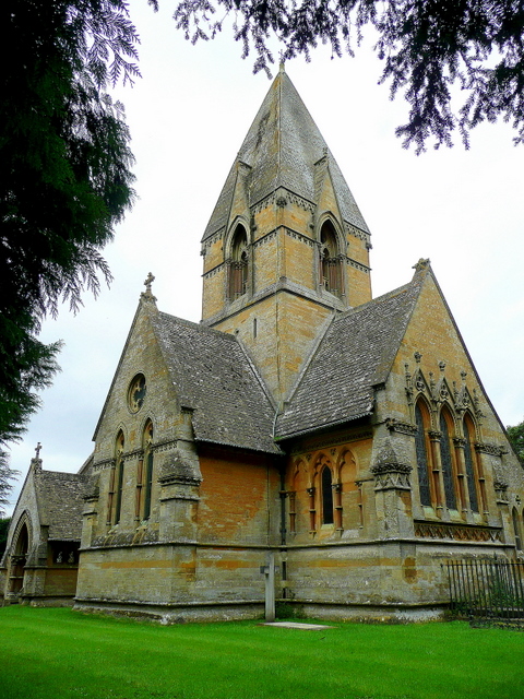
Church of St Peter, Daylesford

The Anglican Church of St Peter at Daylesford in the Cotswold District of Gloucestershire, England was rebuilt in 1860. It is a grade I listed building...

Adlestrop

Adlestrop () is a village and civil parish in the Cotswolds, 3 miles (5 km) east of Stow-on-the-Wold, Gloucestershire, England, on the county boundary...

Adlestrop railway station

Adlestrop railway station was a railway station which served the village of Adlestrop in Gloucestershire, England, between 1853 and 1966. It was on what...

Kingham Hill School

Kingham Hill School is a Christian co-educational private day and boarding school for children aged 11–19, located near the village of Kingham in Oxfordshire...

Cornwell, Oxfordshire

Cornwell is a small village and civil parish about 2.5 miles (4 km) west of Chipping Norton in the West Oxfordshire district of Oxfordshire, near the county...

Chastleton House

Chastleton House () is a Jacobean country house at Chastleton, Oxfordshire, England, close to Moreton-in-Marsh (grid reference SP2429). It has been owned...

Nearby Amenities

Located within 500m of 51.936766,-1.6382618
Horse at Water
Artist Name: Nic Fiddian-Green
Artwork Type: statue
Material: bronze
Tourism: artwork
Lat/Long: 51.9376988/-1.6363784
Material: wood
Power: pole
Source: bing
Lat/Long: 51.9335943/-1.6427216
Material: wood
Power: pole
Source: bing
Lat/Long: 51.9365102/-1.6406711
Material: wood
Power: pole
Source: bing
Lat/Long: 51.9379113/-1.6396813
Material: wood
Power: pole
Source: bing
Lat/Long: 51.9386393/-1.6391663
Material: wood
Power: pole
Source: bing
Lat/Long: 51.9398856/-1.6411002
Material: wood
Power: pole
Source: bing
Lat/Long: 51.940376/-1.6416205
Daylesford House
Power: pole
Transformer: distribution
Voltage Primary: 11000
Lat/Long: 51.9366479/-1.6315649
West Lodge
Location Transition: yes
Material: wood
Power: pole
Transformer: distribution
Voltage Primary: 11000
Lat/Long: 51.9399043/-1.6379238
Material: wood
Power: pole
Lat/Long: 51.9395049/-1.6389316
Material: wood
Power: pole
Lat/Long: 51.9393164/-1.6405001
Material: wood
Power: pole
Lat/Long: 51.9390486/-1.6399455
Material: wood
Power: pole
Lat/Long: 51.9371767/-1.6402003
Material: wood
Power: pole
Lat/Long: 51.9357764/-1.641182
Material: wood
Power: pole
Lat/Long: 51.9350595/-1.6416839
Material: wood
Power: pole
Lat/Long: 51.934336/-1.6421945
The data included in this document is from www.openstreetmap.org. The data is made available under ODbL.

Have you been to Baywell Wood?

Leave your review of Baywell Wood below (or comments, questions and feedback).