Bee Wood

Wood, Forest in Derbyshire Derbyshire Dales

England

Bee Wood

Woodland behind the Eyre Arms This woodland on this hill behind the Eyre Arms is just to the south-west of the centre of SK27.
Woodland behind the Eyre Arms Credit: Roger Temple

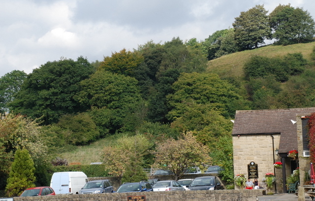
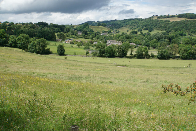
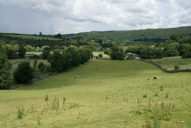
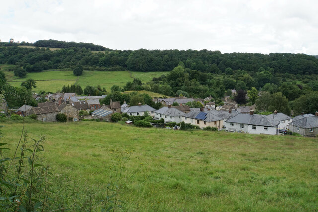
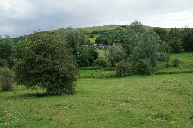
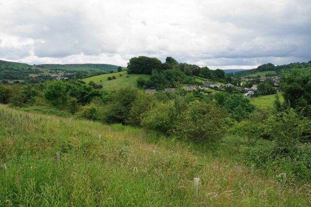
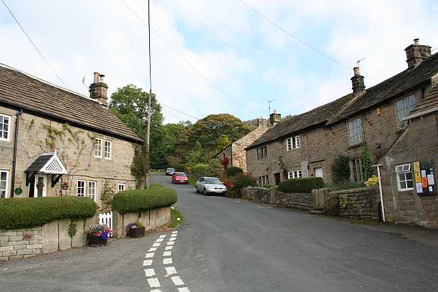
Bee Wood, located in Derbyshire, is a picturesque woodland area known for its natural beauty and diverse wildlife. Covering an expansive area of approximately 400 acres, this ancient forest is a popular destination for nature enthusiasts, hikers, and birdwatchers alike.

The woodland is mainly composed of deciduous trees such as oak, birch, and beech, creating a vibrant and ever-changing landscape throughout the seasons. The dense canopy provides a haven for a variety of bird species, including woodpeckers, owls, and warblers, making it a paradise for birdwatchers.

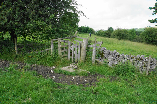
Tranquil walking trails wind their way through the wood, offering visitors a chance to explore its hidden gems and discover the rich biodiversity that thrives within. Along these paths, one may stumble upon charming clearings and babbling brooks, adding to the enchanting atmosphere of the forest.

Bee Wood is also known for its wildflowers, which carpet the forest floor during the spring and summer months. Bluebells, primroses, and foxgloves create a riot of color, attracting butterflies and bees, hence the name of the wood.

The woodland is managed by a local conservation organization, which ensures the preservation of its natural heritage and protects the habitats of various species. Visitors are urged to respect the environment and adhere to the designated trails to minimize any impact on the delicate ecosystem.

Overall, Bee Wood in Derbyshire offers a serene escape into nature, showcasing the beauty and tranquility of the British countryside.

If you have any feedback on the listing, please let us know in the comments section below.

Bee Wood Images

Images are sourced within 2km of 53.278492/-1.6284223 or Grid Reference SK2475. Thanks to Geograph Open Source API. All images are credited.

Woodland behind the Eyre Arms This woodland on this hill behind the Eyre Arms is just to the south-west of the centre of SK27.
Woodland behind the Eyre Arms
This woodland on this hill behind the Eyre Arms is just to the south-west of the centre of SK27.
The Chequers Inn Former Wards brewery pub beside the A625 in Froggatt
The Chequers Inn
Former Wards brewery pub beside the A625 in Froggatt
The sign of The Chequers Inn See <a href="https://www.geograph.org.uk/photo/6922975">SK2476 : The Chequers Inn</a>.
The sign of The Chequers Inn
Chequers Inn wall plaque Dating back to the halcyon days of the Wards brewery in Sheffield.  Oh to be able to drink a pint of that excellent brew again!
Chequers Inn wall plaque
Dating back to the halcyon days of the Wards brewery in Sheffield. Oh to be able to drink a pint of that excellent brew again!
Crossroads in Calver A lot of people will only know Calver from these crossroads, as the A623 passes through, and the A625 turns off. There is a village green here, with more on the opposite side, but the village has quieter and more attractive bits.
Crossroads in Calver
A lot of people will only know Calver from these crossroads, as the A623 passes through, and the A625 turns off. There is a village green here, with more on the opposite side, but the village has quieter and more attractive bits.
Hillside below Calver Low Looking down towards Stoney Middleton. Eyam is just visible further up the far hill.
Hillside below Calver Low
Looking down towards Stoney Middleton. Eyam is just visible further up the far hill.
Field at the bottom of Coombs Dale The A623 runs at the other end of the field. The Derwent valley is in the background with Froggatt Edge on the far side.
Field at the bottom of Coombs Dale
The A623 runs at the other end of the field. The Derwent valley is in the background with Froggatt Edge on the far side.
Footpath and gate above Stoney Middleton The wooden structures around the gate show some evolutionary randomness.
Footpath and gate above Stoney Middleton
The wooden structures around the gate show some evolutionary randomness.
Hillside below Eaton Fold A chance to look down on the rooftops of Stoney Middleton.
Hillside below Eaton Fold
A chance to look down on the rooftops of Stoney Middleton.
Middleton Lane A steeply descending road through Stoney Middleton. The Derwent valley is in the distance.
Middleton Lane
A steeply descending road through Stoney Middleton. The Derwent valley is in the distance.
Green fields at the bottom of Middleton Dale Calver Peak is opposite.
Green fields at the bottom of Middleton Dale
Calver Peak is opposite.
Hillside above Stoke Brook The course of Stoke Brook below is obscured by shrubbery. Opposite is Hare Knoll and Calver.
Hillside above Stoke Brook
The course of Stoke Brook below is obscured by shrubbery. Opposite is Hare Knoll and Calver.
Fields by Knouchley Farm Looking down the Derwent Valley, with Curbar and Baslow Edges up on the left.
Fields by Knouchley Farm
Looking down the Derwent Valley, with Curbar and Baslow Edges up on the left.
Hilly farmland near Knouchley Farm Part of the western side of the Derwent valley opposite Froggatt.
Hilly farmland near Knouchley Farm
Part of the western side of the Derwent valley opposite Froggatt.
Path down to the Derwent Froggatt Edge is at the top of the other side.
Path down to the Derwent
Froggatt Edge is at the top of the other side.
River Derwent Very smooth flowing above Calver Weir.
River Derwent
Very smooth flowing above Calver Weir.
Froggatt Bridge Crossing the River Derwent. Grade II listed and mostly rebuilt in the 19th Century.
Froggatt Bridge
Crossing the River Derwent. Grade II listed and mostly rebuilt in the 19th Century.
River Derwent by New Bridge On the opposite side is the Shuttle House, for which the local authority conservation records are here: <span class="nowrap"><a title="https://her.derbyshire.gov.uk/Monument/MDR3974" rel="nofollow ugc noopener" href="https://her.derbyshire.gov.uk/Monument/MDR3974">Link</a><img style="margin-left:2px;" alt="External link" title="External link - shift click to open in new window" src="https://s1.geograph.org.uk/img/external.png" width="10" height="10"/></span>.
River Derwent by New Bridge
On the opposite side is the Shuttle House, for which the local authority conservation records are here: LinkExternal link.
Show me another place!

Bee Wood is located at Grid Ref: SK2475 (Lat: 53.278492, Lng: -1.6284223)

Administrative County: Derbyshire

District: Derbyshire Dales

Police Authority: Derbyshire

What 3 Words

///goal.dorms.drives. Near Baslow, Derbyshire

Related Wikis

Froggatt, Derbyshire

Froggatt is a village and a civil parish on the A625 road and the River Derwent in the English county of Derbyshire. The population of the civil parish...

Upper Derwent Valley

The Upper Derwent Valley is an area of the Peak District National Park in England. It largely lies in Derbyshire, but its north eastern area lies in Sheffield...

Froggatt Edge

Froggatt Edge is a gritstone escarpment in the Dark Peak area of the Peak District National Park, in Derbyshire, England, close to the villages of Froggatt...

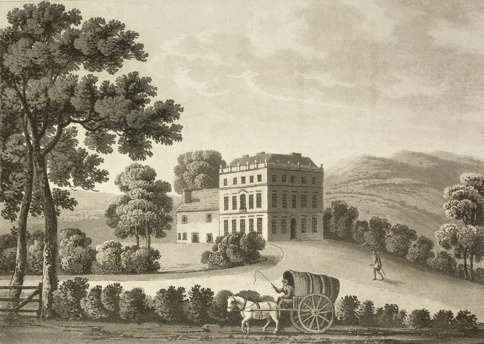
Stoke Hall, Derbyshire

Stoke Hall is a Grade II* listed 30-room Georgian Palladian mansion near the village of Grindleford, Derbyshire, England, whose restoration featured on...

Curbar Edge

Curbar Edge is a gritstone moorland escarpment above the village of Curbar, in Derbyshire, England and close to the villages of Baslow, Calver, and Froggatt...

Curbar

Curbar is a village and civil parish in the Derbyshire Dales district of Derbyshire, England. The population based on the 2011 Census was 417. Curbar is...

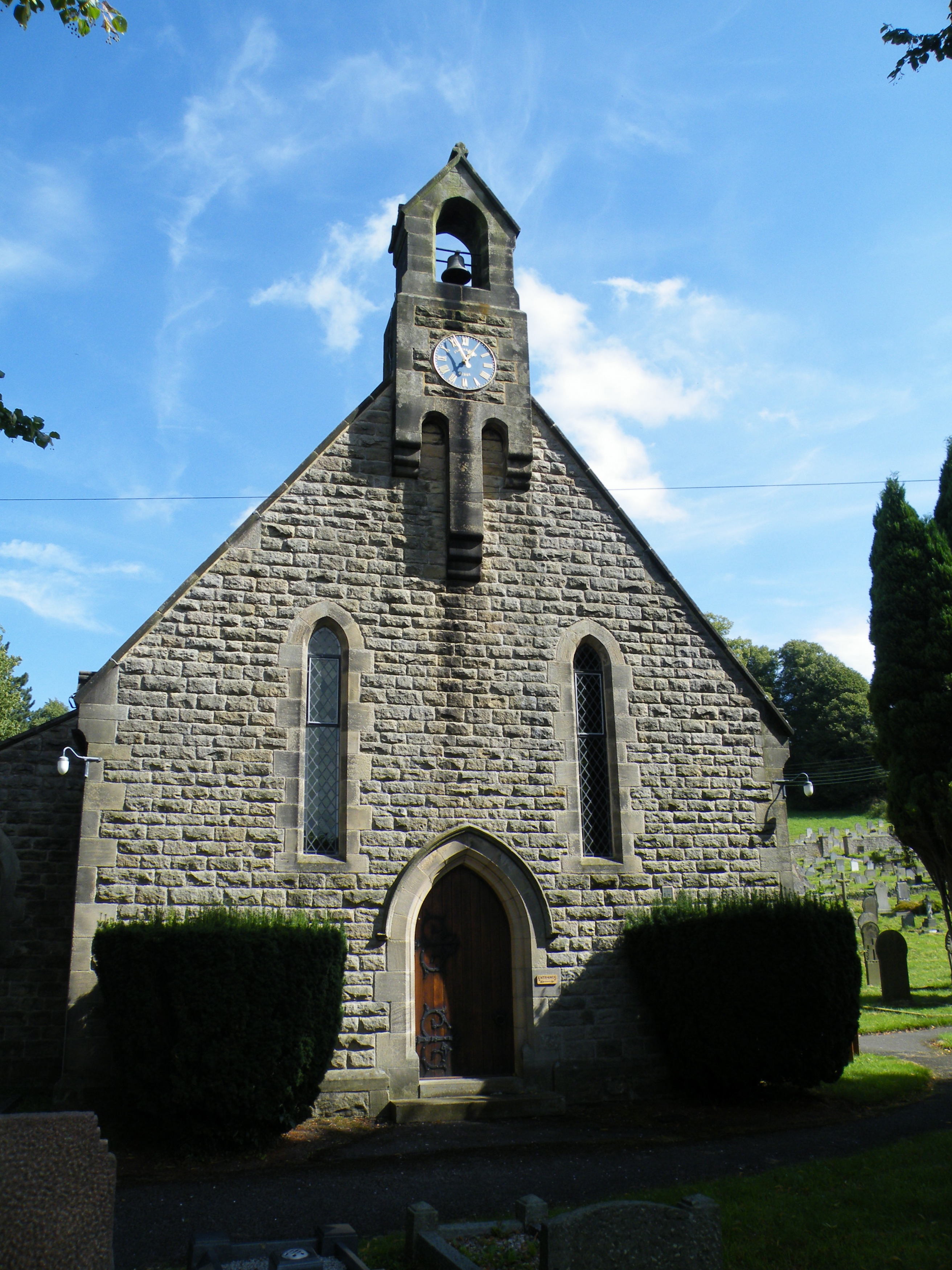
All Saints' Church, Curbar

All Saints’ Church, Curbar is a Church of England parish church in Curbar, Derbyshire. == History == Until the church was built, the nearest parish church...

Calver

Calver (Old English Calf Slope) is a village and civil parish in Derbyshire, England. The population of the civil parish at the 2011 census was 710....

Nearby Amenities

Located within 500m of 53.278492,-1.6284223
Created By: Merkaartor 0.12
Lat/Long: 53.274424/-1.630732
Created By: Merkaartor 0.12
Lat/Long: 53.2802389/-1.6347902
Pub
The Chequers
Real Ale: yes
Lat/Long: 53.2814117/-1.6312423
Created By: Merkaartor 0.12
Lat/Long: 53.2785429/-1.6339639
Created By: Merkaartor 0.12
Lat/Long: 53.275001/-1.6315394
Barrier: stile
Material: stone
Stile: stepover
Lat/Long: 53.2808081/-1.63118
Bench
Lat/Long: 53.2764877/-1.6246433
Chequers Buttress
Natural: cliff
Lat/Long: 53.282269/-1.626694
Barrier: stile
Lat/Long: 53.2793152/-1.6309225
Turning Circle
Lat/Long: 53.2767703/-1.6313415
Parking
Access: yes
Capacity: 6
Fee: no
Parking: street_side
Lat/Long: 53.2793955/-1.6308973
Watering Place
Historic: yes
Lat/Long: 53.2796655/-1.6307175
Barrier: stile
Material: stone
Source: survey;gps
Stile: stepover
Lat/Long: 53.2800597/-1.6343695
The data included in this document is from www.openstreetmap.org. The data is made available under ODbL.

Have you been to Bee Wood?

Leave your review of Bee Wood below (or comments, questions and feedback).