Dames Slough Inclosure

Wood, Forest in Hampshire New Forest

England

Dames Slough Inclosure

Black Water New Forest stream
Black Water Credit: John Myers

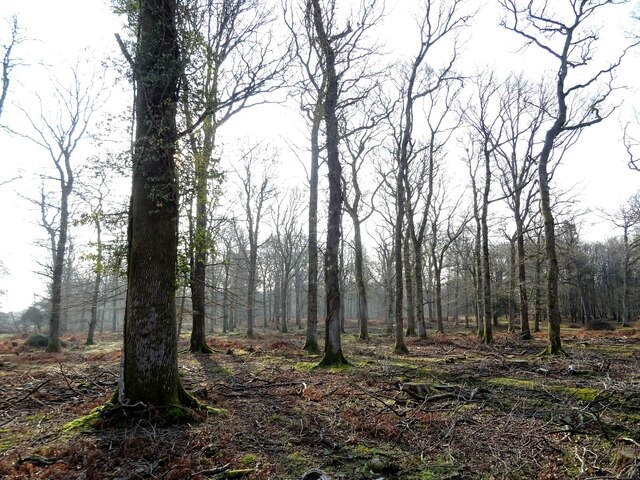
Dames Slough Inclosure is a woodland area located in Hampshire, England. It is part of the New Forest National Park and covers an area of approximately 120 hectares. The inclosure is predominantly composed of mixed deciduous trees, with oak, beech, and birch being the most common species.

The woodland is characterized by its dense vegetation and varied topography, including small valleys, streams, and gentle slopes. Dames Slough Inclosure is known for its rich biodiversity, providing a habitat for a wide range of flora and fauna. The woodland floor is carpeted with bluebells and wildflowers during the spring months, creating a picturesque and colorful landscape.

The inclosure is a popular destination for nature enthusiasts, walkers, and photographers, offering numerous trails and footpaths that wind through the woodland. These pathways provide opportunities to explore the diverse ecosystem and observe the wildlife that inhabits the area. Visitors may encounter deer, squirrels, and a variety of bird species, making it a haven for wildlife enthusiasts and birdwatchers.

Dames Slough Inclosure also serves as an important conservation area, as it is managed by the Forestry Commission to maintain and enhance its natural features. This includes the removal of invasive species, maintaining the health of existing trees, and replanting new saplings to ensure the long-term sustainability of the woodland.

Overall, Dames Slough Inclosure is a stunning woodland in Hampshire, offering visitors a tranquil and immersive experience in nature, while also playing a vital role in preserving the natural heritage of the New Forest National Park.

If you have any feedback on the listing, please let us know in the comments section below.

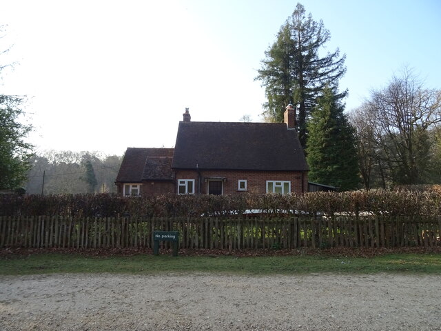
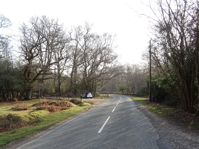
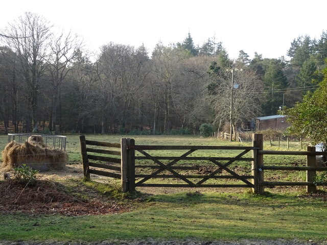
Dames Slough Inclosure Images

Images are sourced within 2km of 50.844241/-1.649809 or Grid Reference SU2405. Thanks to Geograph Open Source API. All images are credited.

Black Water New Forest stream
Black Water
New Forest stream
The Tall Trees Trail South from the car park at Brock Hill
The Tall Trees Trail
South from the car park at Brock Hill
Cep (Boletus edulis) A young Cep (Boletus edulis) in Anderwood Inclosure.  This is perhaps the most prized of edible fungi and as a result is often the subject of heavy exploitation.  Because of this I have chosen to give only the 4 fig grid reference for this particular example.
Cep (Boletus edulis)
A young Cep (Boletus edulis) in Anderwood Inclosure. This is perhaps the most prized of edible fungi and as a result is often the subject of heavy exploitation. Because of this I have chosen to give only the 4 fig grid reference for this particular example.
Oyster Mushroom (Pleurotus ostreatus) A cluster of Oyster Mushrooms (Pleurotus ostreatus) in Anderwood Inclosure.  This particular example was growing on a Silver Birch trunk, rather than the more usual Beech.
Oyster Mushroom (Pleurotus ostreatus)
A cluster of Oyster Mushrooms (Pleurotus ostreatus) in Anderwood Inclosure. This particular example was growing on a Silver Birch trunk, rather than the more usual Beech.
Fly Agaric (Amanita muscaria) A group of three Fly Agarics (Amanita muscaria) growing on a bank alongside a track in Anderwood Inclosure.  The white specks on the cap's surface are the remains of the veil that covers the emergent fruiting body.  For a close up of the nearest of the three, see <a href="https://www.geograph.org.uk/photo/7313586">SU2505 : Fly Agaric (Amanita muscaria)</a>.
Fly Agaric (Amanita muscaria)
A group of three Fly Agarics (Amanita muscaria) growing on a bank alongside a track in Anderwood Inclosure. The white specks on the cap's surface are the remains of the veil that covers the emergent fruiting body. For a close up of the nearest of the three, see SU2505 : Fly Agaric (Amanita muscaria).
Fly Agaric (Amanita muscaria) A Fly Agaric (Amanita muscaria) growing on a bank alongside a track in Anderwood Inclosure.  The white specks on the cap's surface are the remains of the veil that covers the emergent fruiting body as is the ring on the stem, clearly seen in this photo.  This was one of a group of three on the same bank - see <a href="https://www.geograph.org.uk/photo/7313581">SU2505 : Fly Agaric (Amanita muscaria)</a>.
Fly Agaric (Amanita muscaria)
A Fly Agaric (Amanita muscaria) growing on a bank alongside a track in Anderwood Inclosure. The white specks on the cap's surface are the remains of the veil that covers the emergent fruiting body as is the ring on the stem, clearly seen in this photo. This was one of a group of three on the same bank - see SU2505 : Fly Agaric (Amanita muscaria).
Brown Birch Bolete (Leccinum scabrum) A group of Brown Birch Boletes (Leccinum scabrum) in Anderwood Inclosure.  As expected from its English name, they were found growing under a Silver Birch tree.
Brown Birch Bolete (Leccinum scabrum)
A group of Brown Birch Boletes (Leccinum scabrum) in Anderwood Inclosure. As expected from its English name, they were found growing under a Silver Birch tree.
Stinkhorn (Phallus impudicus) A Stinkhorn (Phallus impudicus) growing among leaves in Anderwood Inclosure.  Both the English and Latin names are very apt.  The former refers to the strong smell it gives out to attract flies which then transfer the spores elsewhere, and the latter, translated as "shameless phallus", needs no further explanation.
Stinkhorn (Phallus impudicus)
A Stinkhorn (Phallus impudicus) growing among leaves in Anderwood Inclosure. Both the English and Latin names are very apt. The former refers to the strong smell it gives out to attract flies which then transfer the spores elsewhere, and the latter, translated as "shameless phallus", needs no further explanation.
Burley New Cottage
Burley New Cottage
Lyndhurst Road
Lyndhurst Road
Field entrance off Lyndhurst Road
Lyndhurst Road towards the A35
White Cottages
White Cottages
Grazing towards Spring Wood
New Forest woodland
New Forest woodland
Southmead Cottage
Southmead Cottage
Grazing near Hill Cottages
Bend in Lyndhurst Road - towards the A35
Show me another place!

Dames Slough Inclosure is located at Grid Ref: SU2405 (Lat: 50.844241, Lng: -1.649809)

Administrative County: Hampshire

District: New Forest

Police Authority: Hampshire

What 3 Words

///taps.cotton.arise. Near Burley, Hampshire

Nearby Locations

Dames Slough Inclosure

Related Wikis

Bolderwood, Hampshire

Bolderwood is an area of the New Forest in Hampshire. Bolderwood hosts a deer sanctuary with a public deer observation platform. As a result, the public...

Knightwood Oak

The Knightwood Oak is a pedunculate oak and the largest, and perhaps most famous, oak tree in the New Forest, in southern England. It is also known as...

Warwickslade Cutting Railway

The Warwickslade Cutting Railway was a light railway temporarily built to fill in the Warwickslade Cutting, a straight drainage ditch dug circa 1850 in...

New Forest

The New Forest is one of the largest remaining tracts of unenclosed pasture land, heathland and forest in Southern England, covering southwest Hampshire...

Portuguese Fireplace

The Portuguese Fireplace is a war memorial in the New Forest National Park, near the village of Lyndhurst, Hampshire, England. It is located on the road...

Allum Green

Allum Green is a hamlet southwest of Lyndhurst, Hampshire, England. During the night of 5/6 September 1940 it was the scene of a Luftwaffe bombing raid...

Burley, Hampshire

Burley is a village and civil parish in the New Forest, Hampshire, England. It has ancient origins and is now somewhat tourist-orientated. == The village... ==

New Forest District

New Forest is a local government district in Hampshire, England. Its council is based in Lyndhurst, although the largest town is Totton. The district also...

Nearby Amenities

Located within 500m of 50.844241,-1.649809
Lcn Ref: 118
Lat/Long: 50.8429383/-1.6463288
Lcn Ref: 119
Lat/Long: 50.8446087/-1.6465641
Ford: yes
Lat/Long: 50.8436679/-1.6534243
The data included in this document is from www.openstreetmap.org. The data is made available under ODbL.

Have you been to Dames Slough Inclosure?

Leave your review of Dames Slough Inclosure below (or comments, questions and feedback).