Bedlam Plantation

Wood, Forest in Hampshire Test Valley

England

Bedlam Plantation

Cottages on A338, Shipton Bellinger Most of the village is off to the left.
Cottages on A338, Shipton Bellinger Credit: Robin Webster

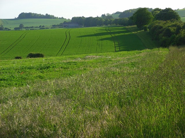
Bedlam Plantation, located in Hampshire, is a picturesque woodland estate known for its natural beauty and rich history. Spread across acres of lush green forest, the plantation offers a tranquil retreat for nature lovers and history enthusiasts alike.

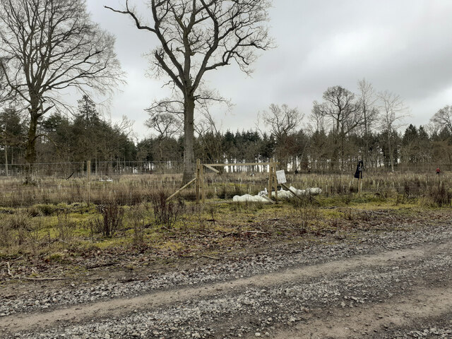
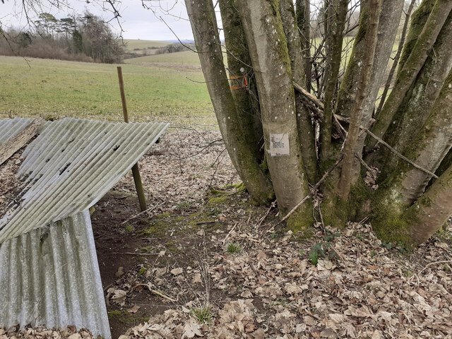
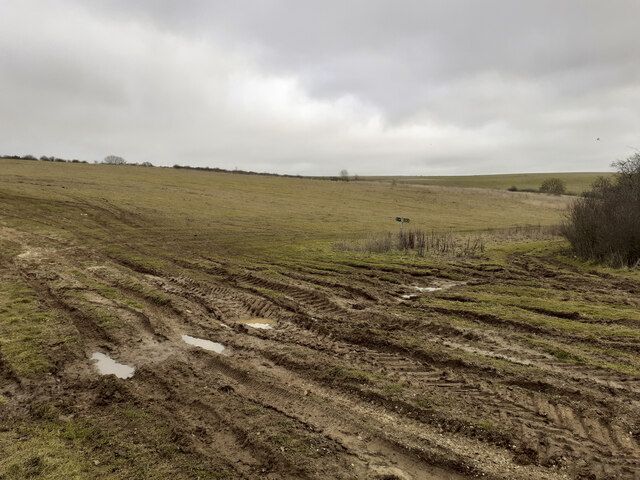
The plantation features a diverse range of trees, including oak, beech, and pine, creating a dense canopy that provides shade and shelter to an array of wildlife. The forest floor is adorned with an abundance of wildflowers, creating a vibrant and colorful landscape throughout the year.

The history of Bedlam Plantation dates back several centuries, with records indicating its existence as early as the 16th century. Originally a hunting ground for the local aristocracy, the plantation later became a center for timber production, supplying wood for various industries.

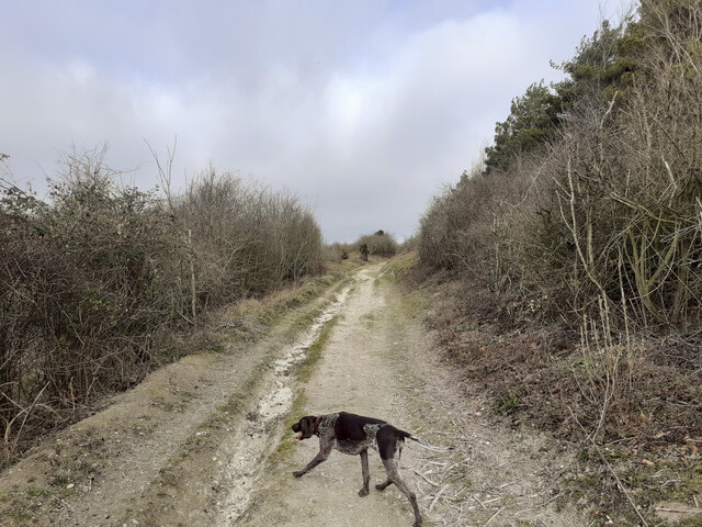
Visitors to Bedlam Plantation can explore its well-maintained walking trails, which wind through the forest and offer stunning views of the surrounding countryside. The trails are suitable for all levels of fitness and provide an opportunity to observe the diverse flora and fauna that call the plantation home.

In addition to its natural beauty, Bedlam Plantation also boasts a charming visitor center, where visitors can learn more about the history of the estate through informative displays and exhibits. There is also a small café offering refreshments for those in need of a break.

Overall, Bedlam Plantation is a delightful destination for nature enthusiasts and history buffs, offering a unique blend of scenic beauty and historical significance. Its idyllic setting and well-preserved trails make it a must-visit location for anyone seeking an escape into nature.

If you have any feedback on the listing, please let us know in the comments section below.

Bedlam Plantation Images

Images are sourced within 2km of 51.217392/-1.647045 or Grid Reference SU2446. Thanks to Geograph Open Source API. All images are credited.

Cottages on A338, Shipton Bellinger Most of the village is off to the left.
Cottages on A338, Shipton Bellinger
Most of the village is off to the left.
A338 Salisbury Road at county border Crossing from Hampshire to Wiltshire.
A338 Salisbury Road at county border
Crossing from Hampshire to Wiltshire.
A338 Salisbury Road, South Tidworth The churchyard wall is on the left.
A338 Salisbury Road, South Tidworth
The churchyard wall is on the left.
Entrance to Old Coach Road from A338 Seen from A338 at Shipton Bellinger. This is a restricted byway. I am not sure if "Old Coach Road" is the name of the byway or if it is just a description of its origin. The white notice at left is the standard Salisbury Plain Military Lands Byelaws 1981.
Entrance to Old Coach Road from A338
Seen from A338 at Shipton Bellinger. This is a restricted byway. I am not sure if "Old Coach Road" is the name of the byway or if it is just a description of its origin. The white notice at left is the standard Salisbury Plain Military Lands Byelaws 1981.
Public Footpath running north from Old Coach Road The woodland on the right is Shipton Plantation. This footpath climbs steadily up the western side of this hill, which I guess is the southern end of Furze Hill.
Public Footpath running north from Old Coach Road
The woodland on the right is Shipton Plantation. This footpath climbs steadily up the western side of this hill, which I guess is the southern end of Furze Hill.
Public Footpath along western edge of Shipton Plantation Climbing quite steeply up the side slopes of what I guess is the southern part of Furze Hill.
Public Footpath along western edge of Shipton Plantation
Climbing quite steeply up the side slopes of what I guess is the southern part of Furze Hill.
Public Footpath and tank crossing on western edge of Shipton Plantation The tank track comes up from the valley at left after crossing the A338, and continues rightwards.
Public Footpath and tank crossing on western edge of Shipton Plantation
The tank track comes up from the valley at left after crossing the A338, and continues rightwards.
View across valley containing the A338 and the River Bourne Also showing a tank track.
View across valley containing the A338 and the River Bourne
Also showing a tank track.
Entering Ashdown Copse from the south on a public footpath There are numerous tracks in Ashdown Copse, few of which are public rights of way, but this one is. There doesn't appear to be any visible constraint upon using the other tracks.
Entering Ashdown Copse from the south on a public footpath
There are numerous tracks in Ashdown Copse, few of which are public rights of way, but this one is. There doesn't appear to be any visible constraint upon using the other tracks.
Wooden platform in Ashdown Copse Apparently part of a mountain bike circuit, judging by the TFTUNED advertisement on it, and the narrow up and down exposed-chalk paths in the area. Whether this is military or commercial I don't know.
Wooden platform in Ashdown Copse
Apparently part of a mountain bike circuit, judging by the TFTUNED advertisement on it, and the narrow up and down exposed-chalk paths in the area. Whether this is military or commercial I don't know.
Track junction in Ashdown Copse
Tree planting in Ashdown Copse In March 2020 the MoD announced the felling of thousands of trees in Ashdown Copse due to infection by Ash dieback disease <span class="nowrap"><a title="https://www.forestryjournal.co.uk/features/18344394.clearing-ash-military-precision/" rel="nofollow ugc noopener" href="https://www.forestryjournal.co.uk/features/18344394.clearing-ash-military-precision/">Link</a><img style="margin-left:2px;" alt="External link" title="External link - shift click to open in new window" src="https://s1.geograph.org.uk/img/external.png" width="10" height="10"/></span> . I don't know if this replanting is related to that. Whips of various species were being planted by men who, it seemed, did not speak English.
Tree planting in Ashdown Copse
In March 2020 the MoD announced the felling of thousands of trees in Ashdown Copse due to infection by Ash dieback disease LinkExternal link . I don't know if this replanting is related to that. Whips of various species were being planted by men who, it seemed, did not speak English.
Track junction in Ashdown Copse At this point I had mistraken my route and strayed off the public footpath I had previously been following <a title="https://www.geograph.org.uk/photo/7396602" href="https://www.geograph.org.uk/photo/7396602">Link</a> .
Track junction in Ashdown Copse
At this point I had mistraken my route and strayed off the public footpath I had previously been following Link .
Weird shelter in Ashdown Copse The note on the tree reads "RV 4 Friendly prisoners are being held at grid SD 299 126". SD 299 126 is a holiday park at Ainsdale-on-Sea south of Southport about 180 miles from here. Whether this note is part of military training or perhaps some paintball event I don't know.
Weird shelter in Ashdown Copse
The note on the tree reads "RV 4 Friendly prisoners are being held at grid SD 299 126". SD 299 126 is a holiday park at Ainsdale-on-Sea south of Southport about 180 miles from here. Whether this note is part of military training or perhaps some paintball event I don't know.
Gate in forestry fence The public footpath here runs through the fine mesh improvised gate seen at right in the photo. It runs for 138 yards in a NNW direction before emerging through another such gate onto another track. There is no visible footpath inside this fence so I followed it by GPS. Essentially this new plantation fencing has cut across the footpath. Rather than following the footpath it would be much easier to simply follow the tracks round the other two sides of this triangle, although there is no right of way to do so.
Gate in forestry fence
The public footpath here runs through the fine mesh improvised gate seen at right in the photo. It runs for 138 yards in a NNW direction before emerging through another such gate onto another track. There is no visible footpath inside this fence so I followed it by GPS. Essentially this new plantation fencing has cut across the footpath. Rather than following the footpath it would be much easier to simply follow the tracks round the other two sides of this triangle, although there is no right of way to do so.
Track junction at SE corner of Warren Hill plantation The Wiltshire County Council right of way sign here has been rotated 90 degrees to give false information. I rotated it back. The real public footpath runs diagonally from the bottom left corner of this photo to the middle right.
Track junction at SE corner of Warren Hill plantation
The Wiltshire County Council right of way sign here has been rotated 90 degrees to give false information. I rotated it back. The real public footpath runs diagonally from the bottom left corner of this photo to the middle right.
Public Footpath in valley south of Warren Hill
Wildlife Area in valley south of Warren Hill The woodland ahead is marked as a wildlife area and there is a request to keep dogs on leads.
Wildlife Area in valley south of Warren Hill
The woodland ahead is marked as a wildlife area and there is a request to keep dogs on leads.
Show me another place!

Bedlam Plantation is located at Grid Ref: SU2446 (Lat: 51.217392, Lng: -1.647045)

Administrative County: Hampshire

District: Test Valley

Police Authority: Hampshire

What 3 Words

///unlocking.tens.funnels. Near Tidworth, Wiltshire

Nearby Locations

Bedlam Plantation

Related Wikis

A338 road

The A338 is a major primary route in southern England, that runs from the junction with the A35 at Poole in Dorset to the junction with the A420 at Besselsleigh...

St Mary's Church, South Tidworth

St Mary's Church in South Tidworth, Wiltshire, England, was built in 1878. It is recorded in the National Heritage List for England as a designated Grade...

Tedworth House

Tedworth House, also known as South Tidworth House, is a 19th-century country house in Tidworth, Wiltshire, England. It is a Grade II* listed building...

Shipton Bellinger

Shipton Bellinger is a village and civil parish in Hampshire, England. Shipton Bellinger is about 5 miles (8 km) north-east of the town of Amesbury and...

Snoddington

Snoddington is a small hamlet in Hampshire and close to the border of Wiltshire near to Thruxton Aerodrome and first mentioned in the eleventh century...

Tidworth

Tidworth is a garrison town and civil parish in south-east Wiltshire, England, on the eastern edge of Salisbury Plain. Lying on both sides of the A338...

Tidworth Camp

Tidworth Camp is a military installation at Tidworth in Wiltshire, England. It forms part of the Tidworth, Netheravon and Bulford (TidNBul) Garrison....

Perham Down

Perham Down is a village in Wiltshire, England, in Tidworth parish on the eastern edge of Salisbury Plain. It lies on a minor road about 1+1⁄2 miles (2...

Have you been to Bedlam Plantation?

Leave your review of Bedlam Plantation below (or comments, questions and feedback).