Howlish Plantation

Wood, Forest in Durham

England

Howlish Plantation

The Miners Arms and The Durham Ox - Coundon
The Miners Arms and The Durham Ox - Coundon Credit: Anthony Parkes

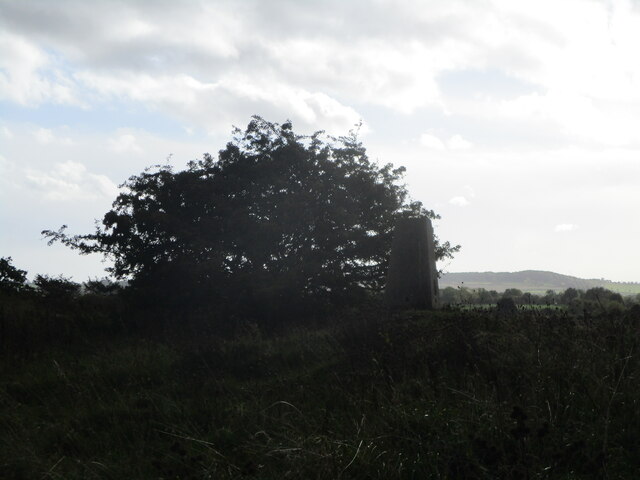
Howlish Plantation is a scenic woodland located in Durham, England. Covering an area of approximately 50 acres, the plantation is known for its dense and diverse collection of trees, making it a popular destination for nature enthusiasts and walkers alike.

The woodland is predominantly composed of native tree species, including oak, beech, birch, and hawthorn, creating a rich and vibrant ecosystem. The trees provide a habitat for a variety of wildlife, such as birds, squirrels, and deer, making it an ideal spot for birdwatching and animal spotting.

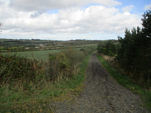
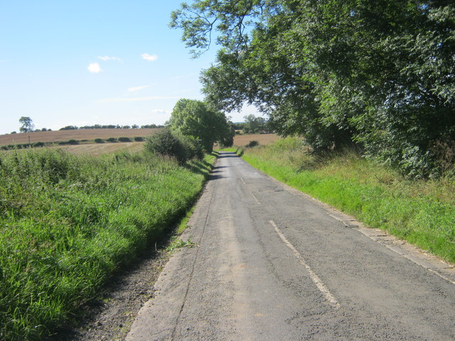
The plantation offers several well-maintained walking trails, allowing visitors to explore the woodland at their own pace. These trails wind their way through the forest, offering breathtaking views of the surrounding countryside and providing a tranquil escape from the hustle and bustle of city life.

Howlish Plantation is also home to a number of historical features, adding to its charm and allure. The remnants of an old stone wall and a dilapidated cottage can be found within the woodland, providing a glimpse into its past and adding an element of mystery and intrigue.

The plantation is easily accessible, with ample parking facilities available nearby. Whether you are a nature lover, a history enthusiast, or simply seeking a peaceful retreat, Howlish Plantation offers a captivating experience that showcases the beauty and tranquility of Durham's woodlands.

If you have any feedback on the listing, please let us know in the comments section below.

Howlish Plantation Images

Images are sourced within 2km of 54.655631/-1.6190449 or Grid Reference NZ2429. Thanks to Geograph Open Source API. All images are credited.

The Miners Arms and The Durham Ox - Coundon
Gateway to Windlestone Hall
Bus Stop near Windlestone
Layby on the A689
Layby on the A689
Eldon Hall Farm trigpoint Trigpoint at Eldon Hall Farm near old eldon
Eldon Hall Farm trigpoint
Trigpoint at Eldon Hall Farm near old eldon
Footpath near Eldon
Footpath near Eldon
Playground in Wharton Street Coundon
The infant Coundon Burn
Fair View Close Coundon
Holberry Terrace Coundon
Well Cottages Windlestone Lane
Unclassified Road south from Westerton
Junction of minor roads near Middlestone Moor In the middle distance Newton Cap Viaduct in Bishop Auckland
Junction of minor roads near Middlestone Moor
In the middle distance Newton Cap Viaduct in Bishop Auckland
Etty Hill near Coundon
Drive to Windlestone Grange carrying a public footpath there and beyond
Entrance gateway  to Howlish Hall Nursing Home off Howlish Lane
Entrance gateway to Howlish Hall Nursing Home off Howlish Lane
Howlish Lane Leading to the hamlet of Howlish.
Howlish Lane
Leading to the hamlet of Howlish.
Hillside Road leading into Coundon from the south
Show me another place!

Howlish Plantation is located at Grid Ref: NZ2429 (Lat: 54.655631, Lng: -1.6190449)

Unitary Authority: County Durham

Police Authority: Durham

What 3 Words

///spaceship.casino.examiner. Near Coundon, Co. Durham

Nearby Locations

Coundon Howlish Plantation

Related Wikis

Leeholme

Leeholme is a village in County Durham, England. It is situated immediately to the north of Coundon. In the 2001 census Leeholme had a population of 513...

Old Eldon

Old Eldon is a village in County Durham, in England. It is situated a short distance to the east of Bishop Auckland. == External links == Media related...

Grange Hill, County Durham

Grange Hill is a hamlet in County Durham, in England. It is situated to the south of Coundon, near Bishop Auckland. == References ==

Coundon

Coundon is an old mining village and former civil parish in the County Durham district, in the ceremonial county of Durham, England. The Boldon Book mentions...

Nearby Amenities

Located within 500m of 54.655631,-1.6190449
Bus Stop
Leeholme Road End
Bus: yes
Naptan AtcoCode: 13004623D
Naptan Bearing: SE
Naptan CommonName: Leeholme Road End
Naptan Indicator: south east bound
Naptan Landmark: Landmark not known
Naptan NaptanCode: durdawpt
Naptan Notes: On road E out of Coundon to roundabout with A689- about 40m E from junction with Leeholme Road
Naptan Street: Unclassified Road
Naptan Verified: no
Public Transport: platform
Source: naptan_import
Lat/Long: 54.6588153/-1.614386
Bus Stop
Leeholme Road End
Bus: yes
Naptan AtcoCode: 13004623H
Naptan Bearing: NW
Naptan CommonName: Leeholme Road End
Naptan Indicator: north west bound
Naptan Landmark: Landmark not known
Naptan NaptanCode: durdawpw
Naptan Notes: On road E out of Coundon to roundabout with A689- about 20m E from junction with Leeholme Road
Naptan Street: Unclassified Road
Naptan Verified: no
Public Transport: platform
Source: naptan_import
Lat/Long: 54.6588632/-1.6153157
Give Way
Direction: backward
Lat/Long: 54.6573566/-1.6215772
Power: pole
Lat/Long: 54.6541728/-1.6147381
Power: pole
Lat/Long: 54.6535723/-1.6144189
Power: pole
Lat/Long: 54.6527235/-1.6139388
Power: pole
Lat/Long: 54.6517226/-1.6193596
Power: pole
Lat/Long: 54.652268/-1.6182813
Power: pole
Lat/Long: 54.6527382/-1.6173425
Power: pole
Lat/Long: 54.6531673/-1.6164735
Power: pole
Lat/Long: 54.653632/-1.615528
Power: pole
Lat/Long: 54.6542061/-1.614773
Power: pole
Lat/Long: 54.65493/-1.6139442
Power: pole
Lat/Long: 54.6556686/-1.6129249
Power: pole
Lat/Long: 54.6563815/-1.6120237
The data included in this document is from www.openstreetmap.org. The data is made available under ODbL.

Have you been to Howlish Plantation?

Leave your review of Howlish Plantation below (or comments, questions and feedback).