Ashdown Copse

Wood, Forest in Hampshire

England

Ashdown Copse

A338 Salisbury Road at county border Crossing from Hampshire to Wiltshire.
A338 Salisbury Road at county border Credit: Robin Webster

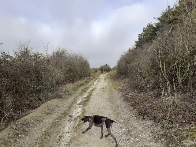
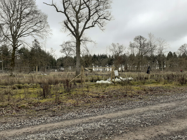
Ashdown Copse is a picturesque woodland located in the county of Hampshire, England. Situated in the heart of the South Downs National Park, this enchanting forest covers an area of approximately 100 hectares. The copse is characterized by its diverse range of tree species, including beech, oak, birch, and hazel, which create a dense and vibrant canopy overhead.

The forest floor of Ashdown Copse is adorned with a rich tapestry of wildflowers, such as bluebells, primroses, and wood anemones, which bloom in abundance during the spring months. This creates a breathtaking display of colors and scents that attract numerous visitors and nature enthusiasts from far and wide.

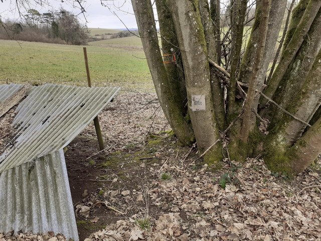
The copse is home to a plethora of wildlife, making it a haven for nature lovers. It is not uncommon to spot deer, foxes, badgers, and a variety of bird species, including woodpeckers, owls, and warblers. The forest's tranquil atmosphere and secluded pathways provide a peaceful haven for both humans and animals alike.

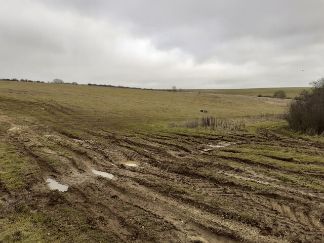
Ashdown Copse offers a range of recreational activities for visitors to enjoy. There are several well-marked walking trails and cycling routes that wind their way through the woodland, allowing visitors to explore its beauty at their own pace. The copse also has designated picnic areas and benches where visitors can relax and soak in the natural surroundings.

Overall, Ashdown Copse is a true gem of Hampshire, offering a serene and captivating woodland experience for all who venture into its depths. Whether it's for a leisurely stroll, a picnic with loved ones, or a chance to immerse oneself in nature, this forest is a must-visit destination for anyone seeking solace and tranquility in Hampshire's great outdoors.

If you have any feedback on the listing, please let us know in the comments section below.

Ashdown Copse Images

Images are sourced within 2km of 51.22353/-1.6548024 or Grid Reference SU2447. Thanks to Geograph Open Source API. All images are credited.

A338 Salisbury Road at county border Crossing from Hampshire to Wiltshire.
A338 Salisbury Road at county border
Crossing from Hampshire to Wiltshire.
A338 Salisbury Road, South Tidworth The churchyard wall is on the left.
A338 Salisbury Road, South Tidworth
The churchyard wall is on the left.
A338, Tidworth View from the Lidl carpark.
A338, Tidworth
View from the Lidl carpark.
Alley, Tidworth By Lidl supermarket.
Alley, Tidworth
By Lidl supermarket.
Entrance to Old Coach Road from A338 Seen from A338 at Shipton Bellinger. This is a restricted byway. I am not sure if "Old Coach Road" is the name of the byway or if it is just a description of its origin. The white notice at left is the standard Salisbury Plain Military Lands Byelaws 1981.
Entrance to Old Coach Road from A338
Seen from A338 at Shipton Bellinger. This is a restricted byway. I am not sure if "Old Coach Road" is the name of the byway or if it is just a description of its origin. The white notice at left is the standard Salisbury Plain Military Lands Byelaws 1981.
Public Footpath running north from Old Coach Road The woodland on the right is Shipton Plantation. This footpath climbs steadily up the western side of this hill, which I guess is the southern end of Furze Hill.
Public Footpath running north from Old Coach Road
The woodland on the right is Shipton Plantation. This footpath climbs steadily up the western side of this hill, which I guess is the southern end of Furze Hill.
Public Footpath along western edge of Shipton Plantation Climbing quite steeply up the side slopes of what I guess is the southern part of Furze Hill.
Public Footpath along western edge of Shipton Plantation
Climbing quite steeply up the side slopes of what I guess is the southern part of Furze Hill.
Public Footpath and tank crossing on western edge of Shipton Plantation The tank track comes up from the valley at left after crossing the A338, and continues rightwards.
Public Footpath and tank crossing on western edge of Shipton Plantation
The tank track comes up from the valley at left after crossing the A338, and continues rightwards.
View across valley containing the A338 and the River Bourne Also showing a tank track.
View across valley containing the A338 and the River Bourne
Also showing a tank track.
Entering Ashdown Copse from the south on a public footpath There are numerous tracks in Ashdown Copse, few of which are public rights of way, but this one is. There doesn't appear to be any visible constraint upon using the other tracks.
Entering Ashdown Copse from the south on a public footpath
There are numerous tracks in Ashdown Copse, few of which are public rights of way, but this one is. There doesn't appear to be any visible constraint upon using the other tracks.
Wooden platform in Ashdown Copse Apparently part of a mountain bike circuit, judging by the TFTUNED advertisement on it, and the narrow up and down exposed-chalk paths in the area. Whether this is military or commercial I don't know.
Wooden platform in Ashdown Copse
Apparently part of a mountain bike circuit, judging by the TFTUNED advertisement on it, and the narrow up and down exposed-chalk paths in the area. Whether this is military or commercial I don't know.
Track junction in Ashdown Copse
Tree planting in Ashdown Copse In March 2020 the MoD announced the felling of thousands of trees in Ashdown Copse due to infection by Ash dieback disease <span class="nowrap"><a title="https://www.forestryjournal.co.uk/features/18344394.clearing-ash-military-precision/" rel="nofollow ugc noopener" href="https://www.forestryjournal.co.uk/features/18344394.clearing-ash-military-precision/">Link</a><img style="margin-left:2px;" alt="External link" title="External link - shift click to open in new window" src="https://s1.geograph.org.uk/img/external.png" width="10" height="10"/></span> . I don't know if this replanting is related to that. Whips of various species were being planted by men who, it seemed, did not speak English.
Tree planting in Ashdown Copse
In March 2020 the MoD announced the felling of thousands of trees in Ashdown Copse due to infection by Ash dieback disease LinkExternal link . I don't know if this replanting is related to that. Whips of various species were being planted by men who, it seemed, did not speak English.
Track junction in Ashdown Copse At this point I had mistraken my route and strayed off the public footpath I had previously been following <a title="https://www.geograph.org.uk/photo/7396602" href="https://www.geograph.org.uk/photo/7396602">Link</a> .
Track junction in Ashdown Copse
At this point I had mistraken my route and strayed off the public footpath I had previously been following Link .
Weird shelter in Ashdown Copse The note on the tree reads "RV 4 Friendly prisoners are being held at grid SD 299 126". SD 299 126 is a holiday park at Ainsdale-on-Sea south of Southport about 180 miles from here. Whether this note is part of military training or perhaps some paintball event I don't know.
Weird shelter in Ashdown Copse
The note on the tree reads "RV 4 Friendly prisoners are being held at grid SD 299 126". SD 299 126 is a holiday park at Ainsdale-on-Sea south of Southport about 180 miles from here. Whether this note is part of military training or perhaps some paintball event I don't know.
Gate in forestry fence The public footpath here runs through the fine mesh improvised gate seen at right in the photo. It runs for 138 yards in a NNW direction before emerging through another such gate onto another track. There is no visible footpath inside this fence so I followed it by GPS. Essentially this new plantation fencing has cut across the footpath. Rather than following the footpath it would be much easier to simply follow the tracks round the other two sides of this triangle, although there is no right of way to do so.
Gate in forestry fence
The public footpath here runs through the fine mesh improvised gate seen at right in the photo. It runs for 138 yards in a NNW direction before emerging through another such gate onto another track. There is no visible footpath inside this fence so I followed it by GPS. Essentially this new plantation fencing has cut across the footpath. Rather than following the footpath it would be much easier to simply follow the tracks round the other two sides of this triangle, although there is no right of way to do so.
Track junction at SE corner of Warren Hill plantation The Wiltshire County Council right of way sign here has been rotated 90 degrees to give false information. I rotated it back. The real public footpath runs diagonally from the bottom left corner of this photo to the middle right.
Track junction at SE corner of Warren Hill plantation
The Wiltshire County Council right of way sign here has been rotated 90 degrees to give false information. I rotated it back. The real public footpath runs diagonally from the bottom left corner of this photo to the middle right.
Public Footpath in valley south of Warren Hill
Show me another place!

Ashdown Copse is located at Grid Ref: SU2447 (Lat: 51.22353, Lng: -1.6548024)

Unitary Authority: Wiltshire

Police Authority: Wiltshire

What 3 Words

///blotchy.exposing.means. Near Tidworth, Wiltshire

Related Wikis

St Mary's Church, South Tidworth

St Mary's Church in South Tidworth, Wiltshire, England, was built in 1878. It is recorded in the National Heritage List for England as a designated Grade...

Tedworth House

Tedworth House, also known as South Tidworth House, is a 19th-century country house in Tidworth, Wiltshire, England. It is a Grade II* listed building...
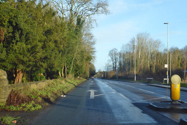
A338 road

The A338 is a major primary route in southern England, that runs from the junction with the A35 at Poole in Dorset to the junction with the A420 at Besselsleigh...

Tidworth

Tidworth is a garrison town and civil parish in south-east Wiltshire, England, on the eastern edge of Salisbury Plain. Lying on both sides of the A338...

Nearby Amenities

Located within 500m of 51.22353,-1.6548024
Generator Method: photovoltaic
Generator Output Electricity: yes
Generator Source: solar
Generator Type: solar_photovoltaic_panel
Location: roof
Power: generator
Lat/Long: 51.2248639/-1.6615212
Generator Method: photovoltaic
Generator Output Electricity: yes
Generator Source: solar
Generator Type: solar_photovoltaic_panel
Location: roof
Power: generator
Lat/Long: 51.2248135/-1.661379
Generator Method: photovoltaic
Generator Output Electricity: yes
Generator Source: solar
Generator Type: solar_photovoltaic_panel
Location: roof
Power: generator
Lat/Long: 51.2246942/-1.6616392
Generator Method: photovoltaic
Generator Output Electricity: yes
Generator Source: solar
Generator Type: solar_photovoltaic_panel
Location: roof
Power: generator
Lat/Long: 51.2246875/-1.6617331
Generator Method: photovoltaic
Generator Output Electricity: yes
Generator Source: solar
Generator Type: solar_photovoltaic_panel
Location: roof
Power: generator
Lat/Long: 51.2245178/-1.6617546
Generator Method: photovoltaic
Generator Output Electricity: yes
Generator Source: solar
Generator Type: solar_photovoltaic_panel
Location: roof
Power: generator
Lat/Long: 51.2245363/-1.6615668
Generator Method: photovoltaic
Generator Output Electricity: yes
Generator Source: solar
Generator Type: solar_photovoltaic_panel
Location: roof
Power: generator
Lat/Long: 51.2245497/-1.6614434
Generator Method: photovoltaic
Generator Output Electricity: yes
Generator Source: solar
Generator Type: solar_photovoltaic_panel
Location: roof
Power: generator
Lat/Long: 51.2245934/-1.6612101
Generator Method: photovoltaic
Generator Output Electricity: yes
Generator Source: solar
Generator Type: solar_photovoltaic_panel
Location: roof
Power: generator
Lat/Long: 51.2246942/-1.6610974
Generator Method: photovoltaic
Generator Output Electricity: yes
Generator Source: solar
Generator Type: solar_photovoltaic_panel
Location: roof
Power: generator
Lat/Long: 51.2247463/-1.6610599
Generator Method: photovoltaic
Generator Output Electricity: yes
Generator Source: solar
Generator Type: solar_photovoltaic_panel
Location: roof
Power: generator
Lat/Long: 51.2248874/-1.6611242
Generator Method: photovoltaic
Generator Output Electricity: yes
Generator Source: solar
Generator Type: solar_photovoltaic_panel
Location: roof
Power: generator
Lat/Long: 51.2249395/-1.6611511
Generator Method: photovoltaic
Generator Output Electricity: yes
Generator Source: solar
Generator Type: solar_photovoltaic_panel
Location: roof
Power: generator
Lat/Long: 51.2250738/-1.660974
Generator Method: photovoltaic
Generator Output Electricity: yes
Generator Source: solar
Generator Type: solar_photovoltaic_panel
Location: roof
Power: generator
Lat/Long: 51.2250973/-1.660907
Generator Method: photovoltaic
Generator Output Electricity: yes
Generator Source: solar
Generator Type: solar_photovoltaic_panel
Location: roof
Power: generator
Lat/Long: 51.2252704/-1.6608238
Generator Method: photovoltaic
Generator Output Electricity: yes
Generator Source: solar
Generator Type: solar_photovoltaic_panel
Location: roof
Power: generator
Lat/Long: 51.2255307/-1.6611886
Generator Method: photovoltaic
Generator Output Electricity: yes
Generator Source: solar
Generator Type: solar_photovoltaic_panel
Location: roof
Power: generator
Lat/Long: 51.2255139/-1.6610867
Generator Method: photovoltaic
Generator Output Electricity: yes
Generator Source: solar
Generator Type: solar_photovoltaic_panel
Location: roof
Power: generator
Lat/Long: 51.2254921/-1.6609499
Generator Method: photovoltaic
Generator Output Electricity: yes
Generator Source: solar
Generator Type: solar_photovoltaic_panel
Location: roof
Power: generator
Lat/Long: 51.2254753/-1.6608587
Generator Method: photovoltaic
Generator Output Electricity: yes
Generator Source: solar
Generator Type: solar_photovoltaic_panel
Location: roof
Power: generator
Lat/Long: 51.2254535/-1.6607219
Generator Method: photovoltaic
Generator Output Electricity: yes
Generator Source: solar
Generator Type: solar_photovoltaic_panel
Location: roof
Power: generator
Lat/Long: 51.22544/-1.6606307
Generator Method: photovoltaic
Generator Output Electricity: yes
Generator Source: solar
Generator Type: solar_photovoltaic_panel
Location: roof
Power: generator
Lat/Long: 51.2257625/-1.6609499
Generator Method: photovoltaic
Generator Output Electricity: yes
Generator Source: solar
Generator Type: solar_photovoltaic_panel
Location: roof
Power: generator
Lat/Long: 51.2257474/-1.6608694
Generator Method: photovoltaic
Generator Output Electricity: yes
Generator Source: solar
Generator Type: solar_photovoltaic_panel
Location: roof
Power: generator
Lat/Long: 51.2257205/-1.6606843
Generator Method: photovoltaic
Generator Output Electricity: yes
Generator Source: solar
Generator Type: solar_photovoltaic_panel
Location: roof
Power: generator
Lat/Long: 51.2257105/-1.6606012
Generator Method: photovoltaic
Generator Output Electricity: yes
Generator Source: solar
Generator Type: solar_photovoltaic_panel
Location: roof
Power: generator
Lat/Long: 51.2258616/-1.6605181
Generator Method: photovoltaic
Generator Output Electricity: yes
Generator Source: solar
Generator Type: solar_photovoltaic_panel
Location: roof
Power: generator
Lat/Long: 51.2258818/-1.6606039
Generator Method: photovoltaic
Generator Output Electricity: yes
Generator Source: solar
Generator Type: solar_photovoltaic_panel
Location: roof
Power: generator
Lat/Long: 51.2258986/-1.6606951
Generator Method: photovoltaic
Generator Output Electricity: yes
Generator Source: solar
Generator Type: solar_photovoltaic_panel
Location: roof
Power: generator
Lat/Long: 51.2261489/-1.6605958
Generator Method: photovoltaic
Generator Output Electricity: yes
Generator Source: solar
Generator Type: solar_photovoltaic_panel
Location: roof
Power: generator
Lat/Long: 51.2261422/-1.6605234
Generator Method: photovoltaic
Generator Output Electricity: yes
Generator Source: solar
Generator Type: solar_photovoltaic_panel
Location: roof
Power: generator
Lat/Long: 51.2261186/-1.6604242
Generator Method: photovoltaic
Generator Output Electricity: yes
Generator Source: solar
Generator Type: solar_photovoltaic_panel
Location: roof
Power: generator
Lat/Long: 51.2263135/-1.6602981
The data included in this document is from www.openstreetmap.org. The data is made available under ODbL.

Have you been to Ashdown Copse?

Leave your review of Ashdown Copse below (or comments, questions and feedback).