Little Park Copse

Wood, Forest in Wiltshire

England

Little Park Copse

Golfers on the fringe of Langley Wood
Golfers on the fringe of Langley Wood Credit: David Martin

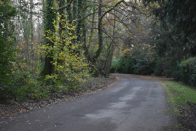
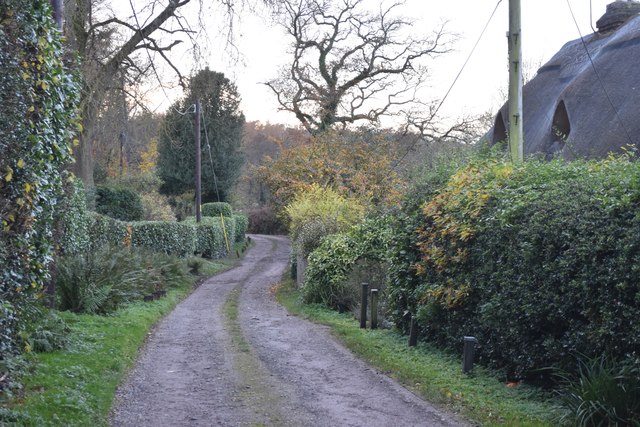
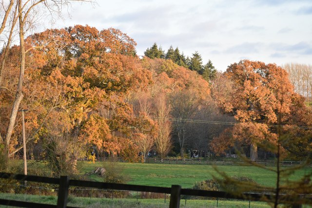
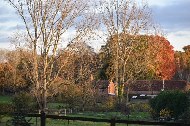
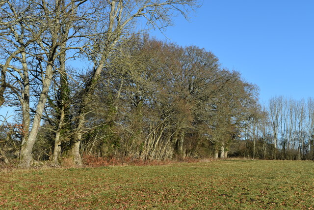
Little Park Copse is a charming woodland located in the county of Wiltshire, England. Spanning approximately 20 acres, this small but enchanting copse is nestled within the picturesque countryside, offering visitors a tranquil escape from the hustle and bustle of everyday life.

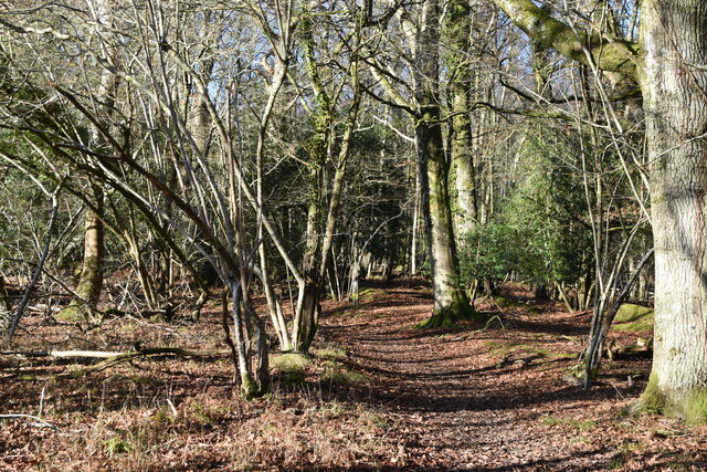
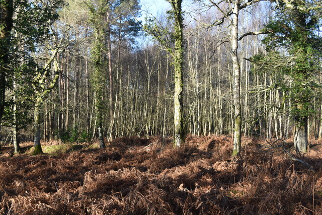
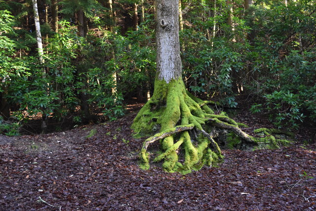
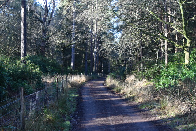
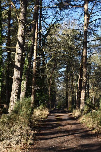
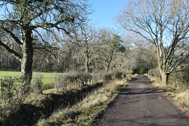
The copse primarily consists of a mixture of deciduous and evergreen trees, such as oak, beech, and ash, creating a diverse and vibrant ecosystem. The dense canopy of the trees provides shade and a sense of seclusion, making it an ideal spot for nature enthusiasts and walkers seeking a peaceful retreat.

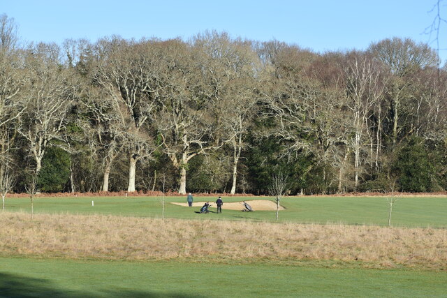
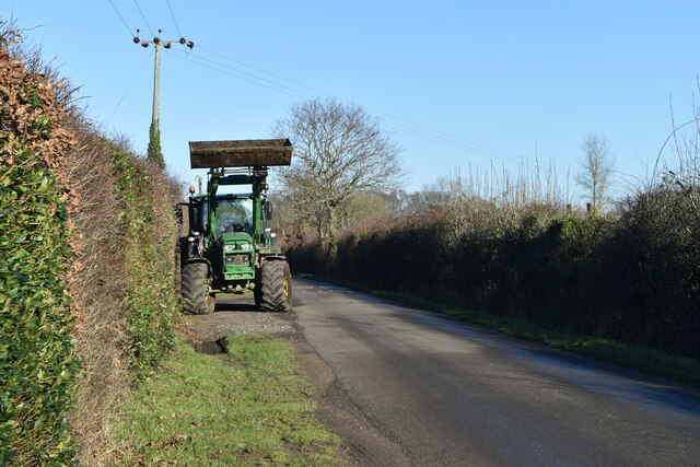
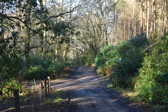
Within the copse, a network of well-maintained footpaths weaves its way through the woodland, allowing visitors to explore the area at their leisure. As one meanders along the paths, they will come across charming little clearings, where sunlight gently filters through the leaves, creating a magical atmosphere.

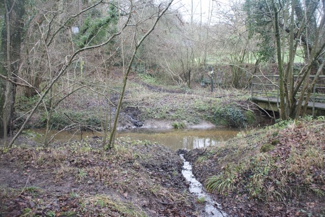
Little Park Copse is also home to a variety of wildlife. Birdwatchers will delight in the opportunity to spot various species, including woodpeckers, blue tits, and robins. The copse is also known to house small mammals such as squirrels and foxes, adding to the biodiversity of the area.

For those interested in the history of the copse, it is believed that it has existed for centuries, potentially dating back to medieval times. The copse has likely witnessed the passage of time and the changing landscape of Wiltshire, making it an intriguing location for history enthusiasts.

Overall, Little Park Copse is a hidden gem within Wiltshire, offering visitors a chance to immerse themselves in nature, explore charming paths, and experience the tranquility of a woodland setting.

If you have any feedback on the listing, please let us know in the comments section below.

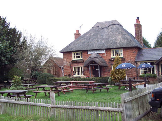
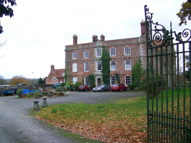
Little Park Copse Images

Images are sourced within 2km of 50.97506/-1.6577573 or Grid Reference SU2419. Thanks to Geograph Open Source API. All images are credited.

Golfers on the fringe of Langley Wood
Footpath on the edge of Hamptworth golf course
Bracken and silver birch in Round Copse
A36 Salisbury Road Towards Salisbury.
A36 Salisbury Road
Towards Salisbury.
A36 Salisbury Road Towards Salisbury.
A36 Salisbury Road
Towards Salisbury.
Former route of the A36 Various sections of the A36 between Salisbury and Southampton have been realigned and this is one of them. The main route passes in a shallow cutting to the east while this downgraded lane provides access to properties.
Former route of the A36
Various sections of the A36 between Salisbury and Southampton have been realigned and this is one of them. The main route passes in a shallow cutting to the east while this downgraded lane provides access to properties.
North Common Lane Providing access to North Common Farm, there are several other rural properties along the way.
North Common Lane
Providing access to North Common Farm, there are several other rural properties along the way.
Late sunlight on autumn leaves In the estate of Landford Lodge.
Late sunlight on autumn leaves
In the estate of Landford Lodge.
Last of the autumn light Looking across the estate of Landford Lodge from the footpath on the edge of the woods.
Last of the autumn light
Looking across the estate of Landford Lodge from the footpath on the edge of the woods.
Abandoned pumpkins beside North Common Lane Looking rather forlorn and decomposed, three weeks after Halloween.
Abandoned pumpkins beside North Common Lane
Looking rather forlorn and decomposed, three weeks after Halloween.
Field edge at Hamptworth The OS map shows a footpath heading to the northwest corner of this field, but it has been diverted and the only exit is now at the northeast corner.
Field edge at Hamptworth
The OS map shows a footpath heading to the northwest corner of this field, but it has been diverted and the only exit is now at the northeast corner.
Tractor on the verge of Lyburn Lane
Mossy roots Moss-covered tree roots high on a bank to the north of the footpath.
Mossy roots
Moss-covered tree roots high on a bank to the north of the footpath.
Tracks junction The track ahead gradually becomes a small public road to Lover, named Black Lane.
Tracks junction
The track ahead gradually becomes a small public road to Lover, named Black Lane.
Track in the woods south of Hamptworth Lodge
Track in the woods Adjacent to a large solar farm.
Track in the woods
Adjacent to a large solar farm.
Track towards Horse Common
Ford at Hamptworth This ford on the River Blackwater is the third of three Hamptworth fords. It is found along a restrictive byway beside the Golf Club and has largely been replaced by a footbridge.
Ford at Hamptworth
This ford on the River Blackwater is the third of three Hamptworth fords. It is found along a restrictive byway beside the Golf Club and has largely been replaced by a footbridge.
Show me another place!

Little Park Copse is located at Grid Ref: SU2419 (Lat: 50.97506, Lng: -1.6577573)

Unitary Authority: Wiltshire

Police Authority: Wiltshire

What 3 Words

///snoozing.blunt.crest. Near Whiteparish, Wiltshire

Related Wikis

Hamptworth

Hamptworth is a hamlet in Wiltshire, England, in the extreme southeast of the county. It is in the civil parish of Landford, and lies within the boundaries...

Langley Wood and Homan's Copse

Langley Wood and Homan's Copse (grid reference SU230206) is a 219.28 hectare biological Site of Special Scientific Interest in Wiltshire, notified in 1985...

Landford

Landford is a village and civil parish 10 miles (16 km) southeast of Salisbury in Wiltshire, England. To the south and east of the parish is the county...

Landford Bog

Landford Bog (grid reference SU259185) is an 11.6 hectare biological Site of Special Scientific Interest at Landford in southeast Wiltshire, England. It...

Landford Manor

Landford Manor is a Grade II* listed house in Stock Lane, Landford, Wiltshire, England. It dates from around 1600, the south wing from around 1680, with...

Nomansland, Wiltshire

Nomansland is a small village in Wiltshire, England, close to the county border with Hampshire. It is part of the parish of Landford and lies about 3.5...

Loosehanger Copse and Meadows

Loosehanger Copse and Meadows (grid reference SU215195) is a 56.27 hectare biological Site of Special Scientific Interest in Wiltshire, England, notified...

Landford Heath

Landford Heath (grid reference SU265178) is an 11.75 hectare biological Site of Special Scientific Interest near Landford in southeast Wiltshire, England...

Nearby Amenities

Located within 500m of 50.97506,-1.6577573
Hamptworth
Is In: Wiltshire
Place: hamlet
Source: npe
Wikidata: Q5646355
Wikipedia: en:Hamptworth
Lat/Long: 50.975389/-1.6535162
Public Bookcase
Booth: K6
Covered: booth
Disused Amenity: telephone
Man Made: telephone_box
Public Bookcase Type: phone_box
Lat/Long: 50.9754385/-1.6537176
Post Box
Operator: Royal Mail
Operator Wikidata: Q638098
Post Box Type: lamp
Ref: SP5 255D
Royal Cypher: EIIR
Royal Cypher Wikidata: Q33102113
Lat/Long: 50.9754373/-1.6536898
Ford: yes
Lat/Long: 50.973388/-1.6541591
Height: 10
Man Made: windmill
Material: metal
Tower Construction: guyed_lattice
Lat/Long: 50.9738753/-1.6641322
Barrier: stile
Lat/Long: 50.9763421/-1.6532076
Access: yes
Door: no
Entrance: main
Lat/Long: 50.9753835/-1.6536999
Board Type: information
Direction: 116
Information: board
Operator: Redlynch Parish Council
Tourism: information
Lat/Long: 50.9753678/-1.6536879
Direction: 10
Information: map
Map Size: region
Map Type: hiking
Operator: Redlynch Parish Council
Start Date: 2000-01-01
Tourism: information
Lat/Long: 50.9754207/-1.6537395
Barrier: stile
Lat/Long: 50.9771863/-1.6625112
Power: pole
Lat/Long: 50.9724602/-1.6633894
Power: pole
Lat/Long: 50.9731347/-1.6626496
Power: pole
Lat/Long: 50.9738189/-1.6618674
Power: pole
Lat/Long: 50.9743186/-1.6612625
Power: pole
Lat/Long: 50.9752745/-1.6597984
Power: pole
Lat/Long: 50.9756433/-1.6588659
Power: pole
Lat/Long: 50.9760246/-1.6579072
Power: pole
Lat/Long: 50.9763985/-1.6567924
Power: pole
Lat/Long: 50.9766002/-1.6560064
Power: pole
Lat/Long: 50.9772161/-1.655637
Power: pole
Lat/Long: 50.9784922/-1.6555537
Power: pole
Lat/Long: 50.9778164/-1.6553403
Power: pole
Lat/Long: 50.9791266/-1.6558205
Power: pole
Lat/Long: 50.9759875/-1.655714
Power: pole
Lat/Long: 50.9752226/-1.6553589
Power: pole
Lat/Long: 50.9748899/-1.6551921
Power: pole
Lat/Long: 50.9743267/-1.654902
Power: pole
Lat/Long: 50.9737485/-1.654536
Power: pole
Lat/Long: 50.973604/-1.6533038
Power: pole
Lat/Long: 50.9735276/-1.6518723
Power: pole
Lat/Long: 50.9736422/-1.6512573
The data included in this document is from www.openstreetmap.org. The data is made available under ODbL.

Have you been to Little Park Copse?

Leave your review of Little Park Copse below (or comments, questions and feedback).