Andover Plantation

Wood, Forest in Hampshire

England

Andover Plantation

A338 Salisbury Road at county border Crossing from Hampshire to Wiltshire.
A338 Salisbury Road at county border Credit: Robin Webster

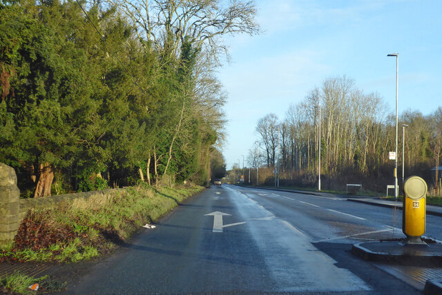
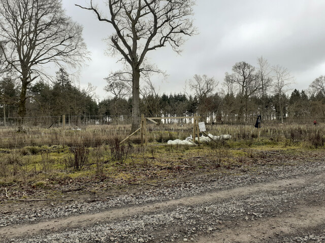
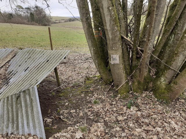
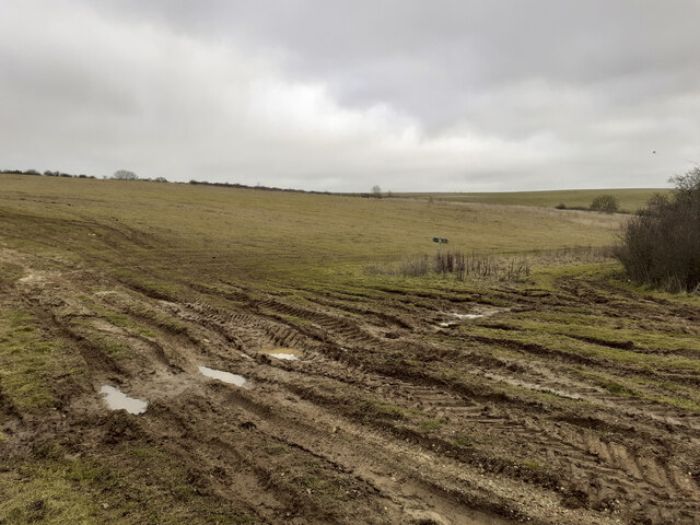
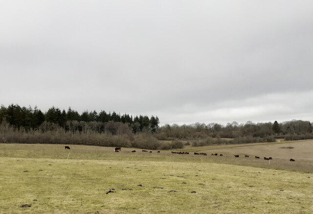
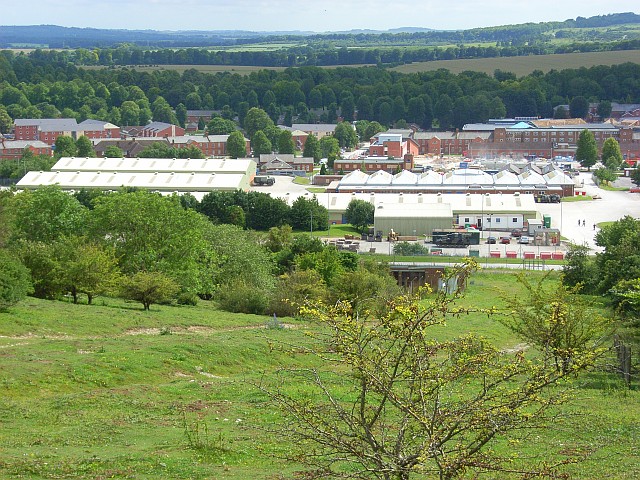
Andover Plantation is a picturesque woodland area located in Hampshire, England. Spread across a vast expanse, the plantation is renowned for its dense forests and natural beauty. The Wood, as it is commonly referred to, offers a serene escape from the bustling city life, attracting visitors from all around.

The plantation is characterized by its diverse range of trees, including oak, beech, and pine. These towering trees create a lush canopy, providing shelter and habitat for a variety of wildlife. Walking through the Wood, one can witness the enchanting sight of sunlight peeking through the branches, casting dappled shadows on the forest floor.

Andover Plantation is home to several well-maintained trails that allow visitors to explore the woodland at their own pace. These paths wind through the forest, offering glimpses of hidden ponds, babbling brooks, and vibrant wildflowers. Nature enthusiasts can indulge in birdwatching, as the Wood is abundant with a multitude of avian species.

In addition to its natural beauty, Andover Plantation also holds historical significance. The plantation has existed for centuries and was once a hunting ground for nobles and royalty. It is said that the Wood still holds remnants of ancient settlements, adding an element of mystery and intrigue to its allure.

Overall, Andover Plantation stands as a testament to the natural wonders of Hampshire. Its tranquil ambiance and breathtaking scenery make it a must-visit destination for anyone seeking solace in the embrace of nature.

If you have any feedback on the listing, please let us know in the comments section below.

Andover Plantation Images

Images are sourced within 2km of 51.233001/-1.6587276 or Grid Reference SU2348. Thanks to Geograph Open Source API. All images are credited.

A338 Salisbury Road at county border Crossing from Hampshire to Wiltshire.
A338 Salisbury Road at county border
Crossing from Hampshire to Wiltshire.
A338 Salisbury Road, South Tidworth The churchyard wall is on the left.
A338 Salisbury Road, South Tidworth
The churchyard wall is on the left.
A338, Tidworth View from the Lidl carpark.
A338, Tidworth
View from the Lidl carpark.
Alley, Tidworth By Lidl supermarket.
Alley, Tidworth
By Lidl supermarket.
Entering Ashdown Copse from the south on a public footpath There are numerous tracks in Ashdown Copse, few of which are public rights of way, but this one is. There doesn't appear to be any visible constraint upon using the other tracks.
Entering Ashdown Copse from the south on a public footpath
There are numerous tracks in Ashdown Copse, few of which are public rights of way, but this one is. There doesn't appear to be any visible constraint upon using the other tracks.
Wooden platform in Ashdown Copse Apparently part of a mountain bike circuit, judging by the TFTUNED advertisement on it, and the narrow up and down exposed-chalk paths in the area. Whether this is military or commercial I don't know.
Wooden platform in Ashdown Copse
Apparently part of a mountain bike circuit, judging by the TFTUNED advertisement on it, and the narrow up and down exposed-chalk paths in the area. Whether this is military or commercial I don't know.
Track junction in Ashdown Copse
Tree planting in Ashdown Copse In March 2020 the MoD announced the felling of thousands of trees in Ashdown Copse due to infection by Ash dieback disease <span class="nowrap"><a title="https://www.forestryjournal.co.uk/features/18344394.clearing-ash-military-precision/" rel="nofollow ugc noopener" href="https://www.forestryjournal.co.uk/features/18344394.clearing-ash-military-precision/">Link</a><img style="margin-left:2px;" alt="External link" title="External link - shift click to open in new window" src="https://s1.geograph.org.uk/img/external.png" width="10" height="10"/></span> . I don't know if this replanting is related to that. Whips of various species were being planted by men who, it seemed, did not speak English.
Tree planting in Ashdown Copse
In March 2020 the MoD announced the felling of thousands of trees in Ashdown Copse due to infection by Ash dieback disease LinkExternal link . I don't know if this replanting is related to that. Whips of various species were being planted by men who, it seemed, did not speak English.
Track junction in Ashdown Copse At this point I had mistraken my route and strayed off the public footpath I had previously been following <a title="https://www.geograph.org.uk/photo/7396602" href="https://www.geograph.org.uk/photo/7396602">Link</a> .
Track junction in Ashdown Copse
At this point I had mistraken my route and strayed off the public footpath I had previously been following Link .
Weird shelter in Ashdown Copse The note on the tree reads "RV 4 Friendly prisoners are being held at grid SD 299 126". SD 299 126 is a holiday park at Ainsdale-on-Sea south of Southport about 180 miles from here. Whether this note is part of military training or perhaps some paintball event I don't know.
Weird shelter in Ashdown Copse
The note on the tree reads "RV 4 Friendly prisoners are being held at grid SD 299 126". SD 299 126 is a holiday park at Ainsdale-on-Sea south of Southport about 180 miles from here. Whether this note is part of military training or perhaps some paintball event I don't know.
Gate in forestry fence The public footpath here runs through the fine mesh improvised gate seen at right in the photo. It runs for 138 yards in a NNW direction before emerging through another such gate onto another track. There is no visible footpath inside this fence so I followed it by GPS. Essentially this new plantation fencing has cut across the footpath. Rather than following the footpath it would be much easier to simply follow the tracks round the other two sides of this triangle, although there is no right of way to do so.
Gate in forestry fence
The public footpath here runs through the fine mesh improvised gate seen at right in the photo. It runs for 138 yards in a NNW direction before emerging through another such gate onto another track. There is no visible footpath inside this fence so I followed it by GPS. Essentially this new plantation fencing has cut across the footpath. Rather than following the footpath it would be much easier to simply follow the tracks round the other two sides of this triangle, although there is no right of way to do so.
Track junction at SE corner of Warren Hill plantation The Wiltshire County Council right of way sign here has been rotated 90 degrees to give false information. I rotated it back. The real public footpath runs diagonally from the bottom left corner of this photo to the middle right.
Track junction at SE corner of Warren Hill plantation
The Wiltshire County Council right of way sign here has been rotated 90 degrees to give false information. I rotated it back. The real public footpath runs diagonally from the bottom left corner of this photo to the middle right.
Public Footpath in valley south of Warren Hill
Wildlife Area in valley south of Warren Hill The woodland ahead is marked as a wildlife area and there is a request to keep dogs on leads.
Wildlife Area in valley south of Warren Hill
The woodland ahead is marked as a wildlife area and there is a request to keep dogs on leads.
Looking along public footpath towards Kimpton Gorse The hillside here seemed to have been dug up or had a crop on it recently. There was no trace of the public footpath, so I followed by GPS.
Looking along public footpath towards Kimpton Gorse
The hillside here seemed to have been dug up or had a crop on it recently. There was no trace of the public footpath, so I followed by GPS.
Public footpath from Klimpton Gorse towards Ashdown Copse The footpath passes in a straight line to the right of the disused pit seen in the distance. The line of scrub seen in the foreground is not marked on the 1:25K OS map. The footpath here is undiscernible but can be followed by GPS.
Public footpath from Klimpton Gorse towards Ashdown Copse
The footpath passes in a straight line to the right of the disused pit seen in the distance. The line of scrub seen in the foreground is not marked on the 1:25K OS map. The footpath here is undiscernible but can be followed by GPS.
Fearsome horned cattle blocking public footpath The indiscernible public footpath is climbing towards Ashdown Copse. I was following it by GPS. The cattle were enclosed by an electric fence. I deviated southwards from the footpath to avoid the cattle.
Fearsome horned cattle blocking public footpath
The indiscernible public footpath is climbing towards Ashdown Copse. I was following it by GPS. The cattle were enclosed by an electric fence. I deviated southwards from the footpath to avoid the cattle.
Public footpath south of Ashdown Copse The footpath does not follow any of the many grassy tracks hereabouts.
Public footpath south of Ashdown Copse
The footpath does not follow any of the many grassy tracks hereabouts.
Show me another place!

Andover Plantation is located at Grid Ref: SU2348 (Lat: 51.233001, Lng: -1.6587276)

Unitary Authority: Wiltshire

Police Authority: Wiltshire

What 3 Words

///averts.zoos.audibly. Near Tidworth, Wiltshire

Related Wikis

Tidworth

Tidworth is a garrison town and civil parish in south-east Wiltshire, England, on the eastern edge of Salisbury Plain. Lying on both sides of the A338...

St Mary's Church, South Tidworth

St Mary's Church in South Tidworth, Wiltshire, England, was built in 1878. It is recorded in the National Heritage List for England as a designated Grade...

The Wellington Academy

The Wellington Academy, founded in 2009, is an 11–19 non-selective state-funded school near Ludgershall, Wiltshire, England. The school has academy status...

Tedworth House

Tedworth House, also known as South Tidworth House, is a 19th-century country house in Tidworth, Wiltshire, England. It is a Grade II* listed building...

Tidworth Camp

Tidworth Camp is a military installation at Tidworth in Wiltshire, England. It forms part of the Tidworth, Netheravon and Bulford (TidNBul) Garrison....

Perham Down

Perham Down is a village in Wiltshire, England, in Tidworth parish on the eastern edge of Salisbury Plain. It lies on a minor road about 1+1⁄2 miles (2...

Swinton Barracks

Swinton Barracks is a military installation accommodating two engineer regiments at Perham Down in Wiltshire, England. The site is on the east edge of...

A338 road

The A338 is a major primary route in southern England, that runs from the junction with the A35 at Poole in Dorset to the junction with the A420 at Besselsleigh...

Related Videos

Walking through Tidworth and Ludgershall, #unitedkindom

Let's walk through Tidworth, tour #youtubeshorts #london #blogger #viral #maldives #youtubevideos #howto #travel #solotravel ...

Bicycle Ride

Bicycle ride in summer holidays 2023. Tidworth - United Kingdom #tidworth #unitedkingdom #thezz #thezzdiary #thesath ...

Nearby Amenities

Located within 500m of 51.233001,-1.6587276
Traffic Signals
Traffic Signals: traffic_lights
Traffic Signals Direction: both
Lat/Long: 51.2348323/-1.6638822
Barrier: bollard
Motor Vehicle: no
Lat/Long: 51.2362597/-1.6587196
Barrier: bollard
Motor Vehicle: no
Lat/Long: 51.2362051/-1.6584507
Post Box
Operator: Royal Mail
Operator Wikidata: Q638098
Post Box Type: pillar
Ref: SP9 40
Royal Cypher: EIIR
Royal Cypher Wikidata: Q33102113
Lat/Long: 51.2346475/-1.6614488
Barrier: bollard
Lat/Long: 51.2360708/-1.6570946
Barrier: bollard
Lat/Long: 51.2361676/-1.657383
Traffic Signals
Traffic Signals: pedestrian_crossing
Lat/Long: 51.2347723/-1.6639857
Give Way
Lat/Long: 51.2348355/-1.6640549
Generator Method: photovoltaic
Generator Output Electricity: yes
Generator Source: solar
Generator Type: solar_photovoltaic_panel
Location: roof
Power: generator
Lat/Long: 51.2292563/-1.658273
Generator Method: photovoltaic
Generator Output Electricity: yes
Generator Source: solar
Generator Type: solar_photovoltaic_panel
Location: roof
Power: generator
Lat/Long: 51.2294309/-1.6581765
Generator Method: photovoltaic
Generator Output Electricity: yes
Generator Source: solar
Generator Type: solar_photovoltaic_panel
Location: roof
Power: generator
Lat/Long: 51.2293184/-1.6593754
Generator Method: photovoltaic
Generator Output Electricity: yes
Generator Source: solar
Generator Type: solar_photovoltaic_panel
Location: roof
Power: generator
Lat/Long: 51.2293957/-1.6593888
Generator Method: photovoltaic
Generator Output Electricity: yes
Generator Source: solar
Generator Type: solar_photovoltaic_panel
Location: roof
Power: generator
Lat/Long: 51.2289035/-1.6589409
Generator Method: photovoltaic
Generator Output Electricity: yes
Generator Source: solar
Generator Type: solar_photovoltaic_panel
Location: roof
Power: generator
Lat/Long: 51.2288851/-1.6587156
Generator Method: photovoltaic
Generator Output Electricity: yes
Generator Source: solar
Generator Type: solar_photovoltaic_panel
Location: roof
Power: generator
Lat/Long: 51.2288716/-1.6585574
Generator Method: photovoltaic
Generator Output Electricity: yes
Generator Source: solar
Generator Type: solar_photovoltaic_panel
Location: roof
Power: generator
Lat/Long: 51.2288565/-1.6583186
Generator Method: photovoltaic
Generator Output Electricity: yes
Generator Source: solar
Generator Type: solar_photovoltaic_panel
Location: roof
Power: generator
Lat/Long: 51.2290295/-1.6581818
Generator Method: photovoltaic
Generator Output Electricity: yes
Generator Source: solar
Generator Type: solar_photovoltaic_panel
Location: roof
Power: generator
Lat/Long: 51.2290379/-1.6583079
Generator Method: photovoltaic
Generator Output Electricity: yes
Generator Source: solar
Generator Type: solar_photovoltaic_panel
Location: roof
Power: generator
Lat/Long: 51.229048/-1.6585654
Generator Method: photovoltaic
Generator Output Electricity: yes
Generator Source: solar
Generator Type: solar_photovoltaic_panel
Location: roof
Power: generator
Lat/Long: 51.2290547/-1.6587102
Generator Method: photovoltaic
Generator Output Electricity: yes
Generator Source: solar
Generator Type: solar_photovoltaic_panel
Location: roof
Power: generator
Lat/Long: 51.2291538/-1.6592118
Generator Method: photovoltaic
Generator Output Electricity: yes
Generator Source: solar
Generator Type: solar_photovoltaic_panel
Location: roof
Power: generator
Lat/Long: 51.2290799/-1.6589329
Generator Method: photovoltaic
Generator Output Electricity: yes
Generator Source: solar
Generator Type: solar_photovoltaic_panel
Location: roof
Power: generator
Lat/Long: 51.2289909/-1.6592521
Generator Method: photovoltaic
Generator Output Electricity: yes
Generator Source: solar
Generator Type: solar_photovoltaic_panel
Location: roof
Power: generator
Lat/Long: 51.2293083/-1.6591153
Generator Method: photovoltaic
Generator Output Electricity: yes
Generator Source: solar
Generator Type: solar_photovoltaic_panel
Location: roof
Power: generator
Lat/Long: 51.2293218/-1.6589704
Generator Method: photovoltaic
Generator Output Electricity: yes
Generator Source: solar
Generator Type: solar_photovoltaic_panel
Location: roof
Power: generator
Lat/Long: 51.2294578/-1.6586512
Generator Method: photovoltaic
Generator Output Electricity: yes
Generator Source: solar
Generator Type: solar_photovoltaic_panel
Location: roof
Power: generator
Lat/Long: 51.2294343/-1.6584742
Generator Method: photovoltaic
Generator Output Electricity: yes
Generator Source: solar
Generator Type: solar_photovoltaic_panel
Location: roof
Power: generator
Lat/Long: 51.2295737/-1.6577393
Generator Method: photovoltaic
Generator Output Electricity: yes
Generator Source: solar
Generator Type: solar_photovoltaic_panel
Location: roof
Power: generator
Lat/Long: 51.2297501/-1.6577822
Generator Method: photovoltaic
Generator Output Electricity: yes
Generator Source: solar
Generator Type: solar_photovoltaic_panel
Location: roof
Power: generator
Lat/Long: 51.2296728/-1.6577661
Generator Method: photovoltaic
Generator Output Electricity: yes
Generator Source: solar
Generator Type: solar_photovoltaic_panel
Location: roof
Power: generator
Lat/Long: 51.2296258/-1.6580933
Generator Method: photovoltaic
Generator Output Electricity: yes
Generator Source: solar
Generator Type: solar_photovoltaic_panel
Location: roof
Power: generator
Lat/Long: 51.229609/-1.6582918
Generator Method: photovoltaic
Generator Output Electricity: yes
Generator Source: solar
Generator Type: solar_photovoltaic_panel
Location: roof
Power: generator
Lat/Long: 51.2296258/-1.6584367
Generator Method: photovoltaic
Generator Output Electricity: yes
Generator Source: solar
Generator Type: solar_photovoltaic_panel
Location: roof
Power: generator
Lat/Long: 51.2296527/-1.6586512
Generator Method: photovoltaic
Generator Output Electricity: yes
Generator Source: solar
Generator Type: solar_photovoltaic_panel
Location: roof
Power: generator
Lat/Long: 51.2295804/-1.6589114
Generator Method: photovoltaic
Generator Output Electricity: yes
Generator Source: solar
Generator Type: solar_photovoltaic_panel
Location: roof
Power: generator
Lat/Long: 51.2295703/-1.6591126
Generator Method: photovoltaic
Generator Output Electricity: yes
Generator Source: solar
Generator Type: solar_photovoltaic_panel
Location: roof
Power: generator
Lat/Long: 51.2295653/-1.6592306
Generator Method: photovoltaic
Generator Output Electricity: yes
Generator Source: solar
Generator Type: solar_photovoltaic_panel
Location: roof
Power: generator
Lat/Long: 51.2295418/-1.6594398
Generator Method: photovoltaic
Generator Output Electricity: yes
Generator Source: solar
Generator Type: solar_photovoltaic_panel
Location: roof
Power: generator
Lat/Long: 51.2295216/-1.6595846
Generator Method: photovoltaic
Generator Output Electricity: yes
Generator Source: solar
Generator Type: solar_photovoltaic_panel
Location: roof
Power: generator
Lat/Long: 51.2363286/-1.662586
Generator Method: photovoltaic
Generator Output Electricity: yes
Generator Source: solar
Generator Type: solar_photovoltaic_panel
Location: roof
Power: generator
Lat/Long: 51.2364293/-1.6621998
Generator Method: photovoltaic
Generator Output Electricity: yes
Generator Source: solar
Generator Type: solar_photovoltaic_panel
Location: roof
Power: generator
Lat/Long: 51.2364646/-1.6621918
Generator Method: photovoltaic
Generator Output Electricity: yes
Generator Source: solar
Generator Type: solar_photovoltaic_panel
Location: roof
Power: generator
Lat/Long: 51.2363252/-1.6625324
Barrier: bollard
Lat/Long: 51.2368107/-1.6579801
Barrier: bollard
Motor Vehicle: no
Lat/Long: 51.2370767/-1.6563438
Barrier: bollard
Lat/Long: 51.237071/-1.6576607
Barrier: bollard
Motor Vehicle: no
Lat/Long: 51.2357452/-1.658863
Barrier: bollard
Motor Vehicle: no
Lat/Long: 51.2362349/-1.6575408
Bench
Backrest: yes
Material: wood
Lat/Long: 51.2362267/-1.6608184
Bench
Backrest: yes
Material: wood
Lat/Long: 51.2365586/-1.6607791
Bench
Backrest: yes
Material: wood
Lat/Long: 51.2360415/-1.6610901
Bench
Backrest: yes
Material: wood
Lat/Long: 51.2362102/-1.6608461
Bench
Backrest: yes
Material: wood
Lat/Long: 51.2361608/-1.6609804
Leisure: picnic_table
Lat/Long: 51.236156/-1.660769
Bench
Backrest: yes
Material: wood
Lat/Long: 51.2365863/-1.6608227
Bench
Backrest: yes
Material: wood
Lat/Long: 51.2360458/-1.6611523
Leisure: picnic_table
Lat/Long: 51.2361928/-1.6607764
Leisure: picnic_table
Lat/Long: 51.2361194/-1.6605314
Leisure: picnic_table
Lat/Long: 51.2361901/-1.6605507
Leisure: picnic_table
Lat/Long: 51.2361609/-1.6605176
Bench
Backrest: yes
Material: wood
Lat/Long: 51.2361471/-1.6610548
Leisure: picnic_table
Lat/Long: 51.2361085/-1.6607704
The data included in this document is from www.openstreetmap.org. The data is made available under ODbL.

Have you been to Andover Plantation?

Leave your review of Andover Plantation below (or comments, questions and feedback).