Common Wood

Wood, Forest in Yorkshire Harrogate

England

Common Wood

Sign for Grewelthorpe Looking across the sign for Grewelthorpe on the west side of the village.
Sign for Grewelthorpe Credit: DS Pugh

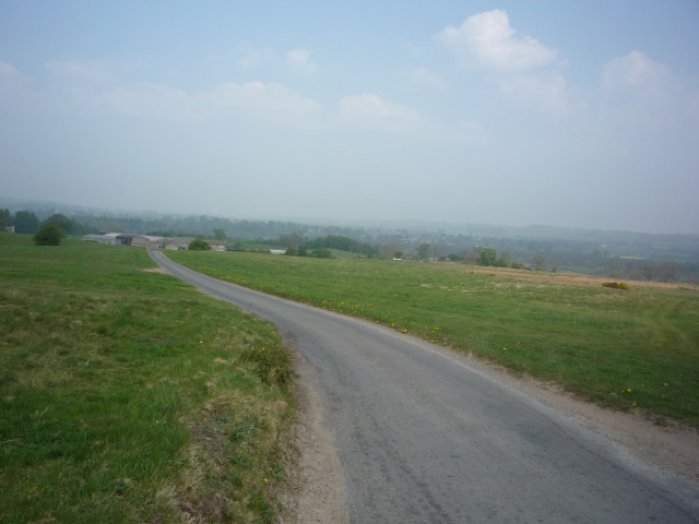
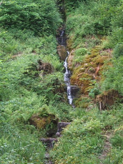
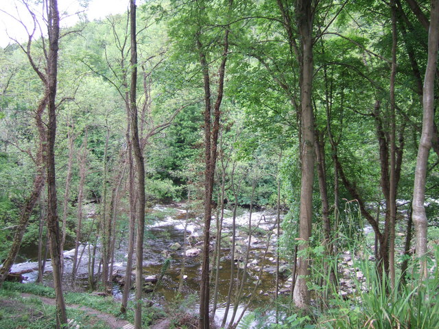
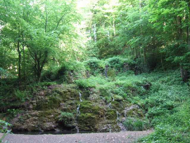
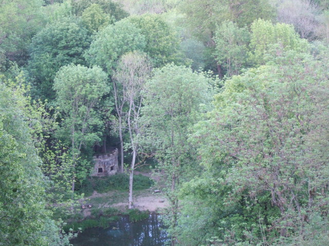
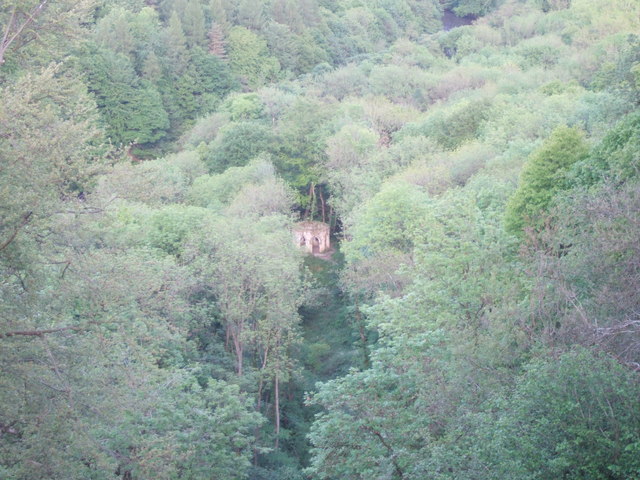
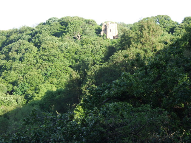
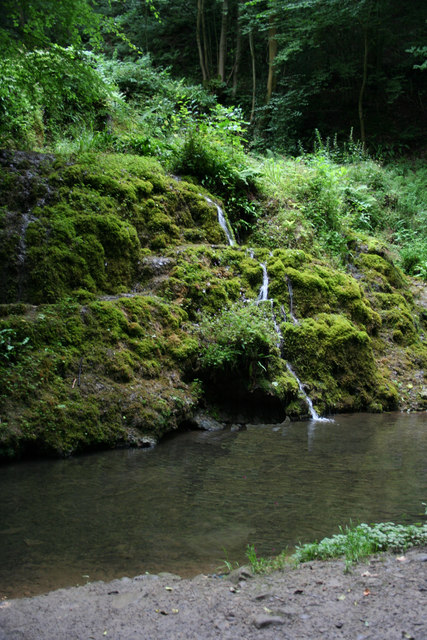
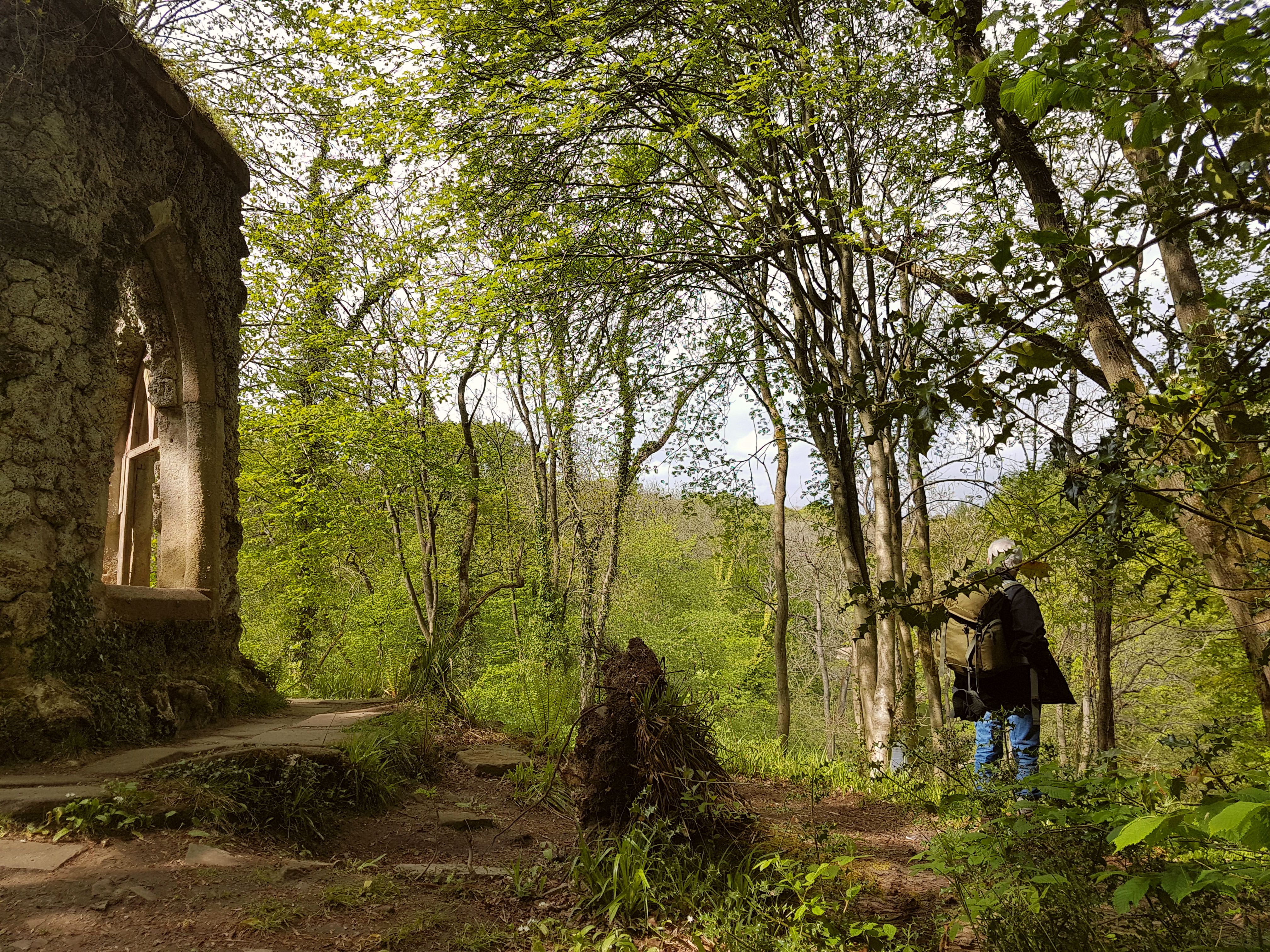
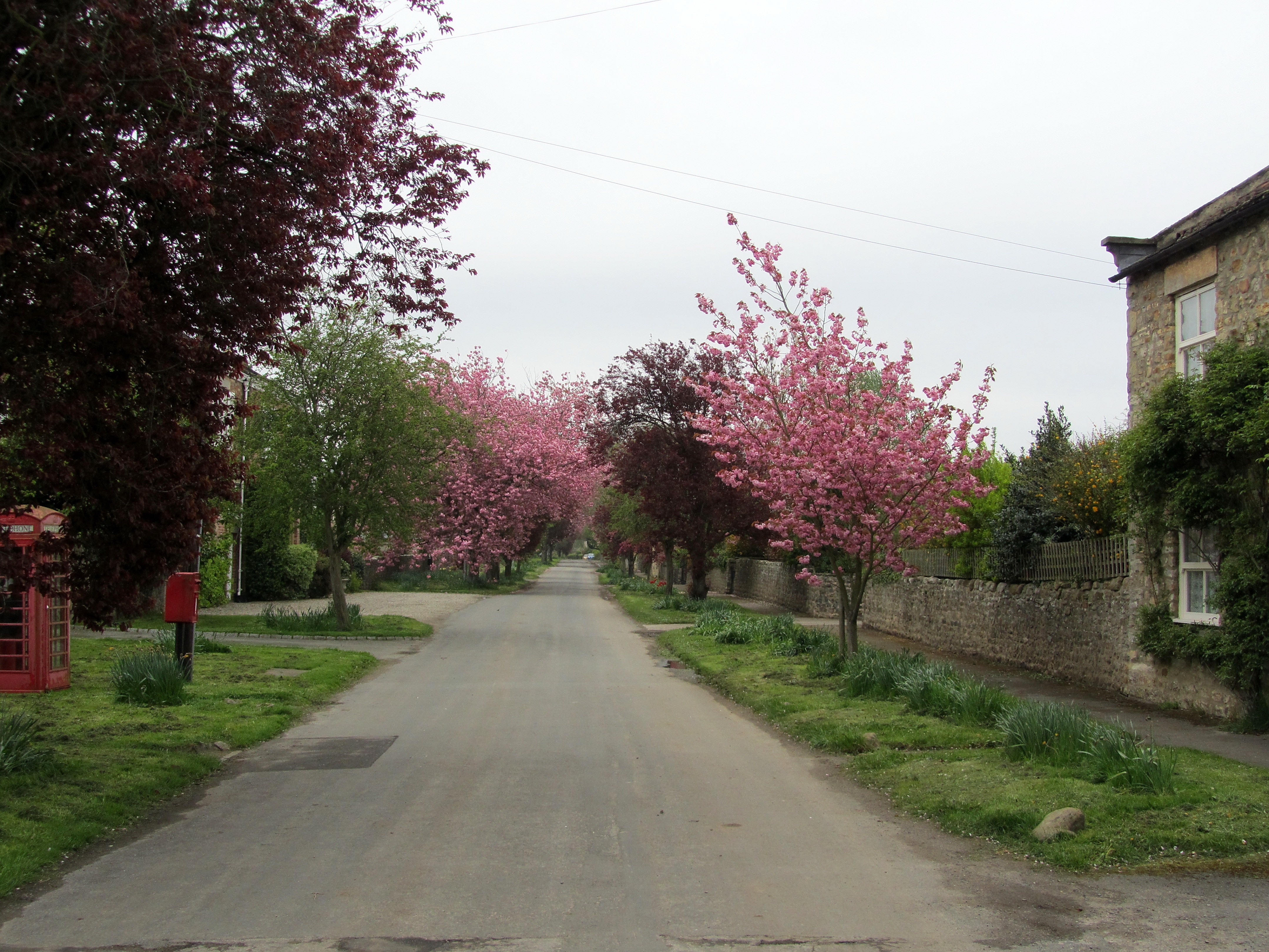
Common Wood, Yorkshire, also known as Wood or Forest, is a picturesque area located in the northern part of England. It is nestled in the heart of the Yorkshire Dales National Park, renowned for its stunning landscapes and rich biodiversity. Common Wood covers an area of approximately 500 acres and is a popular destination for nature enthusiasts and outdoor adventurers.

The wood is predominantly made up of broadleaf trees, such as oak, beech, and ash, which create a dense canopy and provide a habitat for various wildlife species. Visitors can explore the area through a network of well-maintained footpaths and hiking trails, offering panoramic views of the surrounding countryside.

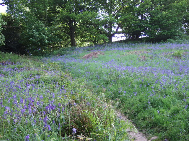
Common Wood is home to a diverse range of flora and fauna. Wildflowers such as bluebells, primroses, and wood anemones carpet the forest floor during spring, creating a vibrant and colorful display. The wood also supports a variety of bird species, including robins, blackbirds, and great tits, making it a haven for birdwatchers.

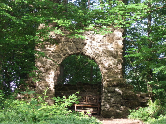
Aside from its natural beauty, Common Wood offers recreational activities for visitors. Picnic areas and designated camping spots are available for those who wish to spend more time in the wood. Additionally, the wood is a popular spot for mountain biking, with designated trails suitable for all levels of experience.

In conclusion, Common Wood, Yorkshire, is a breathtaking natural area that showcases the beauty of the Yorkshire Dales National Park. Its diverse flora and fauna, combined with its recreational opportunities, make it a must-visit destination for nature lovers and outdoor enthusiasts alike.

If you have any feedback on the listing, please let us know in the comments section below.

Common Wood Images

Images are sourced within 2km of 54.189059/-1.6400944 or Grid Reference SE2377. Thanks to Geograph Open Source API. All images are credited.

Sign for Grewelthorpe Looking across the sign for Grewelthorpe on the west side of the village.
Sign for Grewelthorpe
Looking across the sign for Grewelthorpe on the west side of the village.
Grewelthorpe Entering Grewelthorpe from the Kirkby Malzeard direction.
Grewelthorpe
Entering Grewelthorpe from the Kirkby Malzeard direction.
Nutwith Lane Looking towards Nutwith Lane in Grewelthorpe.
Nutwith Lane
Looking towards Nutwith Lane in Grewelthorpe.
Road to Masham Looking towards Masham from Grewelthorpe.
Road to Masham
Looking towards Masham from Grewelthorpe.
Above the Ure Taken next to the car park north of Grewelthorpe. Paths lead down to the River Ure from here.
Above the Ure
Taken next to the car park north of Grewelthorpe. Paths lead down to the River Ure from here.
Road to Roomer The road to Masham and the road to Roomer & Swinton diverege here.
Road to Roomer
The road to Masham and the road to Roomer & Swinton diverege here.
Hackfall Woods - the fountain at the fountain pond in full flow The Woodland Trust's 'Hackfall Walks' leaflet describes the fountain as follows - 'The fountain at the pond was originally created in 1756 as part of William Aislabie's master plan for Hackfall...... The fountain has now been restored using modern pipework and a gravity feed system filled from a natural spring on the hillside above. Once a certain water level is achieved in the system, a tumbler opens a valve and water flows to the fountain'. The Ruin folly can be seen on the skyline.
Hackfall Woods - the fountain at the fountain pond in full flow
The Woodland Trust's 'Hackfall Walks' leaflet describes the fountain as follows - 'The fountain at the pond was originally created in 1756 as part of William Aislabie's master plan for Hackfall...... The fountain has now been restored using modern pipework and a gravity feed system filled from a natural spring on the hillside above. Once a certain water level is achieved in the system, a tumbler opens a valve and water flows to the fountain'. The Ruin folly can be seen on the skyline.
Hackfall Woods - the River Ure from Fisher's Hall
Hackfall Woods - Forty Foot Fall
Hackfall Woods - The Grotto
The River Ure from Hackfall Wood This was taken from just by Fisher's Hall.
The River Ure from Hackfall Wood
This was taken from just by Fisher's Hall.
Hackfall Woods - view north from Kent's Seat
Hackfall Woods - The Fountain Pond and the Rustic Temple Taken from by the Ruin folly.
Hackfall Woods - The Fountain Pond and the Rustic Temple
Taken from by the Ruin folly.
Hackfall Woods - looking down on Fisher's Hall Taken from near the Ruin folly.
Hackfall Woods - looking down on Fisher's Hall
Taken from near the Ruin folly.
Hackfall Woods - Mowbray Castle from near the Ruin
Hackfall Woods - bluebells, May 2011
Alum spring water Alum spring water flowing into tributary of River Ure
Alum spring water
Alum spring water flowing into tributary of River Ure
Roadside barn, Kirkby Malzeard Roughly half way along the road from Kirkby Malzeard to Grewelthorpe, this barn shows both upland and lowland features. The walls are of upland sandstone, but the roof is tiled rather than stone slated, tiles being more common in the lowlands to the east.
Roadside barn, Kirkby Malzeard
Roughly half way along the road from Kirkby Malzeard to Grewelthorpe, this barn shows both upland and lowland features. The walls are of upland sandstone, but the roof is tiled rather than stone slated, tiles being more common in the lowlands to the east.
Show me another place!

Common Wood is located at Grid Ref: SE2377 (Lat: 54.189059, Lng: -1.6400944)

Division: West Riding

Administrative County: North Yorkshire

District: Harrogate

Police Authority: North Yorkshire

What 3 Words

///drilling.ferrying.twitchy. Near Masham, North Yorkshire

Related Wikis

Hack Fall Wood

Hack Fall Wood, otherwise known as Hackfall, is a Site of Special Scientific Interest, or SSSI, of 44.8687 hectares (0.4487 km2; 0.1732 sq mi), lying north...
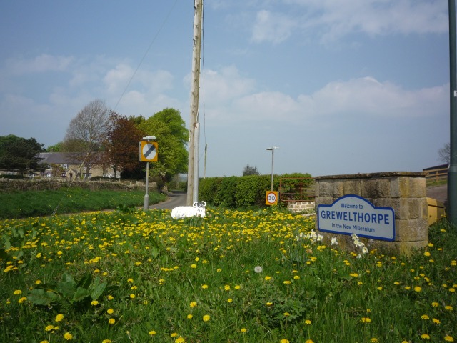
Grewelthorpe

Grewelthorpe is a village and civil parish in the Harrogate district of North Yorkshire, England situated 3 miles (5 km) south of Masham and 6.2 miles...

Mickley, North Yorkshire

Mickley is a village in the Harrogate District of North Yorkshire, England. The village is on the south bank of the River Ure between Masham and West Tanfield...

Kirkby Malzeard

Kirkby Malzeard () is a village and civil parish in the Harrogate district of North Yorkshire, England. There has been a creamery in the village making...

Swinton with Warthermarske

Swinton with Warthermarske is a civil parish in Harrogate district, North Yorkshire, England. The parish includes the village of Swinton and the hamlets...

Binsoe

Binsoe is a hamlet in the civil parish of West Tanfield, North Yorkshire, England. The hamlet is just to the north of the A6108 road, being 1.25 miles...

Swinton, Harrogate

Swinton is a small village in the Harrogate district of North Yorkshire, England. It is situated to the immediate south-west of Masham and separated from...

Azerley

Azerley is a village and civil parish in the Harrogate district of North Yorkshire, England. It is about 4 miles (6 km) north-west of Ripon. The civil...

Nearby Amenities

Located within 500m of 54.189059,-1.6400944
Created By: Merkaartor 0.13
Note: yes, the stream does divide
Lat/Long: 54.1898011/-1.6397464
Ford: yes
Source: survey
Lat/Long: 54.189459/-1.6383272
Ford: yes
Source: survey
Lat/Long: 54.1898693/-1.6396414
Created By: Merkaartor 0.13
Lat/Long: 54.190164/-1.6392546
Tourism: viewpoint
Lat/Long: 54.1903775/-1.6453752
Lover's Leap
Tourism: viewpoint
Lat/Long: 54.1910211/-1.6453449
Bench
Kent's Seat
Lat/Long: 54.1882011/-1.6435789
Fixme: Start of steps approximate
Lat/Long: 54.1887267/-1.6350465
Bench
Sandbed Hut
Lat/Long: 54.1934158/-1.6402607
Fountain
Lat/Long: 54.1910399/-1.6438232
Bench
Grotto
Historic: folly
Lat/Long: 54.1907073/-1.6430354
Earthwork in Magdalen Field
Historic: archaeological_site
Wikidata: Q17643668
Lat/Long: 54.1919094/-1.6363084
Information: route_marker
Tourism: information
Lat/Long: 54.1899155/-1.6399398
Note: Not really a ford - just step over
Lat/Long: 54.1927726/-1.6412455
Information: route_marker
Tourism: information
Lat/Long: 54.1926453/-1.6412274
Note: Not really a ford - just step over
Lat/Long: 54.1912865/-1.6408342
Note: Not really a ford - just step over
Lat/Long: 54.191454/-1.6408255
Hack Fall
Fixme: Location approx only.
Waterway: waterfall
Lat/Long: 54.1889849/-1.6418324
Bench
Backrest: yes
Lat/Long: 54.1910341/-1.6453679
Description: Ornamental Stepping Stones feature
Ford: stepping_stones
Lat/Long: 54.1881814/-1.6435013
Waterway: dam
Lat/Long: 54.1881738/-1.6435152
Access: no
Note: A clear barrier was placed accross the path here during survay 3.7.21. No sign. Clear attempt to block access but passable.
Lat/Long: 54.1882232/-1.6398605
Note: Route becomes impassable due to overgrowth
Lat/Long: 54.188159/-1.639181
Direction: 0
Tourism: viewpoint
Lat/Long: 54.1883788/-1.6407378
The data included in this document is from www.openstreetmap.org. The data is made available under ODbL.

Have you been to Common Wood?

Leave your review of Common Wood below (or comments, questions and feedback).