Stuphill Covert
Wood, Forest in Oxfordshire West Oxfordshire
England
Stuphill Covert

Stuphill Covert is a beautiful woodland area located in Oxfordshire, England. Situated near the village of Wood, this enchanting forest covers an approximate area of 200 acres. The covert is known for its dense and diverse collection of trees, creating a haven for nature enthusiasts and wildlife alike.
The woodland is predominantly composed of native broadleaf species, such as oak, beech, and ash trees. These towering giants provide a rich and vibrant canopy, offering shade and shelter to an array of flora and fauna. The forest floor is adorned with an assortment of mosses, ferns, and wildflowers, contributing to the area's natural beauty.
Stuphill Covert boasts a well-maintained network of walking trails, allowing visitors to explore its captivating surroundings. The paths wind through the woodland, offering glimpses of hidden glades and babbling brooks. As one delves deeper into the covert, they may encounter charming wildlife, including red squirrels, deer, and a variety of bird species.
The woodland is also home to several ancient trees that have stood the test of time, their gnarled trunks and twisting branches telling stories of centuries past. These majestic specimens add an air of mystique and history to Stuphill Covert, making it a truly magical place to visit.
Overall, Stuphill Covert in Oxfordshire is a captivating woodland sanctuary, offering a tranquil retreat for nature lovers. With its lush vegetation, diverse wildlife, and serene atmosphere, it is a place where visitors can immerse themselves in the beauty of the natural world.
If you have any feedback on the listing, please let us know in the comments section below.
Stuphill Covert Images
Images are sourced within 2km of 51.971003/-1.6657024 or Grid Reference SP2330. Thanks to Geograph Open Source API. All images are credited.


Stuphill Covert is located at Grid Ref: SP2330 (Lat: 51.971003, Lng: -1.6657024)
Administrative County: Oxfordshire
District: West Oxfordshire
Police Authority: Thames Valley
What 3 Words
///assemble.piled.forgotten. Near Moreton in Marsh, Gloucestershire
Nearby Locations
Related Wikis
Evenlode
Evenlode is a village and civil parish (ONS Code 23UC051) in the Cotswold District of eastern Gloucestershire in England.Evenlode is bordered by the Gloucestershire...
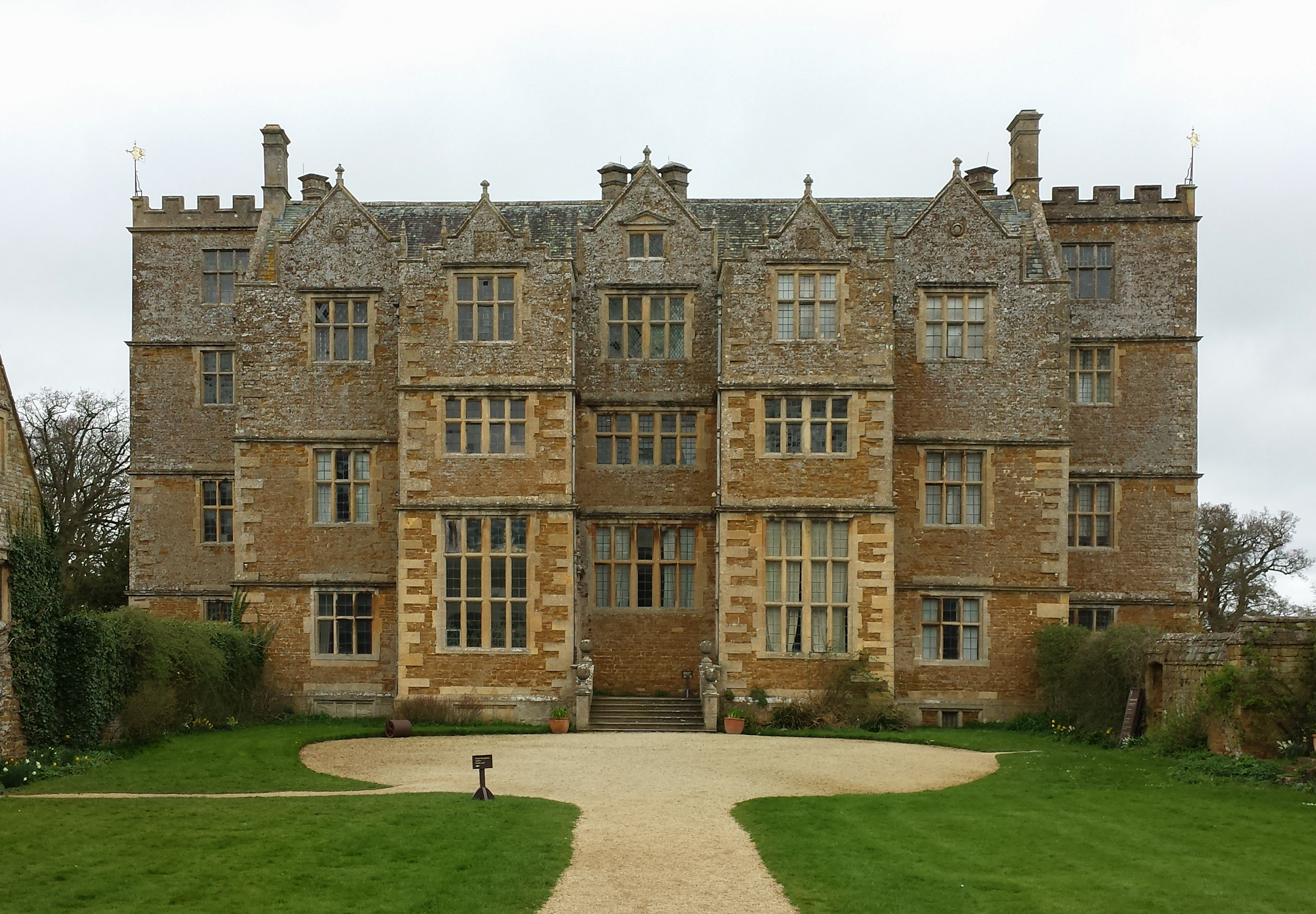
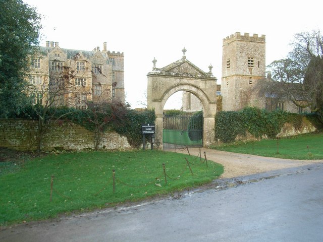
Chastleton House
Chastleton House () is a Jacobean country house at Chastleton, Oxfordshire, England, close to Moreton-in-Marsh (grid reference SP2429). It has been owned...
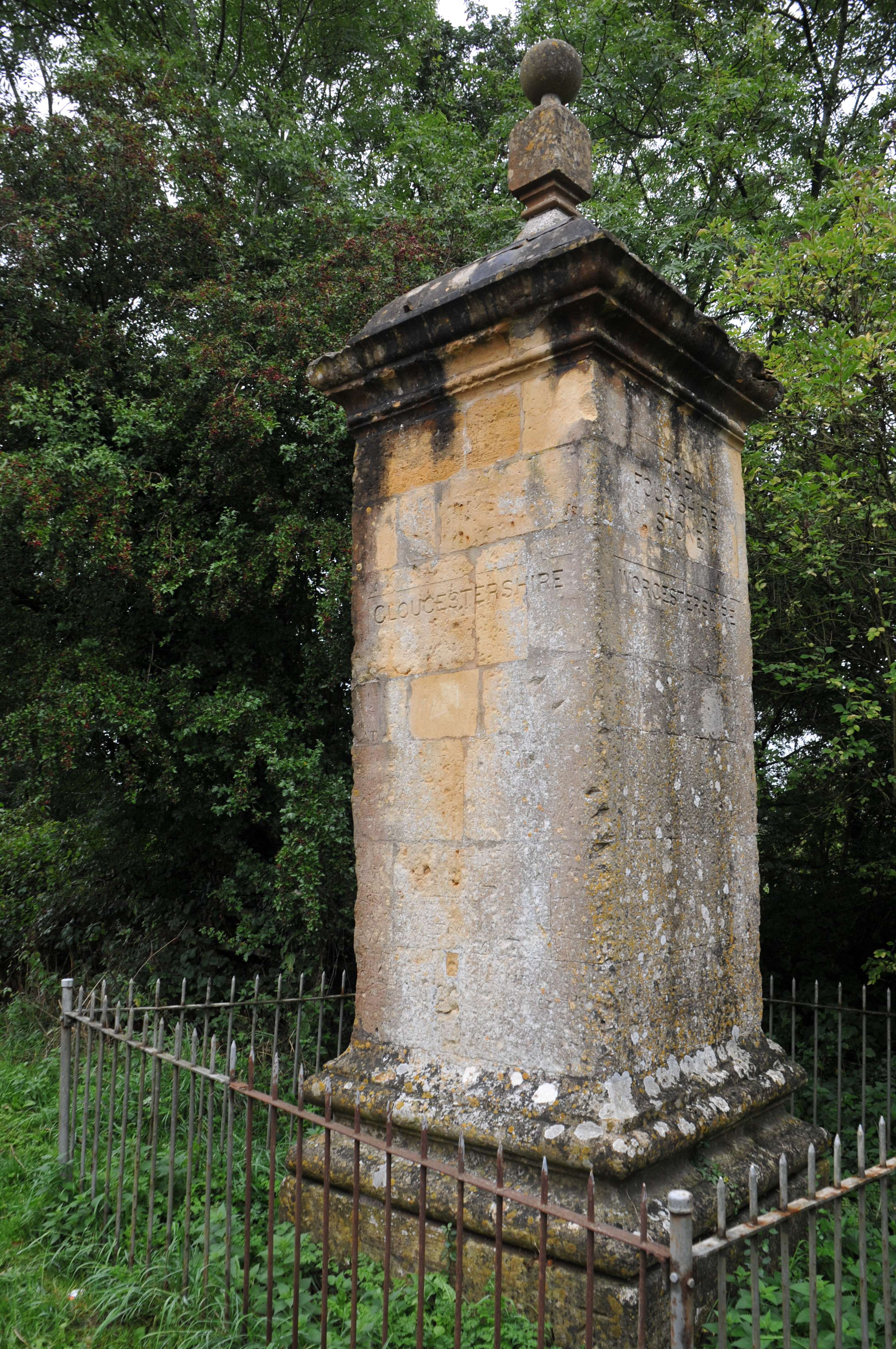
Four Shire Stone
The Four Shire Stone is a boundary marker that marks the place where the four historic English counties of Warwickshire, Oxfordshire, Gloucestershire,...
Chastleton
Chastleton is a village and civil parish in the Cotswold Hills in Oxfordshire, England, about 4 miles (6.4 km) northeast of Stow-on-the-Wold. Chastleton...
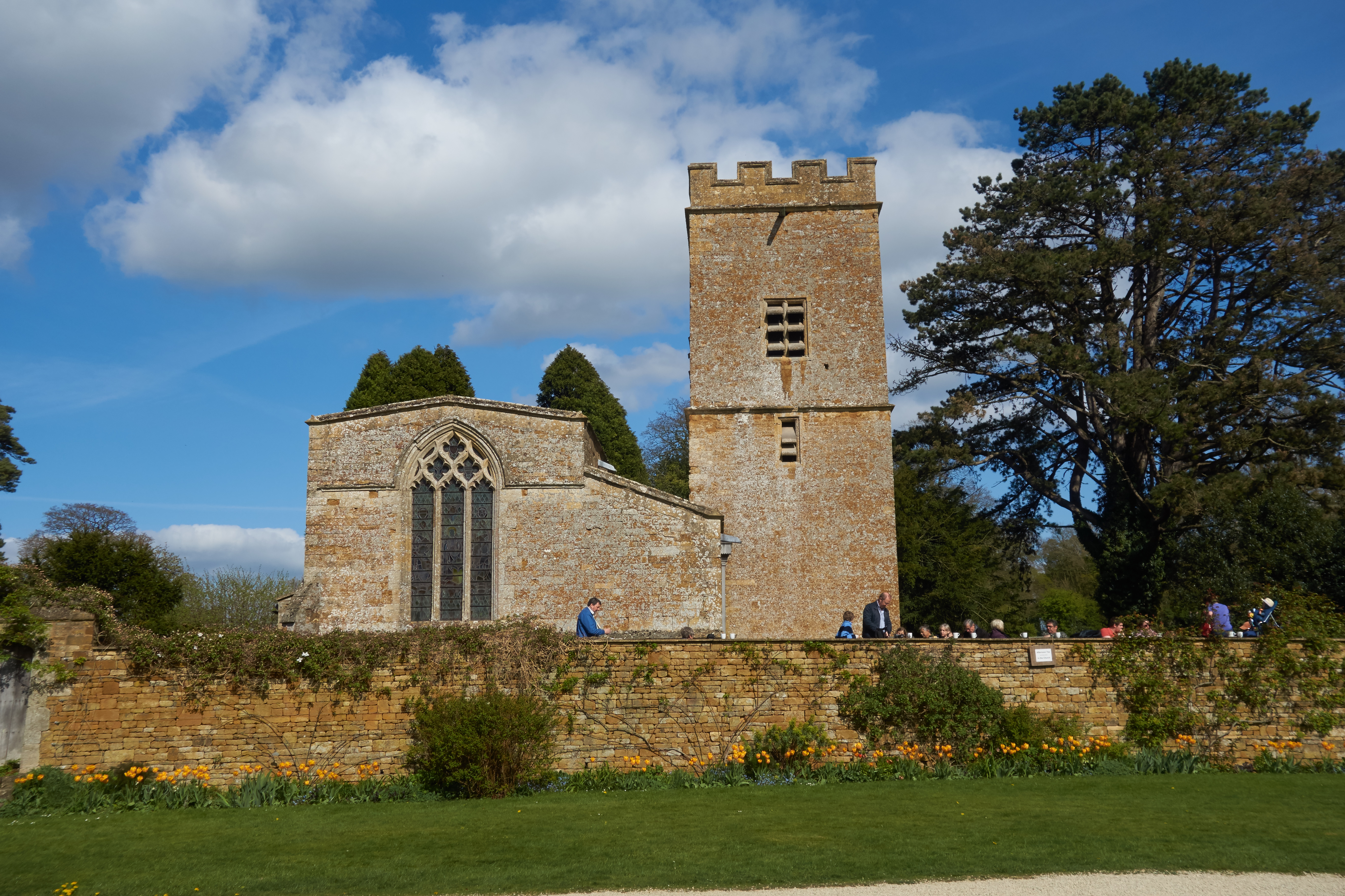
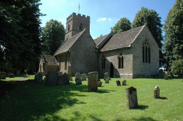
St Mary's Church, Chastleton
The Church of St Mary the Virgin is the Church of England parish church of Chastleton, Oxfordshire, England. It is a parish church in the parish of Little...

Moreton Rangers F.C.
Moreton Rangers Football Club is a football club based in Moreton-in-Marsh, Gloucestershire, England. Affiliated in the Gloucestershire County Football...
Fire Service College
The Fire Service College is responsible for providing leadership, management and advanced operational training courses for senior fire officers from the...
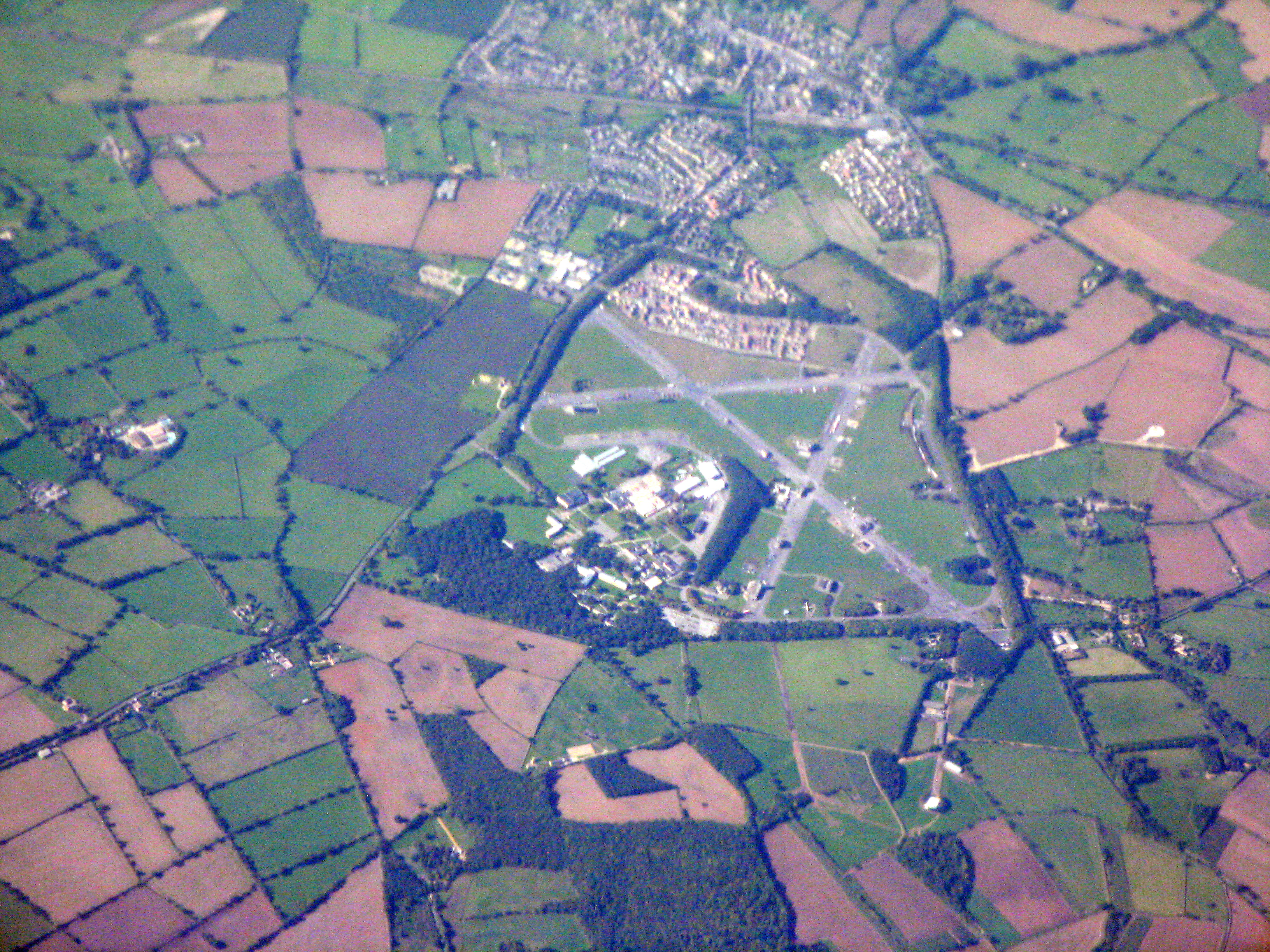
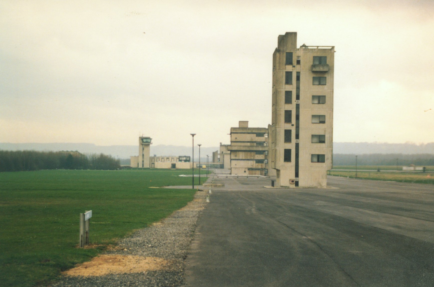
RAF Moreton-in-Marsh
RAF Moreton-in-Marsh was a Royal Air Force station near Moreton-in-Marsh, Gloucestershire. It was opened in November 1940 with three concrete and tarmac...
Nearby Amenities
Located within 500m of 51.971003,-1.6657024Have you been to Stuphill Covert?
Leave your review of Stuphill Covert below (or comments, questions and feedback).