Broughton Copse

Wood, Forest in Oxfordshire West Oxfordshire

England

Broughton Copse

Village sign in Filkins Village sign entering Filkins from the north.
Village sign in Filkins Credit: Kevin Pearson

Broughton Copse, located in Oxfordshire, is a captivating woodland area that showcases the natural beauty of the region. Spanning over a vast area, this copse is a haven for nature enthusiasts and those seeking tranquility amidst the bustling city life.

The copse is primarily composed of dense woods and forests, offering a diverse range of flora and fauna. Towering oak, beech, and chestnut trees dominate the landscape, creating a picturesque setting that changes with the seasons. The vibrant greens of spring and summer give way to the warm hues of autumn, and the bare branches in winter create a serene atmosphere.

Broughton Copse is home to a wide variety of wildlife, making it a popular spot for birdwatchers and nature photographers. Visitors may catch glimpses of colorful songbirds, majestic raptors, and elusive woodland creatures such as deer, foxes, and badgers. The copse also hosts a rich diversity of plant life, including wildflowers, ferns, and mosses, adding to its natural charm.

Several well-maintained trails wind through the copse, allowing visitors to explore its beauty at their own pace. These paths offer an opportunity to immerse oneself in the sights, sounds, and scents of the woodland, making it an ideal destination for peaceful walks or invigorating hikes.

Broughton Copse is not only a haven for nature lovers but also serves as an important ecological site. Its preservation and conservation efforts ensure the protection of its unique ecosystem, contributing to the overall biodiversity of Oxfordshire.

Overall, Broughton Copse is a captivating woodland that offers a serene escape from the urban environment. Its natural beauty, diverse wildlife, and well-maintained trails make it a must-visit destination for those seeking a connection with nature.

If you have any feedback on the listing, please let us know in the comments section below.

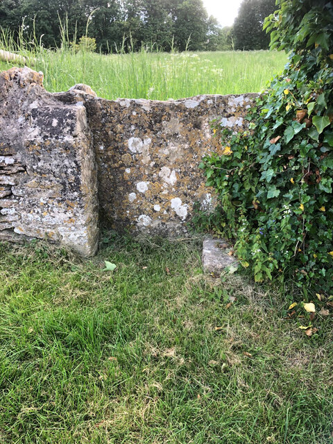
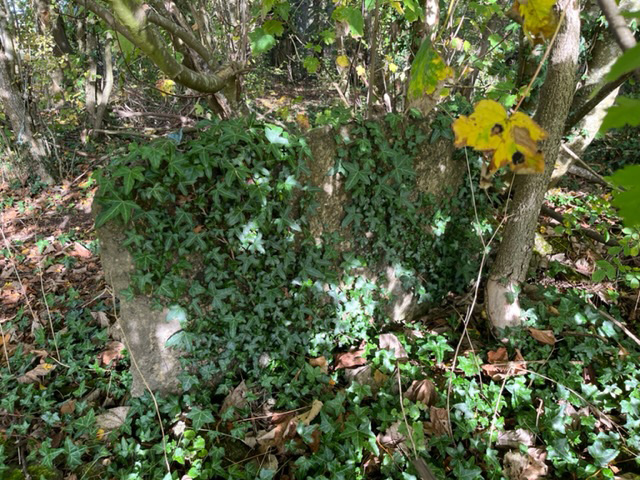
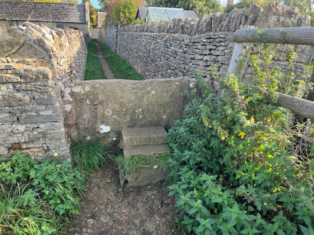
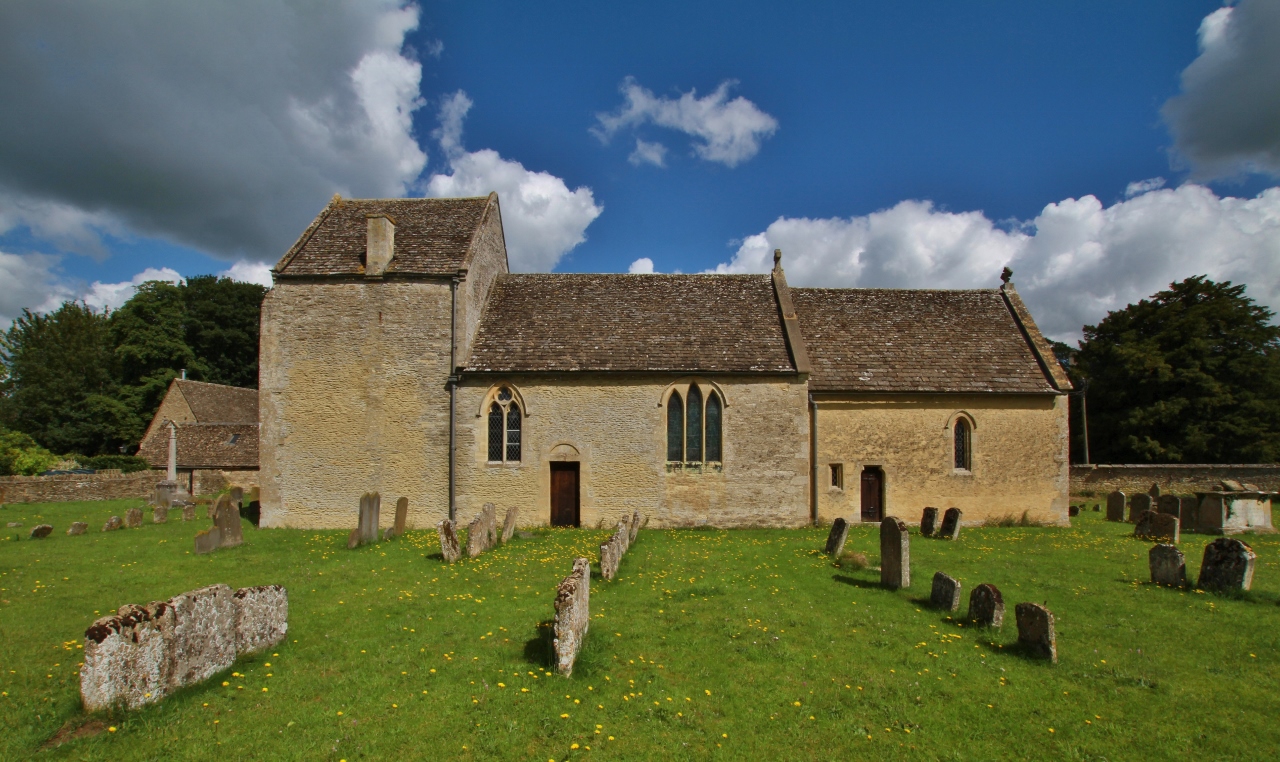
Broughton Copse Images

Images are sourced within 2km of 51.727399/-1.6707151 or Grid Reference SP2203. Thanks to Geograph Open Source API. All images are credited.

Village sign in Filkins Village sign entering Filkins from the north.
Village sign in Filkins
Village sign entering Filkins from the north.
Stone Stile, Broughton Poggs In the village of Filkins, just NE of Oxfordshire footpath 212/8/20, looking SW over to the footpath. The view NE is <a href="https://www.geograph.org.uk/photo/7226679">SP2304 : Stone Stile, Broughton Poggs</a>.
Stone Stile, Broughton Poggs
In the village of Filkins, just NE of Oxfordshire footpath 212/8/20, looking SW over to the footpath. The view NE is SP2304 : Stone Stile, Broughton Poggs.
Stone Stile, Broughton Poggs In the village of Filkins, just NE of Oxfordshire footpath 212/8/20, looking NE from the footpath. The view SW is <a href="https://www.geograph.org.uk/photo/7226678">SP2304 : Stone Stile, Broughton Poggs</a>.
Stone Stile, Broughton Poggs
In the village of Filkins, just NE of Oxfordshire footpath 212/8/20, looking NE from the footpath. The view SW is SP2304 : Stone Stile, Broughton Poggs.
Stone Stile, Broughton Poggs In the village of Filkins, on Oxfordshire footpath 212/8/20 as it exits the alley adjacent to Well Cottage onto a field. Looking to the field, the alternative view looking into the alley is <a href="https://www.geograph.org.uk/photo/7316852">SP2304 : Stone Stile, Broughton Poggs</a>.
Stone Stile, Broughton Poggs
In the village of Filkins, on Oxfordshire footpath 212/8/20 as it exits the alley adjacent to Well Cottage onto a field. Looking to the field, the alternative view looking into the alley is SP2304 : Stone Stile, Broughton Poggs.
Stone Stile, Broughton Poggs GS6003 Looking SW off Rouses Lane, Filkins village. Not on a recognised footpath. The stile is not on a recognised footpath, though the desire lines visible on satellite images show it is well used. This view looks from the road, the view looking back is <a href="https://www.geograph.org.uk/photo/7316779">SP2304 : Stone Stile, Broughton Poggs GS6003</a>.
Stone Stile, Broughton Poggs GS6003
Looking SW off Rouses Lane, Filkins village. Not on a recognised footpath. The stile is not on a recognised footpath, though the desire lines visible on satellite images show it is well used. This view looks from the road, the view looking back is SP2304 : Stone Stile, Broughton Poggs GS6003.
Stone Stile, Broughton Poggs GS6003 Looking SW off Rouses Lane (Oxfordshire footpath 212/9/30), Filkins village. The stile is not on a recognised footpath, though the desire lines visible on satellite images show it is well used. This view looks to the road, the view looking back is <a href="https://www.geograph.org.uk/photo/7226716">SP2304 : Stone Stile, Broughton Poggs GS6003</a>.
Stone Stile, Broughton Poggs GS6003
Looking SW off Rouses Lane (Oxfordshire footpath 212/9/30), Filkins village. The stile is not on a recognised footpath, though the desire lines visible on satellite images show it is well used. This view looks to the road, the view looking back is SP2304 : Stone Stile, Broughton Poggs GS6003.
Stone Stile, Broughton Poggs On Oxfordshire footpath 212/9/30, in the Rouses Lane Woods. The view from the other side is <a href="https://www.geograph.org.uk/photo/7316808">SP2304 : Stone Stile, Broughton Poggs</a>.
Stone Stile, Broughton Poggs
On Oxfordshire footpath 212/9/30, in the Rouses Lane Woods. The view from the other side is SP2304 : Stone Stile, Broughton Poggs.
Stone Stile, Broughton Poggs On Oxfordshire footpath 212/9/30, in the Rouses Lane Woods. The view from the other side is <a href="https://www.geograph.org.uk/photo/7316806">SP2304 : Stone Stile, Broughton Poggs</a>.
Stone Stile, Broughton Poggs
On Oxfordshire footpath 212/9/30, in the Rouses Lane Woods. The view from the other side is SP2304 : Stone Stile, Broughton Poggs.
Stone Stile, Broughton Poggs A little private step stile as a shortcut to the owner's drive.
Stone Stile, Broughton Poggs
A little private step stile as a shortcut to the owner's drive.
Stone Stile, Broughton Poggs In the village of Filkins, on Oxfordshire footpath 212/8/20 as it exits the alley adjacent to Well Cottage onto a field. This is looking down the alley, the view to the field is <a href="https://www.geograph.org.uk/photo/7226703">SP2304 : Stone Stile, Broughton Poggs</a>.
Stone Stile, Broughton Poggs
In the village of Filkins, on Oxfordshire footpath 212/8/20 as it exits the alley adjacent to Well Cottage onto a field. This is looking down the alley, the view to the field is SP2304 : Stone Stile, Broughton Poggs.
St Peter's Church, Filkins
St Margaret's Church, Little Faringdon
Filkins swimming pool Unheated outdoor pool, therefore tending to be COLD! Unoccupied on a day of sunshine and heavy showers in mid June.
Filkins swimming pool
Unheated outdoor pool, therefore tending to be COLD! Unoccupied on a day of sunshine and heavy showers in mid June.
The road through Little Faringdon
Little Faringdon church, in late October
Road to Langford Downs Farm
The Coach House at the end of the road, Broughton Poggs
St Peter's church, Broughton Poggs As the web site says "The church at Broughton Poggs takes some finding, standing as it does beyond a farmyard and reached by a lane". Worth the visit though. <span class="nowrap"><a title="http://www.filkins.org.uk/church_st_peters_bp.html" rel="nofollow ugc noopener" href="http://www.filkins.org.uk/church_st_peters_bp.html">Link</a><img style="margin-left:2px;" alt="External link" title="External link - shift click to open in new window" src="https://s1.geograph.org.uk/img/external.png" width="10" height="10"/></span>
St Peter's church, Broughton Poggs
As the web site says "The church at Broughton Poggs takes some finding, standing as it does beyond a farmyard and reached by a lane". Worth the visit though. LinkExternal link
Show me another place!

Broughton Copse is located at Grid Ref: SP2203 (Lat: 51.727399, Lng: -1.6707151)

Administrative County: Oxfordshire

District: West Oxfordshire

Police Authority: Thames Valley

What 3 Words

///tilting.documents.enjoys. Near Lechlade, Gloucestershire

Nearby Locations

Broughton Copse

Related Wikis

Broughton Poggs

Broughton Poggs is a village in the civil parish of Filkins and Broughton Poggs in West Oxfordshire. Broughton Poggs is 3 miles (5 km) southwest of Carterton...

Filkins and Broughton Poggs

Filkins and Broughton Poggs is a civil parish in West Oxfordshire, on the Oxfordshire county boundary with Gloucestershire. The parish includes the villages...

Swinford Museum

The Swinford Museum is a small museum in the village of Filkins, west Oxfordshire, England.The collection covers local domestic, agricultural, trade and...

Filkins

For people with the surname, see Filkins (surname). Filkins is a village in the civil parish of Filkins and Broughton Poggs, about 2.5 miles (4 km) southwest...

Little Faringdon

Little Faringdon is a village and civil parish in West Oxfordshire, about 1 mile (1.6 km) north of Lechlade in neighbouring Gloucestershire. The 2001 Census...

Langford, Oxfordshire

Langford is a village and civil parish in West Oxfordshire, about 3 miles (5 km) northeast of Lechlade in neighbouring Gloucestershire. The 2011 Census...

St Matthew's Church, Langford

The Parish Church of Saint Matthew, Langford is the Church of England parish church of Langford, a village in West Oxfordshire about 3 miles (5 km) northeast...

Broadwell, Oxfordshire

Broadwell is a village and civil parish about 2 miles (3 km) south-west of Carterton in West Oxfordshire. The 2011 Census recorded the parish's population...

Nearby Amenities

Located within 500m of 51.727399,-1.6707151
Power: tower
Lat/Long: 51.7252694/-1.6682378
Power: tower
Lat/Long: 51.7276597/-1.6728186
Material: wood
Power: pole
Source: Bing
Lat/Long: 51.7242519/-1.6722526
Material: wood
Power: pole
Source: Bing
Lat/Long: 51.7239214/-1.6713648
Material: wood
Power: pole
Source: Bing
Lat/Long: 51.7304871/-1.6729526
Material: wood
Power: pole
Source: Bing
Lat/Long: 51.7246059/-1.673178
Material: wood
Power: pole
Source: Bing
Lat/Long: 51.7317131/-1.670721
Material: wood
Power: pole
Source: Bing
Lat/Long: 51.7249187/-1.6741087
Material: wood
Power: pole
Source: Bing
Lat/Long: 51.7298974/-1.6740631
Material: wood
Power: pole
Source: Bing
Lat/Long: 51.7232119/-1.6694765
The data included in this document is from www.openstreetmap.org. The data is made available under ODbL.

Have you been to Broughton Copse?

Leave your review of Broughton Copse below (or comments, questions and feedback).