Barnclose Wood

Wood, Forest in Derbyshire Derbyshire Dales

England

Barnclose Wood

Ruined farm building near Pilsley This view has been captured by several geographers over the years: the earliest example I can find was in 2007 <a href="https://www.geograph.org.uk/photo/580707">SK2371 : Beyond their useful life</a> and little has changed other than a dead tree has been felled.
Ruined farm building near Pilsley Credit: Graham Hogg

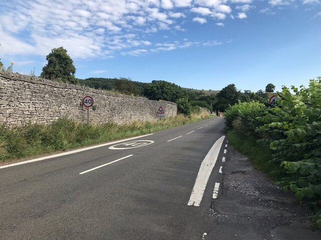
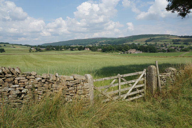
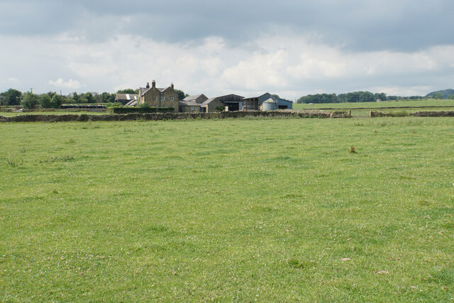
Barnclose Wood is a picturesque woodland located in Derbyshire, England. Covering an area of approximately 100 acres, it is renowned for its natural beauty and diverse ecosystem. The wood is predominantly composed of deciduous trees, including oak, beech, and birch, which provide a stunning display of colors during the autumn season.

The woodland offers a tranquil escape from the bustling city life, providing a haven for wildlife and nature enthusiasts alike. Visitors can explore the numerous walking trails that wind through the wood, allowing them to immerse themselves in the peaceful surroundings. The forest floor is adorned with a variety of wildflowers, creating a vibrant tapestry of colors in the spring and summer months.

Barnclose Wood is home to a wide range of wildlife, including deer, squirrels, and a variety of bird species. Birdwatchers can spot woodpeckers, owls, and other woodland birds within its boundaries. The wood also serves as a vital habitat for several protected species, such as bats and dormice.

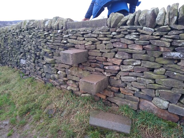
In addition to its natural splendor, the wood has historical significance. It is believed to have been part of an ancient hunting ground and has remnants of old boundary walls and stone structures. These relics provide a glimpse into the area's past and add a sense of intrigue to the woodland.

Overall, Barnclose Wood is a captivating destination for nature lovers, offering a peaceful retreat and a chance to connect with the natural world. Its scenic beauty, diverse flora and fauna, and rich history make it a must-visit location in Derbyshire.

If you have any feedback on the listing, please let us know in the comments section below.

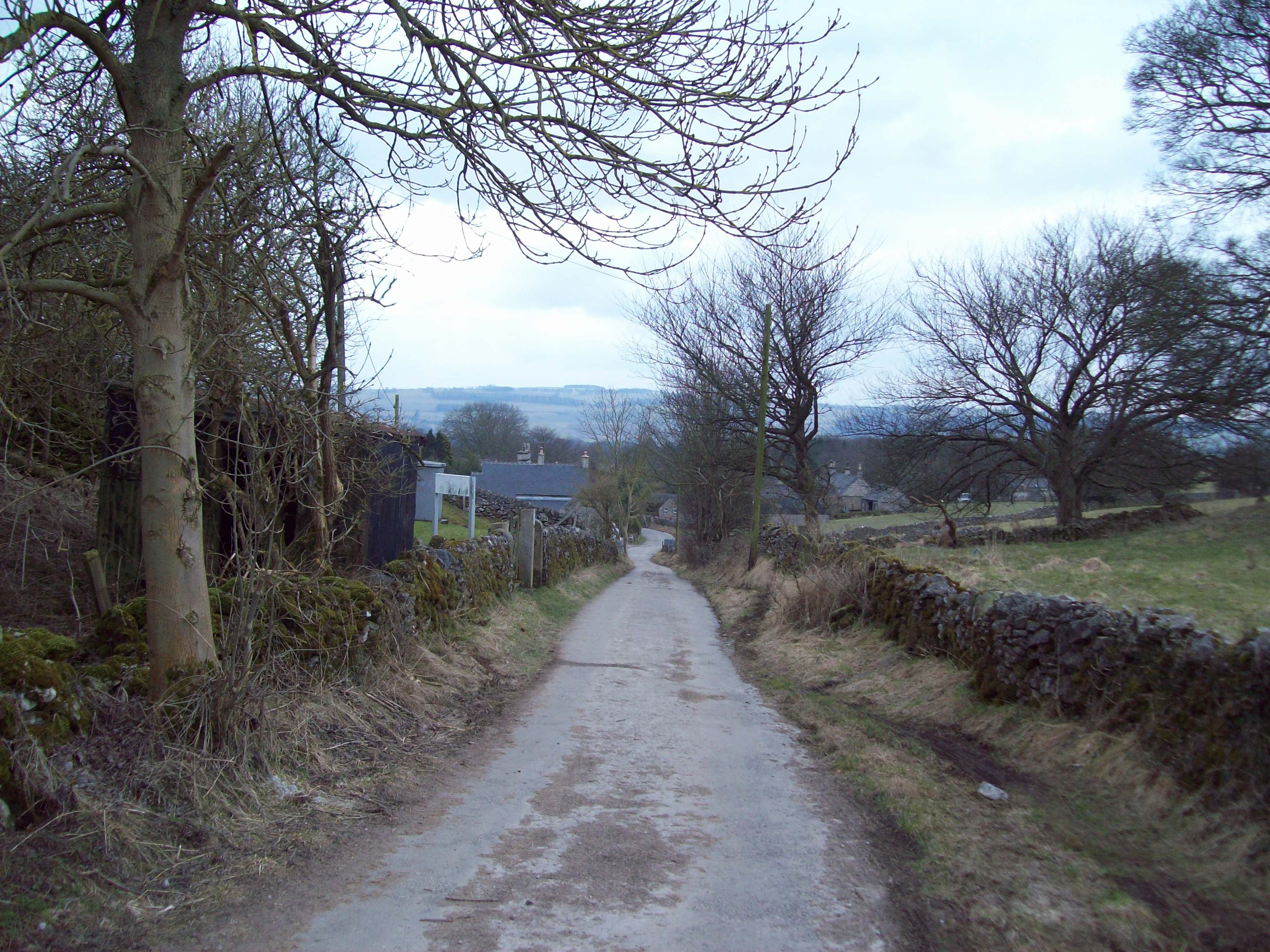
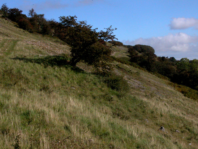
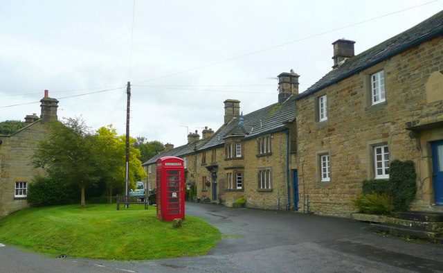
Barnclose Wood Images

Images are sourced within 2km of 53.248382/-1.6625977 or Grid Reference SK2272. Thanks to Geograph Open Source API. All images are credited.

Ruined farm building near Pilsley This view has been captured by several geographers over the years: the earliest example I can find was in 2007 <a href="https://www.geograph.org.uk/photo/580707">SK2371 : Beyond their useful life</a> and little has changed other than a dead tree has been felled.
Ruined farm building near Pilsley
This view has been captured by several geographers over the years: the earliest example I can find was in 2007 SK2371 : Beyond their useful life and little has changed other than a dead tree has been felled.
The B6001 Between Bakewell and Calver.  Here a 40 mph speed limit for the village of Hassop starts.
The B6001
Between Bakewell and Calver. Here a 40 mph speed limit for the village of Hassop starts.
The Eyre Arms The sign on the building says Eyre Arms whereas the one across the road says the Old Eyre Alms <a href="https://www.geograph.org.uk/photo/4888611">SK2272 : The Old Eyre Arms, Hassop</a> which would differentiate it from the other Eyre Arms a few miles away in Calver <a href="https://www.geograph.org.uk/photo/3614234">SK2374 : An Eyre of Importance (8)</a>.  Take your pick!
The Eyre Arms
The sign on the building says Eyre Arms whereas the one across the road says the Old Eyre Alms SK2272 : The Old Eyre Arms, Hassop which would differentiate it from the other Eyre Arms a few miles away in Calver SK2374 : An Eyre of Importance (8). Take your pick!
The sign of The Eyre Arms See <a href="https://www.geograph.org.uk/photo/6922970">SK2272 : The Eyre Arms</a>
The sign of The Eyre Arms
Baslow, A619, Thirteen Bends BM on post

SK 2420 7155
Baslow, A619, Thirteen Bends
BM on post SK 2420 7155
Baslow, A619, Thirteen Bends OS Rivet on gatepost 

SK 2392 7152
Baslow, A619, Thirteen Bends
OS Rivet on gatepost SK 2392 7152
Field entrance near Baslow Quite prominent behind the gate is Bubnell Hall. On the hills behind are Baslow Edge and Curbar Edge.
Field entrance near Baslow
Quite prominent behind the gate is Bubnell Hall. On the hills behind are Baslow Edge and Curbar Edge.
Cattle lined up above Rymas Brook Almost looking like a welcoming party, but they weren't bothered by my presence. Both Rymas Brook and the A619 run in the bottom of the valley behind.
Cattle lined up above Rymas Brook
Almost looking like a welcoming party, but they weren't bothered by my presence. Both Rymas Brook and the A619 run in the bottom of the valley behind.
Bubnell Cliff Farm Viewed from a nearby footpath.
Bubnell Cliff Farm
Viewed from a nearby footpath.
Footpath to Baslow The path has to cross Rymas Brook which involves a fairly abrupt down and up. Baslow can be seen straight ahead.
Footpath to Baslow
The path has to cross Rymas Brook which involves a fairly abrupt down and up. Baslow can be seen straight ahead.
Pilsley A view of the village from a footpath coming from Baslow.
Pilsley
A view of the village from a footpath coming from Baslow.
Hillside above Rymas Brook A view from a bridleway near Pilsley which drops into the valley. Longstone Edge is seen in the background.
Hillside above Rymas Brook
A view from a bridleway near Pilsley which drops into the valley. Longstone Edge is seen in the background.
High Street, Pilsley The top of the village where the street degenerates into a bridleway.
High Street, Pilsley
The top of the village where the street degenerates into a bridleway.
Ruined barn near Pilsley No longer required for the surrounding grazing.
Ruined barn near Pilsley
No longer required for the surrounding grazing.
Footpath junction near Pilsley
Steps over stone wall Blocky concrete steps built into a stone wall to allow people to climb over it. On the corner of a field near Baslow.
Steps over stone wall
Blocky concrete steps built into a stone wall to allow people to climb over it. On the corner of a field near Baslow.
Old milepost All that is left of the metal Derbyshire bobbin milepost on the 'Thirteen Bends' on the A619.   It was leaning <a href="https://www.geograph.org.uk/photo/5623769">SK2371 : Old Milepost by the A619, north west of Pilsley</a> but now has been the victim of a careless driver.
Old milepost
All that is left of the metal Derbyshire bobbin milepost on the 'Thirteen Bends' on the A619. It was leaning SK2371 : Old Milepost by the A619, north west of Pilsley but now has been the victim of a careless driver.
Farmland south of Longstone Edge
Show me another place!

Barnclose Wood is located at Grid Ref: SK2272 (Lat: 53.248382, Lng: -1.6625977)

Administrative County: Derbyshire

District: Derbyshire Dales

Police Authority: Derbyshire

What 3 Words

///mistaken.private.encodes. Near Baslow, Derbyshire
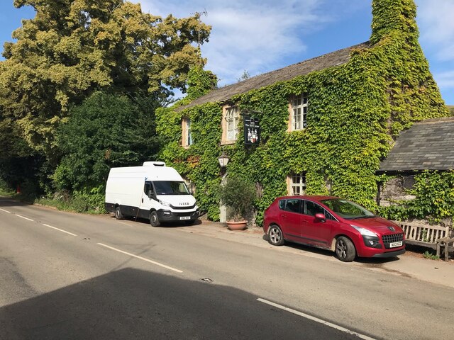
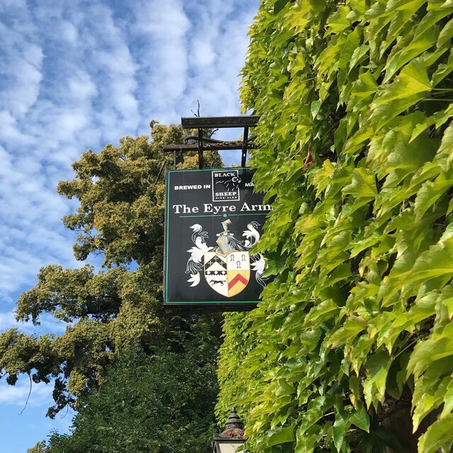
Related Wikis

Church of All Saints, Hassop

The Church of All Saints is a Roman Catholic parish church in Hassop, Derbyshire. Built in 1816–17, the architect was Joseph Ireland. It is a Grade...

Hassop

Hassop is a village in the local government district of Derbyshire Dales in Derbyshire, England. It is in the civil parish of Great Longstone It developed...

Hassop Hall

Hassop Hall is a 17th-century country house near Bakewell, Derbyshire, which was operated as a hotel until it closed on 29 September 2019. It is a Grade...

Rowland, Derbyshire

Rowland is a village and a civil parish in the Derbyshire Dales District, in the English county of Derbyshire. It is near the larger village of Great Longstone...

Longstone Edge

Longstone Edge is a limestone ridge in the Peak District National Park, in Derbyshire, England. Longstone Edge is immediately north of the village of Great...

Pilsley, Derbyshire Dales

Pilsley is a small village and civil parish in Derbyshire, England. At the 2011 Census the population of the civil parish was 152. It is close to Chatsworth...

Hassop railway station

Hassop railway station was a station situated about two miles from the village of Hassop in the Peak District of Derbyshire. It was opened in 1862 by the...

Coombs Dale

Coombs Dale is a steep-sided, dry carboniferous limestone valley in the Derbyshire Peak District of England. The village of Calver lies about 1 km to the...

Nearby Amenities

Located within 500m of 53.248382,-1.6625977
Hassop
Is In: Derbyshire, England, UK
Place: village
Wikidata: Q2625516
Wikipedia: en:Hassop
Lat/Long: 53.2479586/-1.6653412
Addr City: Bakewell
Addr Housename: Hassop Hall
Addr Postcode: DE45 1NS
Addr Street: Longreave Lane
Alt Name: Hassop Hall Hotel
Disused Tourism: hotel
Old Fhrs Id: 258964
Old Name: Hassop Hall
Old Website: https://www.hassophallhotel.co.uk/
Source Addr: FHRS Open Data
Lat/Long: 53.2465025/-1.6688401
Post Box
Collection Times: Mo-Fr 09:00; Sa 07:00
Operator: Royal Mail
Post Box Type: lamp
Ref: DE45 1287D
Royal Cypher: EIIR
Lat/Long: 53.2473292/-1.6662917
Bench
Ele: 171.4794922
Lat/Long: 53.2473118/-1.6664039
Description: historic trough
Historic: yes
Lat/Long: 53.2472672/-1.6685598
Natural: spring
Lat/Long: 53.2472755/-1.6685644
Bus Stop
Hassop (Eyre Arms)
Bus: yes
Naptan AtcoCode: 1000DHBE3743
Naptan NaptanCode: dbsgtjwg
Public Transport: platform
Lat/Long: 53.2475198/-1.6652909
Hassop (Eyre Arms)
Bus: yes
Public Transport: stop_position
Lat/Long: 53.2474757/-1.6652616
Defibrillator
Access: yes
Booth: K6
Check Date: 2023-03-09
Covered: booth
Defibrillator Location: In old telephone box.
Disused Amenity: telephone
Emergency: defibrillator
Indoor: no
Man Made: telephone_box
Old Phone: +44 1629 640311
Opening Hours: 24/7
Ref GB The Circuit: 5FE190CD-CD5E-4154-8ACA-312C28DE673C
Lat/Long: 53.2475412/-1.6652051
Give Way
Direction: forward
Lat/Long: 53.2472304/-1.6665412
Give Way
Direction: forward
Lat/Long: 53.2472508/-1.666266
Give Way
Direction: backward
Lat/Long: 53.2470942/-1.6663917
Give Way
Direction: forward
Lat/Long: 53.2479139/-1.6638571
Watering Place
Lat/Long: 53.2472667/-1.6685687
The data included in this document is from www.openstreetmap.org. The data is made available under ODbL.

Have you been to Barnclose Wood?

Leave your review of Barnclose Wood below (or comments, questions and feedback).