Bolehill Wood

Wood, Forest in Derbyshire Derbyshire Dales

England

Bolehill Wood

Footpath steps climbing out of Hurst Clough This is the start of an old field path into Bamford. When Bamford Filters waterworks was constructed, the path had to be diverted around the perimeter. The area is also much more wooded than it once was.
Footpath steps climbing out of Hurst Clough Credit: Ian Calderwood

Bolehill Wood is a charming woodland located in Derbyshire, England. Covering an area of approximately 20 hectares, this forest is situated near the town of Wirksworth, just a few miles away from the Peak District National Park. The wood is known for its scenic beauty and tranquil atmosphere, making it a popular destination for nature enthusiasts and hikers.

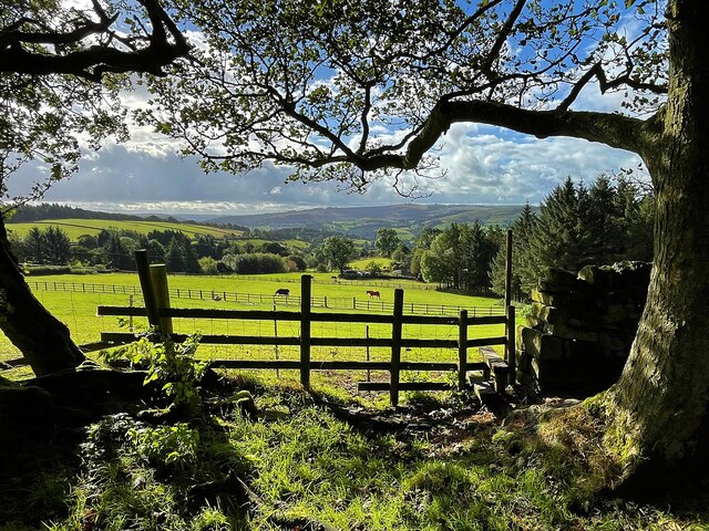
Bolehill Wood is primarily composed of deciduous trees, such as oak, ash, and beech, which create a vibrant display of colors during the autumn season. The forest floor is covered in a carpet of wildflowers, including bluebells and primroses, adding to its natural charm. The diverse vegetation provides a habitat for various species of birds, butterflies, and small mammals, making it an ideal spot for wildlife observation.

The woodland offers a network of well-maintained footpaths and trails, allowing visitors to explore its natural splendor at their own pace. There are also designated picnic areas and benches along the trails, providing opportunities for visitors to relax and enjoy a picnic amidst the peaceful surroundings. Additionally, the wood has a small stream running through it, adding to the tranquility of the environment.

Bolehill Wood is easily accessible, with a car park located nearby for visitors' convenience. The wood is open year-round and is free to enter, making it a popular destination for both locals and tourists. Whether one is seeking a peaceful stroll, a family picnic, or an opportunity to immerse oneself in nature, Bolehill Wood offers a serene and picturesque setting for all.

If you have any feedback on the listing, please let us know in the comments section below.

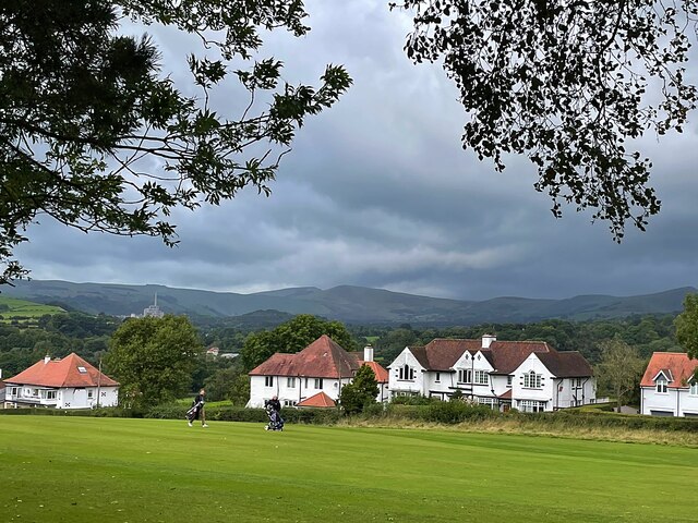
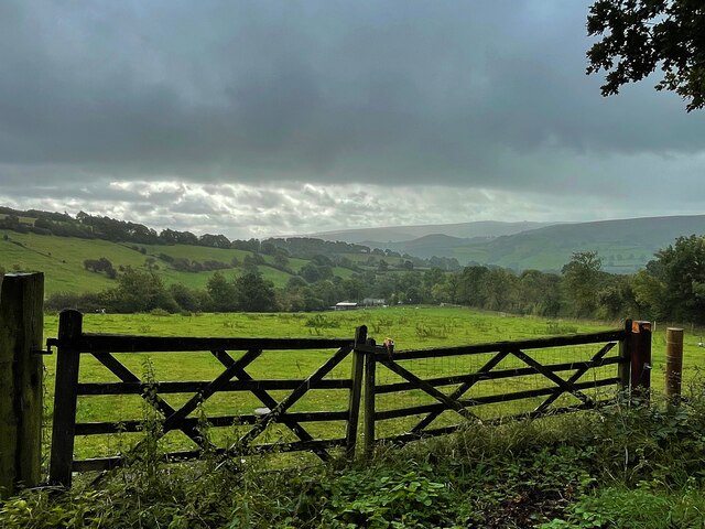
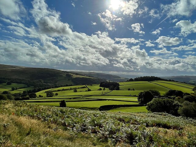
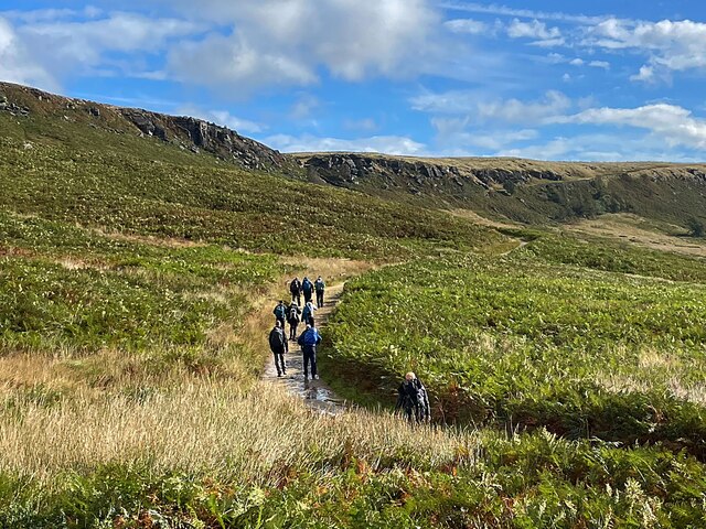
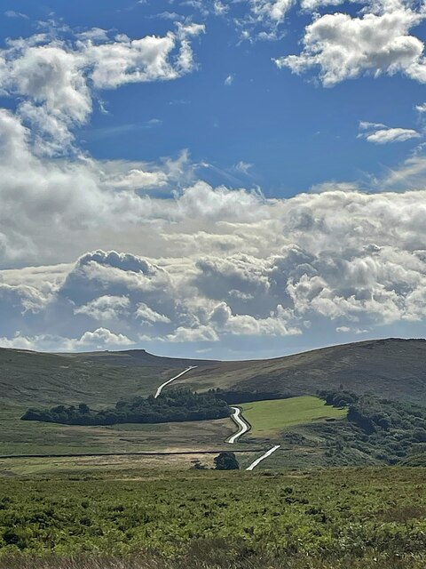
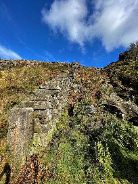
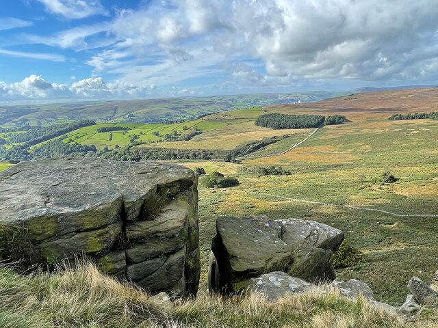
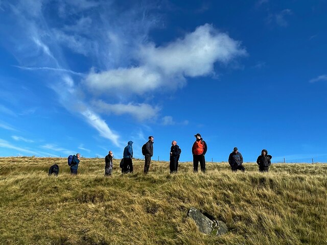
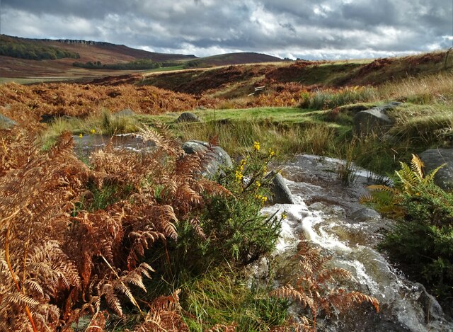
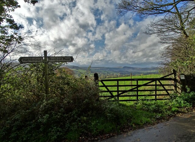
Bolehill Wood Images

Images are sourced within 2km of 53.351042/-1.6686386 or Grid Reference SK2283. Thanks to Geograph Open Source API. All images are credited.

Footpath steps climbing out of Hurst Clough This is the start of an old field path into Bamford. When Bamford Filters waterworks was constructed, the path had to be diverted around the perimeter. The area is also much more wooded than it once was.
Footpath steps climbing out of Hurst Clough
This is the start of an old field path into Bamford. When Bamford Filters waterworks was constructed, the path had to be diverted around the perimeter. The area is also much more wooded than it once was.
Derwent Aqueduct access gates and discharge well The Derwent Aqueduct was laid to bring water from the Derwent to Derby, Nottingham and Leicester. Its line is marked by distinctive access gates, like this one, which gives access to a discharge well. There is second gate, half buried in the undergrowth, in the background.
Derwent Aqueduct access gates and discharge well
The Derwent Aqueduct was laid to bring water from the Derwent to Derby, Nottingham and Leicester. Its line is marked by distinctive access gates, like this one, which gives access to a discharge well. There is second gate, half buried in the undergrowth, in the background.
Houses on Saltergate Lane Viewed across Sickleholme Golf Course
Houses on Saltergate Lane
Viewed across Sickleholme Golf Course
Hirstclough Lane A steep byway open to all traffic to the east of Bamford
Hirstclough Lane
A steep byway open to all traffic to the east of Bamford
Cloudy sky over the Derwent Valley From Hurstclough Lane. Fortunately the grey clouds passed without depositing too much rain.
Cloudy sky over the Derwent Valley
From Hurstclough Lane. Fortunately the grey clouds passed without depositing too much rain.
Looking over the Derwent Valley From a public footpath in Bolehill Wood.
Looking over the Derwent Valley
From a public footpath in Bolehill Wood.
Cloudy blue sky over green fields and trees The glorious view to the east from Bole Hill
Cloudy blue sky over green fields and trees
The glorious view to the east from Bole Hill
Walking up to Stanage Edge This path provides a gentle climb to the edge.
Walking up to Stanage Edge
This path provides a gentle climb to the edge.
View from a path to Stanage Edge The minor road runs over Cattis-side Moor between Stanage Edge and Carrhead Rocks.
View from a path to Stanage Edge
The minor road runs over Cattis-side Moor between Stanage Edge and Carrhead Rocks.
Wall and stream below Stanage Edge
The view from Stanage Edge Looking over Bamford Moor to the Hope Valley.
The view from Stanage Edge
Looking over Bamford Moor to the Hope Valley.
On Stanage Edge A group of walkers are admiring the view.
On Stanage Edge
A group of walkers are admiring the view.
Hood Brook draining through Sheepwash Bank
At the junction of Birley Lane and Coggers Lane Looking towards Hope Cement Works in The Hope Valley.
At the junction of Birley Lane and Coggers Lane
Looking towards Hope Cement Works in The Hope Valley.
Hathersage, Cloggers Lane This map reference, according to the OS benchmark database, is the location of a gatepost with a cutmark. Today the field wall has been rebuilt and a new bench seat positioned with a splendid view down the valley. The seat is built on 2 stone supporting blocks. Is this horizontal cut to the rear of the block the remnants of the cutmark?
Hathersage, Cloggers Lane
This map reference, according to the OS benchmark database, is the location of a gatepost with a cutmark. Today the field wall has been rebuilt and a new bench seat positioned with a splendid view down the valley. The seat is built on 2 stone supporting blocks. Is this horizontal cut to the rear of the block the remnants of the cutmark?
Hathersage, Coggers Lane This map reference, according to the OS benchmark database, is the location of a gatepost with a cutmark. Today the field wall has been rebuilt and a new bench seat positioned with a splendid view down the valley. The seat is built on 2 stone supporting blocks. Are the blocks the remnants of the old gateposts?
Hathersage, Coggers Lane
This map reference, according to the OS benchmark database, is the location of a gatepost with a cutmark. Today the field wall has been rebuilt and a new bench seat positioned with a splendid view down the valley. The seat is built on 2 stone supporting blocks. Are the blocks the remnants of the old gateposts?
Bamford Moor
Bamford Moor
Moscar Moor
Moscar Moor
Show me another place!

Bolehill Wood is located at Grid Ref: SK2283 (Lat: 53.351042, Lng: -1.6686386)

Administrative County: Derbyshire

District: Derbyshire Dales

Police Authority: Derbyshire

What 3 Words

///limo.secures.chariots. Near Hathersage, Derbyshire

Nearby Locations

Outseats Bolehill Wood

Related Wikis

Bamford

Bamford is a village in the Peak District, Derbyshire, England, close to the River Derwent. To the north-east is Bamford Edge, and to the north-west the...

Our Lady of Sorrows Church, Bamford

Our Lady of Sorrows Church, Bamford is a Roman Catholic church in the village of Bamford, Derbyshire. The church dates back to the mid-19th century and...

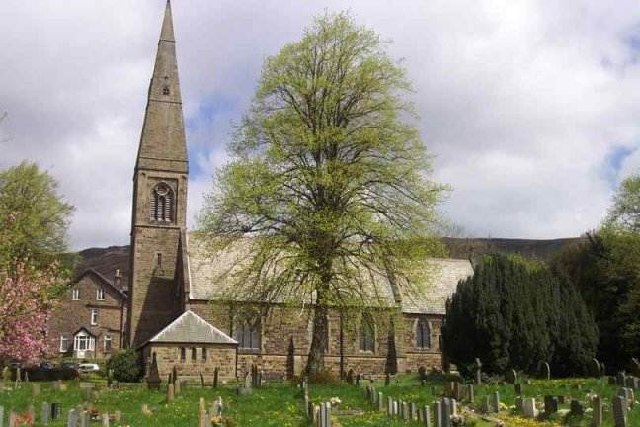
St John the Baptist's Church, Bamford

St John the Baptist church is a C of E church in Bamford in the Hope Valley, Derbyshire, England. == History == The building that is seen today is largely...

Hood Brook

Hood Brook is a stream in the Derbyshire Peak District, originating near Stanage Edge, close to Robin Hoods Cave. == Background == Hood Brook flows south...

Nearby Amenities

Located within 500m of 53.351042,-1.6686386
Barrier: stile
Material: stone
Source: survey;gps
Stile: stepover
Lat/Long: 53.3483949/-1.6647929
Barrier: stile
Material: wood
Source: survey;gps
Stile: stepover
Lat/Long: 53.3493331/-1.666113
Barrier: stile
Step Count: 2
Stile: stepover
Lat/Long: 53.347844/-1.6660053
Barrier: stile
Material: wood
Source: survey;gps
Stile: stepover
Lat/Long: 53.3486131/-1.6660077
Barrier: stile
Material: wood
Source: survey;gps
Stile: stepover
Lat/Long: 53.3498218/-1.6663487
Barrier: stile
Foot: yes
Material: wood
Stile: stepover
Lat/Long: 53.3473185/-1.665927
Barrier: stile
Material: wood
Stile: stepover
Lat/Long: 53.3526348/-1.6707066
Barrier: stile
Material: wood
Stile: stepover
Lat/Long: 53.3534723/-1.6731229
The data included in this document is from www.openstreetmap.org. The data is made available under ODbL.

Have you been to Bolehill Wood?

Leave your review of Bolehill Wood below (or comments, questions and feedback).