Birch Wood
Wood, Forest in Durham
England
Birch Wood
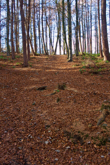
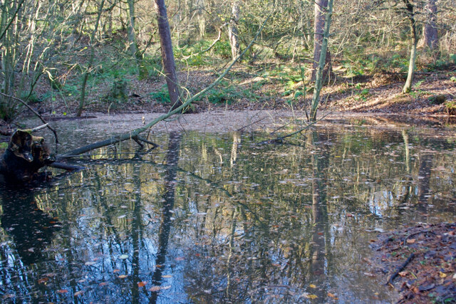
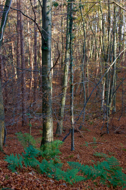
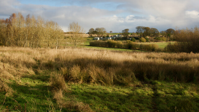
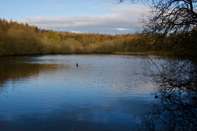
Birch Wood is a picturesque forest located in the county of Durham, England. Spread across an area of approximately 100 hectares, this woodland is a sanctuary for nature lovers and outdoor enthusiasts alike. The wood is primarily composed of birch trees, which dominate the landscape with their slender trunks and distinctive white bark.
The forest is renowned for its diverse ecosystem, supporting a wide range of plant and animal species. The forest floor is covered in a lush carpet of bluebells during the spring, creating a breathtaking sight for visitors. The wood is also home to various species of birds, including the great spotted woodpecker and tawny owl, making it a popular destination for birdwatchers.
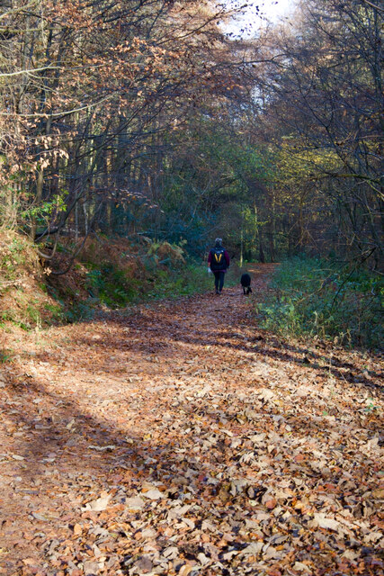
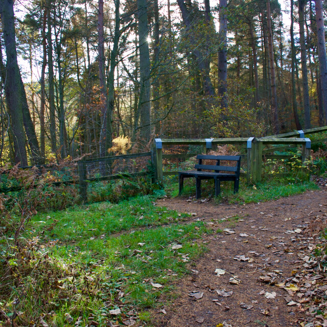
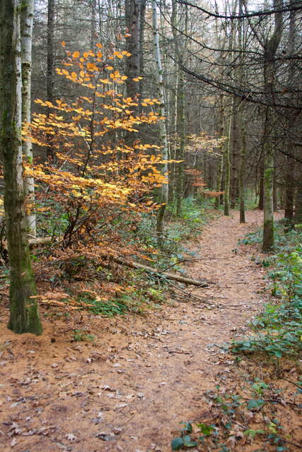
Traversing through Birch Wood is made easy by a network of well-maintained footpaths that crisscross the area. These paths offer visitors the opportunity to explore the wood at their own pace, immersing themselves in the tranquil atmosphere and enjoying the sights and sounds of nature. There are also several designated picnic areas, allowing visitors to take a break and enjoy a meal amidst the natural beauty of the forest.
Birch Wood is a popular destination for recreational activities such as hiking, jogging, and dog walking. Its accessibility and well-preserved environment make it an ideal location for families and individuals seeking a peaceful escape from the hustle and bustle of daily life. Whether it is the vibrant colors of autumn or the fresh greenery of summer, Birch Wood offers a captivating experience for visitors throughout the year.
If you have any feedback on the listing, please let us know in the comments section below.
Birch Wood Images
Images are sourced within 2km of 54.883053/-1.6580693 or Grid Reference NZ2254. Thanks to Geograph Open Source API. All images are credited.
![Industrial Ruins Probably boiler and engine houses associated with nearby drift.
sitelines.newcastle.gov.uk. (2021). Beamish Burn, engine house and windlass. [online] Available at: <span class="nowrap"><a title="https://twsitelines.info/SMR/6960" rel="nofollow ugc noopener" href="https://twsitelines.info/SMR/6960">Link</a><img style="margin-left:2px;" alt="External link" title="External link - shift click to open in new window" src="https://s1.geograph.org.uk/img/external.png" width="10" height="10"/></span> [Accessed 2 Dec. 2021].
sitelines.newcastle.gov.uk. (2021). Beamish Burn, boilers. [online] Available at: <span class="nowrap"><a title="https://twsitelines.info/SMR/6961" rel="nofollow ugc noopener" href="https://twsitelines.info/SMR/6961">Link</a><img style="margin-left:2px;" alt="External link" title="External link - shift click to open in new window" src="https://s1.geograph.org.uk/img/external.png" width="10" height="10"/></span> [Accessed 2 Dec. 2021].](https://s1.geograph.org.uk/geophotos/07/03/40/7034045_0235e4a8.jpg)
![Industrial Ruins Probably boiler and engine houses associated with nearby drift.
sitelines.newcastle.gov.uk. (2021). Beamish Burn, engine house and windlass. [online] Available at: <span class="nowrap"><a title="https://twsitelines.info/SMR/6960" rel="nofollow ugc noopener" href="https://twsitelines.info/SMR/6960">Link</a><img style="margin-left:2px;" alt="External link" title="External link - shift click to open in new window" src="https://s1.geograph.org.uk/img/external.png" width="10" height="10"/></span> [Accessed 2 Dec. 2021].
sitelines.newcastle.gov.uk. (2021). Beamish Burn, boilers. [online] Available at: <span class="nowrap"><a title="https://twsitelines.info/SMR/6961" rel="nofollow ugc noopener" href="https://twsitelines.info/SMR/6961">Link</a><img style="margin-left:2px;" alt="External link" title="External link - shift click to open in new window" src="https://s1.geograph.org.uk/img/external.png" width="10" height="10"/></span> [Accessed 2 Dec. 2021].](https://s3.geograph.org.uk/geophotos/07/03/40/7034047_99ec8b36.jpg)
![Industrial Ruins - dressed stone scatter Probably boiler and engine houses associated with nearby drift.
sitelines.newcastle.gov.uk. (2021). Beamish Burn, engine house and windlass. [online] Available at: <span class="nowrap"><a title="https://twsitelines.info/SMR/6960" rel="nofollow ugc noopener" href="https://twsitelines.info/SMR/6960">Link</a><img style="margin-left:2px;" alt="External link" title="External link - shift click to open in new window" src="https://s1.geograph.org.uk/img/external.png" width="10" height="10"/></span> [Accessed 2 Dec. 2021].
sitelines.newcastle.gov.uk. (2021). Beamish Burn, boilers. [online] Available at: <span class="nowrap"><a title="https://twsitelines.info/SMR/6961" rel="nofollow ugc noopener" href="https://twsitelines.info/SMR/6961">Link</a><img style="margin-left:2px;" alt="External link" title="External link - shift click to open in new window" src="https://s1.geograph.org.uk/img/external.png" width="10" height="10"/></span> [Accessed 2 Dec. 2021].](https://s0.geograph.org.uk/geophotos/07/03/40/7034048_1bffea26.jpg)
![Flint Saw Mill A water-powered corn, flint, fulling, and saw mill.
Annotated as &#039;Flint Saw Mill&#039; on the 1898 O.S. ordnance Survey map.
Maps.nls.uk. (2021). View map: Durham XII.NE (includes: Lamesley; Pelton; Urpeth.) - Ordnance Survey Six-inch England and Wales, 1842-1952. [online] Available at: <span class="nowrap"><a title="https://maps.nls.uk/view/101099582" rel="nofollow ugc noopener" href="https://maps.nls.uk/view/101099582">Link</a><img style="margin-left:2px;" alt="External link" title="External link - shift click to open in new window" src="https://s1.geograph.org.uk/img/external.png" width="10" height="10"/></span> [Accessed 2 Dec. 2021].
For more details:
Millsarchive.org. (2021). Pockerley Flint Mill, Beamish – The Mills Archive. [online] Available at: <span class="nowrap"><a title="https://new.millsarchive.org/mills/index/?action=show&amp;which=10294" rel="nofollow ugc noopener" href="https://new.millsarchive.org/mills/index/?action=show&amp;which=10294">Link</a><img style="margin-left:2px;" alt="External link" title="External link - shift click to open in new window" src="https://s1.geograph.org.uk/img/external.png" width="10" height="10"/></span> [Accessed 2 Dec. 2021].](https://s1.geograph.org.uk/geophotos/07/03/40/7034089_fd4776ce.jpg)
![Flint Saw Mill A water-powered corn, flint, fulling, and saw mill.
Annotated as &#039;Flint Saw Mill&#039; on the 1898 O.S. ordnance Survey map.
Maps.nls.uk. (2021). View map: Durham XII.NE (includes: Lamesley; Pelton; Urpeth.) - Ordnance Survey Six-inch England and Wales, 1842-1952. [online] Available at: <span class="nowrap"><a title="https://maps.nls.uk/view/101099582" rel="nofollow ugc noopener" href="https://maps.nls.uk/view/101099582">Link</a><img style="margin-left:2px;" alt="External link" title="External link - shift click to open in new window" src="https://s1.geograph.org.uk/img/external.png" width="10" height="10"/></span> [Accessed 2 Dec. 2021].
For more details:
Millsarchive.org. (2021). Pockerley Flint Mill, Beamish – The Mills Archive. [online] Available at: <span class="nowrap"><a title="https://new.millsarchive.org/mills/index/?action=show&amp;which=10294" rel="nofollow ugc noopener" href="https://new.millsarchive.org/mills/index/?action=show&amp;which=10294">Link</a><img style="margin-left:2px;" alt="External link" title="External link - shift click to open in new window" src="https://s1.geograph.org.uk/img/external.png" width="10" height="10"/></span> [Accessed 2 Dec. 2021].](https://s2.geograph.org.uk/geophotos/07/03/40/7034094_db8bc3ff.jpg)
![Flint Saw Mill - wheel pit A water-powered corn, flint, fulling, and saw mill.
Annotated as &#039;Flint Saw Mill&#039; on the 1898 O.S. ordnance Survey map.
Maps.nls.uk. (2021). View map: Durham XII.NE (includes: Lamesley; Pelton; Urpeth.) - Ordnance Survey Six-inch England and Wales, 1842-1952. [online] Available at: <span class="nowrap"><a title="https://maps.nls.uk/view/101099582" rel="nofollow ugc noopener" href="https://maps.nls.uk/view/101099582">Link</a><img style="margin-left:2px;" alt="External link" title="External link - shift click to open in new window" src="https://s1.geograph.org.uk/img/external.png" width="10" height="10"/></span> [Accessed 2 Dec. 2021].
For more details:
Millsarchive.org. (2021). Pockerley Flint Mill, Beamish – The Mills Archive. [online] Available at: <span class="nowrap"><a title="https://new.millsarchive.org/mills/index/?action=show&amp;which=10294" rel="nofollow ugc noopener" href="https://new.millsarchive.org/mills/index/?action=show&amp;which=10294">Link</a><img style="margin-left:2px;" alt="External link" title="External link - shift click to open in new window" src="https://s1.geograph.org.uk/img/external.png" width="10" height="10"/></span> [Accessed 2 Dec. 2021].](https://s1.geograph.org.uk/geophotos/07/03/41/7034113_8856d6b5.jpg)
![Flint Saw Mill A water-powered corn, flint, fulling, and saw mill.
Annotated as &#039;Flint Saw Mill&#039; on the 1898 O.S. ordnance Survey map.
Maps.nls.uk. (2021). View map: Durham XII.NE (includes: Lamesley; Pelton; Urpeth.) - Ordnance Survey Six-inch England and Wales, 1842-1952. [online] Available at: <span class="nowrap"><a title="https://maps.nls.uk/view/101099582" rel="nofollow ugc noopener" href="https://maps.nls.uk/view/101099582">Link</a><img style="margin-left:2px;" alt="External link" title="External link - shift click to open in new window" src="https://s1.geograph.org.uk/img/external.png" width="10" height="10"/></span> [Accessed 2 Dec. 2021].
For more details:
Millsarchive.org. (2021). Pockerley Flint Mill, Beamish – The Mills Archive. [online] Available at: <span class="nowrap"><a title="https://new.millsarchive.org/mills/index/?action=show&amp;which=10294" rel="nofollow ugc noopener" href="https://new.millsarchive.org/mills/index/?action=show&amp;which=10294">Link</a><img style="margin-left:2px;" alt="External link" title="External link - shift click to open in new window" src="https://s1.geograph.org.uk/img/external.png" width="10" height="10"/></span> [Accessed 2 Dec. 2021].](https://s0.geograph.org.uk/geophotos/07/03/41/7034116_6971915f.jpg)
![Flint Saw Mill A water-powered corn, flint, fulling, and saw mill.
Annotated as &#039;Flint Saw Mill&#039; on the 1898 O.S. ordnance Survey map.
Maps.nls.uk. (2021). View map: Durham XII.NE (includes: Lamesley; Pelton; Urpeth.) - Ordnance Survey Six-inch England and Wales, 1842-1952. [online] Available at: <span class="nowrap"><a title="https://maps.nls.uk/view/101099582" rel="nofollow ugc noopener" href="https://maps.nls.uk/view/101099582">Link</a><img style="margin-left:2px;" alt="External link" title="External link - shift click to open in new window" src="https://s1.geograph.org.uk/img/external.png" width="10" height="10"/></span> [Accessed 2 Dec. 2021].
For more details:
Millsarchive.org. (2021). Pockerley Flint Mill, Beamish – The Mills Archive. [online] Available at: <span class="nowrap"><a title="https://new.millsarchive.org/mills/index/?action=show&amp;which=10294" rel="nofollow ugc noopener" href="https://new.millsarchive.org/mills/index/?action=show&amp;which=10294">Link</a><img style="margin-left:2px;" alt="External link" title="External link - shift click to open in new window" src="https://s1.geograph.org.uk/img/external.png" width="10" height="10"/></span> [Accessed 2 Dec. 2021].](https://s1.geograph.org.uk/geophotos/07/03/41/7034117_b6551ec5.jpg)
![High Forge &quot;A number of interesting industrial sites survive along the Beamish Burn (most of which are in County Durham). High Forge is the most well preserved of all the buildings. It was originally a corn mill but was converted into a Trip Hammer Forge where bar iron was used for cannon making, shovels and files. First recorded in 1714 as Pigg Mill. Little survives of Middle Forge, although its location and the mill race can still be deduced. It was probably partially destroyed in the Beamish Burn flood in 1877. By 1895 buildings were still present but no races. In 1939 the buildings were demolished. The pumping station was built to work in conjunction with the drift mining in the area to remove the water from the mine shafts. Two shafts were present by the engine house. There are records of an &quot;old engine&quot; in 1836, but by 1839 the water wheel power became insufficient to remove water so a steam engine was erected in 1860 and closed c.1926. Low Forge, known as &quot;Hussey&#039;s Forge&quot; in 1764, is probably the oldest of the three forges. It closed in 1877 due to the Beamish Burn flood and the buildings were demolished in 1895. The well-covered remains of a stone archway still exist as the entrance to the Paper Mill or Money Hill drift, in operation from 1895 to 1920. One of the buildings of Urpeth Paper Mill still stands and is used as a stable. Mount Escop was originally worker&#039;s cottages. The mill was in use from at least 1792 and may have been destroyed by the flood in 1877. Few records exist of wagonways but they were present in the burn between 1895-1903. The forges were a significant contributor to armaments (canon making) around 1800, especially for the Napoleonic Wars. High and Low Quarries probably supplied stone for the Beamish Estate. High Quarry provided high quality stone, and Low Quarry provided stone for less important buildings. Since c.1900 they have been used for dumping rubbish so little remains. John Eden&#039;s Almshouses were built in 1836 by John Eden, landowner of Beamish, as retirement homes for workers from his estate.&quot;
Taken from sitelines.newcastle.gov.uk. (2021). Beamish Burn, industrial archaeological remains. [online] Available at: <span class="nowrap"><a title="https://twsitelines.info/SMR/1027" rel="nofollow ugc noopener" href="https://twsitelines.info/SMR/1027">Link</a><img style="margin-left:2px;" alt="External link" title="External link - shift click to open in new window" src="https://s1.geograph.org.uk/img/external.png" width="10" height="10"/></span> [Accessed 2 Dec. 2021].](https://s3.geograph.org.uk/geophotos/07/03/41/7034119_7fd67542.jpg)
Birch Wood is located at Grid Ref: NZ2254 (Lat: 54.883053, Lng: -1.6580693)
Unitary Authority: County Durham
Police Authority: Durham
What 3 Words
///scared.engrossed.lame. Near Pelton, Co. Durham
Nearby Locations
Related Wikis

Beamish Museum
Beamish Museum is the first regional open-air museum, in England, located at Beamish, near the town of Stanley, in County Durham, England. Beamish pioneered...

Beamish Museum transport collection
Beamish Museum contains much of transport interest, and the size of its site makes good internal transportation for visitors and staff purposes a necessity...

High Forge
High Forge is a hamlet in County Durham, England. It is situated a short distance to the west of Urpeth, north of Beamish. == References ==

Beamish railway station
Beamish was a railway station which served the village of Beamish in County Durham, North East England, from 1894 to 1953. The station was built by the...

Beamish Hall
Beamish Hall is a mid-18th-century country house, now converted to a hotel, which stands in 24 acres (97,000 m2) of grounds near the town of Stanley, County...

Beamish, County Durham
Beamish, previously named 'Pit Hill', is a village in County Durham, England, situated to the north east of Stanley. The village is contained within...

No Place
No Place is a small village near the town of Stanley in County Durham, England, east of Stanley and west of Beamish. Situated to the south of the A693...

Urpeth
Urpeth (Urpeth Grange) is a village in County Durham, England. It is situated a short distance from Ouston and Beamish, near the border with Tyne and Wear...
Nearby Amenities
Located within 500m of 54.883053,-1.6580693Have you been to Birch Wood?
Leave your review of Birch Wood below (or comments, questions and feedback).