Gannaway Wood

Wood, Forest in Warwickshire Stratford-on-Avon

England

Gannaway Wood

St Michael & All Angels Church, Claverdon
St Michael & All Angels Church, Claverdon Credit: Ian S

Gannaway Wood is a charming woodland located in the heart of Warwickshire, England. Covering an area of approximately 100 acres, this ancient forest is a haven for nature lovers and outdoor enthusiasts alike. The wood is situated on gently rolling terrain, providing visitors with picturesque views and a peaceful atmosphere.

The wood is predominantly composed of deciduous trees, such as oak, beech, and ash, which create a dense canopy that filters sunlight and creates a cool, shaded environment beneath. The forest floor is covered in a lush carpet of ferns, wildflowers, and mosses, giving it a vibrant and magical appearance.

Gannaway Wood is home to a diverse range of wildlife, including various bird species, small mammals, and insects. Nature enthusiasts can spot woodpeckers hammering away at tree trunks, squirrels scurrying through the branches, and deer grazing in the clearings. The woodland is also known for its vibrant birdlife, with species such as great tits, blue tits, and chaffinches being commonly sighted.

The wood offers a network of well-maintained walking trails, allowing visitors to explore its beauty at their own pace. These trails wind through the forest, passing by enchanting glades, babbling brooks, and ancient trees. The wood is particularly stunning during the autumn months when the foliage transforms into a riot of vibrant reds, oranges, and yellows.

Gannaway Wood is a true gem within Warwickshire, offering visitors a tranquil retreat where they can immerse themselves in the beauty of nature. Whether for a leisurely stroll, birdwatching, or simply to escape the hustle and bustle of everyday life, Gannaway Wood is a delightful destination worth exploring.

If you have any feedback on the listing, please let us know in the comments section below.

Gannaway Wood Images

Images are sourced within 2km of 52.271322/-1.6845528 or Grid Reference SP2163. Thanks to Geograph Open Source API. All images are credited.

St Michael & All Angels Church, Claverdon
Claverdon The Church of St. Michael and All Angels.
Claverdon
The Church of St. Michael and All Angels.
St. Michael and All Angels' church, Claverdon Looking east across the large churchyard.
St. Michael and All Angels' church, Claverdon
Looking east across the large churchyard.
St. Michael and All Angels' church, Claverdon View from the south.
St. Michael and All Angels' church, Claverdon
View from the south.
St. Michael and All Angels' church, Claverdon - interior Looking along the Victorian nave and chancel.
St. Michael and All Angels' church, Claverdon - interior
Looking along the Victorian nave and chancel.
St. Michael and All Angels' church, Claverdon - interior View from the pulpit towards the west end and ringing chamber at the base of the 15th century tower.
St. Michael and All Angels' church, Claverdon - interior
View from the pulpit towards the west end and ringing chamber at the base of the 15th century tower.
St. Michael and All Angels' church, Claverdon - window A modern window in the south aisle.
This caught my eye for its simple but effective design.
St. Michael and All Angels' church, Claverdon - window
A modern window in the south aisle. This caught my eye for its simple but effective design.
View from Claverdon churchyard The Church Centre (Hall) is over to the right.
Sheltered housing to the left.
View from Claverdon churchyard
The Church Centre (Hall) is over to the right. Sheltered housing to the left.
The Church of St Michael and All Angels, Claverdon
Claverdon, St Michael and All Angels' Church View of the northern side of the church.
Claverdon, St Michael and All Angels' Church
View of the northern side of the church.
St Michael and All Angels' Church, Claverdon View of the tower at the western end of the church.
St Michael and All Angels' Church, Claverdon
View of the tower at the western end of the church.
The Church of St Michael and All Angels, Claverdon From Church Road.
The Church of St Michael and All Angels, Claverdon
From Church Road.
Spinney below Church Road, Claverdon Gannaway Wood on the skyline above it; Home Meadow in the foreground; Park Farm on the left.
Spinney below Church Road, Claverdon
Gannaway Wood on the skyline above it; Home Meadow in the foreground; Park Farm on the left.
The Old Rectory The old rectory is situated right next door to the church on the south side of the village.
The Old Rectory
The old rectory is situated right next door to the church on the south side of the village.
Claverdon Church Clock The original clock was built in 1777 by William Wilks of Wolverton for the grand sum of £20 (about £2,500 in 2010 prices). This was replaced in 1905 but the old one has been restored and is now in the nave.
Claverdon Church Clock
The original clock was built in 1777 by William Wilks of Wolverton for the grand sum of £20 (about £2,500 in 2010 prices). This was replaced in 1905 but the old one has been restored and is now in the nave.
Claverdon Church View Cottage Opposite the church.
Claverdon Church View Cottage
Opposite the church.
Dorothea Mitchell Hall, Claverdon A village hall hired out for clubs, weddings and parties.
Dorothea Mitchell Hall, Claverdon
A village hall hired out for clubs, weddings and parties.
St. Michael and All Angels', Claverdon: churchyard (a)
Show me another place!

Gannaway Wood is located at Grid Ref: SP2163 (Lat: 52.271322, Lng: -1.6845528)

Administrative County: Warwickshire

District: Stratford-on-Avon

Police Authority: Warwickshire

What 3 Words

///blackbird.newly.milder. Near Hatton, Warwickshire

Related Wikis

Claverdon railway station

Claverdon railway station serves the village of Claverdon in Warwickshire, England. It is managed by West Midlands Railway, although most of the services...

Wolverton, Warwickshire

Wolverton is a village in the Stratford-on-Avon District of Warwickshire, England. The population at the 2011 census was 212. == Heritage == Roman artefacts...

Claverdon

Claverdon is a village and civil parish in the Stratford-on-Avon district of Warwickshire, England, about 5 miles (8.0 km) west of the county town of Warwick...

Pinley Priory

Pinley Priory, also called Pinley Abbey, was a Cistercian nunnery in the parish of Rowington in Warwickshire, England. It was founded in the early 12th...
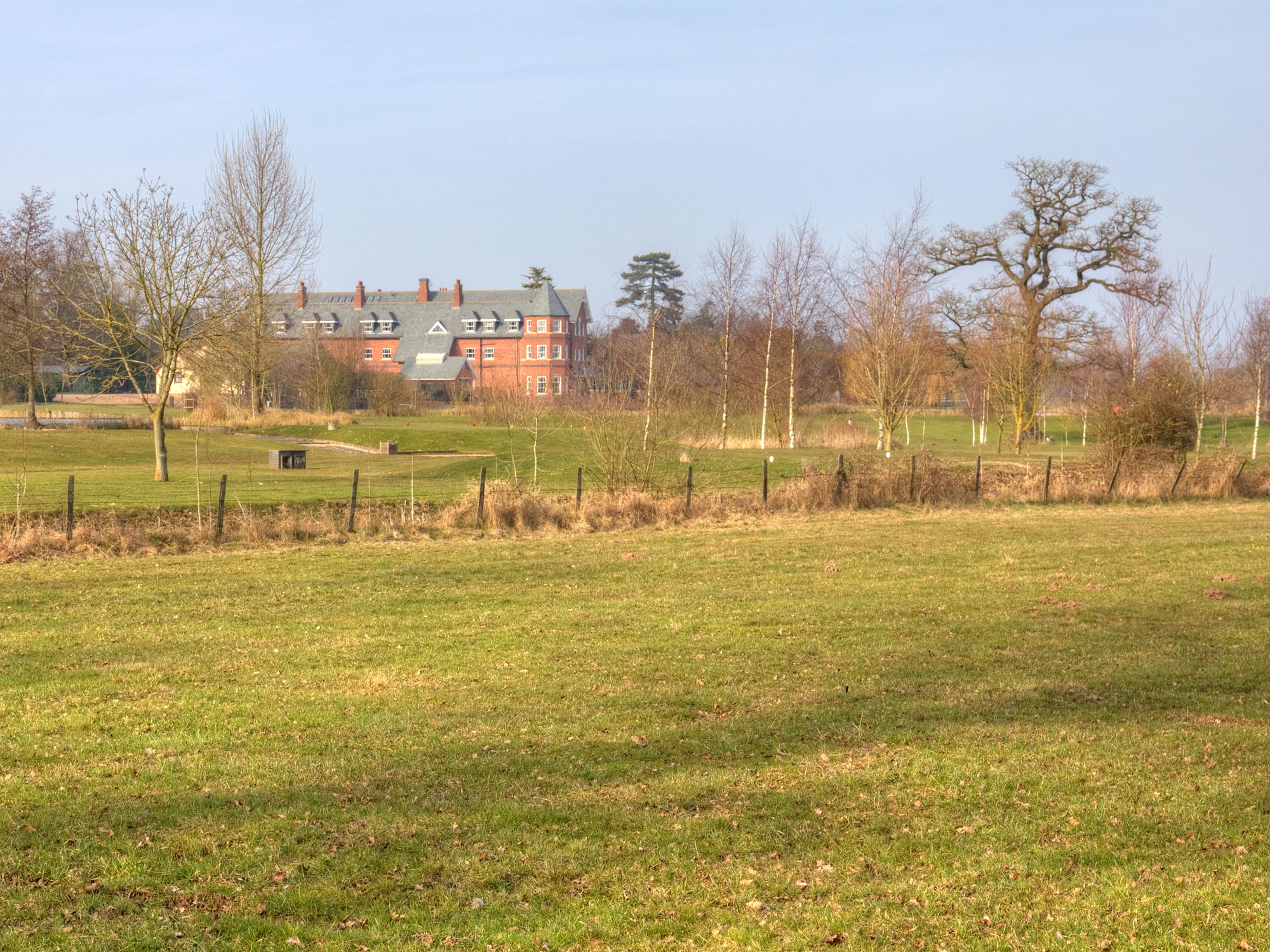
Ardencote Manor

Ardencote Manor is a hotel and former manor house located 0.5 miles (0.8 km) north of the village of Claverdon, Warwickshire, England. The manor was originally...

Langley, Warwickshire

Langley is a village and civil parish in the Stratford-on-Avon district of Warwickshire, England. The village is about 6 miles (10 km) west from the county...

Norton Lindsey

Norton Lindsey is a village and civil parish in Warwickshire, England, 3.5 miles south-west of the tourist and county town of Warwick and a mile west of...

Hatton railway station (England)

Hatton railway station takes the name of the village of Hatton in Warwickshire, England, although it is about 1 mile (1.6 km) from the village. It is situated...

Nearby Amenities

Located within 500m of 52.271322,-1.6845528
Barrier: stile
Lat/Long: 52.2677757/-1.6836945
Barrier: stile
Lat/Long: 52.2693888/-1.6822177
Barrier: stile
Lat/Long: 52.2710186/-1.6804237
Barrier: stile
Lat/Long: 52.2672438/-1.683625
Barrier: stile
Lat/Long: 52.2711282/-1.680237
Material: wood
Operator: National Grid Electricity Distribution
Operator Wikidata: Q7988183
Power: pole
Lat/Long: 52.2722378/-1.691578
Material: wood
Operator: National Grid Electricity Distribution
Operator Wikidata: Q7988183
Power: pole
Lat/Long: 52.2714877/-1.691047
Material: wood
Operator: National Grid Electricity Distribution
Operator Wikidata: Q7988183
Power: pole
Source: bing
Lat/Long: 52.2744239/-1.6853929
Material: wood
Operator: National Grid Electricity Distribution
Operator Wikidata: Q7988183
Power: pole
Source: bing
Lat/Long: 52.2747587/-1.6835395
Material: wood
Operator: National Grid Electricity Distribution
Operator Wikidata: Q7988183
Power: pole
Source: bing
Lat/Long: 52.2750951/-1.6817182
Material: wood
Operator: National Grid Electricity Distribution
Operator Wikidata: Q7988183
Power: pole
Source: bing
Lat/Long: 52.2678135/-1.6886008
Material: wood
Operator: National Grid Electricity Distribution
Operator Wikidata: Q7988183
Power: pole
Source: bing
Lat/Long: 52.268553/-1.6891024
Material: wood
Operator: National Grid Electricity Distribution
Operator Wikidata: Q7988183
Power: pole
Source: bing
Lat/Long: 52.2692965/-1.6896093
Material: wood
Operator: National Grid Electricity Distribution
Operator Wikidata: Q7988183
Power: pole
Source: bing
Lat/Long: 52.2700204/-1.6901162
Material: wood
Operator: National Grid Electricity Distribution
Operator Wikidata: Q7988183
Power: pole
Ref: 931442
Transformer: distribution
Lat/Long: 52.2707885/-1.6906178
The data included in this document is from www.openstreetmap.org. The data is made available under ODbL.

Have you been to Gannaway Wood?

Leave your review of Gannaway Wood below (or comments, questions and feedback).