Bleakley Plantation

Wood, Forest in Derbyshire Derbyshire Dales

England

Bleakley Plantation

Broadmeadow Shaft Adjacent to the cottages here, which were once the offices of the Alport Mining Company, can be seen a large mound which marks the site of the Broadmeadow Shaft on the Alport mines. This company was an amalgamation of various separate mining concerns and operated the very rich lead mines of this area. They were classed as the most heavily watered mines in the country and suffered from inflows of more than 6000 gallons a minute. Consequently, heavy pumping was necessary, chiefly by water pressure engines which used a column of water to power them. The well known Cornish engineer, Richard Trevithick was consulted and he was responsible for the first of many such underground machines within this region. Water to power the engine in this shaft was taken from the River Lathkill and over Alport village in wooden launders and then by a tunnel to the shaft. All the pumped water, along with that used by the engines (of which there were upwards of seven scattered throughout the workings) was drained away by the deep Hillcarr Sough, a tunnel driven from the River Derwent near Darley Dale.
Broadmeadow Shaft Credit: Richard Bird

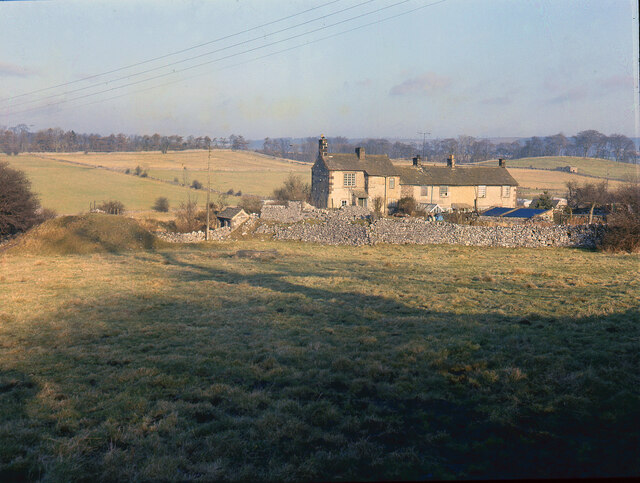
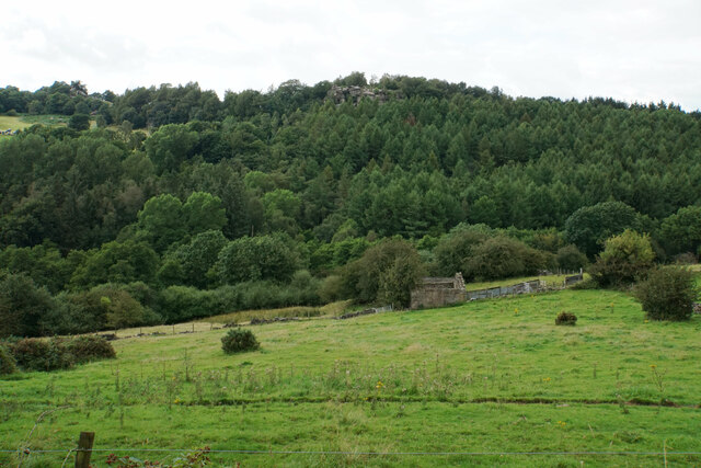
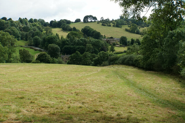
Bleakley Plantation is a historical site located in Derbyshire, England. Situated in the heart of a dense woodland area, it encompasses a vast expanse of lush greenery and towering trees. The plantation is renowned for its stunning natural beauty, making it a popular destination for nature enthusiasts and history buffs alike.

Covering an area of approximately 500 acres, Bleakley Plantation is home to a diverse range of flora and fauna. The forest is predominantly composed of oak, birch, and beech trees, creating a picturesque landscape that changes dramatically with the seasons. In spring, the woodland is adorned with vibrant blossoms and fresh foliage, while in autumn, the forest floor is blanketed with a riot of colorful fallen leaves.

The plantation holds great historical significance, dating back to the 18th century. It was originally established as a timber plantation, providing a valuable resource for the local community. Over the years, it has also served as a hunting ground for the aristocracy, showcasing its rich heritage.

Today, Bleakley Plantation offers a range of recreational activities for visitors. There are numerous walking trails that meander through the forest, allowing visitors to explore its hidden treasures and enjoy the tranquility of nature. The plantation also hosts educational programs and guided tours, providing insight into its history and ecological importance.

Bleakley Plantation, with its breathtaking natural beauty and historical significance, is a captivating destination that offers a unique blend of serenity and cultural enrichment.

If you have any feedback on the listing, please let us know in the comments section below.

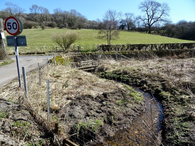
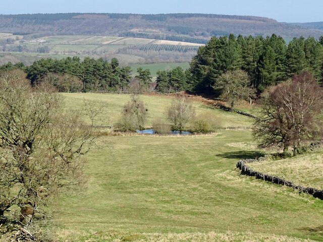
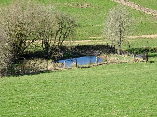
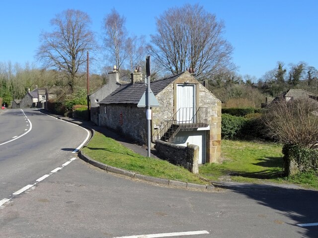
Bleakley Plantation Images

Images are sourced within 2km of 53.163497/-1.6809724 or Grid Reference SK2162. Thanks to Geograph Open Source API. All images are credited.

Broadmeadow Shaft Adjacent to the cottages here, which were once the offices of the Alport Mining Company, can be seen a large mound which marks the site of the Broadmeadow Shaft on the Alport mines. This company was an amalgamation of various separate mining concerns and operated the very rich lead mines of this area. They were classed as the most heavily watered mines in the country and suffered from inflows of more than 6000 gallons a minute. Consequently, heavy pumping was necessary, chiefly by water pressure engines which used a column of water to power them. The well known Cornish engineer, Richard Trevithick was consulted and he was responsible for the first of many such underground machines within this region. Water to power the engine in this shaft was taken from the River Lathkill and over Alport village in wooden launders and then by a tunnel to the shaft. All the pumped water, along with that used by the engines (of which there were upwards of seven scattered throughout the workings) was drained away by the deep Hillcarr Sough, a tunnel driven from the River Derwent near Darley Dale.
Broadmeadow Shaft
Adjacent to the cottages here, which were once the offices of the Alport Mining Company, can be seen a large mound which marks the site of the Broadmeadow Shaft on the Alport mines. This company was an amalgamation of various separate mining concerns and operated the very rich lead mines of this area. They were classed as the most heavily watered mines in the country and suffered from inflows of more than 6000 gallons a minute. Consequently, heavy pumping was necessary, chiefly by water pressure engines which used a column of water to power them. The well known Cornish engineer, Richard Trevithick was consulted and he was responsible for the first of many such underground machines within this region. Water to power the engine in this shaft was taken from the River Lathkill and over Alport village in wooden launders and then by a tunnel to the shaft. All the pumped water, along with that used by the engines (of which there were upwards of seven scattered throughout the workings) was drained away by the deep Hillcarr Sough, a tunnel driven from the River Derwent near Darley Dale.
Ruined barn near Birchover Hermit's Cave and Robin Hood's Stride are rocky outcrops on the opposite hill.
Ruined barn near Birchover
Hermit's Cave and Robin Hood's Stride are rocky outcrops on the opposite hill.
Path towards Elton Elton is over the top of the hill seen ahead.
Path towards Elton
Elton is over the top of the hill seen ahead.
Grave of John Millington, railway navvy, Youlgreave Churchyard During the construction of the Midland Railway near Haddon Hall in 1861 a tunnel was insisted upon by the Duke of Rutland so that the line could not be seen from the hall. A part of this tunnel collapsed during construction on 2nd July 1861 killing five workers. The grave of one of these can be found in the churchyard. The inscription reads: "In memory of John Millington of Stanton, killed by the falling of an arch on the railway near Haddon Hall, July 2nd 1861 aged 46 years". Reference to his 6 year old daughter is also on the stone whose body rests in Warrick churchyard, Ruthin, North Wales.
Grave of John Millington, railway navvy, Youlgreave Churchyard
During the construction of the Midland Railway near Haddon Hall in 1861 a tunnel was insisted upon by the Duke of Rutland so that the line could not be seen from the hall. A part of this tunnel collapsed during construction on 2nd July 1861 killing five workers. The grave of one of these can be found in the churchyard. The inscription reads: "In memory of John Millington of Stanton, killed by the falling of an arch on the railway near Haddon Hall, July 2nd 1861 aged 46 years". Reference to his 6 year old daughter is also on the stone whose body rests in Warrick churchyard, Ruthin, North Wales.
Ivy Bar Brook at Dudwood Lane Instead of flowing down the north side of Dudwood Lane, the brook, for some reason, flows underneath it to the south side, before immediately looping back to the north again.
Ivy Bar Brook at Dudwood Lane
Instead of flowing down the north side of Dudwood Lane, the brook, for some reason, flows underneath it to the south side, before immediately looping back to the north again.
The hermit's cave The hermit's cave is thought to be 14th century in origin but may be older. There would have been a wooden lean-to structure on the outside. It contains the crucifixion carving, pictured in <a href="https://www.geograph.org.uk/photo/53753">SK2262 : Hermit's cave</a>.
The hermit's cave
The hermit's cave is thought to be 14th century in origin but may be older. There would have been a wooden lean-to structure on the outside. It contains the crucifixion carving, pictured in SK2262 : Hermit's cave.
Pond on Harthill Moor
Old reservoir Now just a pond but marked on old maps as a reservoir, possibly for the hydraulic ram sited a short distance downstream.
Old reservoir
Now just a pond but marked on old maps as a reservoir, possibly for the hydraulic ram sited a short distance downstream.
Old barn on the edge of Alport Not yet converted into a luxury residence.
Old barn on the edge of Alport
Not yet converted into a luxury residence.
Robin Hood's Stride near Birchover
Stone Stile, Elton Just off the Limestone Way (Derbyshire footpath Harthill FP 1) allowing private access past the gate, when there had been one. This is looking South, the alternative view North is <a href="https://www.geograph.org.uk/photo/7519024">SK2262 : Stone Stile, Elton</a>.
Stone Stile, Elton
Just off the Limestone Way (Derbyshire footpath Harthill FP 1) allowing private access past the gate, when there had been one. This is looking South, the alternative view North is SK2262 : Stone Stile, Elton.
Stone Stile, Elton Just off the Limestone Way (Derbyshire footpath Harthill FP 1) allowing private access past the gate, when there had been one. This is looking North, the alternative view South is <a href="https://www.geograph.org.uk/photo/7519022">SK2262 : Stone Stile, Elton</a>.
Stone Stile, Elton
Just off the Limestone Way (Derbyshire footpath Harthill FP 1) allowing private access past the gate, when there had been one. This is looking North, the alternative view South is SK2262 : Stone Stile, Elton.
Stone Stile, Elton On the Limestone Way (Derbyshire footpath, Harthill FP 1)  due North of Elton village looking NW. The view East is <a href="https://www.geograph.org.uk/photo/7519093">SK2262 : Stone Stile, Elton</a>.
Stone Stile, Elton
On the Limestone Way (Derbyshire footpath, Harthill FP 1) due North of Elton village looking NW. The view East is SK2262 : Stone Stile, Elton.
Stone Stile, Elton On the Limestone Way (Derbyshire footpath Harthill FP 1), North of Elton village looking East. The view NW is <a href="https://www.geograph.org.uk/photo/7519091">SK2262 : Stone Stile, Elton</a>.
Stone Stile, Elton
On the Limestone Way (Derbyshire footpath Harthill FP 1), North of Elton village looking East. The view NW is SK2262 : Stone Stile, Elton.
Stone Stile, Elton Looking South from Derbyshire footpath Harthill FP 18, onto Limestone Way  (footpath Harthill FP 1). The view looking North is <a href="https://www.geograph.org.uk/photo/7519109">SK2262 : Stone Stile, Elton</a>.
Stone Stile, Elton
Looking South from Derbyshire footpath Harthill FP 18, onto Limestone Way (footpath Harthill FP 1). The view looking North is SK2262 : Stone Stile, Elton.
Stone Stile, Elton Leading North to Derbyshire footpath Harthill FP 18 off Limestone Way  (footpath Harthill FP 1)  looking North. The view looking South is <a href="https://www.geograph.org.uk/photo/7519108">SK2262 : Stone Stile, Elton</a>.
Stone Stile, Elton
Leading North to Derbyshire footpath Harthill FP 18 off Limestone Way (footpath Harthill FP 1) looking North. The view looking South is SK2262 : Stone Stile, Elton.
Stone Stile, Elton On the Limestone Way (Derbyshire footpath Winster FP 13)  North of Elton village looking North.
The view South is <a href="https://www.geograph.org.uk/photo/7519168">SK2262 : Stone Stile, Elton</a>.
Stone Stile, Elton
On the Limestone Way (Derbyshire footpath Winster FP 13) North of Elton village looking North. The view South is SK2262 : Stone Stile, Elton.
Stone Stile, Elton On the Limestone Way (Derbyshire footpath Winster FP 13)  North of Elton village looking South. The view North is <a href="https://www.geograph.org.uk/photo/7519167">SK2262 : Stone Stile, Elton</a>.
Stone Stile, Elton
On the Limestone Way (Derbyshire footpath Winster FP 13) North of Elton village looking South. The view North is SK2262 : Stone Stile, Elton.
Show me another place!

Bleakley Plantation is located at Grid Ref: SK2162 (Lat: 53.163497, Lng: -1.6809724)

Administrative County: Derbyshire

District: Derbyshire Dales

Police Authority: Derbyshire

What 3 Words

///puddings.concerts.amused. Near Youlgreave, Derbyshire

Related Wikis

Harthill Moor

Harthill Moor is a small upland area in the Derbyshire Peak District of central and northern England, lying between Matlock and Bakewell near the villages...

Nine Stones Close

Nine Stones Close, also known as the Grey Ladies, is a stone circle on Harthill Moor in Derbyshire in the English East Midlands. It is part of a tradition...

Harthill, Derbyshire

Harthill is a civil parish within the Derbyshire Dales district, in the county of Derbyshire, England. Largely rural, along with parts of the neighbouring...
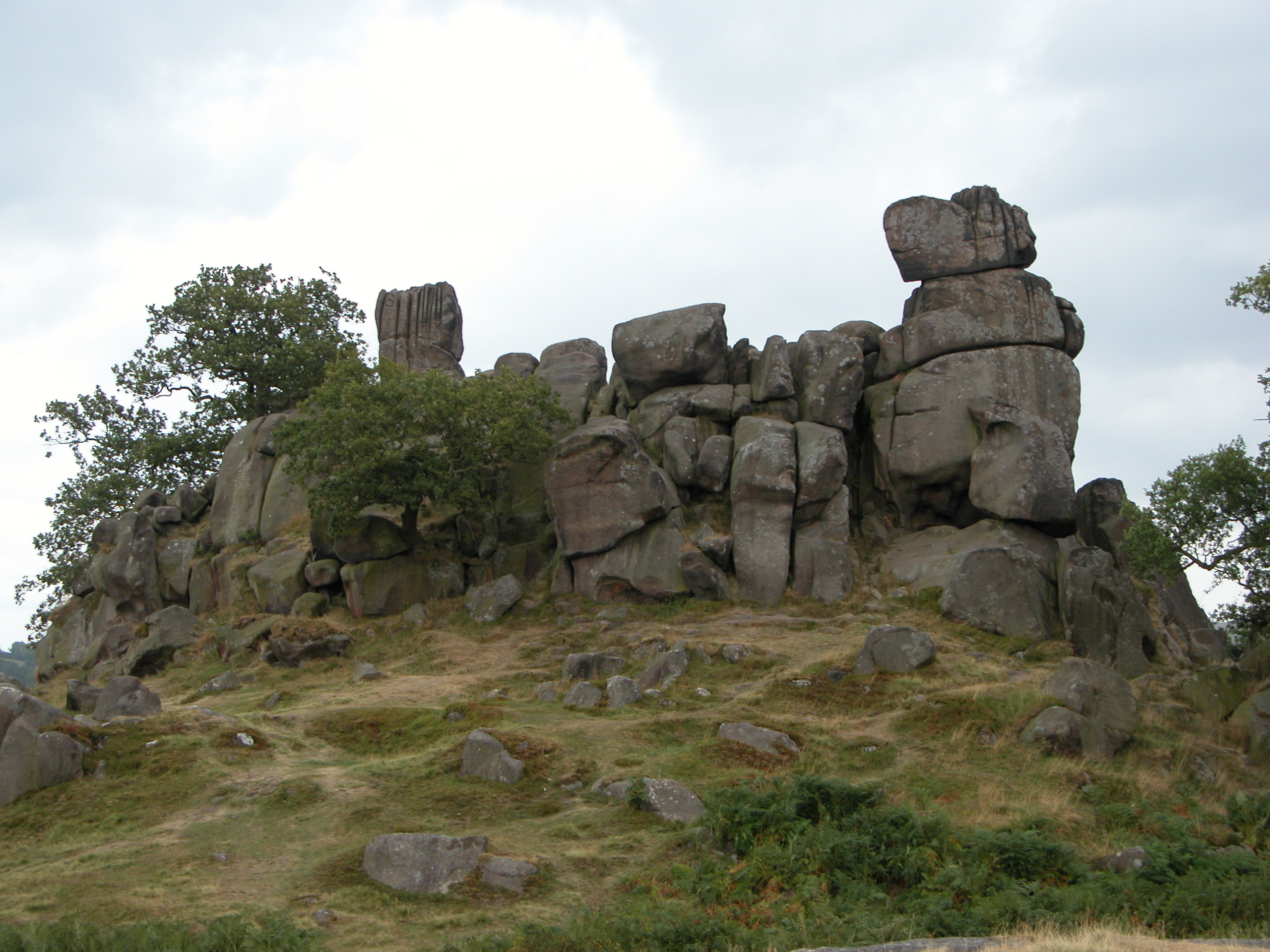
Robin Hood's Stride

Robin Hood's Stride (also known as Mock Beggar's Mansion) is a rock formation on the Limestone Way in Derbyshire close to the village of Elton. The nearest...

Youlgreave

Youlgreave or Youlgrave is a village and civil parish in the Peak District of Derbyshire, England, on the River Bradford 2+1⁄2 miles (4.0 km) south of...

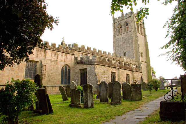
All Saints' Church, Youlgreave

All Saints’ Church, Youlgreave is a Grade I listed parish church in the Church of England in Youlgreave, Derbyshire. == History == The church dates from...

River Bradford

The River Bradford is a river in the Peak District National Park in Derbyshire. Its source is on Gratton Moor and after passing below Youlgreave it joins...

Dale End, Derbyshire

Dale End is a hamlet in Derbyshire, England to the west of Elton. == References ==

Nearby Amenities

Located within 500m of 53.163497,-1.6809724
Barrier: stile
Material: wood
Source: survey;gps
Stile: stepover
Lat/Long: 53.1660644/-1.6783364
Barrier: stile
Foot: yes
Stile: squeezer
Lat/Long: 53.1667411/-1.685974
Barrier: stile
Foot: yes
Steps: 0
Stile: stepover
Lat/Long: 53.1619447/-1.6849722
Barrier: stile
Foot: yes
Steps: 1
Stile: wall
Lat/Long: 53.1600626/-1.6839751
Barrier: stile
Foot: yes
Steps: 1
Stile: wall
Lat/Long: 53.1598837/-1.6839691
Barrier: stile
Material: stone
Source: survey;gps
Stile: squeezer
Lat/Long: 53.1607099/-1.6807243
Barrier: stile
Material: wood
Source: survey;bing;gps
Stile: stepover
Lat/Long: 53.1632505/-1.6741604
Barrier: stile
Material: stone
Source: survey;gps
Stile: squeezer
Lat/Long: 53.1643067/-1.6763119
Barrier: stile
Material: stone
Source: survey;gps
Stile: squeezer
Lat/Long: 53.1628967/-1.6859869
Barrier: stile
Material: stone
Stile: stepover
Lat/Long: 53.1634537/-1.688201
Barrier: stile
Material: stone
Source: survey;gps
Stile: stepover
Lat/Long: 53.1606531/-1.6795009
Barrier: stile
Material: stone
Source: survey;gps
Stile: squeezer
Lat/Long: 53.1614655/-1.6818668
Barrier: stile
Material: stone
Source: survey;gps
Stile: squeezer
Lat/Long: 53.162328/-1.6847907
Barrier: yes
Lat/Long: 53.1660993/-1.6864472
Foot: yes
Ford: yes
Lat/Long: 53.1632472/-1.6741267
The data included in this document is from www.openstreetmap.org. The data is made available under ODbL.

Have you been to Bleakley Plantation?

Leave your review of Bleakley Plantation below (or comments, questions and feedback).