Broomhill Plantation
Wood, Forest in Durham
England
Broomhill Plantation

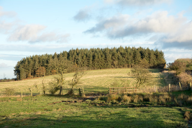
Broomhill Plantation is a picturesque woodland located in Durham, England. Situated in the Wood, Forest area, it covers a vast area of approximately 500 acres. The plantation is nestled between the villages of Broomhill and Wingate, offering a tranquil escape from the bustling city life.
The woodland is predominantly composed of native broadleaf trees, such as oak, ash, and birch, which provide a diverse habitat for a variety of wildlife. The dense canopy created by the trees allows for a cool and shaded environment, making it an ideal spot for leisurely walks and nature exploration.
Broomhill Plantation is crisscrossed with an intricate network of walking trails, offering visitors the opportunity to immerse themselves in the natural beauty of the area. The paths are well-maintained, making it accessible for both casual strollers and more avid hikers.
The woodland is home to a plethora of wildlife species. Visitors may catch glimpses of roe deer, foxes, badgers, and a wide range of bird species, including woodpeckers and owls. The plantation also boasts a rich diversity of plant life, with wildflowers carpeting the forest floor during the spring and summer months.
The plantation offers a peaceful retreat for those seeking solace in nature. Its proximity to Durham makes it a popular destination for locals and tourists alike, who can enjoy the beauty of the woodland and the tranquility it offers. Broomhill Plantation is a haven for nature enthusiasts and a valuable natural resource within the Wood, Forest area of Durham.
If you have any feedback on the listing, please let us know in the comments section below.
Broomhill Plantation Images
Images are sourced within 2km of 54.828077/-1.6689939 or Grid Reference NZ2148. Thanks to Geograph Open Source API. All images are credited.


Broomhill Plantation is located at Grid Ref: NZ2148 (Lat: 54.828077, Lng: -1.6689939)
Unitary Authority: County Durham
Police Authority: Durham
What 3 Words
///gems.state.unfilled. Near Sacriston, Co. Durham
Nearby Locations
Related Wikis

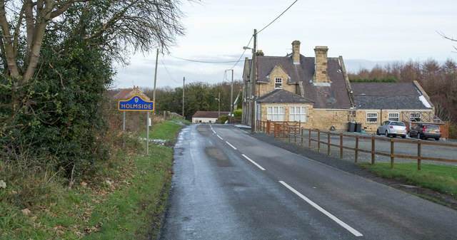
Holmside
Holmside is a village in County Durham, in England. It is situated to the north-west of Sacriston. The village has a 5.5 MW wind farm, Holmside Hall Wind...
Holmside Hall
Holmside Hall is an early 19th-century farmhouse and equestrian centre at Holmside, Burnhope, County Durham, England. The farm is built on the site of...

Holmside Hall Wind Farm
Holmside Hall Wind Farm is a wind farm near Stanley, County Durham, England. Owned and operated by E.ON UK, the farm has a nameplate capacity of 5.5MW...

Craghead
Craghead is a village and former civil parish, now in the parish of Stanley, in the County Durham district, in the ceremonial county of Durham, England...
Edmondsley
Edmondsley is a small village in County Durham, England. It is situated a few miles south-west of Chester-le-Street, near the villages of Craghead and...
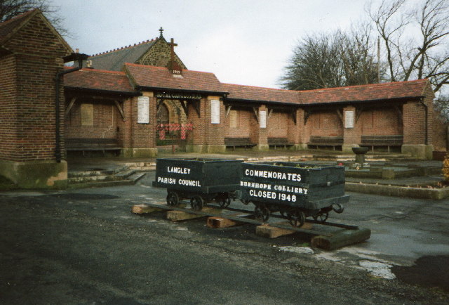
Burnhope
Burnhope is a village and civil parish in County Durham, England. It is located in the Craghead valley on the opposite side to Stanley and has 1,564 inhabitants...
The Middles
The Middles is a village in County Durham, in England. It is situated between Stanley and Craghead. == References ==
Witton Gilbert railway station
Witton Gilbert railway station served the village of Witton Gilbert, County Durham, England from 1862 to 1963 on the Lanchester Valley Line. == History... ==
Nearby Amenities
Located within 500m of 54.828077,-1.6689939Have you been to Broomhill Plantation?
Leave your review of Broomhill Plantation below (or comments, questions and feedback).