Biggin Wood

Wood, Forest in Yorkshire Harrogate

England

Biggin Wood

Kirk Bank Minor lane heading west from Kirkby Malzeard.
Kirk Bank Credit: Chris Heaton

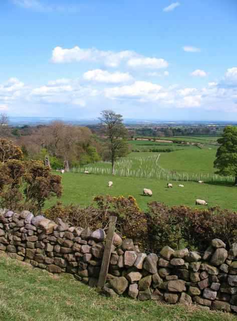
Biggin Wood is a lush and sprawling forest located in the heart of Yorkshire, England. Covering an area of approximately 500 hectares, it is a haven for nature enthusiasts and a significant landmark in the region. The wood is situated in the picturesque countryside, surrounded by rolling hills and meandering streams.

The wood is predominantly composed of native broadleaf trees such as oak, beech, and ash. These majestic trees create a dense canopy, providing shade and shelter for a diverse range of flora and fauna. Bluebells carpet the forest floor in the spring, creating a stunning display of vibrant colors.

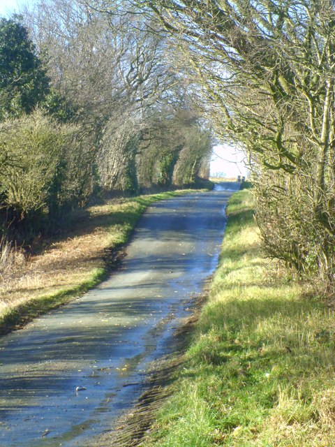
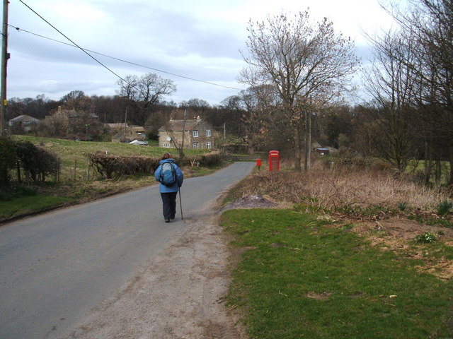
Biggin Wood is known for its well-maintained network of walking trails, allowing visitors to explore its beauty at their own pace. The paths wind through the forest, offering glimpses of ancient trees, enchanting clearings, and hidden wildlife. Birdwatchers are particularly drawn to the wood due to its abundance of avian species, including woodpeckers, owls, and various songbirds.

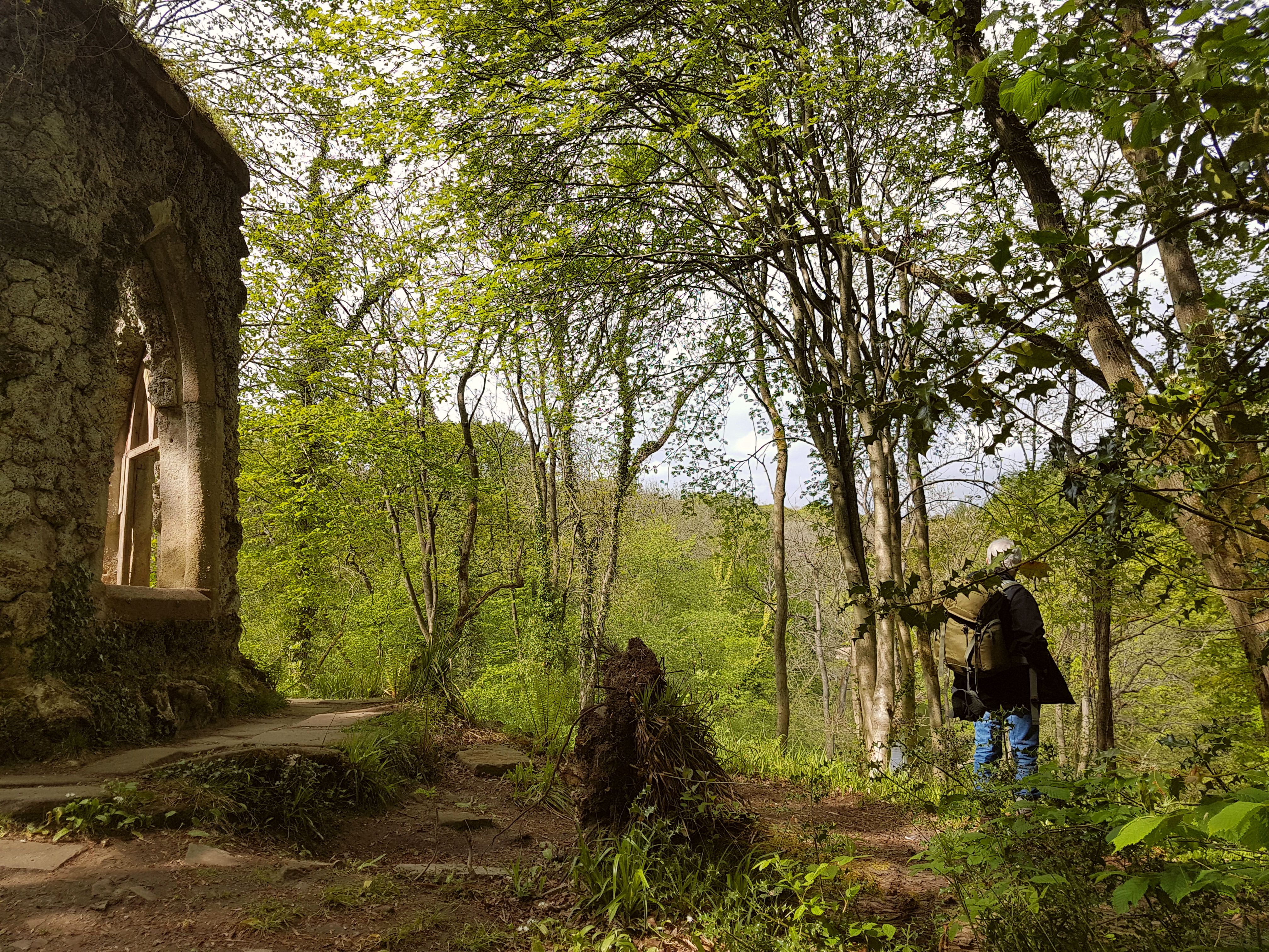
The wood also serves as an important habitat for several mammals, including foxes, badgers, and deer. These elusive creatures can occasionally be spotted by patient and observant visitors. In addition to its natural wonders, Biggin Wood boasts a rich history, with evidence of human activity dating back to the Roman era. Archaeological remains, such as ancient earthworks and burial mounds, add an extra layer of intrigue to the wood.

Overall, Biggin Wood is a captivating destination that offers a harmonious blend of natural beauty and historical significance. Whether one seeks tranquility, adventure, or a deeper connection with nature, this enchanting forest is sure to leave a lasting impression.

If you have any feedback on the listing, please let us know in the comments section below.

Biggin Wood Images

Images are sourced within 2km of 54.173179/-1.6786673 or Grid Reference SE2175. Thanks to Geograph Open Source API. All images are credited.

Kirk Bank Minor lane heading west from Kirkby Malzeard.
Kirk Bank
Minor lane heading west from Kirkby Malzeard.
Foulgate Nook Lane Access to Foulgate Farm from Grewelthorpe.
Foulgate Nook Lane
Access to Foulgate Farm from Grewelthorpe.
Access Lane to Thorpe Grange Tarmaced access lane leading off Foulgate Nook Lane towards Thorpe Grange.
Access Lane to Thorpe Grange
Tarmaced access lane leading off Foulgate Nook Lane towards Thorpe Grange.
Parked Up Old Ford tractor with a trailer full of stone parked up outside Foulgate Farm.
Parked Up
Old Ford tractor with a trailer full of stone parked up outside Foulgate Farm.
Bridleway to Kirkby Malzeard Bridleway from Foulgate to Kirkby Malzeard. This is probably an ancient track dating back to the medieval period when Kirkby was a market centre. The bridleway provides a through route to Lofthouse and upper Nidderdale.
Bridleway to Kirkby Malzeard
Bridleway from Foulgate to Kirkby Malzeard. This is probably an ancient track dating back to the medieval period when Kirkby was a market centre. The bridleway provides a through route to Lofthouse and upper Nidderdale.
Footbridge over Kex Beck Footbridge and ford at Kex Beck to the west of Kirkby Malzeard.
Footbridge over Kex Beck
Footbridge and ford at Kex Beck to the west of Kirkby Malzeard.
Tractors at work Ploughing fields to the west of Kirkby Malzeard.
Tractors at work
Ploughing fields to the west of Kirkby Malzeard.
Holmes Farm Holmes Farm stands amongst pastureland to the west of Kirkby Malzeard.
Holmes Farm
Holmes Farm stands amongst pastureland to the west of Kirkby Malzeard.
Duck pond, Foulgate A recently constructed duck pond, complete with smart duck house on an island.
Duck pond, Foulgate
A recently constructed duck pond, complete with smart duck house on an island.
Young trees in a dandelion patch Saplings planted in a field of dandelions on Grewelthorpe Moor. In the middle distance is Oak Stile Farm.
Young trees in a dandelion patch
Saplings planted in a field of dandelions on Grewelthorpe Moor. In the middle distance is Oak Stile Farm.
Sheep pastures, Spring Hill Green pastures slope away to the east from Spring Hill. The view extends to the distant Vale of York.
Sheep pastures, Spring Hill
Green pastures slope away to the east from Spring Hill. The view extends to the distant Vale of York.
Wreaks Lane Unsurfaced lane heading gently downhill towards Grewelthorpe.
Wreaks Lane
Unsurfaced lane heading gently downhill towards Grewelthorpe.
Kirk Bank The lane running westwards from Kirkby Malzeard towards Bagwith House and the moor edge is known as Kirk Bank. Its straightness would suggest that it was aligned around the time of 19thC parliamentary enclosures, although it is probably close to the line of medieval trackways that led from the markets in Kirkby to Upper Nidderdale.
Kirk Bank
The lane running westwards from Kirkby Malzeard towards Bagwith House and the moor edge is known as Kirk Bank. Its straightness would suggest that it was aligned around the time of 19thC parliamentary enclosures, although it is probably close to the line of medieval trackways that led from the markets in Kirkby to Upper Nidderdale.
Biggin Grange Sprawling farm buildings to the north of Kirk Bank near Kirkby Moorside. The name might suggest a link with the medieval granges of Fountains Abbey which is just a few miles away.
Biggin Grange
Sprawling farm buildings to the north of Kirk Bank near Kirkby Moorside. The name might suggest a link with the medieval granges of Fountains Abbey which is just a few miles away.
Kirk Bank Country lane that runs west from Kirkby Malzeard towards the moor edge. The lane is mostly straight, as are the field boundaries to either side, suggesting a 19thC enclosure road.
Kirk Bank
Country lane that runs west from Kirkby Malzeard towards the moor edge. The lane is mostly straight, as are the field boundaries to either side, suggesting a 19thC enclosure road.
Road junction in Kirkby Malzeard Looking eastward.
Road junction in Kirkby Malzeard
Looking eastward.
Ordnance Survey Flush Bracket S0409 This can be found on the roadside wall of a house in Kirkby Malzeard.
For more detail see : <span class="nowrap"><a title="http://www.bench-marks.org.uk/bm11417" rel="nofollow ugc noopener" href="http://www.bench-marks.org.uk/bm11417">Link</a><img style="margin-left:2px;" alt="External link" title="External link - shift click to open in new window" src="https://s1.geograph.org.uk/img/external.png" width="10" height="10"/></span>
Ordnance Survey Flush Bracket S0409
This can be found on the roadside wall of a house in Kirkby Malzeard. For more detail see : LinkExternal link
Biggin Wood Ford This ford is found on Wreaks Beck at Biggin Wood.
Biggin Wood Ford
This ford is found on Wreaks Beck at Biggin Wood.
Show me another place!

Biggin Wood is located at Grid Ref: SE2175 (Lat: 54.173179, Lng: -1.6786673)

Division: West Riding

Administrative County: North Yorkshire

District: Harrogate

Police Authority: North Yorkshire

What 3 Words

///aviation.remarried.wharfs. Near Masham, North Yorkshire

Nearby Locations

Biggin Wood

Related Wikis

Grewelthorpe

Grewelthorpe is a village and civil parish in the Harrogate district of North Yorkshire, England situated 3 miles (5 km) south of Masham and 6.2 miles...

Kirkby Malzeard

Kirkby Malzeard () is a village and civil parish in the Harrogate district of North Yorkshire, England. There has been a creamery in the village making...

Swinton with Warthermarske

Swinton with Warthermarske is a civil parish in Harrogate district, North Yorkshire, England. The parish includes the village of Swinton and the hamlets...

Hack Fall Wood

Hack Fall Wood, otherwise known as Hackfall, is a Site of Special Scientific Interest, or SSSI, of 44.8687 hectares (0.4487 km2; 0.1732 sq mi), lying north...

Laverton, North Yorkshire

Laverton is a village and civil parish in the Harrogate district of North Yorkshire, England, about 7 miles (11 km) west of Ripon. The population of this...

Ilton, North Yorkshire

Ilton is a village in North Yorkshire, England, 3 miles south-west of Masham. It is the principal settlement in the civil parish of Ilton cum Pott, in...

Warthermarske

Warthermarske is a hamlet in the Harrogate borough of North Yorkshire, England. It is near Swinton, about 1 mile (2 km) south-west of Masham. The village...

Dallowgill

Dallowgill (historically also Dallaghill) is a village in Harrogate district in North Yorkshire, England. It consists of a number of scattered settlements...

Nearby Amenities

Located within 500m of 54.173179,-1.6786673
Wreaks Wath
Ford: yes
Source: OS OpenData StreetView
Lat/Long: 54.1750131/-1.6790548
Building: yes
Lat/Long: 54.1703363/-1.6831178
Information: route_marker
Tourism: information
Lat/Long: 54.1715569/-1.6816748
Barrier: cattle_grid
Lat/Long: 54.170374/-1.6818292
Information: route_marker
Tourism: information
Lat/Long: 54.1705252/-1.6775969
Ford: yes
Lat/Long: 54.1726408/-1.6746579
Power: pole
Lat/Long: 54.1707448/-1.6802087
Power: pole
Lat/Long: 54.1704501/-1.6788037
Power: pole
Lat/Long: 54.1701331/-1.6772846
Barrier: stile
Lat/Long: 54.1705011/-1.6775273
Power: pole
Lat/Long: 54.1697893/-1.6756403
Power: pole
Lat/Long: 54.1710411/-1.6817004
Power: pole
Lat/Long: 54.1713571/-1.6831662
The data included in this document is from www.openstreetmap.org. The data is made available under ODbL.

Have you been to Biggin Wood?

Leave your review of Biggin Wood below (or comments, questions and feedback).