Amberwood Inclosure

Wood, Forest in Hampshire New Forest

England

Amberwood Inclosure

Bowl Barrow on Hiscocks Hill (Scale 1m) <span class="nowrap"><a title="https://historicengland.org.uk/listing/the-list/list-entry/1010086?section=official-listing" rel="nofollow ugc noopener" href="https://historicengland.org.uk/listing/the-list/list-entry/1010086?section=official-listing">Link</a><img style="margin-left:2px;" alt="External link" title="External link - shift click to open in new window" src="https://s1.geograph.org.uk/img/external.png" width="10" height="10"/></span>
Bowl Barrow on Hiscocks Hill Credit: Sandy Gerrard

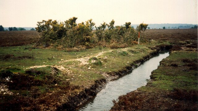
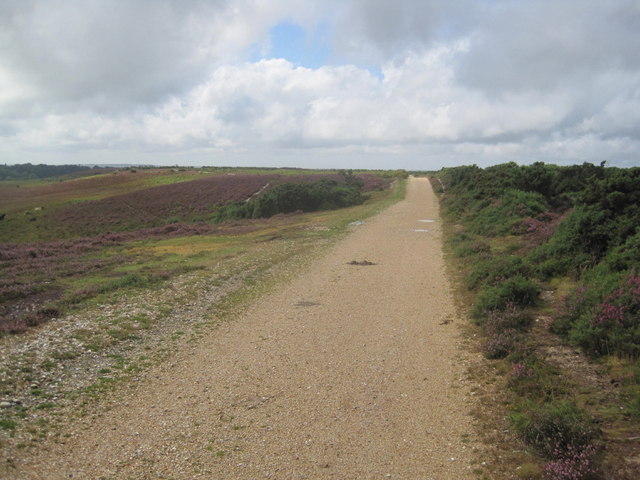
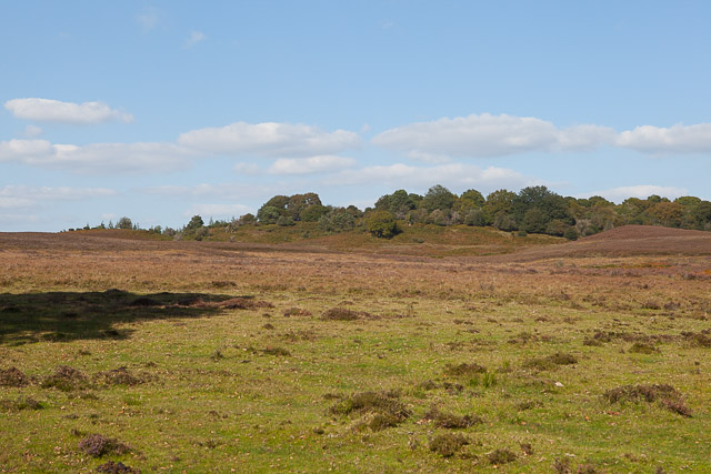
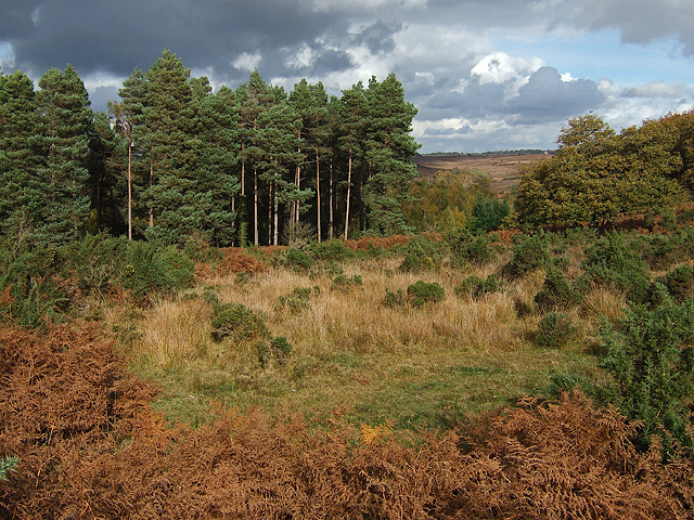
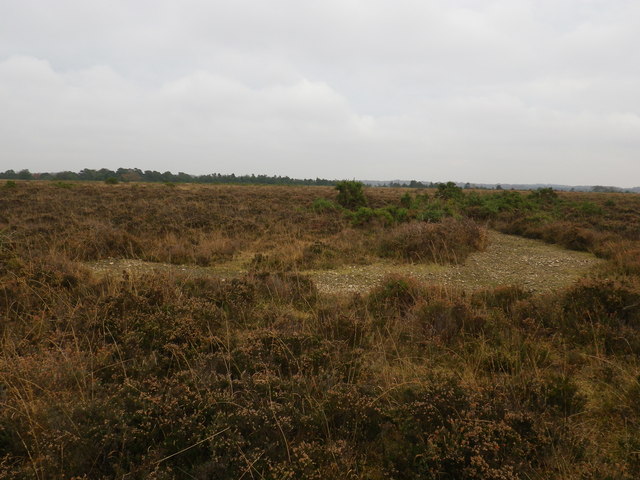
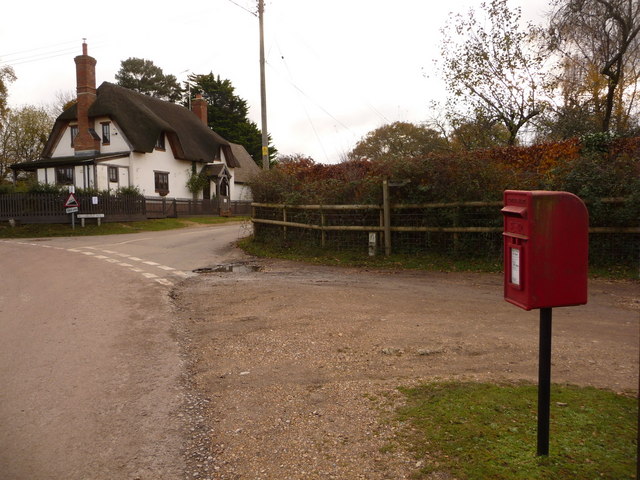
Amberwood Inclosure is a picturesque woodland area located in Hampshire, England. Covering an area of approximately 100 hectares, it is part of the larger New Forest National Park. The inclosure is known for its diverse flora and fauna, making it a popular destination for nature enthusiasts and hikers.

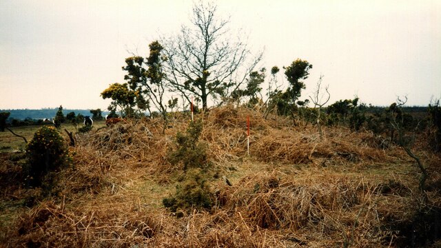
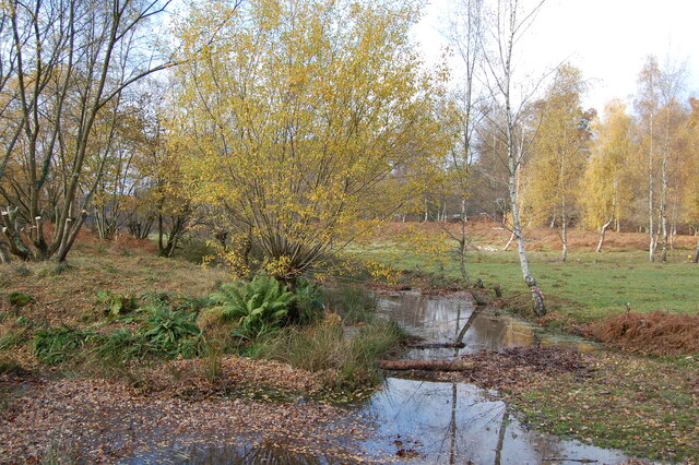
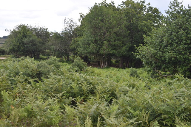
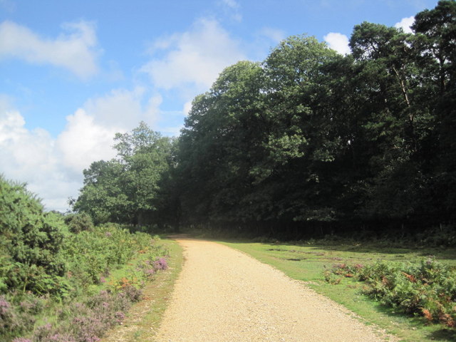
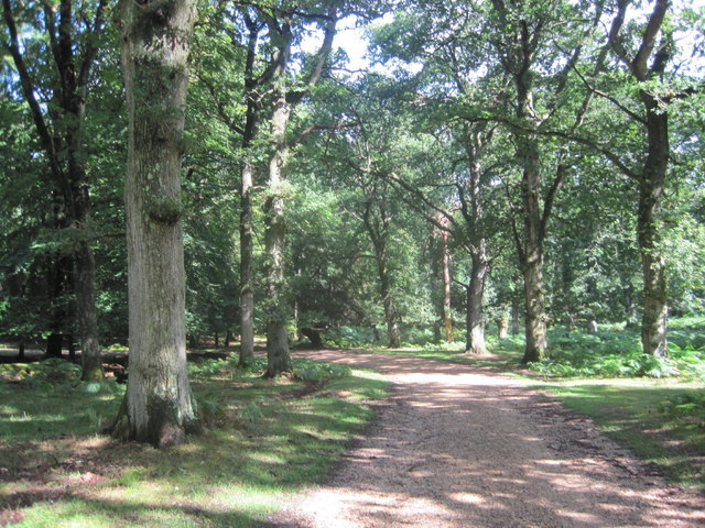
The woodland consists primarily of deciduous trees, including oak, beech, and birch, which provide a dense canopy and create a tranquil atmosphere. Throughout the year, the forest floor is carpeted with wildflowers such as bluebells and wood anemones, adding to its natural beauty.

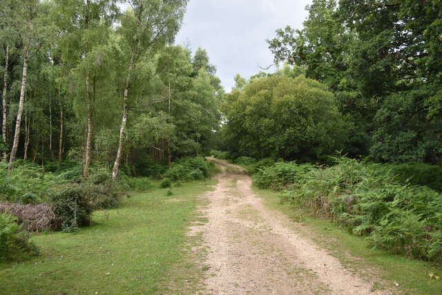
Amberwood Inclosure offers a network of well-maintained walking trails, allowing visitors to explore the area and enjoy the peaceful surroundings. The trails vary in length and difficulty, catering to both casual walkers and more experienced hikers. Along the way, visitors may encounter a variety of wildlife, including deer, squirrels, and a wide array of bird species.

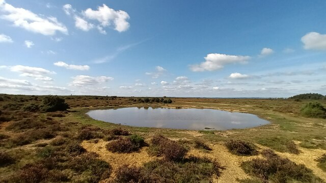
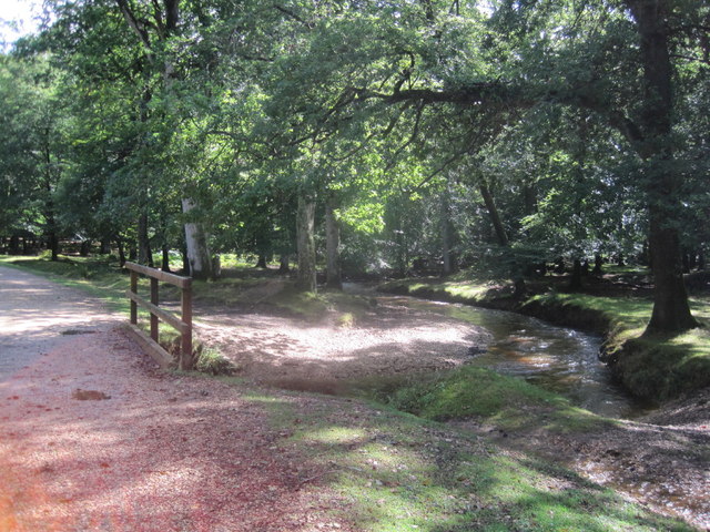
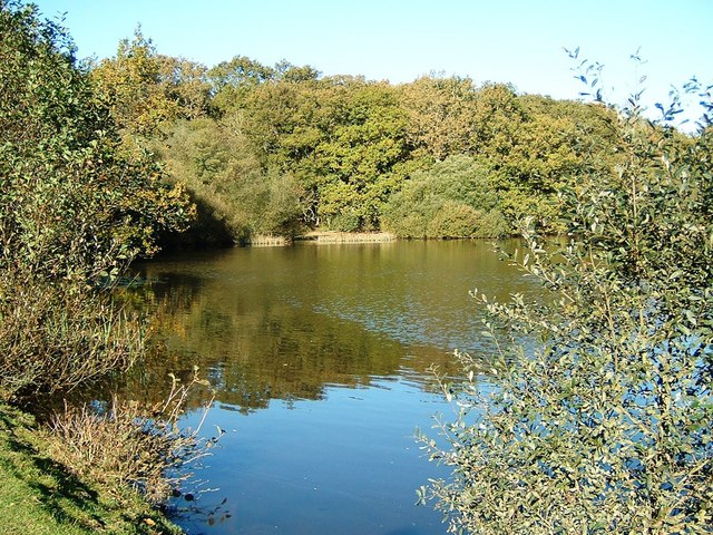
The inclosure is also home to a small pond, known as Amberwood Pond, which attracts a range of aquatic life, including frogs, newts, and dragonflies. This provides a peaceful spot for visitors to sit and observe the natural surroundings.

As part of the New Forest National Park, Amberwood Inclosure is managed by the Forestry Commission, who ensure the preservation of the woodland while also promoting responsible usage. This means visitors must adhere to certain guidelines, such as keeping dogs on leads and sticking to designated paths.

Overall, Amberwood Inclosure offers a tranquil and scenic woodland experience, making it an ideal destination for nature lovers and those seeking a peaceful retreat in the heart of Hampshire.

If you have any feedback on the listing, please let us know in the comments section below.

Amberwood Inclosure Images

Images are sourced within 2km of 50.922216/-1.7019356 or Grid Reference SU2113. Thanks to Geograph Open Source API. All images are credited.

Bowl Barrow on Hiscocks Hill (Scale 1m) <span class="nowrap"><a title="https://historicengland.org.uk/listing/the-list/list-entry/1010086?section=official-listing" rel="nofollow ugc noopener" href="https://historicengland.org.uk/listing/the-list/list-entry/1010086?section=official-listing">Link</a><img style="margin-left:2px;" alt="External link" title="External link - shift click to open in new window" src="https://s1.geograph.org.uk/img/external.png" width="10" height="10"/></span>
Bowl Barrow on Hiscocks Hill
(Scale 1m) LinkExternal link
Bowl barrow at Ashley Cross (Scales 1m) <span class="nowrap"><a title="https://historicengland.org.uk/listing/the-list/list-entry/1012537?section=official-listing" rel="nofollow ugc noopener" href="https://historicengland.org.uk/listing/the-list/list-entry/1012537?section=official-listing">Link</a><img style="margin-left:2px;" alt="External link" title="External link - shift click to open in new window" src="https://s1.geograph.org.uk/img/external.png" width="10" height="10"/></span>
Bowl barrow at Ashley Cross
(Scales 1m) LinkExternal link
Track passing west of Island Thorns Inclosure
Track climbing from the ford in Ashley Bottom
Observation shelter on the former Ashley Walk Bombing Range On the inside of the near end wall is the information board shown in <a href="https://www.geograph.org.uk/photo/4477882">SU2014 : (7d) A tour of the WWII Ashley Walk Bombing Range - Observation Shelter (detail)</a>.
Observation shelter on the former Ashley Walk Bombing Range
On the inside of the near end wall is the information board shown in SU2014 : (7d) A tour of the WWII Ashley Walk Bombing Range - Observation Shelter (detail).
Island Thorns Inclosure Track heading downhill into open mixed woodland.
<span class="nowrap"><a title="www.newforestnpa.gov.uk" rel="nofollow ugc noopener" href="http://www.newforestnpa.gov.uk">Link</a><img style="margin-left:2px;" alt="External link" title="External link - shift click to open in new window" src="https://s1.geograph.org.uk/img/external.png" width="10" height="10"/></span>
Island Thorns Inclosure
Track heading downhill into open mixed woodland. LinkExternal link
Grand Slam View looking WNW across Grand Slam bomb crater  from top of  tumulus.
Grand Slam
View looking WNW across Grand Slam bomb crater from top of tumulus.
Small stream in Pitts Wood Inclosure,  New Forest The stream has divided here to form a small island.
Small stream in Pitts Wood Inclosure, New Forest
The stream has divided here to form a small island.
Bracken and woodland at Lodge Hill
Flintstone Broken flint, with what is supected to be quartz crystals within. Found on Ashley Walk WW2 Bombing range, adjacent to a number of bomb craters.
Flintstone
Broken flint, with what is supected to be quartz crystals within. Found on Ashley Walk WW2 Bombing range, adjacent to a number of bomb craters.
Traffic Free Cycle, Alderhill Bottom
Traffic Free Cycle Route into Amberwood Inclosure
Traffic Free Cycle Route through Amberwood Inclosure
Unnamed Stream near Gorley Bushes
Woodland south of Sloden Inclosure Looking across a mire from Splash Bridge to woodland outside Sloden Inclosure. Within this woodland is the site of a royal hunting lodge. It appears to be named The Churchyard, but whether this refers to the woodland or the site I know not.
Woodland south of Sloden Inclosure
Looking across a mire from Splash Bridge to woodland outside Sloden Inclosure. Within this woodland is the site of a royal hunting lodge. It appears to be named The Churchyard, but whether this refers to the woodland or the site I know not.
A tour of the WWII Ashley Walk Bombing Range (addendum) - site of Grand Slam bomb crater The only live test of a Grand Slam bomb took place on 13 March 1945 at the Ashley Walk Bombing Range. The Barnes-Wallis designed 22,000 pound "Earthquake Bomb" was released from a specially modified Lancaster from 16,000 ft over the village of Godshill. It penetrated the ground and on cue, exploded as intended 9 seconds later creating an enormous crater 130 ft across, and 70 ft deep. This was preparatory to the successful raid on the Bielefeld Viaduct by Lancasters of 617 ("Dambusters") Squadron the following day using Tallboys, and one Grand Slam bomb carried by a specially modified Lancaster. The Grand Slam proved instrumental in the final destruction of the viaduct that hitherto had withstood  a number of previously unsuccessful attacks.

Unfortunately for historians there is no trace of the crater of the range's test bomb visible today, as it was infilled as part of the New Forest post-war restorative programme of works. However, Norman Parker in his definitive work on the Ashley Walk Bombing Range identifies the area of the crater just north of the "Submarine Pen" target as '..a marshy depression 100 yards south-west of the Ashley Cross gate into Pitts Wood. Its site is marked by a large growth of reeds.' His description of the former crater fits this view of the area precisely.

For a photo and information on subsequent operations involving both Tallboy and Grand Slam bombs see: <a title="https://www.geograph.org.uk/photo/4275685" href="https://www.geograph.org.uk/photo/4275685">Link</a>

Google Earth view: <span class="nowrap"><a title="https://www.google.co.uk/maps/@50.9268175,-1.71671,205m/data=!3m1!1e3" rel="nofollow ugc noopener" href="https://www.google.co.uk/maps/@50.9268175,-1.71671,205m/data=!3m1!1e3">Link</a><img style="margin-left:2px;" alt="External link" title="External link - shift click to open in new window" src="https://s1.geograph.org.uk/img/external.png" width="10" height="10"/></span>

BACK: <a href="https://www.geograph.org.uk/photo/4478140">SU2016 : (17b) A tour of the WWII Ashley Walk Bombing Range - site of North Tower</a>
A tour of the WWII Ashley Walk Bombing Range (addendum) - site of Grand Slam bomb crater
The only live test of a Grand Slam bomb took place on 13 March 1945 at the Ashley Walk Bombing Range. The Barnes-Wallis designed 22,000 pound "Earthquake Bomb" was released from a specially modified Lancaster from 16,000 ft over the village of Godshill. It penetrated the ground and on cue, exploded as intended 9 seconds later creating an enormous crater 130 ft across, and 70 ft deep. This was preparatory to the successful raid on the Bielefeld Viaduct by Lancasters of 617 ("Dambusters") Squadron the following day using Tallboys, and one Grand Slam bomb carried by a specially modified Lancaster. The Grand Slam proved instrumental in the final destruction of the viaduct that hitherto had withstood a number of previously unsuccessful attacks. Unfortunately for historians there is no trace of the crater of the range's test bomb visible today, as it was infilled as part of the New Forest post-war restorative programme of works. However, Norman Parker in his definitive work on the Ashley Walk Bombing Range identifies the area of the crater just north of the "Submarine Pen" target as '..a marshy depression 100 yards south-west of the Ashley Cross gate into Pitts Wood. Its site is marked by a large growth of reeds.' His description of the former crater fits this view of the area precisely. For a photo and information on subsequent operations involving both Tallboy and Grand Slam bombs see: Link Google Earth view: LinkExternal link BACK: SU2016 : (17b) A tour of the WWII Ashley Walk Bombing Range - site of North Tower
"C" symbol on fragmentation target area on Ashley Walk bombing range The symbol is quite hard to locate and only becomes visible within the last 15 metres or so.
"C" symbol on fragmentation target area on Ashley Walk bombing range
The symbol is quite hard to locate and only becomes visible within the last 15 metres or so.
"D" symbol on fragmentation target area on Ashley Walk bombing range The "D" symbol is easier to find than the "C" symbol, just look to the west of the nearby gravel track for a clump of bushes.
"D" symbol on fragmentation target area on Ashley Walk bombing range
The "D" symbol is easier to find than the "C" symbol, just look to the west of the nearby gravel track for a clump of bushes.
Show me another place!

Amberwood Inclosure is located at Grid Ref: SU2113 (Lat: 50.922216, Lng: -1.7019356)

Administrative County: Hampshire

District: New Forest

Police Authority: Hampshire

What 3 Words

///conductor.orbited.deprives. Near Fordingbridge, Hampshire

Nearby Locations

Amberwood Inclosure

Related Wikis

Eyeworth Pond

Eyeworth Pond is a pond located near Fritham in the New Forest, in Hampshire, England. The pond was created in 1871 by damming Latchmore Brook, with the...

Ashley Range

Ashley Range is a former World War II bombing range in the New Forest, Hampshire, England. The range is approximately 5 mi (8.0 km) north-west of Lyndhurst...

Ocknell Plain

Ocknell Plain can be found in the New Forest near Southampton, England. The area was used in World War II for the Stoney Cross airfield and it is now very...

Fritham

Fritham is a small village in Hampshire, England. It lies in the north of the New Forest, near the Wiltshire border. It is in the civil parish of Bramshaw...

RAF Stoney Cross

Royal Air Force Stoney Cross or more simply RAF Stoney Cross is a former Royal Air Force station in the New Forest, Hampshire, England. The airfield is...

Ogdens

Ogdens is a small hamlet south of Hyde Common near Frogham in the New Forest area of Hampshire, England. Ogdens is a hamlet in the civil parish of Hyde...

Blissford

Blissford is a hamlet in the civil parish of Hyde situated in the New Forest National Park in Hampshire, England. Its nearest town is Fordingbridge, which...

Frogham, Hampshire

Frogham is a small village in the New Forest National Park of Hampshire, England. It is in the civil parish of Hyde. Its nearest town is Fordingbridge...

Nearby Amenities

Located within 500m of 50.922216,-1.7019356
Lcn Ref: 10
Lat/Long: 50.9261663/-1.7028231
Bicycle: yes
Ford: yes
Motor Vehicle: yes
Lat/Long: 50.9217828/-1.7018251
Bicycle: yes
Foot: yes
Ford: yes
Motor Vehicle: no
Seasonal: no
Lat/Long: 50.9247504/-1.6962874
Ford: yes
Lat/Long: 50.9241943/-1.6966981
The data included in this document is from www.openstreetmap.org. The data is made available under ODbL.

Have you been to Amberwood Inclosure?

Leave your review of Amberwood Inclosure below (or comments, questions and feedback).