Ash Plantation
Wood, Forest in Gloucestershire Cotswold
England
Ash Plantation

Ash Plantation is a woodland area located in Gloucestershire, England. Situated in the southern part of the county, it covers an area of approximately 50 acres. The plantation is predominantly composed of ash trees, hence its name, although there are also other species of trees present, including oak and beech.
The woodland is well-preserved and managed by the local authorities, ensuring its biodiversity and ecological integrity. It provides a habitat for a variety of plant and animal species, making it an important site for nature conservation. The mix of tree species creates a diverse canopy, allowing for the growth of undergrowth and providing shelter for wildlife.
Ash Plantation is a popular destination for outdoor enthusiasts and nature lovers. It offers a range of recreational activities, such as walking trails, cycling paths, and birdwatching spots. The forest paths are well-maintained, making it accessible for people of all ages and abilities.
The woodland also holds historical significance, as it is believed to have been present for several centuries. It has witnessed changes in land use and has played a role in the local economy over the years. Today, it serves as a peaceful retreat away from the hustle and bustle of urban life, providing a tranquil environment for visitors to enjoy the beauty of nature.
Overall, Ash Plantation in Gloucestershire offers a rich natural environment, recreational opportunities, and a glimpse into the region's history.
If you have any feedback on the listing, please let us know in the comments section below.
Ash Plantation Images
Images are sourced within 2km of 51.853935/-1.6995715 or Grid Reference SP2017. Thanks to Geograph Open Source API. All images are credited.


Ash Plantation is located at Grid Ref: SP2017 (Lat: 51.853935, Lng: -1.6995715)
Administrative County: Gloucestershire
District: Cotswold
Police Authority: Gloucestershire
What 3 Words
///corporate.opposite.vision. Near Bourton on the Water, Gloucestershire
Nearby Locations
Related Wikis

Great Rissington
Great Rissington is a village in the Cotswold district of Gloucestershire, England. The population taken at the 2011 census was 367. == History == In the...

RAF Little Rissington
Royal Air Force Little Rissington or more simply RAF Little Rissington (ICAO: EGVL) is an Royal Air Force satellite station in Gloucestershire, England...

Upper Rissington
Upper Rissington is a village and civil parish in the Cotswold district of Gloucestershire, England. It is located about two-and-a-half miles east of Bourton...

River Dikler
The River Dikler is a short river in the Cotswold District of Gloucestershire which flows for 12 kilometres (7.5 mi) through Upper Swell and to the west...
Westcote, Gloucestershire
Westcote is a civil parish in the Cotswold district, in the county of Gloucestershire, England. The village is about 4 miles (6 km) south-southeast of...

Fifield, Oxfordshire
Fifield is a village and civil parish about 4 miles (6.4 km) north of Burford in Oxfordshire. The western boundary of the parish forms part of the county...

Little Rissington
Little Rissington is a village and civil parish about 3+1⁄2 miles (6 km) south of Stow-on-the-Wold in the Cotswold District of Gloucestershire, England...
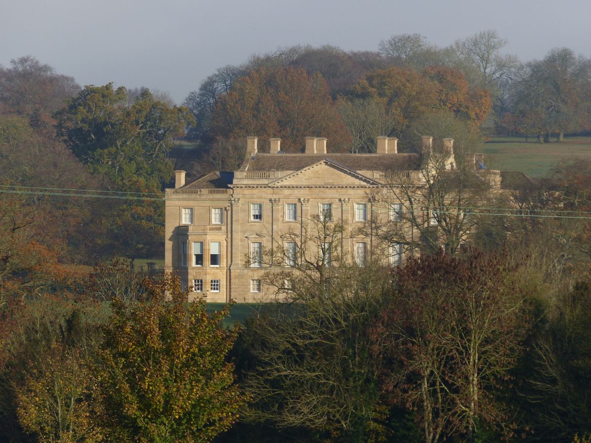
Barrington Park
Barrington Park is a Palladian style country house standing in an estate of the same name near the villages of Great Barrington and Little Barrington,...
Nearby Amenities
Located within 500m of 51.853935,-1.6995715Have you been to Ash Plantation?
Leave your review of Ash Plantation below (or comments, questions and feedback).