Kitty's Plantation

Wood, Forest in Durham

England

Kitty's Plantation

Straw Bales Taken from the Lanchester Valley Walk with Burnhope TV Mast in the distance.
Straw Bales Credit: Mick Garratt

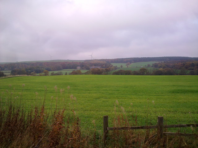
Kitty's Plantation, located in Durham, is a charming woodland area known for its serene ambiance and lush greenery. Situated within a dense forest, this picturesque plantation offers a peaceful retreat from the bustling city life.

Covering an expansive area, Kitty's Plantation is home to a diverse range of plant species, creating a rich and vibrant ecosystem. Towering trees, such as oak, maple, and pine, dominate the landscape, providing ample shade and creating a cool and refreshing atmosphere.

The plantation boasts a well-maintained pathway that meanders through the woods, allowing visitors to explore the natural beauty at their own pace. The trail is adorned with colorful wildflowers, which add a touch of vibrancy to the surroundings.

Kitty's Plantation also features a small pond, adding to the tranquility of the environment. The pond serves as a habitat for various aquatic plants and creatures, enhancing the plantation's ecological diversity.

This natural haven attracts a plethora of wildlife, including squirrels, rabbits, and a variety of bird species. Birdwatchers will find delight in observing the different avian residents, such as cardinals, blue jays, and woodpeckers, among others.

Visitors to Kitty's Plantation can enjoy a leisurely stroll amidst nature, taking in the sights and sounds of the forest. The plantation provides the perfect escape for those seeking solace, relaxation, and a closer connection to the natural world.

If you have any feedback on the listing, please let us know in the comments section below.

Kitty's Plantation Images

Images are sourced within 2km of 54.817588/-1.6784478 or Grid Reference NZ2047. Thanks to Geograph Open Source API. All images are credited.

Straw Bales Taken from the Lanchester Valley Walk with Burnhope TV Mast in the distance.
Straw Bales
Taken from the Lanchester Valley Walk with Burnhope TV Mast in the distance.
Inscription on Burnhope War Memorial Primitive Methodist Church in background
Inscription on Burnhope War Memorial
Primitive Methodist Church in background
Burnhope War Memorial
Burnhope War Memorial in 1992 The coal tubs commemorating Burnhope Colliery are no longer a feature on the war memorial site in 2006
Burnhope War Memorial in 1992
The coal tubs commemorating Burnhope Colliery are no longer a feature on the war memorial site in 2006
Standagainstall Plantation, Long Edge
Field in front of Langley West House Lanchester
Road to Langley West House
Lanchester-Witton Gilbert Road
Tree near Burnhopeside Hall
View towards Burnhope
Looking across the valley View north from the Lanchester Valley Walk from west of Langley Park. The big farm in the distance is Langley House, on the A691 Durham road.
Looking across the valley
View north from the Lanchester Valley Walk from west of Langley Park. The big farm in the distance is Langley House, on the A691 Durham road.
View across the Browney Valley Looking north from the Lanchester Valley Railway Path, west of Langley Park.
View across the Browney Valley
Looking north from the Lanchester Valley Railway Path, west of Langley Park.
Road across field, heading towards wind turbine The road may well be an access route for the wind machine and for others although it / they, lie beyond the hedge and a minor road.
Road across field, heading towards wind turbine
The road may well be an access route for the wind machine and for others although it / they, lie beyond the hedge and a minor road.
Looking North from the railway path View from the Lanchester Valley walk. The farm in the middle distance is Langley House.
Looking North from the railway path
View from the Lanchester Valley walk. The farm in the middle distance is Langley House.
Bridleway sign on footpath, by Holmside Lane This is the footpath running south, the bridleway is on the other side of the wire fence.
Bridleway sign on footpath, by Holmside Lane
This is the footpath running south, the bridleway is on the other side of the wire fence.
Muddy bridleway, south of Holmside Lane Seen from the parallel footpath.
Muddy bridleway, south of Holmside Lane
Seen from the parallel footpath.
Footpath to Fellside Plantation Heading south from Holmside Lane.
Footpath to Fellside Plantation
Heading south from Holmside Lane.
Burnhopeside Cottages Between Durham and Lanchester.
Burnhopeside Cottages
Between Durham and Lanchester.
Show me another place!

Kitty's Plantation is located at Grid Ref: NZ2047 (Lat: 54.817588, Lng: -1.6784478)

Unitary Authority: County Durham

Police Authority: Durham

What 3 Words

///worms.mediate.stuffing. Near Langley Park, Co. Durham

Related Wikis

Witton Gilbert railway station

Witton Gilbert railway station served the village of Witton Gilbert, County Durham, England from 1862 to 1963 on the Lanchester Valley Line. == History... ==

Wall Nook

Wall Nook is a small village in County Durham, in England. It is situated to the south of Langley Park, to the north west of Durham. Wall Nook is known...

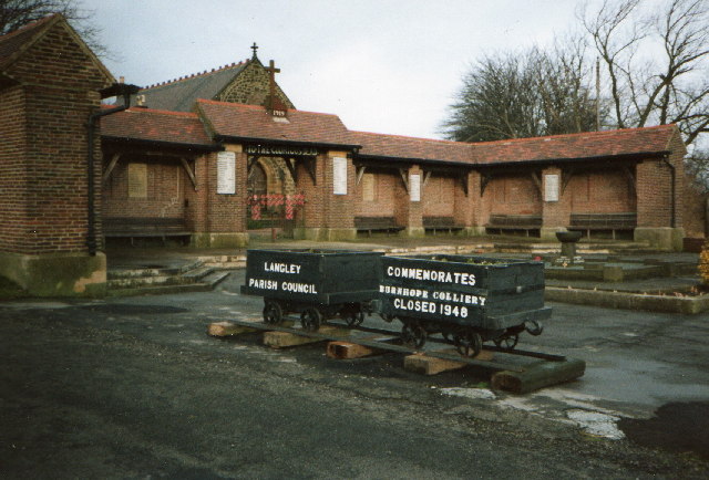
Langley Park, County Durham

Langley Park is a village in County Durham, England. The historic city of Durham lies 4 miles (6.4 km) to the east, and the larger city (and regional capital...

Holmside

Holmside is a village in County Durham, in England. It is situated to the north-west of Sacriston. The village has a 5.5 MW wind farm, Holmside Hall Wind...

Nearby Amenities

Located within 500m of 54.817588,-1.6784478
The data included in this document is from www.openstreetmap.org. The data is made available under ODbL.

Have you been to Kitty's Plantation?

Leave your review of Kitty's Plantation below (or comments, questions and feedback).