Crab Orchard
Wood, Forest in Gloucestershire Cotswold
England
Crab Orchard

Crab Orchard is a small wood located in the county of Gloucestershire, England. Situated in the heart of the Forest of Dean, it covers an area of approximately 50 acres and is renowned for its natural beauty and diverse wildlife.
The woodland is characterized by a mixture of deciduous and coniferous trees, including oak, beech, pine, and spruce, creating a rich tapestry of colors throughout the year. The forest floor is covered in a thick carpet of ferns, mosses, and wildflowers, adding to the enchanting atmosphere of the wood.
Crab Orchard is a popular destination for nature enthusiasts, hikers, and birdwatchers. The wood is home to a wide variety of bird species, including woodpeckers, owls, and songbirds, offering visitors a unique opportunity to observe and appreciate the local avifauna.
In addition to its natural beauty, Crab Orchard also has historical significance. The wood was once part of the ancient Royal Forest of Dean, which was a royal hunting ground dating back to the Roman times. Remnants of the forest's past can still be found in the form of old boundary markers and disused charcoal pits, providing visitors with a glimpse into the area's rich history.
Overall, Crab Orchard is a picturesque woodland that offers a tranquil and immersive experience for those seeking to escape the hustle and bustle of everyday life. Whether you are a nature lover, history enthusiast, or simply looking for a peaceful retreat, Crab Orchard in Gloucestershire is sure to captivate and inspire.
If you have any feedback on the listing, please let us know in the comments section below.
Crab Orchard Images
Images are sourced within 2km of 51.953326/-1.7021386 or Grid Reference SP2028. Thanks to Geograph Open Source API. All images are credited.


Crab Orchard is located at Grid Ref: SP2028 (Lat: 51.953326, Lng: -1.7021386)
Administrative County: Gloucestershire
District: Cotswold
Police Authority: Gloucestershire
What 3 Words
///beanbag.bookcases.bleaker. Near Donnington, Gloucestershire
Nearby Locations
Related Wikis
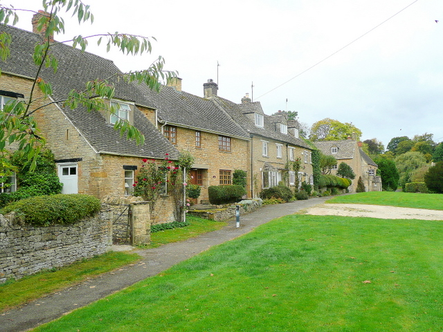
Broadwell, Cotswold
Broadwell is a village and civil parish in the English county of Gloucestershire. It is about 1.5 miles (2.4 km) north of Stow-on-the-Wold, In the 2001...

Donnington, Gloucestershire
Donnington is a small village and civil parish in Gloucestershire, near the Roman Fosse Way in the Cotswold District Council area of south west England...
Battle of Stow-on-the-Wold
The Battle of Stow-on-the-Wold (21 March 1646) took place during the First English Civil War. It was a Parliamentarian victory by detachments of the New...

Longborough
Longborough is a village and civil parish 2.5 miles (4.0 km) north of the market town of Stow on the Wold, Gloucestershire. The parish population taken...
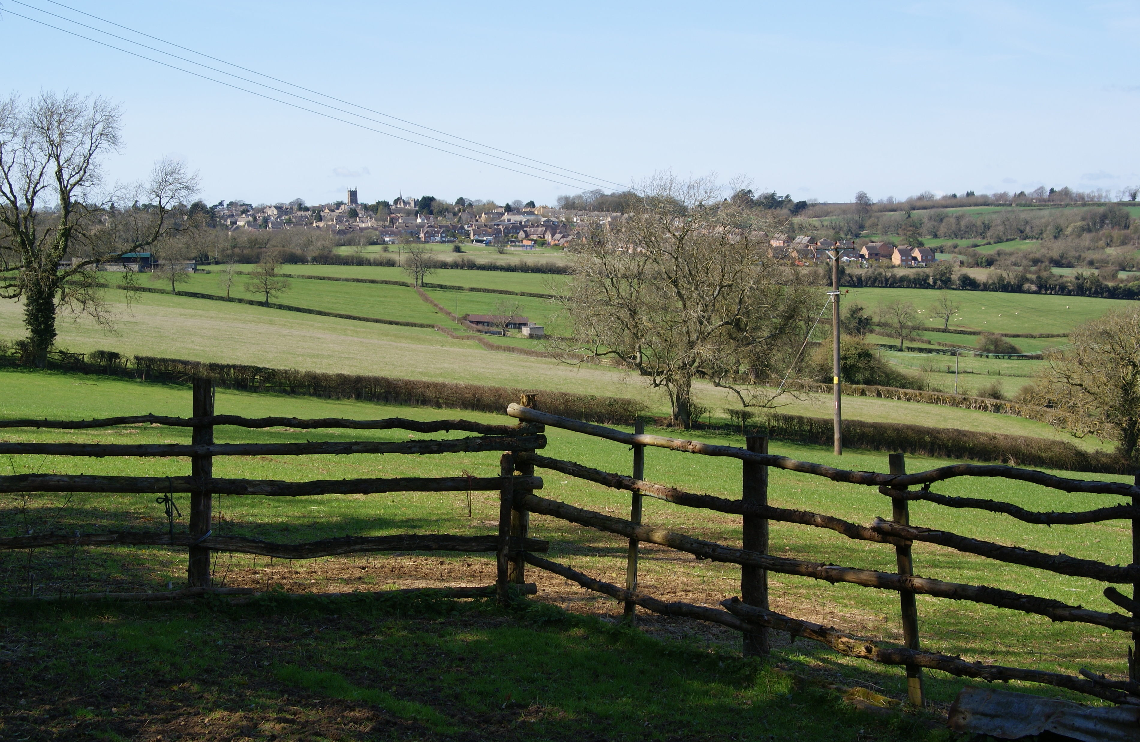
Evenlode
Evenlode is a village and civil parish (ONS Code 23UC051) in the Cotswold District of eastern Gloucestershire in England.Evenlode is bordered by the Gloucestershire...

Stow-on-the-Wold
Stow-on-the-Wold is a market town and civil parish in Gloucestershire, England, on top of an 800-foot (244 m) hill at the junction of main roads through...
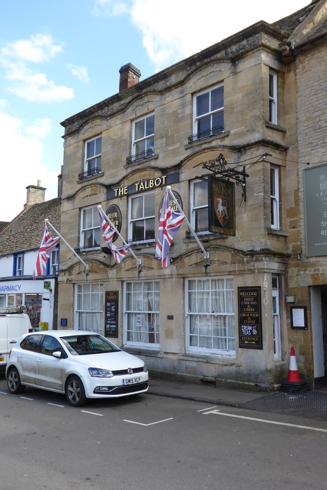
The Talbot, Stow-on-the-Wold
The Talbot, formerly known as The Talbot Hotel, is a public house in the Market Square in Stow-on-the-Wold, Gloucestershire, England. The structure, which...
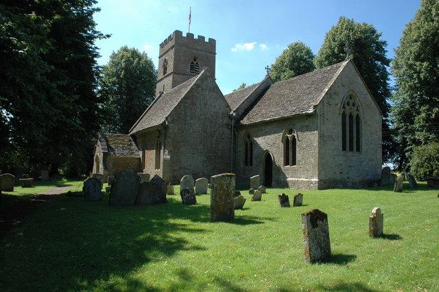
St James' Church, Longborough
St James' Church is the Church of England parish church of Longborough, Gloucestershire, England. It is in the deanery of Stow, the archdeaconry of Cheltenham...
Nearby Amenities
Located within 500m of 51.953326,-1.7021386Have you been to Crab Orchard?
Leave your review of Crab Orchard below (or comments, questions and feedback).