New Forest

Wood, Forest in Wiltshire

England

New Forest

Farmland, Mildenhall Stubble viewed from the bridleway below Rabley Barn,
Farmland, Mildenhall Credit: Andrew Smith

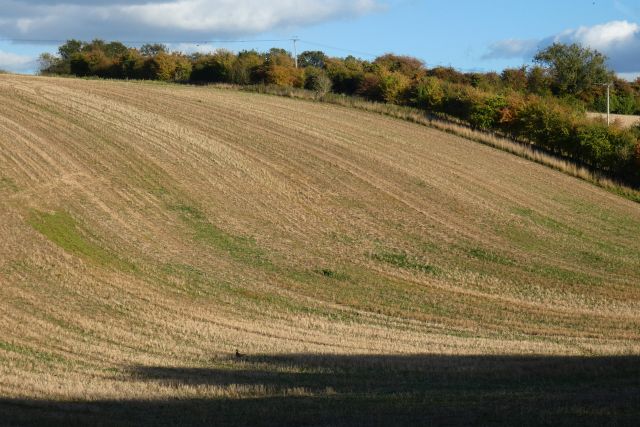
New Forest, located in Wiltshire, England, is a beautiful and expansive woodland area known for its rich history and diverse wildlife. Covering an area of approximately 150 square miles, the forest is bordered by the River Avon to the west and the Hampshire border to the east.

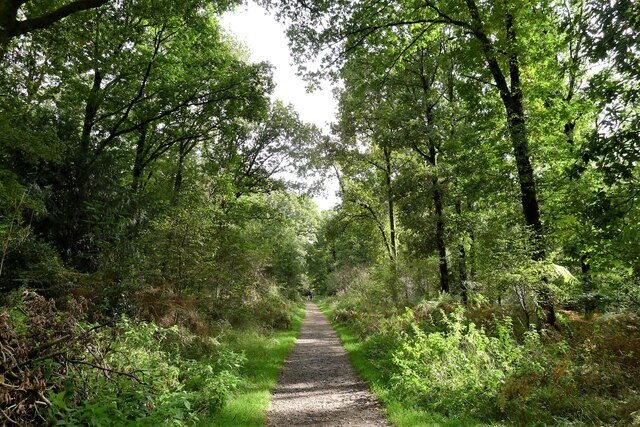
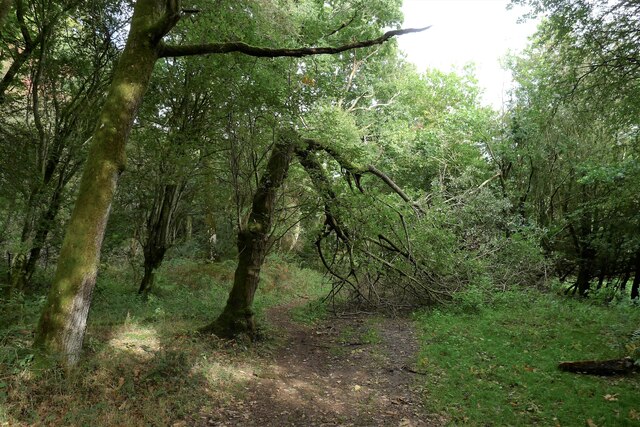
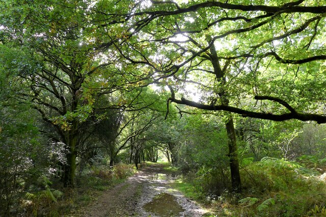
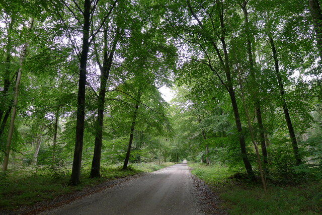
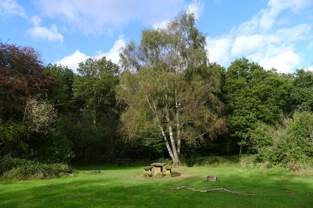
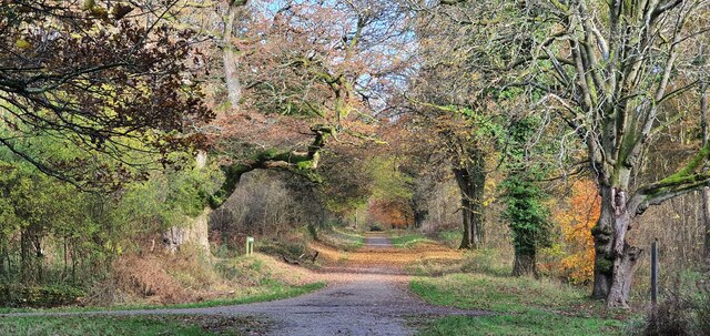
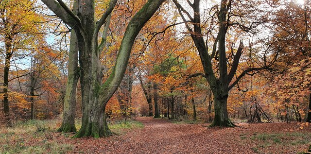
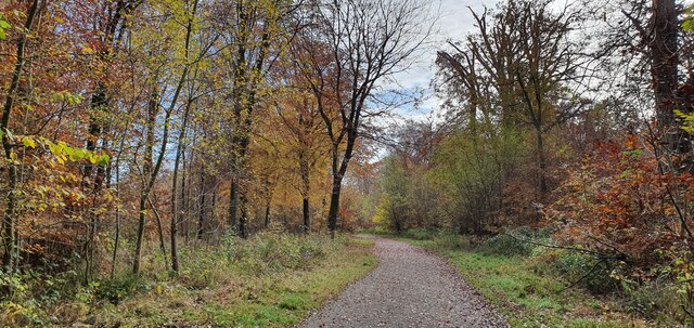
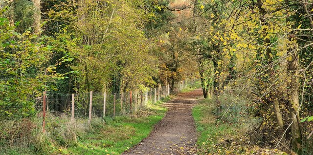
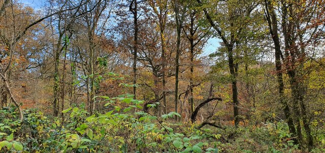
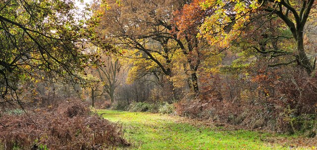
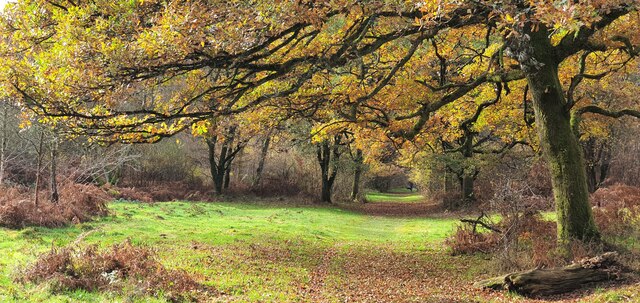
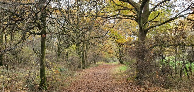
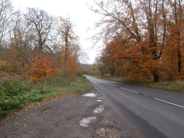
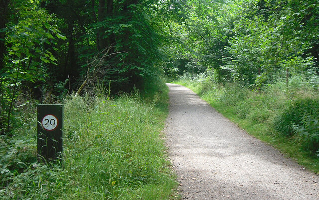
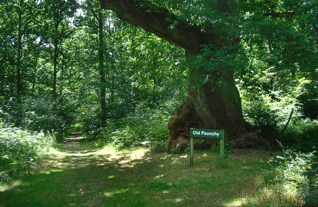
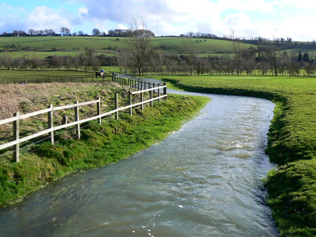
The New Forest is characterized by its ancient woodland, heathland, and picturesque villages. The forest is predominantly composed of deciduous trees, including oak, beech, and birch, which create a stunning and ever-changing landscape throughout the seasons.

This area has a long and fascinating history, dating back to William the Conqueror's reign in the 11th century when it was designated as a royal hunting ground. Today, it remains a protected area under the jurisdiction of the New Forest National Park Authority, ensuring the preservation of its natural beauty and cultural heritage.

The New Forest is not only a haven for nature enthusiasts but also home to a diverse range of wildlife. Visitors may catch a glimpse of iconic New Forest ponies, deer, badgers, foxes, and a variety of bird species, including the rare Dartford warbler.

The forest offers numerous recreational opportunities, including walking, cycling, horse riding, and picnicking. There are also several visitor centers and information points that provide valuable insights into the forest's ecology, history, and conservation efforts.

In summary, the New Forest in Wiltshire is a captivating woodland area that offers a unique blend of natural beauty, wildlife, and historical significance. It provides a perfect retreat for those seeking tranquility and a chance to connect with nature.

If you have any feedback on the listing, please let us know in the comments section below.

New Forest Images

Images are sourced within 2km of 51.41617/-1.7079835 or Grid Reference SU2068. Thanks to Geograph Open Source API. All images are credited.

Farmland, Mildenhall Stubble viewed from the bridleway below Rabley Barn,
Farmland, Mildenhall
Stubble viewed from the bridleway below Rabley Barn,
'Grey Road' through Savernake Forest Savernake Forest is a 4,500 acre estate believed to hold the highest concentration of 'veteran' oak and beech trees in Europe. First mentioned as 'Safernoc' in the 10th century (and therefore older than the 'New Forest'), the area came under Norman ownership after the Conquest of 1066, and subsequently passed down an unbroken line of family ownership. It is the only forest in Britain still in private hands, but the family trustees administering the estate allow extensive, free public access (closed on only one day in the year), and the estate is managed by the Forestry Commission on a 999 year lease. <span class="nowrap"><a title="https://www.savernakeestate.co.uk/" rel="nofollow ugc noopener" href="https://www.savernakeestate.co.uk/">Link</a><img style="margin-left:2px;" alt="External link" title="External link - shift click to open in new window" src="https://s1.geograph.org.uk/img/external.png" width="10" height="10"/></span>
'Grey Road' through Savernake Forest
Savernake Forest is a 4,500 acre estate believed to hold the highest concentration of 'veteran' oak and beech trees in Europe. First mentioned as 'Safernoc' in the 10th century (and therefore older than the 'New Forest'), the area came under Norman ownership after the Conquest of 1066, and subsequently passed down an unbroken line of family ownership. It is the only forest in Britain still in private hands, but the family trustees administering the estate allow extensive, free public access (closed on only one day in the year), and the estate is managed by the Forestry Commission on a 999 year lease. LinkExternal link
Broken ash, Great Lodge Bottom, Savernake Forest Savernake Forest is a 4,500 acre estate believed to hold the highest concentration of 'veteran' oak and beech trees in Europe. First mentioned as 'Safernoc' in the 10th century (and therefore older than the 'New Forest'), the area came under Norman ownership after the Conquest of 1066, and subsequently passed down an unbroken line of family ownership. It is the only forest in Britain still in private hands, but the family trustees administering the estate allow extensive, free public access (closed on only one day in the year), and the estate is managed by the Forestry Commission on a 999 year lease. <span class="nowrap"><a title="https://www.savernakeestate.co.uk/" rel="nofollow ugc noopener" href="https://www.savernakeestate.co.uk/">Link</a><img style="margin-left:2px;" alt="External link" title="External link - shift click to open in new window" src="https://s1.geograph.org.uk/img/external.png" width="10" height="10"/></span>
Broken ash, Great Lodge Bottom, Savernake Forest
Savernake Forest is a 4,500 acre estate believed to hold the highest concentration of 'veteran' oak and beech trees in Europe. First mentioned as 'Safernoc' in the 10th century (and therefore older than the 'New Forest'), the area came under Norman ownership after the Conquest of 1066, and subsequently passed down an unbroken line of family ownership. It is the only forest in Britain still in private hands, but the family trustees administering the estate allow extensive, free public access (closed on only one day in the year), and the estate is managed by the Forestry Commission on a 999 year lease. LinkExternal link
Great Lodge Bottom, Savernake Forest The track follows a shallow chalk valley heading towards Great Lodge Farm on the edge of the forest.
Great Lodge Bottom, Savernake Forest
The track follows a shallow chalk valley heading towards Great Lodge Farm on the edge of the forest.
Grand Avenue, Savernake Forest "Running right through the middle of the Forest is Capability Brown's 'Grand Avenue'. This avenue of beech trees - now a Private Road - was laid out in the late 1790's, and at just over 4 miles long it stands in the Guinness Book of Records as the longest Avenue in Britain." <span class="nowrap"><a title="https://www.savernakeestate.co.uk/" rel="nofollow ugc noopener" href="https://www.savernakeestate.co.uk/">Link</a><img style="margin-left:2px;" alt="External link" title="External link - shift click to open in new window" src="https://s1.geograph.org.uk/img/external.png" width="10" height="10"/></span>
Grand Avenue, Savernake Forest
"Running right through the middle of the Forest is Capability Brown's 'Grand Avenue'. This avenue of beech trees - now a Private Road - was laid out in the late 1790's, and at just over 4 miles long it stands in the Guinness Book of Records as the longest Avenue in Britain." LinkExternal link
Picnic spot, Savernake Forest Savernake Forest is a 4,500 acre estate believed to hold the highest concentration of 'veteran' oak and beech trees in Europe. First mentioned as 'Safernoc' in the 10th century (and therefore older than the 'New Forest'), the area came under Norman ownership after the Conquest of 1066, and subsequently passed down an unbroken line of family ownership. It is the only forest in Britain still in private hands, but the family trustees administering the estate allow extensive, free public access (closed on only one day in the year), and the estate is managed by the Forestry Commission on a 999 year lease. <span class="nowrap"><a title="https://www.savernakeestate.co.uk/" rel="nofollow ugc noopener" href="https://www.savernakeestate.co.uk/">Link</a><img style="margin-left:2px;" alt="External link" title="External link - shift click to open in new window" src="https://s1.geograph.org.uk/img/external.png" width="10" height="10"/></span>
Picnic spot, Savernake Forest
Savernake Forest is a 4,500 acre estate believed to hold the highest concentration of 'veteran' oak and beech trees in Europe. First mentioned as 'Safernoc' in the 10th century (and therefore older than the 'New Forest'), the area came under Norman ownership after the Conquest of 1066, and subsequently passed down an unbroken line of family ownership. It is the only forest in Britain still in private hands, but the family trustees administering the estate allow extensive, free public access (closed on only one day in the year), and the estate is managed by the Forestry Commission on a 999 year lease. LinkExternal link
Savernake Forest Looking northwest along an autumnal track in Savernake Forest.
Savernake Forest
Looking northwest along an autumnal track in Savernake Forest.
Savernake Forest, Wiltshire White road within Savernake Forest.
Savernake Forest, Wiltshire
White road within Savernake Forest.
Savernake Forest, Wiltshire A southeasterly view along a track in Savernake Forest in the vicinity of Postern Hill.
Savernake Forest, Wiltshire
A southeasterly view along a track in Savernake Forest in the vicinity of Postern Hill.
Savernake Forest, Wiltshire Looking southeast along a track in Savernake Forest in the vicinity of Furze Coppice.
Savernake Forest, Wiltshire
Looking southeast along a track in Savernake Forest in the vicinity of Furze Coppice.
Savernake Forest, Wiltshire Looking south within Savernake Forest in the vicinity of Furze Coppice.
Savernake Forest, Wiltshire
Looking south within Savernake Forest in the vicinity of Furze Coppice.
Savernake Forest, Wiltshire A track within Savernake Forest, in the vicinity of Great Lodge Bottom.
Savernake Forest, Wiltshire
A track within Savernake Forest, in the vicinity of Great Lodge Bottom.
Savernake Forest, Wiltshire A view along Great Lodge Bottom within Savernake Forest.
Savernake Forest, Wiltshire
A view along Great Lodge Bottom within Savernake Forest.
Savernake Forest, Wiltshire A view along Great Lodge Bottom in the vicinity of Cadley, within Savernake Forest.
Savernake Forest, Wiltshire
A view along Great Lodge Bottom in the vicinity of Cadley, within Savernake Forest.
The A4 passes through Savernake Forest Laybys on stretches of road passing through privately-owned woodland tend to be few and far between, and poorly maintained.  This short and narrow layby beside the eastbound A4 in Savernake Forest was covered in deep puddles.  However the reward for stopping was the sight of magnificent autumn colour on the beech trees.
The A4 passes through Savernake Forest
Laybys on stretches of road passing through privately-owned woodland tend to be few and far between, and poorly maintained. This short and narrow layby beside the eastbound A4 in Savernake Forest was covered in deep puddles. However the reward for stopping was the sight of magnificent autumn colour on the beech trees.
Cottage, Mildenhall
Cottage, Mildenhall
Speed Limit on the Bridleway Church Walk, Savernake Forest, a public bridleway. Not sure who the speed limit is there for. Can you do 20 mph on a horse. Maybe.
Speed Limit on the Bridleway
Church Walk, Savernake Forest, a public bridleway. Not sure who the speed limit is there for. Can you do 20 mph on a horse. Maybe.
Old Paunchy beside Church Walk A specially named old oak tree with a strange bulge on one side.
Church Walk heads towards the now closed Christ Church at Cadley. It is the only marked public bridleway in the forest, although this is now a bit of a technicality as the forest is access land and all the tracks are available.
Old Paunchy beside Church Walk
A specially named old oak tree with a strange bulge on one side. Church Walk heads towards the now closed Christ Church at Cadley. It is the only marked public bridleway in the forest, although this is now a bit of a technicality as the forest is access land and all the tracks are available.
Show me another place!

New Forest is located at Grid Ref: SU2068 (Lat: 51.41617, Lng: -1.7079835)

Unitary Authority: Wiltshire

Police Authority: Wiltshire

What 3 Words

///juror.harsh.redefined. Near Mildenhall, Wiltshire

Nearby Locations

New Forest Forest Hill

Related Wikis

Marlborough railway stations

Marlborough railway stations refers to the two railway stations which served Marlborough, Wiltshire, England, until 1964. The stations were on separate...

Marlborough Royal Free Grammar School

Marlborough Royal Free Grammar School, previously known as Marlborough Grammar School and King Edward's School, Marlborough, was a grammar school in the...

Mildenhall, Wiltshire

Mildenhall ( MY-nəl) is a village and civil parish in the Kennet Valley in Wiltshire, England, immediately east of the market town of Marlborough. The...

Cunetio Hoard

The Cunetio Hoard, also known as the Mildenhall Hoard, is the largest hoard of Roman coins found in Britain. It was discovered in 1978 at the site of the...

St John's Marlborough

St John's Marlborough (formerly St John's School and Community College) is a mixed secondary school with academy status in Marlborough, Wiltshire, England...

Cunetio

Cunetio was a large walled town in a valley of the River Kennet in modern-day Wiltshire, England. The settlement was occupied from the 2nd century CE by...

River Og

The River Og is a short river in Wiltshire, England. It rises near the hamlet of Draycot Foliat, and flows south for about 3.1 km (1.9 miles) through Ogbourne...

Marlborough and Ramsbury Rural District

Marlborough and Ramsbury was a rural district in Wiltshire, England from 1935 to 1974. It was formed by a County Review Order in 1935 as a merger of the...

Related Videos

Marlborough | Drive & Walkthrough Of Historic Wiltshire Market Town

Join us a we do a tour of historic Marlborough in Wiltshire, England. We took a walk through and drive through of this beautiful ...

The Tale of Marlborough: A Walk Through Wiltshire's Ancient Streets

Wiltshire Playlist: https://www.youtube.com/playlist?list=PL3rSdzPpvGruQ9f4ZtF9VE4KFNs7nqCGi Map Location: ...

Walking the length of the A4 - Episode 6 (North Wessex Downs)

This week, despite the glorious sceneries of Avebury stone circle and the town of Marlborough, the walk finally takes its toll on me.

Marlborough an English Market Town.

Marlborough is a town in the English county of Wiltshire on the Old Bath Road, the old main road from London to Bath. The town is ...

Nearby Amenities

Located within 500m of 51.41617,-1.7079835
Millennium Milepost St Margarets
Description: 1) Marlborough 1, Bristol [65] 2) Newbury [22] 3) Swindon 13, Cirencester 30
Image: https://www.cyclestreets.net/location/202953/cyclestreets202953-size640.jpg
Information: guidepost
Ncn Milepost: rowe
Sustrans Ref: MP 95
Tourism: information
Lat/Long: 51.4199246/-1.7112695
Post Box
Brand: Royal Mail
Brand Wikidata: Q638098
Collection Times: Mo-Fr 09:00; Sa 07:00
Drive Through: no
Operator: Royal Mail
Operator Wikidata: Q638098
Post Box Type: wall
Ref: SN8 91D
Royal Cypher: GR
Royal Cypher Wikidata: Q33102273
Lat/Long: 51.4188809/-1.7115686
Post Box
Post Box Type: wall
Postal Code: SN8
Ref: SN8 8
Royal Cypher: GVIR
Royal Cypher Wikidata: Q33102169
Lat/Long: 51.4144424/-1.702605
Cell Phone Mast
Man Made: tower
Source: Bing
Lat/Long: 51.4150597/-1.7062618
Bus Stop
Barnfield
Bus: yes
Naptan AtcoCode: 4600WIA13231
Naptan Bearing: W
Naptan CommonName: Barnfield
Naptan Indicator: W-bound
Naptan NaptanCode: wildjwpd
Naptan Street: A4
Naptan Verified: no
Public Transport: platform
Shelter: yes
Lat/Long: 51.41826/-1.711612
Bus Stop
Savernake Hospital
Bus: yes
Naptan AtcoCode: 4600WIA13232
Naptan Bearing: NW
Naptan CommonName: Savernake Hospital
Naptan Indicator: NW-bound
Naptan NaptanCode: wildmajg
Naptan Street: A4
Naptan Verified: no
Public Transport: platform
Shelter: yes
Source: mapilary;naptan;bing;naptan_compare_tool
Lat/Long: 51.4155853/-1.7038443
Bus Stop
Barnfield
Bus: yes
Naptan AtcoCode: 4600WIA13230
Naptan Bearing: E
Naptan CommonName: Barnfield
Naptan Indicator: E-bound
Naptan NaptanCode: wildjwpg
Naptan Street: London Road
Naptan Verified: no
Public Transport: platform
Lat/Long: 51.418442/-1.7117886
Bus Stop
Savernake Hospital
Bus: yes
Naptan AtcoCode: 4600WIA13233
Naptan Bearing: SE
Naptan CommonName: Savernake Hospital
Naptan Indicator: SE-bound
Naptan NaptanCode: wildmajw
Naptan Street: A4
Naptan Verified: no
Public Transport: platform
Shelter: no
Source: mapilary;naptan;bing;naptan_compare_tool
Lat/Long: 51.4154594/-1.7033665
Forest Hill
Place: hamlet
Lat/Long: 51.4152302/-1.7036069
New Forest
Place: locality
Lat/Long: 51.415631/-1.7082685
Power: pole
Lat/Long: 51.4181112/-1.7123035
Bench
Lat/Long: 51.4153889/-1.7047312
Bench
Lat/Long: 51.4155586/-1.7045736
Waste Basket
Lat/Long: 51.4155287/-1.7046636
Grit Bin
Lat/Long: 51.4154187/-1.7047656
Booth: K6
Colour: red
Man Made: telephone_box
Note: now used as plant display
Operator: Marlborough Council
Lat/Long: 51.4185635/-1.7120481
Generator Method: photovoltaic
Generator Output Electricity: yes
Generator Source: solar
Generator Type: solar_photovoltaic_panel
Location: roof
Power: generator
Lat/Long: 51.419753/-1.7063047
Generator Method: photovoltaic
Generator Output Electricity: yes
Generator Source: solar
Generator Type: solar_photovoltaic_panel
Location: roof
Power: generator
Lat/Long: 51.4196568/-1.707277
Generator Method: photovoltaic
Generator Output Electricity: yes
Generator Source: solar
Generator Type: solar_photovoltaic_panel
Location: roof
Power: generator
Lat/Long: 51.4195606/-1.7075653
Generator Method: photovoltaic
Generator Output Electricity: yes
Generator Source: solar
Generator Type: solar_photovoltaic_panel
Location: roof
Power: generator
Lat/Long: 51.4196434/-1.7074487
Generator Method: photovoltaic
Generator Output Electricity: yes
Generator Source: solar
Generator Type: solar_photovoltaic_panel
Location: roof
Power: generator
Lat/Long: 51.4194653/-1.7095757
Generator Method: photovoltaic
Generator Output Electricity: yes
Generator Source: solar
Generator Type: solar_photovoltaic_panel
Location: roof
Power: generator
Lat/Long: 51.4190923/-1.7080897
Generator Method: photovoltaic
Generator Output Electricity: yes
Generator Source: solar
Generator Type: solar_photovoltaic_panel
Location: roof
Power: generator
Lat/Long: 51.4184859/-1.7109422
Generator Method: photovoltaic
Generator Output Electricity: yes
Generator Source: solar
Generator Type: solar_photovoltaic_panel
Location: roof
Power: generator
Lat/Long: 51.4195221/-1.7109208
Generator Method: photovoltaic
Generator Output Electricity: yes
Generator Source: solar
Generator Type: solar_photovoltaic_panel
Location: roof
Power: generator
Lat/Long: 51.4202815/-1.7104621
Generator Method: photovoltaic
Generator Output Electricity: yes
Generator Source: solar
Generator Type: solar_photovoltaic_panel
Location: roof
Power: generator
Lat/Long: 51.417918/-1.7137827
Generator Method: photovoltaic
Generator Output Electricity: yes
Generator Source: solar
Generator Type: solar_photovoltaic_panel
Location: roof
Power: generator
Lat/Long: 51.4179205/-1.7138578
Generator Method: photovoltaic
Generator Output Electricity: yes
Generator Source: solar
Generator Type: solar_photovoltaic_panel
Location: roof
Power: generator
Lat/Long: 51.4178762/-1.7140214
Generator Method: photovoltaic
Generator Output Electricity: yes
Generator Source: solar
Generator Type: solar_photovoltaic_panel
Location: roof
Power: generator
Lat/Long: 51.4178093/-1.7144063
The data included in this document is from www.openstreetmap.org. The data is made available under ODbL.

Have you been to New Forest?

Leave your review of New Forest below (or comments, questions and feedback).