Brigmerston Firs

Wood, Forest in Wiltshire

England

Brigmerston Firs

Sun Plantation, Wiltshire Looking north over a bridleway crossroads, on the Old Marlborough Road, in the vicinity of Sun Plantation. This area is within the military Salisbury Plain Training Area.
Sun Plantation, Wiltshire Credit: Rebecca A Wills

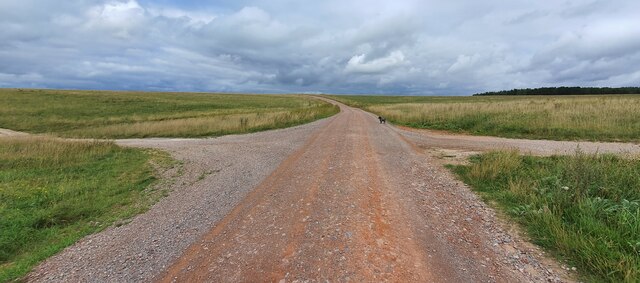
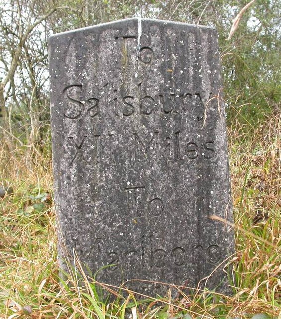
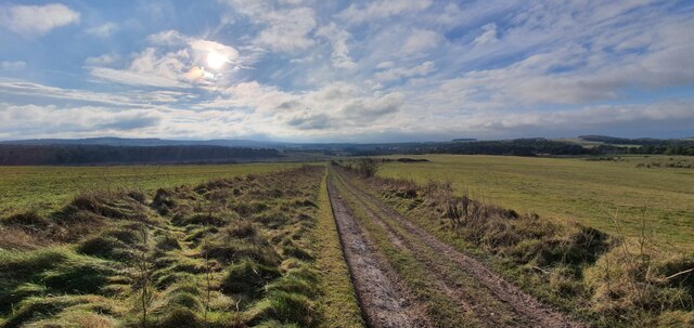
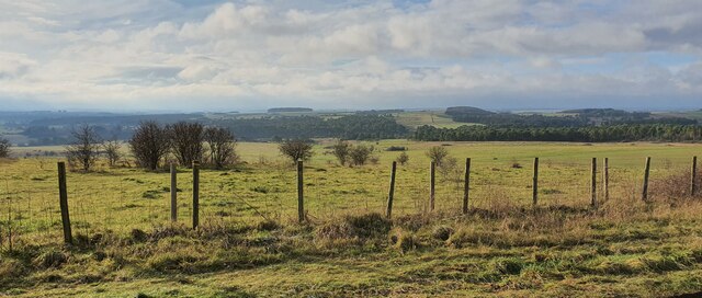
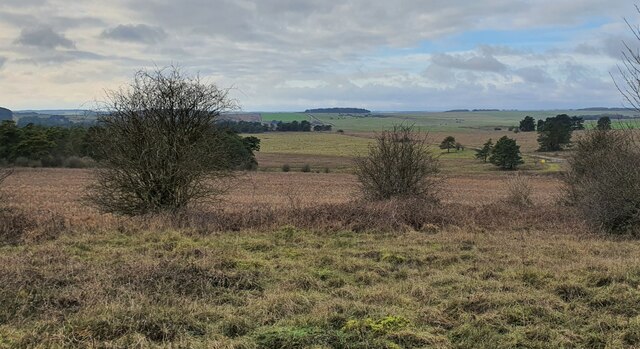
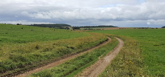
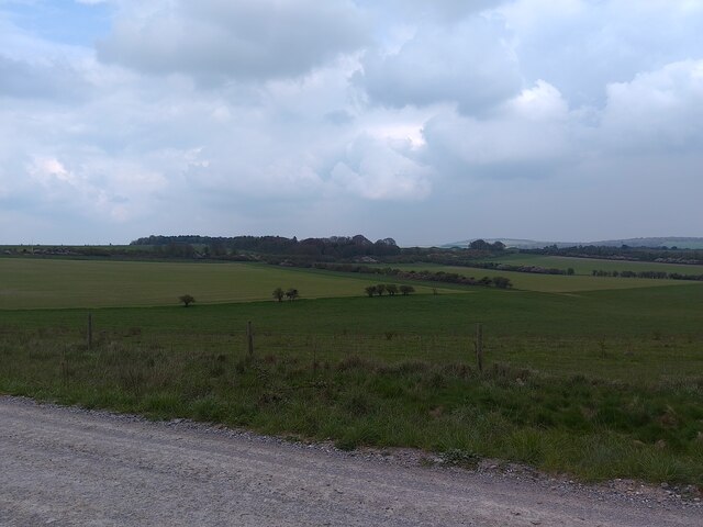
Brigmerston Firs, located in Wiltshire, England, is a captivating wood that spans across a vast area, providing a scenic retreat for nature enthusiasts. This ancient forest is nestled in the heart of the countryside, approximately 5 miles southwest of the historic city of Salisbury.

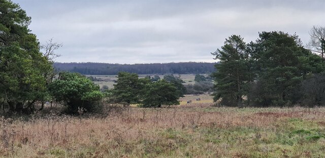
Covering an expansive area of around 600 hectares, Brigmerston Firs is characterized by a dense and diverse collection of trees, predominantly consisting of conifers. Towering pines, spruces, and firs create a captivating canopy, casting enchanting shadows on the forest floor. The forest's age is evident in the majestic presence of several ancient trees, some of which are estimated to be several centuries old.

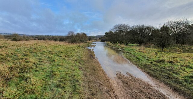
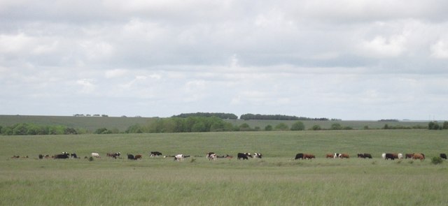
The wood's natural beauty is further enhanced by the presence of a meandering stream that winds its way through the forest, adding a touch of tranquility to the surroundings. Wildlife thrives within the woodland, with a plethora of species calling Brigmerston Firs their home. Deer, foxes, badgers, and a variety of bird species can be spotted, making it an ideal destination for birdwatchers and nature photographers.

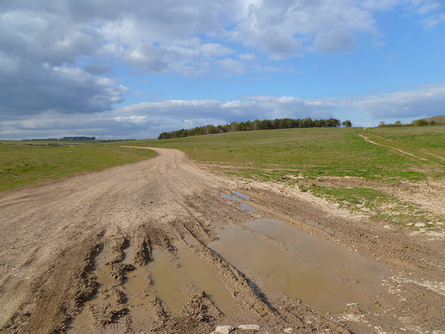
Brigmerston Firs is a popular destination for outdoor activities, offering numerous walking trails that cater to all abilities. The forest's well-maintained paths provide an opportunity to explore the enchanting woodlands, allowing visitors to immerse themselves in the peaceful ambiance and reconnect with nature.

With its awe-inspiring landscapes, diverse flora and fauna, and a rich history, Brigmerston Firs stands as a testament to the enduring beauty of Wiltshire's natural heritage. Whether one seeks solitude, adventure, or simply a moment of respite, this woodland sanctuary provides an escape from the bustle of everyday life, offering an opportunity to reconnect with the wonders of the natural world.

If you have any feedback on the listing, please let us know in the comments section below.

Brigmerston Firs Images

Images are sourced within 2km of 51.227429/-1.7136752 or Grid Reference SU2047. Thanks to Geograph Open Source API. All images are credited.

Sun Plantation, Wiltshire Looking north over a bridleway crossroads, on the Old Marlborough Road, in the vicinity of Sun Plantation. This area is within the military Salisbury Plain Training Area.
Sun Plantation, Wiltshire
Looking north over a bridleway crossroads, on the Old Marlborough Road, in the vicinity of Sun Plantation. This area is within the military Salisbury Plain Training Area.
Replacement Milestone by The Old Marlborough Road, Brigmerston Plantation Concrete post by the bridleway, in parish of FIGHELDEAN (SALISBURY District), Brigmerston Plantation; 150m South of MOD red gate, 10m from track, on West side of road. Salisbury replica Roman stone, erected by the Ministry of Defence in the 20th century. 

Inscription reads:-
: To / Salisbury / XII Miles / To / Marlboro / XV : : (on Rear) : REPLICA STONE / ERECTED BY MOD / 1980 :   

Milestone Society National ID: WI_MLSA15R.
Replacement Milestone by The Old Marlborough Road, Brigmerston Plantation
Concrete post by the bridleway, in parish of FIGHELDEAN (SALISBURY District), Brigmerston Plantation; 150m South of MOD red gate, 10m from track, on West side of road. Salisbury replica Roman stone, erected by the Ministry of Defence in the 20th century. Inscription reads:- : To / Salisbury / XII Miles / To / Marlboro / XV : : (on Rear) : REPLICA STONE / ERECTED BY MOD / 1980 : Milestone Society National ID: WI_MLSA15R.
Old Milestone by Old Marlborough Road on Figheldean Down Salisbury Roman stone by the bridleway, in parish of Figheldean (Salisbury District), Figheldean Down; opposite fenced off tumuli, 12m from road and marked by 4 wooden posts.

Inscription reads:-
To
Salisbury
XIII Miles
To
Marlbro
XIV

Wiltshire and Swindon HER.
HER Number: MWI17707 <span class="nowrap"><a title="https://www.heritagegateway.org.uk/Gateway/Results_Single.aspx?uid=MWI17707&resourceID=1047" rel="nofollow ugc noopener" href="https://www.heritagegateway.org.uk/Gateway/Results_Single.aspx?uid=MWI17707&resourceID=1047">Link</a><img style="margin-left:2px;" alt="External link" title="External link - shift click to open in new window" src="https://s1.geograph.org.uk/img/external.png" width="10" height="10"/></span>

Surveyed but may be destroyed by tank Nov 2014

Milestone Society National ID: WI_MLSA14
Old Milestone by Old Marlborough Road on Figheldean Down
Salisbury Roman stone by the bridleway, in parish of Figheldean (Salisbury District), Figheldean Down; opposite fenced off tumuli, 12m from road and marked by 4 wooden posts. Inscription reads:- To Salisbury XIII Miles To Marlbro XIV Wiltshire and Swindon HER. HER Number: MWI17707 LinkExternal link Surveyed but may be destroyed by tank Nov 2014 Milestone Society National ID: WI_MLSA14
Bourne Bottom, Wiltshire Looking from Bourne Bottom towards Brigmerston Down. This photograph was taken inside the Bulford Ranges Danger Area, which is open to the public when the red flags are not flying.
Bourne Bottom, Wiltshire
Looking from Bourne Bottom towards Brigmerston Down. This photograph was taken inside the Bulford Ranges Danger Area, which is open to the public when the red flags are not flying.
Milston Down, Wiltshire Flooding around Nine Mile River on Milston Down. This photograph was taken inside the Bulford Ranges Danger Area, which is open to the public when the red flags are not flying.
Milston Down, Wiltshire
Flooding around Nine Mile River on Milston Down. This photograph was taken inside the Bulford Ranges Danger Area, which is open to the public when the red flags are not flying.
Hare Warren, Wiltshire Looking from Hare Warren in the direction of Milston Down. This photograph was taken inside the Bulford Ranges Danger Area, which is open to the public when the red flags are not flying.
Hare Warren, Wiltshire
Looking from Hare Warren in the direction of Milston Down. This photograph was taken inside the Bulford Ranges Danger Area, which is open to the public when the red flags are not flying.
Brigmerston Down, Wiltshire Looking southwest over Brigmerston Down from the vicinity of the Devil's Ditch (a Late Bronze Age or Iron Age boundary earthwork). This photograph was taken inside the Bulford Ranges Danger Area, which is open to the public when the red flags are not flying.
Brigmerston Down, Wiltshire
Looking southwest over Brigmerston Down from the vicinity of the Devil's Ditch (a Late Bronze Age or Iron Age boundary earthwork). This photograph was taken inside the Bulford Ranges Danger Area, which is open to the public when the red flags are not flying.
Dunch Hill Plantation, Wiltshire Looking over Brigmerston Down from the vicinity of Dunch Hill Plantation. The photograph was taken from the Bulford Danger Area range road.
Dunch Hill Plantation, Wiltshire
Looking over Brigmerston Down from the vicinity of Dunch Hill Plantation. The photograph was taken from the Bulford Danger Area range road.
Bourne Bottom, Wiltshire Looking east over a diverging track in the vicinity of Bourne Bottom. This area is within the military Salisbury Plain Training Area.
Bourne Bottom, Wiltshire
Looking east over a diverging track in the vicinity of Bourne Bottom. This area is within the military Salisbury Plain Training Area.
Hare Folly, Wiltshire Looking down a bridleway in the vicinity of Hare Folly. This area is within the military Salisbury Plain Training Area.
Hare Folly, Wiltshire
Looking down a bridleway in the vicinity of Hare Folly. This area is within the military Salisbury Plain Training Area.
Down Barn Plantation Looking from a track across Brigmerston Field at Down Barn Plantation near to Bulford.
Down Barn Plantation
Looking from a track across Brigmerston Field at Down Barn Plantation near to Bulford.
Cattle on Salisbury Plain Low-intensity farming exists alongside the military activity on Salisbury Plain.
Cattle on Salisbury Plain
Low-intensity farming exists alongside the military activity on Salisbury Plain.
Milestone, Old Marlborough Road The Old Marlborough Road is preserved as a graded byway across Salisbury Plain. You can read the destinations as Salisbury and Marlborough, but the distances are not legible.

The painted posts are to warn military vehicles of this historic milestone.
Milestone, Old Marlborough Road
The Old Marlborough Road is preserved as a graded byway across Salisbury Plain. You can read the destinations as Salisbury and Marlborough, but the distances are not legible. The painted posts are to warn military vehicles of this historic milestone.
Track and downland, Figheldean The track heading towards Sun Plantation from beside the milestone on the Old Marlborough Road.
Track and downland, Figheldean
The track heading towards Sun Plantation from beside the milestone on the Old Marlborough Road.
Track and downland, Figheldean The byway beside Ablington Furze.
Track and downland, Figheldean
The byway beside Ablington Furze.
Track and downland, Figheldean The byway in Bourne Bottom.
Track and downland, Figheldean
The byway in Bourne Bottom.
Track and downland, Figheldean A byway with a modern surface approaching Ablington Furze.  Beacon Hill is in the background.
Track and downland, Figheldean
A byway with a modern surface approaching Ablington Furze. Beacon Hill is in the background.
Downland, Figheldean A track approaching the western side of The Wig.
Downland, Figheldean
A track approaching the western side of The Wig.
Show me another place!

Brigmerston Firs is located at Grid Ref: SU2047 (Lat: 51.227429, Lng: -1.7136752)

Unitary Authority: Wiltshire

Police Authority: Wiltshire

What 3 Words

///chin.dried.wicket. Near Tidworth, Wiltshire

Related Wikis

Tidworth Camp

Tidworth Camp is a military installation at Tidworth in Wiltshire, England. It forms part of the Tidworth, Netheravon and Bulford (TidNBul) Garrison....

Tedworth House

Tedworth House, also known as South Tidworth House, is a 19th-century country house in Tidworth, Wiltshire, England. It is a Grade II* listed building...

Sidbury Hill

Sidbury Hill, or Sidbury Camp, is the site of an Iron Age bivallate hillfort on the eastern edge of Salisbury Plain in Wiltshire, England. The site is...

St Mary's Church, South Tidworth

St Mary's Church in South Tidworth, Wiltshire, England, was built in 1878. It is recorded in the National Heritage List for England as a designated Grade...

Barrow Clump

Barrow Clump is an archaeological site in Figheldean parish, Wiltshire, England, about 3+1⁄2 miles (5.6 km) north of the town of Amesbury. The site is...

Tidworth

Tidworth is a garrison town and civil parish in south-east Wiltshire, England, on the eastern edge of Salisbury Plain. Lying on both sides of the A338...
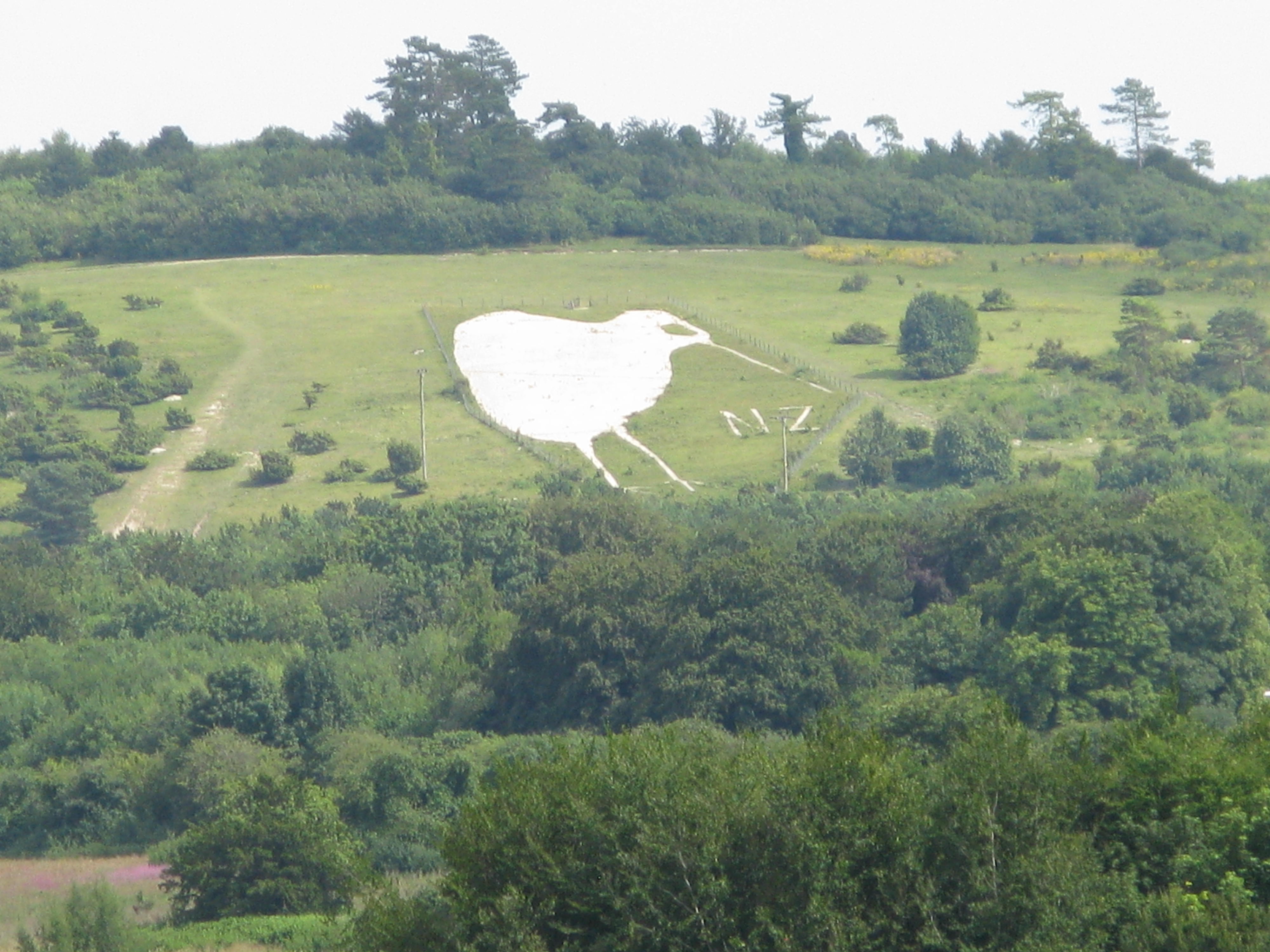
Bulford Kiwi

The Bulford Kiwi is a large depiction of a kiwi, carved in the chalk on Beacon Hill above the military town of Bulford on Salisbury Plain in Wiltshire...

Sling Camp

Sling Camp was a World War I camp occupied by New Zealand soldiers beside the then-military town of Bulford on the Salisbury Plain in Wiltshire, England...

Nearby Amenities

Located within 500m of 51.227429,-1.7136752
Archaeological Site: tumulus
Historic: archaeological_site
Lat/Long: 51.2302275/-1.7159536
Archaeological Site: tumulus
Historic: archaeological_site
Lat/Long: 51.2308724/-1.7158999
Archaeological Site: tumulus
Historic: archaeological_site
Lat/Long: 51.2278063/-1.7116888
Archaeological Site: tumulus
Historic: archaeological_site
Lat/Long: 51.2274401/-1.711265
Archaeological Site: earthwork
Historic: archaeological_site
Lat/Long: 51.2254729/-1.7095608
Archaeological Site: megalith
Historic: archaeological_site
Megalith Type: long_barrow
Lat/Long: 51.2248303/-1.7098058
Archaeological Site: tumulus
Historic: archaeological_site
Lat/Long: 51.2303184/-1.7153184
Ford: yes
Lat/Long: 51.2243147/-1.7130837
Ford: yes
Lat/Long: 51.2259644/-1.7135636
The data included in this document is from www.openstreetmap.org. The data is made available under ODbL.

Have you been to Brigmerston Firs?

Leave your review of Brigmerston Firs below (or comments, questions and feedback).