Allen Wood

Wood, Forest in Yorkshire

England

Allen Wood

View towards Emley Mast from Huddersfield Road, Shelley This is a revisit to the first geograph for the square: <a href="https://www.geograph.org.uk/photo/123985">SE2011 : Radcliffe Wood, near Shelley</a>  taken in February 2006. Radcliffe Wood is on the left. A young tree has grown and the hawthorn hedge makes the viewpoint a bit uncomfortable. The slender mast to the right of Emley Moor mast is a temporary one. "A temporary 310m mast was erected to May 2018 to enable transmissions to continue whilst the existing mast’s antennas are being modified to prepare for the 700MHz clearance and interruption of the broadcasts are not allowed. It was never made clear how long the temporary mast would be up for, but mid to late 2021 would seem a good guess,  being as they were advertising its sale (for collection...) from that date !" From <span class="nowrap"><a title="https://www.aerialsandtv.com/knowledge/transmitters/emley-moor-transmitter" rel="nofollow ugc noopener" href="https://www.aerialsandtv.com/knowledge/transmitters/emley-moor-transmitter">Link</a><img style="margin-left:2px;" alt="External link" title="External link - shift click to open in new window" src="https://s1.geograph.org.uk/img/external.png" width="10" height="10"/></span> .
View towards Emley Mast from Huddersfield Road, Shelley Credit: Humphrey Bolton

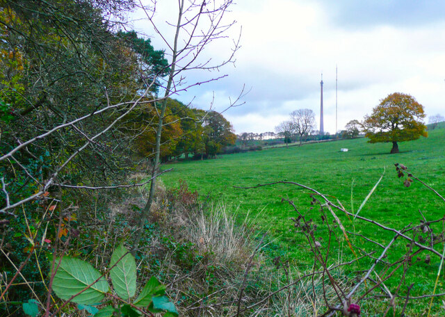
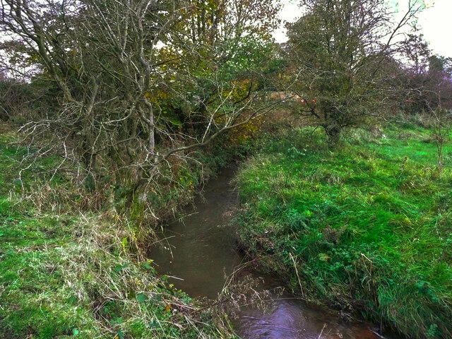
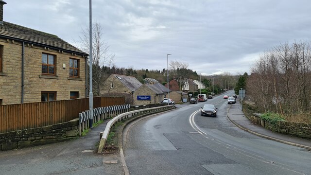
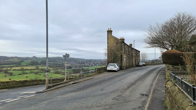
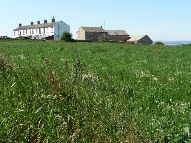
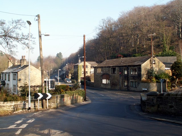
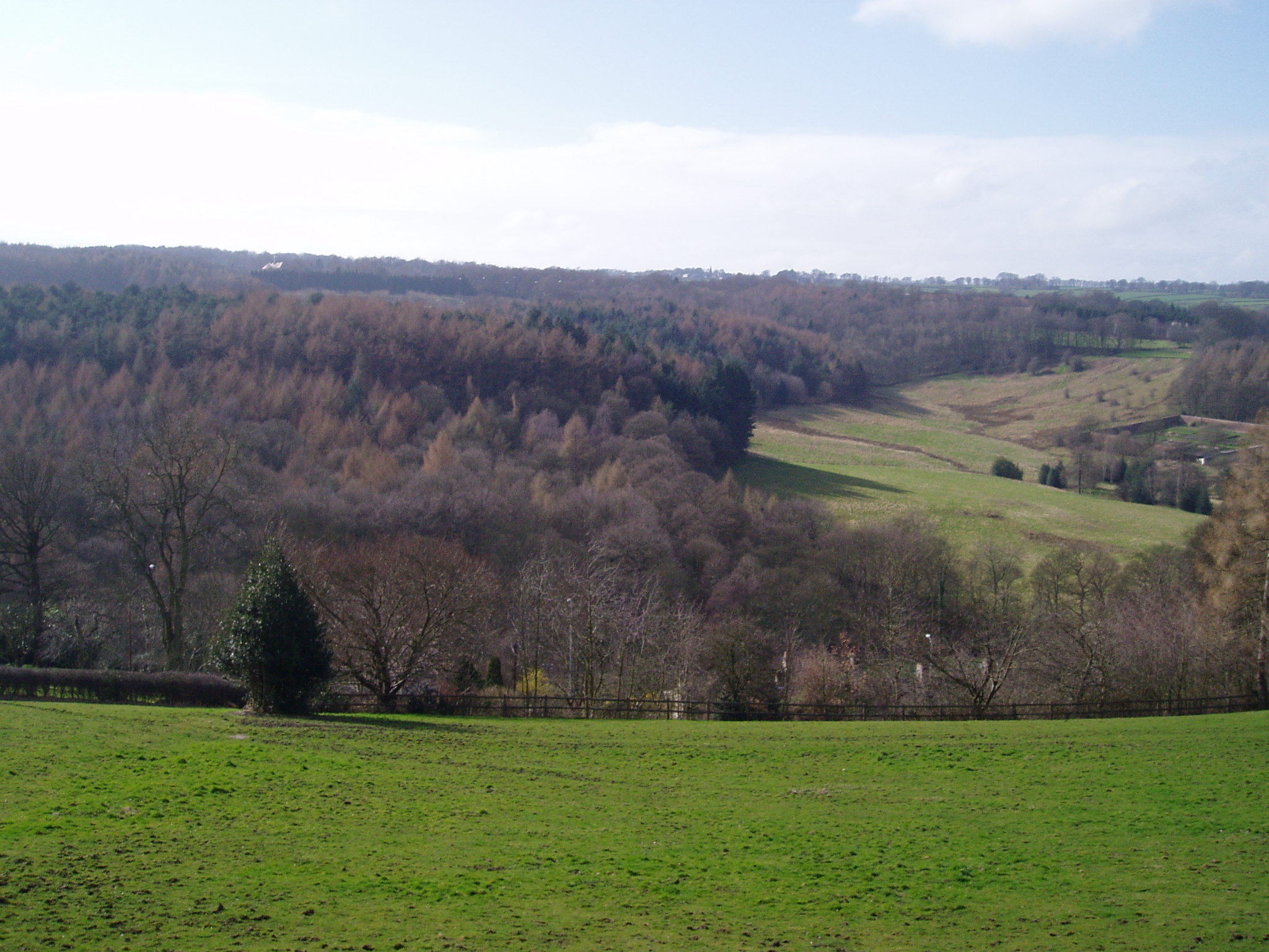
Allen Wood is a small village located in the county of Yorkshire, England. Situated within the larger area known as the Yorkshire Dales, Allen Wood is known for its picturesque landscape and tranquil atmosphere. The village is nestled within a dense forest, which gives it a distinct charm and natural beauty.

The woodland in Allen Wood is home to a variety of native tree species, including oak, beech, and pine, making it an ideal destination for nature enthusiasts and hikers. The forest provides a haven for wildlife, with various species of birds, mammals, and insects thriving in this lush environment.

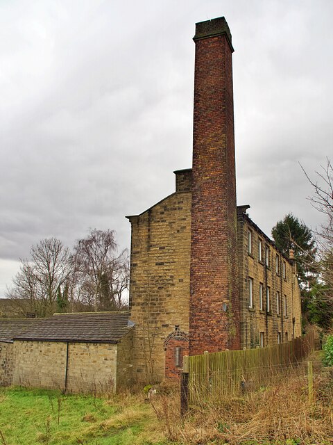
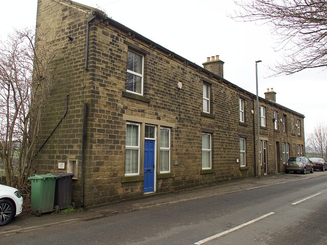
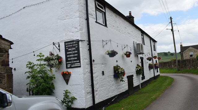
Despite its relatively small size, Allen Wood boasts a close-knit community that takes pride in maintaining the village's heritage and preserving its natural surroundings. The village is dotted with traditional stone cottages, adding to its rustic appeal.

The village offers limited amenities, with a local pub being the main social hub for residents and visitors alike. The pub serves as a meeting place for social gatherings and a venue for community events.

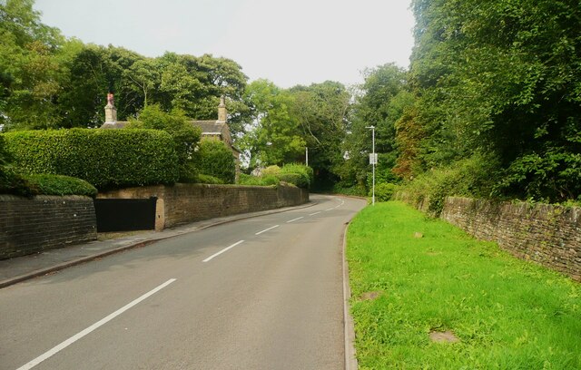
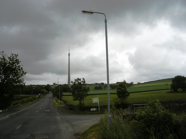
For those seeking outdoor activities, Allen Wood provides ample opportunities for walking, cycling, and exploring the surrounding countryside. The village is also located near several popular tourist attractions, such as historical landmarks and charming market towns.

In conclusion, Allen Wood is a quaint village situated within the beautiful Yorkshire Dales. With its idyllic forest setting, thriving wildlife, and strong sense of community, it offers a peaceful retreat for nature lovers and a gateway to the stunning landscapes of Yorkshire.

If you have any feedback on the listing, please let us know in the comments section below.

Allen Wood Images

Images are sourced within 2km of 53.603967/-1.7059252 or Grid Reference SE1911. Thanks to Geograph Open Source API. All images are credited.

View towards Emley Mast from Huddersfield Road, Shelley This is a revisit to the first geograph for the square: <a href="https://www.geograph.org.uk/photo/123985">SE2011 : Radcliffe Wood, near Shelley</a>  taken in February 2006. Radcliffe Wood is on the left. A young tree has grown and the hawthorn hedge makes the viewpoint a bit uncomfortable. The slender mast to the right of Emley Moor mast is a temporary one. "A temporary 310m mast was erected to May 2018 to enable transmissions to continue whilst the existing mast’s antennas are being modified to prepare for the 700MHz clearance and interruption of the broadcasts are not allowed. It was never made clear how long the temporary mast would be up for, but mid to late 2021 would seem a good guess,  being as they were advertising its sale (for collection...) from that date !" From <span class="nowrap"><a title="https://www.aerialsandtv.com/knowledge/transmitters/emley-moor-transmitter" rel="nofollow ugc noopener" href="https://www.aerialsandtv.com/knowledge/transmitters/emley-moor-transmitter">Link</a><img style="margin-left:2px;" alt="External link" title="External link - shift click to open in new window" src="https://s1.geograph.org.uk/img/external.png" width="10" height="10"/></span> .
View towards Emley Mast from Huddersfield Road, Shelley
This is a revisit to the first geograph for the square: SE2011 : Radcliffe Wood, near Shelley taken in February 2006. Radcliffe Wood is on the left. A young tree has grown and the hawthorn hedge makes the viewpoint a bit uncomfortable. The slender mast to the right of Emley Moor mast is a temporary one. "A temporary 310m mast was erected to May 2018 to enable transmissions to continue whilst the existing mast’s antennas are being modified to prepare for the 700MHz clearance and interruption of the broadcasts are not allowed. It was never made clear how long the temporary mast would be up for, but mid to late 2021 would seem a good guess, being as they were advertising its sale (for collection...) from that date !" From LinkExternal link .
Shepley Dike off Near Bank, Shelley, looking downstream A tree, probably hawthorn. has fallen over the stream.
Shepley Dike off Near Bank, Shelley, looking downstream
A tree, probably hawthorn. has fallen over the stream.
Shepley Dike off Near Bank looking upstream Brook House Bridge is a little way upstream.
Shepley Dike off Near Bank looking upstream
Brook House Bridge is a little way upstream.
Stream alongside Brook House Lane, Shelley It is not clear from maps whether this flows through Brook House Mill or Barncliffe Mills, but either way it joins Shepley Dike and is its longest tributary.
Stream alongside Brook House Lane, Shelley
It is not clear from maps whether this flows through Brook House Mill or Barncliffe Mills, but either way it joins Shepley Dike and is its longest tributary.
Old industrial building and chimney Off Abbey Road in Shepley. The building now appears to be in residential use.
Old industrial building and chimney
Off Abbey Road in Shepley. The building now appears to be in residential use.
Bus stop and shelter on Far Bank Provided by West Yorkshire PTE
Bus stop and shelter on Far Bank
Provided by West Yorkshire PTE
Three cottages on Far Bank Named Bakers Cottage, Drapers Cottage and Grocers Cottage they were presumably small businesses before being converted to residential use.
Three cottages on Far Bank
Named Bakers Cottage, Drapers Cottage and Grocers Cottage they were presumably small businesses before being converted to residential use.
Tree-lined path to Emmanuel Church I think these are flowering cherry trees and, if so, would provide a beautiful approach to the church in Spring.
Tree-lined path to Emmanuel Church
I think these are flowering cherry trees and, if so, would provide a beautiful approach to the church in Spring.
Abbey Road, Shelley
Abbey Road, Shelley
Huddersfield Road, Shelley Slim line housing between two roads on the hillside, previously including small shop units.
Huddersfield Road, Shelley
Slim line housing between two roads on the hillside, previously including small shop units.
Former Gardener's Arms, Shelley Closed for over 50 years but still identifiable for what it was
Former Gardener's Arms, Shelley
Closed for over 50 years but still identifiable for what it was
Emanuel Church, Shelley
Old milestone In Shelley at the junction of the B6116 Huddersfield Road and Far Bank.   This stone has been painted recently.   Note the very small hands.   It may date from the 19thC.  Grade II listed 1135366.
Old milestone
In Shelley at the junction of the B6116 Huddersfield Road and Far Bank. This stone has been painted recently. Note the very small hands. It may date from the 19thC. Grade II listed 1135366.
Thorncliffe Social Club Walking the Emley Boundary Way.
Thorncliffe Social Club
Walking the Emley Boundary Way.
Turnshaw Road, Kirkburton
Road junction at High Wood Lane
Roydhouse houses The western end of a hilltop hamlet.
Roydhouse houses
The western end of a hilltop hamlet.
Cross Lane Running down to the Huddersfield Road.
Cross Lane
Running down to the Huddersfield Road.
Show me another place!

Allen Wood is located at Grid Ref: SE1911 (Lat: 53.603967, Lng: -1.7059252)

Division: West Riding

Unitary Authority: Kirklees

Police Authority: West Yorkshire
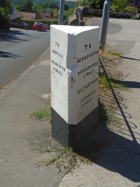
What 3 Words

///forgets.treaty.regress. Near Kirkburton, West Yorkshire

Related Wikis

Kirkburton

Kirkburton is a village, civil parish and ward in Kirklees in West Yorkshire, England. It is 5 miles (8 km) south-east of Huddersfield. Historically part...

Thunder Bridge

Thunder Bridge or Thunderbridge is a hamlet and bridge in the civil parish of Kirkburton, in the Kirklees district, in the county of West Yorkshire, England...

Myers Wood

Myers Wood is a wooded area in the village of Kirkburton, West Yorkshire, England. It forms part of a heavily forested area to the west of the village...

Huddersfield Town F.C. Women

Huddersfield Town Women Football Club is an English women's football club based in Huddersfield, West Yorkshire. The team play their homes matches at the...

Shelley C.F.C.

Shelley Community Football Club is a football club based in Shelley, West Yorkshire, England. They are currently members of the North West Counties League...

Kirkburton railway station

Kirkburton railway station served the village of Kirkburton, West Yorkshire, England until closure in 1930. == History == The Huddersfield-Kirkburton Branch...

Shelley, West Yorkshire

Shelley is a village in the civil parish of Kirkburton, in the Kirklees district, in the county of West Yorkshire, England. The village is 3 miles (5 km...

Stocksmoor railway station

Stocksmoor railway station serves the village of Stocksmoor near Huddersfield in West Yorkshire, England. The station is 6.25 miles (10 km) from Huddersfield...

Nearby Amenities

Located within 500m of 53.603967,-1.7059252
Barrier: stile
Step Count: 1
Stile: stepover
Lat/Long: 53.6069163/-1.7052673
Bus Stop
Penistone Road Thunder Bridge Lane
Local Ref: 45016786
Naptan AtcoCode: 450016786
Naptan Bearing: S
Naptan CommonName: Penistone Road Thunder Bridge Lane
Naptan Crossing: Thunder Bridge Lane
Naptan Indicator: Stop 45016786
Naptan Notes: OSR taken place 170106
Naptan PlusbusZoneRef: LEEDS
Naptan ShortCommonName: Thunder Bridge Lane
Naptan Street: Penistone Road
Naptan Verified: no
Source: naptan_import
Lat/Long: 53.6048242/-1.7119941
Bus Stop
Penistone Road Thunder Bridge Lane
Local Ref: 45016787
Naptan AtcoCode: 450016787
Naptan Bearing: N
Naptan CommonName: Penistone Road Thunder Bridge Lane
Naptan Crossing: Thunder Bridge Lane
Naptan Indicator: Stop 45016787
Naptan PlusbusZoneRef: LEEDS
Naptan ShortCommonName: Thunder Bridge Lane
Naptan Street: Penistone Road
Naptan Verified: no
Source: naptan_import
Lat/Long: 53.6043845/-1.7123296
Bus Stop
Huddersfield Road Shelley Lane Estate
Local Ref: 45020753
Naptan AtcoCode: 450020753
Naptan Bearing: NW
Naptan CommonName: Huddersfield Road Shelley Lane Estate
Naptan Crossing: Shelley Lane Estate
Naptan Indicator: Stop 45020753
Naptan Notes: OSR taken place 160106
Naptan PlusbusZoneRef: LEEDS
Naptan ShortCommonName: Shelley Lane Estate
Naptan Street: Huddersfield Road
Naptan Verified: no
Source: naptan_import
Lat/Long: 53.6065671/-1.7006622
Bus Stop
Huddersfield Road Shelley Lane Estate
Local Ref: 45020754
Naptan AtcoCode: 450020754
Naptan Bearing: SE
Naptan CommonName: Huddersfield Road Shelley Lane Estate
Naptan Crossing: Shelley Lane Estate
Naptan Indicator: Stop 45020754
Naptan Notes: OSR taken place 160106 size 2 case fitted
Naptan PlusbusZoneRef: LEEDS
Naptan ShortCommonName: Shelley Lane Estate
Naptan Street: Huddersfield Road
Naptan Verified: no
Source: naptan_import
Lat/Long: 53.6065848/-1.7005563
Turning Circle
Lat/Long: 53.6069444/-1.7006402
Barrier: bollard
Material: metal
Source: survey
Lat/Long: 53.6074354/-1.7034569
Causeway Foot
Place: locality
Lat/Long: 53.606194/-1.7092345
Barrier: stile
Step Count: 1
Stile: stepover
Lat/Long: 53.5997773/-1.7086797
Generator Method: photovoltaic
Generator Output Electricity: small_installation
Generator Source: solar
Generator Type: solar_photovoltaic_panel
Note: roof domestic
Power: generator
Lat/Long: 53.6000561/-1.7024927
Generator Method: photovoltaic
Generator Output Electricity: small_installation
Generator Source: solar
Generator Type: solar_photovoltaic_panel
Note: roof household
Power: generator
Lat/Long: 53.6068193/-1.7003137
Generator Method: photovoltaic
Generator Output Electricity: small_installation
Generator Source: solar
Generator Type: solar_photovoltaic_panel
Note: roof household
Power: generator
Lat/Long: 53.6071935/-1.7033066
Generator Method: photovoltaic
Generator Output Electricity: small_installation
Generator Source: solar
Generator Type: solar_photovoltaic_panel
Note: roof household
Power: generator
Lat/Long: 53.6080783/-1.7045729
Post Box
Collection Times: Mo-Fr 17:00; Sa 11:45
Operator: Royal Mail
Operator Wikidata: Q638098
Post Box Type: wall
Ref: HD8 127
Royal Cypher: VR
Royal Cypher Wikidata: Q33102356
Source: survey
Lat/Long: 53.605029/-1.7119979
Barrier: stile
Material: stone
Stile: squeezer
Lat/Long: 53.60692/-1.7008853
Barrier: stile
Material: stone
Step Count: 3
Stile: stepover
Lat/Long: 53.607155/-1.7108658
Board Title: Trans-Pennine Trail
Information: board
Tourism: information
Lat/Long: 53.6071692/-1.7018297
Man Made: mast
Tower Type: communication
Lat/Long: 53.6019647/-1.709438
Man Made: mast
Tower Type: communication
Lat/Long: 53.6021384/-1.7093779
Barrier: stile
Stile: squeezer
Lat/Long: 53.6058574/-1.7061599
Stop
Direction: forward
Stop: minor
Lat/Long: 53.6049683/-1.7121428
The data included in this document is from www.openstreetmap.org. The data is made available under ODbL.

Have you been to Allen Wood?

Leave your review of Allen Wood below (or comments, questions and feedback).