Dan Caerlan
Settlement in Glamorgan
Wales
Dan Caerlan

Dan Caerlan is a village located in the county of Glamorgan, Wales. Situated in the southern part of the country, it is nestled in a picturesque valley surrounded by rolling green hills and lush countryside. With a population of approximately 500 residents, it maintains a close-knit community feel.
The village is known for its charming, traditional Welsh architecture, with many of the buildings dating back several centuries. The houses are predominantly made of local stone, giving them a rustic and timeless appearance. The village center features a quaint church, which serves as a focal point for both religious and community events.
Surrounded by natural beauty, Dan Caerlan offers plenty of opportunities for outdoor activities. The nearby countryside boasts numerous walking trails, providing stunning views of the surrounding landscapes. The village is also dotted with small streams and rivers, making it an ideal spot for fishing enthusiasts.
Despite its serene rural setting, Dan Caerlan is conveniently located near larger towns and cities. The bustling market town of Glamorgan is just a short drive away, offering a wider range of amenities, including shops, restaurants, and leisure facilities.
Overall, Dan Caerlan is a charming village that combines natural beauty with a strong sense of community. Its idyllic location and historic architecture make it an attractive destination for those seeking a peaceful retreat in the heart of Glamorgan.
If you have any feedback on the listing, please let us know in the comments section below.
Dan Caerlan Images
Images are sourced within 2km of 51.545257/-3.367617 or Grid Reference ST0583. Thanks to Geograph Open Source API. All images are credited.


Dan Caerlan is located at Grid Ref: ST0583 (Lat: 51.545257, Lng: -3.367617)
Unitary Authority: Rhondda Cynon Taf
Police Authority: South Wales
What 3 Words
///gliding.practical.fever. Near Llantrisant, Rhondda Cynon Taf
Nearby Locations
Related Wikis

Llantrisant rail accident
On 12 August 1893 a T-link broke beneath a locomotive running down the bank from Merthyr to Cardiff hauling a passenger train. This allowed an underhung...
Llantrisant
Llantrisant (Welsh pronunciation: [ɬanˈtrɪsant] ; "Parish of the Three Saints") is a town in the county borough of Rhondda Cynon Taf, within the historic...

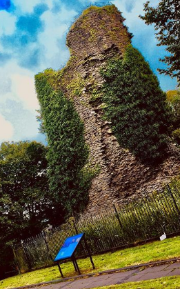
Llantrisant Castle
Llantrisant Castle is a ruined castle in Llantrisant, Rhondda Cynon Taf, Glamorgan, Wales. The ruins are on a good elevation, commanding extensive views...
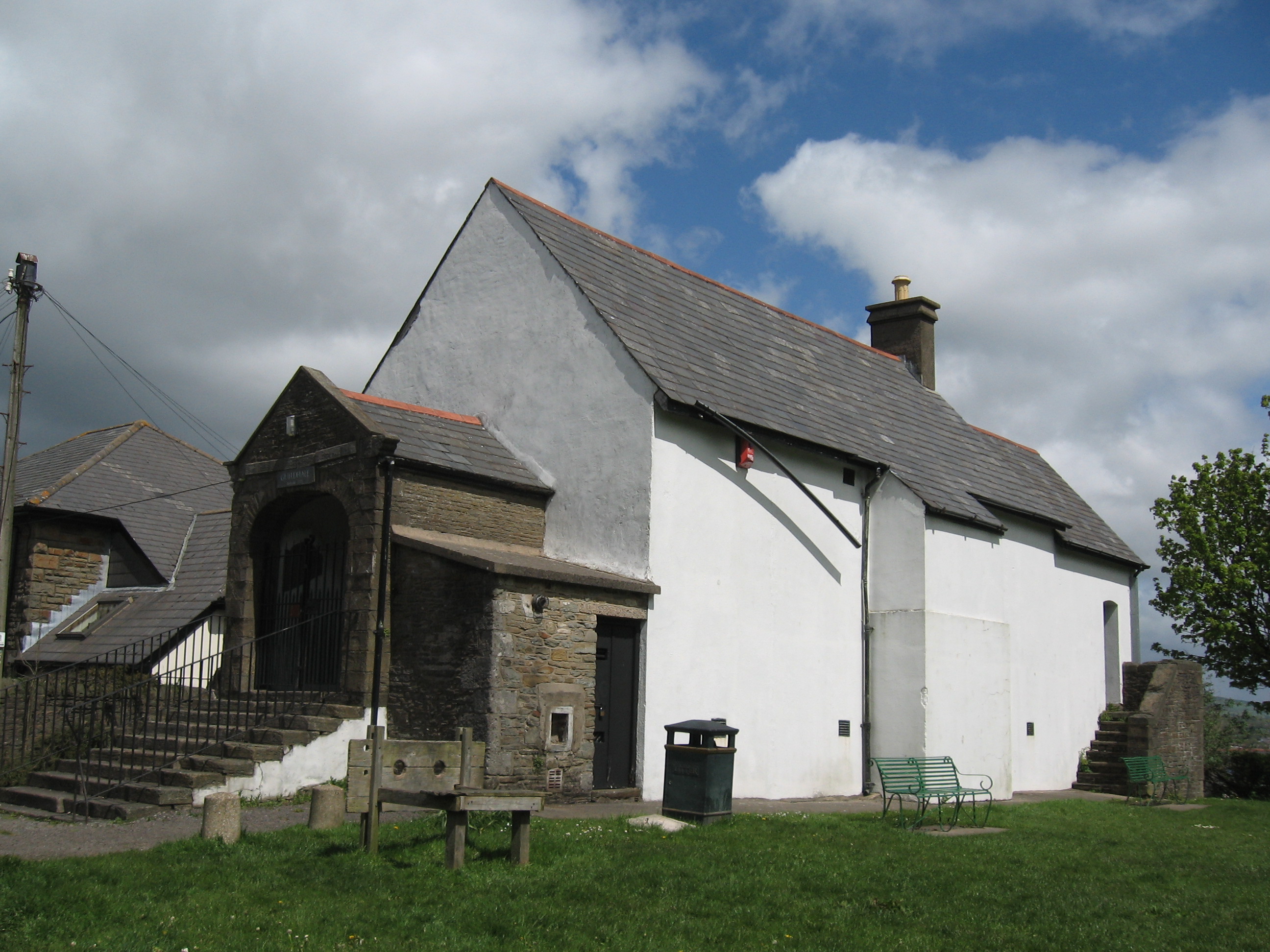
Llantrisant Guildhall
Llantrisant Guildhall (Welsh: Neuadd y Dref Llantrisant) is a municipal building on Castle Green, Llantrisant, Rhondda Cynon Taf, Wales. The structure...
Nearby Amenities
Located within 500m of 51.545257,-3.367617Have you been to Dan Caerlan?
Leave your review of Dan Caerlan below (or comments, questions and feedback).