Cobblersnook Plantation

Wood, Forest in Derbyshire Derbyshire Dales

England

Cobblersnook Plantation

Ruined sheepfold This old sheepfold is marked on the 1880 Ordnance Survey map but is now in ruins.
Ruined sheepfold Credit: Ian Calderwood

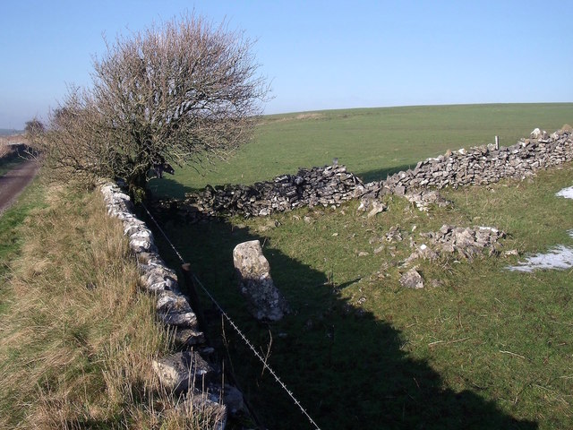
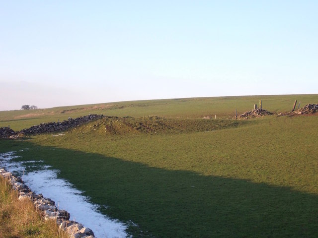
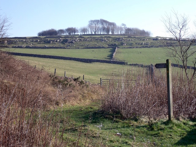
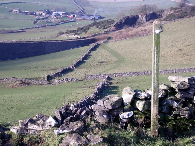
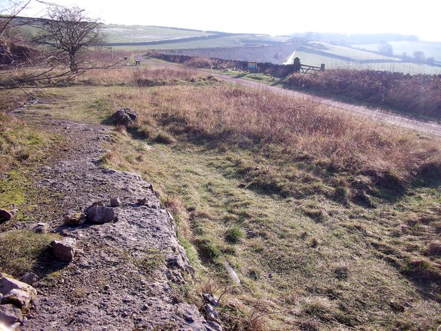
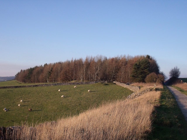
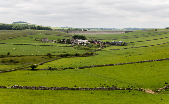
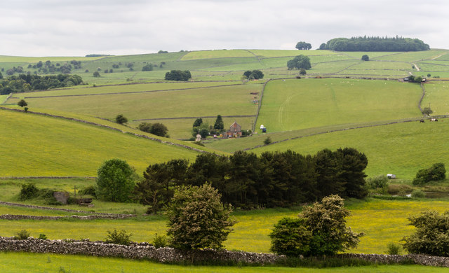
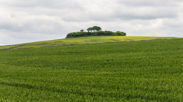
Cobblersnook Plantation is a picturesque woodland located in the heart of Derbyshire, England. Covering an area of approximately 500 acres, it is a haven for nature enthusiasts and outdoor adventurers alike. The plantation is situated within the larger Derbyshire Dales National Park, offering visitors a unique opportunity to immerse themselves in the natural beauty of the area.

The woodland is predominantly made up of a variety of native tree species, including oak, beech, and birch, which create a dense and diverse canopy that provides shelter for numerous wildlife species. Visitors can expect to encounter an array of birdlife, such as woodpeckers and owls, as well as small mammals like foxes, squirrels, and badgers.

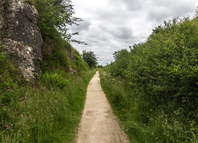
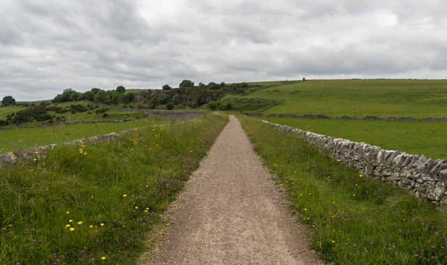
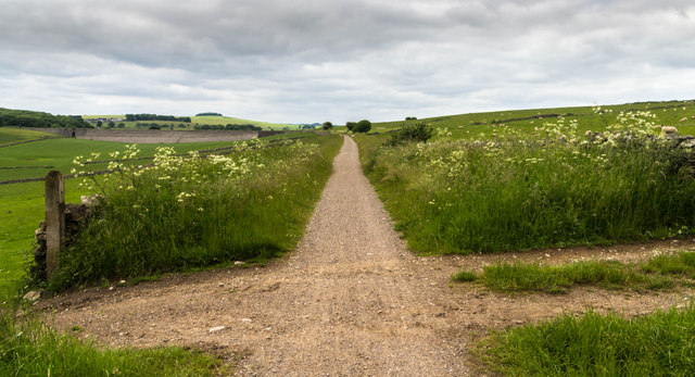
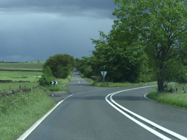
Traversing through the plantation, visitors will find a network of well-maintained walking trails that cater to different levels of difficulty. These paths wind through the enchanting forest, leading visitors to hidden gems such as tranquil streams, vibrant wildflower meadows, and stunning viewpoints offering panoramic vistas of the surrounding countryside.

Cobblersnook Plantation is also renowned for its rich history, dating back centuries. The area was once home to a thriving shoe-making industry, and remnants of old workshops and cottages can still be found scattered throughout the woodland. These historical artifacts serve as a reminder of the area's industrial past and add an intriguing element to the overall experience.

Whether you're seeking a peaceful stroll amidst nature, an opportunity to spot wildlife, or a chance to delve into the region's history, Cobblersnook Plantation in Derbyshire is a must-visit destination for all nature lovers and history enthusiasts.

If you have any feedback on the listing, please let us know in the comments section below.

Cobblersnook Plantation Images

Images are sourced within 2km of 53.118383/-1.7133554 or Grid Reference SK1957. Thanks to Geograph Open Source API. All images are credited.

Ruined sheepfold This old sheepfold is marked on the 1880 Ordnance Survey map but is now in ruins.
Ruined sheepfold
This old sheepfold is marked on the 1880 Ordnance Survey map but is now in ruins.
Dew pond and old quarry The quarry is in the background, in the next field.
Dew pond and old quarry
The quarry is in the background, in the next field.
Minninglow Concession Route There is no public footpath to the top of Minninglow but this concession route allows access for walkers.
Minninglow Concession Route
There is no public footpath to the top of Minninglow but this concession route allows access for walkers.
Minninglow Concession Route from above Looking back down the concession route up Minninglow Hill to the High Peak Trail. There is no public footpath to the top of Minninglow but this concession path provides access for walkers.
Minninglow Concession Route from above
Looking back down the concession route up Minninglow Hill to the High Peak Trail. There is no public footpath to the top of Minninglow but this concession path provides access for walkers.
Minninglow Quarry siding The rails left in-situ can still be seen peeping through the turf on the line of the former quarry siding off the Cromford & High Peak Railway.
Minninglow Quarry siding
The rails left in-situ can still be seen peeping through the turf on the line of the former quarry siding off the Cromford & High Peak Railway.
The former Royston Grange Quarries The diagonal wall in the foreground shows the line of the railway that lead into the quarries.
The former Royston Grange Quarries
The diagonal wall in the foreground shows the line of the railway that lead into the quarries.
High Peak Trail The High Peak Trail near Roystone Grange Quarries.
High Peak Trail
The High Peak Trail near Roystone Grange Quarries.
High Peak Trail The High Peak Trail near Minninglow Quarry.
High Peak Trail
The High Peak Trail near Minninglow Quarry.
Minninglow Grange View of Minninglow Grange Farm.
Minninglow Grange
View of Minninglow Grange Farm.
Minninglow View from the High Peak Trail.
Minninglow
View from the High Peak Trail.
Minninglow Hill
Minninglow Hill
High Peak Trail The High Peak Trail.
High Peak Trail
The High Peak Trail.
Old road below Minninglow This embankment by a wall in a field used to be the main road from Manchester to Derby. It is thought to have begun as a prehistoric trackway and was certainly part of the Roman road from Mamucium (Manchester) to Derventio (Derby). It remained in use into the 19th century, when better roads, such as the turnpike through Ashbourne, made it redundant.
Old road below Minninglow
This embankment by a wall in a field used to be the main road from Manchester to Derby. It is thought to have begun as a prehistoric trackway and was certainly part of the Roman road from Mamucium (Manchester) to Derventio (Derby). It remained in use into the 19th century, when better roads, such as the turnpike through Ashbourne, made it redundant.
Junction A5012
Junction A5012
Pasture above Minninglow Grange Farm Seen from The High Peak Trail
Pasture above Minninglow Grange Farm
Seen from The High Peak Trail
A Derbyshire Cow Behind her - one of the limestone railway embankments built in the 1820's to carry the Cromford and High Peak Railway - now a leisure path.
A Derbyshire Cow
Behind her - one of the limestone railway embankments built in the 1820's to carry the Cromford and High Peak Railway - now a leisure path.
Abandoned quarrying machinery At the now disused Minninglow limestone quarry adjacent to The High Peak Trail.
Abandoned quarrying machinery
At the now disused Minninglow limestone quarry adjacent to The High Peak Trail.
Just east of Minninglow looking towards Aldwark
Show me another place!

Cobblersnook Plantation is located at Grid Ref: SK1957 (Lat: 53.118383, Lng: -1.7133554)

Administrative County: Derbyshire

District: Derbyshire Dales

Police Authority: Derbyshire

What 3 Words

///rotations.rabble.sports. Near Newhaven, Derbyshire

Nearby Locations

Cobblersnook Plantation

Related Wikis

Gotham Curve

The Gotham Curve was once the sharpest curve on any standard gauge railway line in the UK. The curve, which was situated in the sparsely populated, exposed...

Pikehall

Pikehall is a small village in the Derbyshire Dales consisting of a few dozen households and a handful of farms. The population of the village is included...
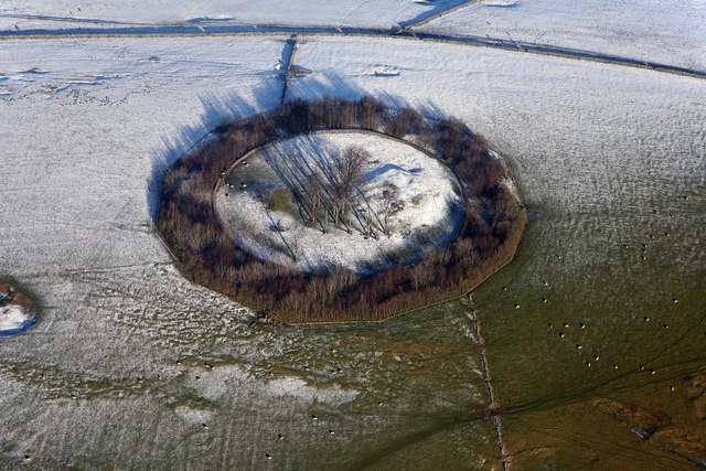
Minninglow

Minninglow (or Minning Low) is a hill in the Peak District National Park in Derbyshire, located within the White Peak area at grid reference SK209573....

Long Dale

Long Dale is a carboniferous limestone valley near the village of Elton, Derbyshire, in the Peak District of England. The dale is cut into the plateau...

High Peak Trail

The High Peak Trail is a 17-mile (27 km) trail for walkers, cyclists and horse riders in the Peak District of England. Running from Dowlow (53.2059°N 1...

Ballidon Dale

Ballidon Dale is a steep-sided, dry carboniferous limestone valley near Parwich in the Derbyshire Peak District of England. The ancient hamlet of Ballidon...

Parwich

Parwich is a village and parish in the Derbyshire Dales, 7 miles north of Ashbourne. In the 2011 census the population of the civil parish was 472.Village...
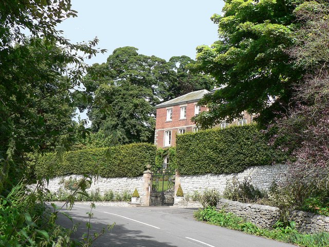
Parwich Hall

Parwich Hall is a privately owned 18th-century mansion house at Parwich, near Ashbourne, Derbyshire Dales. It is a Grade II* listed building.The Manor...

Nearby Amenities

Located within 500m of 53.118383,-1.7133554
Minninglow
Tourism: picnic_site
Lat/Long: 53.1203507/-1.7106324
Minninglow
Description: Minninglow information board
Ele: 321
Information: board
Tourism: information
Lat/Long: 53.1202724/-1.7106833
Description: Minninglow car park information board
Ele: 321
Information: board
Tourism: information
Lat/Long: 53.1202837/-1.7108201
Source: bing
Lat/Long: 53.1164806/-1.7108032
Note: Bollards no separate HPT from car park
Lat/Long: 53.1203123/-1.710877
Information: route_marker
Tourism: information
Lat/Long: 53.120064/-1.7099103
Information: route_marker
Tourism: information
Lat/Long: 53.1200614/-1.7098631
Information: route_marker
Tourism: information
Lat/Long: 53.1201605/-1.7099468
Information: route_marker
Tourism: information
Lat/Long: 53.1202701/-1.7110819
Information: route_marker
Tourism: information
Lat/Long: 53.1202787/-1.7107566
Information: route_marker
Tourism: information
Lat/Long: 53.1200602/-1.7098223
Covered: no
Leisure: picnic_table
Lat/Long: 53.1203217/-1.7114182
Covered: no
Leisure: picnic_table
Lat/Long: 53.1203329/-1.7114729
Bicycle Parking
Access: yes
Bicycle Parking: stands
Capacity: 2
Covered: no
Fee: no
Lit: no
Lat/Long: 53.1203207/-1.7114818
Bicycle Parking
Access: yes
Bicycle Parking: stands
Capacity: 2
Covered: no
Fee: no
Lit: no
Lat/Long: 53.1203085/-1.7114292
The data included in this document is from www.openstreetmap.org. The data is made available under ODbL.

Have you been to Cobblersnook Plantation?

Leave your review of Cobblersnook Plantation below (or comments, questions and feedback).