Gotham Plantation

Wood, Forest in Derbyshire Derbyshire Dales

England

Gotham Plantation

Ruined sheepfold This old sheepfold is marked on the 1880 Ordnance Survey map but is now in ruins.
Ruined sheepfold Credit: Ian Calderwood

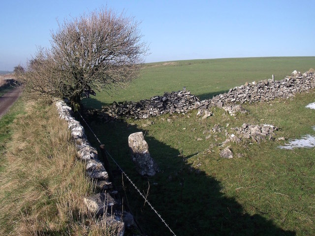
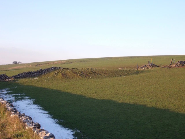
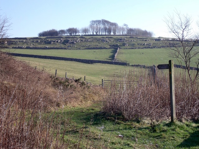
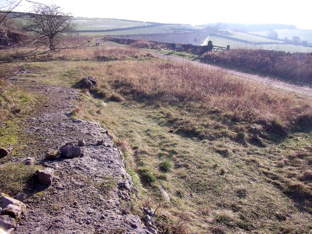
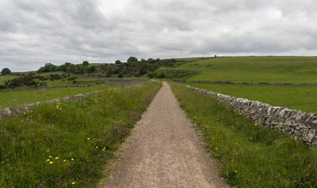
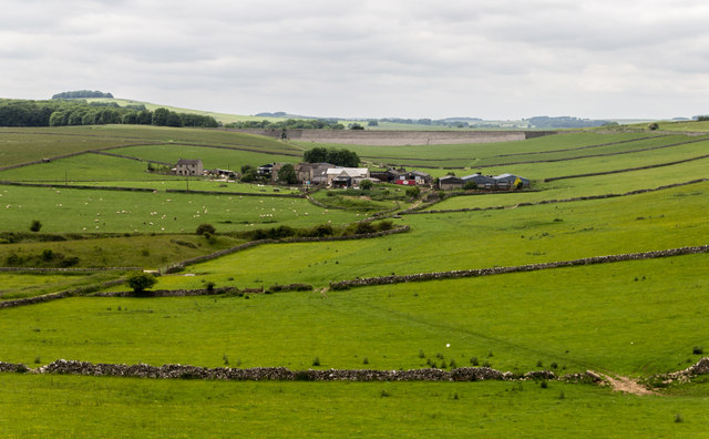
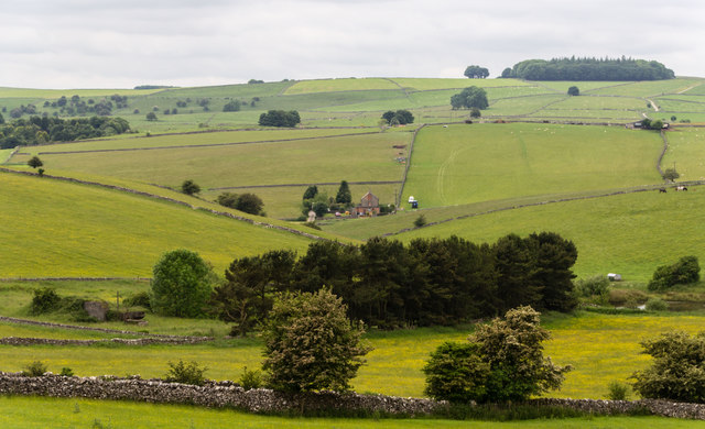
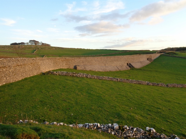
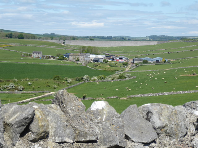
Gotham Plantation is a picturesque woodland area located in Derbyshire, England. Situated within the heart of the region, this sprawling plantation covers a vast area and is known for its dense forest and rich biodiversity. With its tranquil atmosphere and stunning natural beauty, it is a popular destination for nature enthusiasts and hikers.

The woodland in Gotham Plantation features a diverse range of tree species, including oak, beech, and birch, creating a lush and vibrant environment. The dense canopy provides ample shade, making it an ideal habitat for a variety of wildlife. Visitors may spot various bird species such as woodpeckers, owls, and thrushes, as well as small mammals like foxes, rabbits, and squirrels.

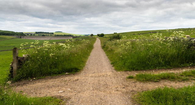
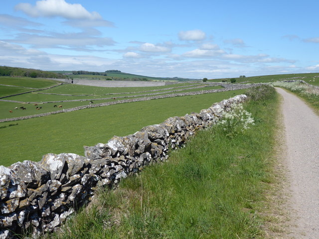
The plantation offers a network of well-maintained walking trails, allowing visitors to explore its natural wonders at their own pace. These trails wind through the forest, offering breathtaking views of the surrounding landscapes and opportunities to discover hidden gems, such as secluded ponds and clearings.

In addition to its natural beauty, Gotham Plantation also holds historical significance. It is believed to have been in existence since the medieval times, serving as a hunting ground for the local nobility. Remnants of old structures, such as stone walls and foundations, can still be found throughout the woodland, adding a touch of historical charm to the area.

Overall, Gotham Plantation in Derbyshire is a captivating destination that offers a tranquil escape into nature. Its lush forest, diverse wildlife, and historical remnants make it a must-visit location for both locals and tourists seeking a serene and enriching outdoor experience.

If you have any feedback on the listing, please let us know in the comments section below.

Gotham Plantation Images

Images are sourced within 2km of 53.119615/-1.7215054 or Grid Reference SK1858. Thanks to Geograph Open Source API. All images are credited.

Ruined sheepfold This old sheepfold is marked on the 1880 Ordnance Survey map but is now in ruins.
Ruined sheepfold
This old sheepfold is marked on the 1880 Ordnance Survey map but is now in ruins.
Dew pond and old quarry The quarry is in the background, in the next field.
Dew pond and old quarry
The quarry is in the background, in the next field.
Minninglow Concession Route There is no public footpath to the top of Minninglow but this concession route allows access for walkers.
Minninglow Concession Route
There is no public footpath to the top of Minninglow but this concession route allows access for walkers.
Minninglow Quarry siding The rails left in-situ can still be seen peeping through the turf on the line of the former quarry siding off the Cromford & High Peak Railway.
Minninglow Quarry siding
The rails left in-situ can still be seen peeping through the turf on the line of the former quarry siding off the Cromford & High Peak Railway.
High Peak Trail The High Peak Trail near Minninglow Quarry.
High Peak Trail
The High Peak Trail near Minninglow Quarry.
Minninglow Grange View of Minninglow Grange Farm.
Minninglow Grange
View of Minninglow Grange Farm.
Minninglow View from the High Peak Trail.
Minninglow
View from the High Peak Trail.
High Peak Trail The High Peak Trail.
High Peak Trail
The High Peak Trail.
Pasture above Minninglow Grange Farm Seen from The High Peak Trail
Pasture above Minninglow Grange Farm
Seen from The High Peak Trail
Abandoned quarrying machinery At the now disused Minninglow limestone quarry adjacent to The High Peak Trail.
Abandoned quarrying machinery
At the now disused Minninglow limestone quarry adjacent to The High Peak Trail.
Minninglow Embankment
Below Minninglow Minninglow is a low hill that has a Tumulus on it but also it has a circle of trees inside a low earthen wall.  This ring of trees can be seen from many miles away and it was thought it was created to be a landmark for travellers many, many, years ago.
Below Minninglow
Minninglow is a low hill that has a Tumulus on it but also it has a circle of trees inside a low earthen wall. This ring of trees can be seen from many miles away and it was thought it was created to be a landmark for travellers many, many, years ago.
Farm buildings at Roystone Grange
Long-abandoned quarrying machinery
The Pennine Bridleway near Minninglow Hill
The Pennine Bridleway near Minninglow Grange
Show me another place!

Gotham Plantation is located at Grid Ref: SK1858 (Lat: 53.119615, Lng: -1.7215054)

Administrative County: Derbyshire

District: Derbyshire Dales

Police Authority: Derbyshire

What 3 Words

///stealthier.jaws.ivory. Near Newhaven, Derbyshire

Nearby Locations

Gotham Plantation

Related Wikis

Gotham Curve

The Gotham Curve was once the sharpest curve on any standard gauge railway line in the UK. The curve, which was situated in the sparsely populated, exposed...

Pikehall

Pikehall is a small village in the Derbyshire Dales consisting of a few dozen households and a handful of farms. The population of the village is included...

Long Dale

Long Dale is a carboniferous limestone valley near the village of Elton, Derbyshire, in the Peak District of England. The dale is cut into the plateau...

Minninglow

Minninglow (or Minning Low) is a hill in the Peak District National Park in Derbyshire, located within the White Peak area at grid reference SK209573....

High Peak Trail

The High Peak Trail is a 17-mile (27 km) trail for walkers, cyclists and horse riders in the Peak District of England. Running from Dowlow (53.2059°N 1...

Newhaven, Derbyshire

Newhaven is a hamlet in the county of Derbyshire, England, east of Hartington and west of Cromford. The principal employer in the area is DSF Refractories...

Friden Goods Yard

Friden Goods Yard was a goods station located on the Cromford and High Peak Railway near the villages of Friden in Derbyshire. Mostly for moving mineral...

Friden, Derbyshire

Friden is a hamlet in the civil parish of Hartington Nether Quarter, Derbyshire, England. It is 11 miles (18 km) south-east of Buxton, just off the Newhaven...

Nearby Amenities

Located within 500m of 53.119615,-1.7215054
High Peak and Tissington Trails
Ele: 319
Information: board
Tourism: information
Lat/Long: 53.1231861/-1.7210212
Ele: 296.4499512
Lat/Long: 53.1232572/-1.7181911
Barrier: stile
Steps: 2
Stile: wall
Lat/Long: 53.1231918/-1.718149
Barrier: cattle_grid
Ele: 317.8392334
Lat/Long: 53.1231048/-1.7211249
Ele: 328.1732178
Lat/Long: 53.1229516/-1.7226683
Ele: 338
Lat/Long: 53.1237268/-1.724538
Ele: 333.9411621
Lat/Long: 53.1233276/-1.7238639
Barrier: stile
Steps: 3
Stile: wall
Lat/Long: 53.1190111/-1.7210309
Barrier: stile
Steps: 2
Stile: wall
Lat/Long: 53.1155989/-1.7202809
Barrier: stile
Steps: 2
Stile: stepover
Lat/Long: 53.1151905/-1.7201836
Barrier: stile
Material: stone
Source: survey;bing;gps
Stile: stepover
Lat/Long: 53.1171557/-1.7247116
Barrier: stile
Steps: 2
Stile: wall
Lat/Long: 53.1180038/-1.7211442
Barrier: stile
Steps: 2
Stile: wall
Lat/Long: 53.1167641/-1.7206501
Barrier: stile
Material: stone
Source: survey;gps
Steps: 1
Stile: stepover
Lat/Long: 53.1167044/-1.7206725
Barrier: stile
Steps: 3
Stile: wall
Lat/Long: 53.1224924/-1.7191729
Barrier: stile
Source: survey;gps
Stile: stepover
Lat/Long: 53.1230715/-1.7226094
Barrier: stile
Steps: 3
Stile: wall
Lat/Long: 53.1225323/-1.7189571
The data included in this document is from www.openstreetmap.org. The data is made available under ODbL.

Have you been to Gotham Plantation?

Leave your review of Gotham Plantation below (or comments, questions and feedback).