Sole Beck Plantation

Wood, Forest in Yorkshire Harrogate

England

Sole Beck Plantation

Road junction near Ilton Straight on for Ilton and left for Cindra How.
Road junction near Ilton Credit: Maigheach-gheal

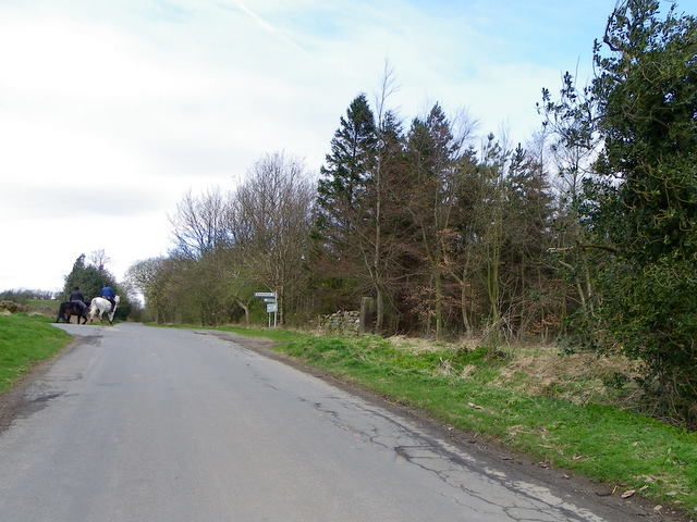
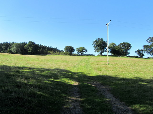
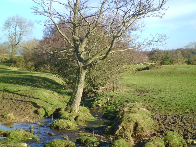
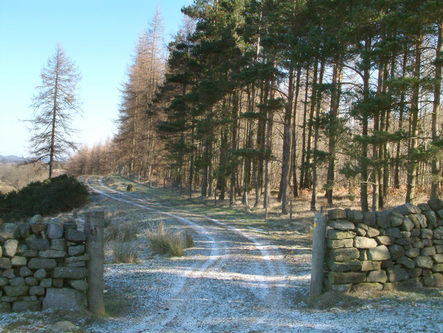
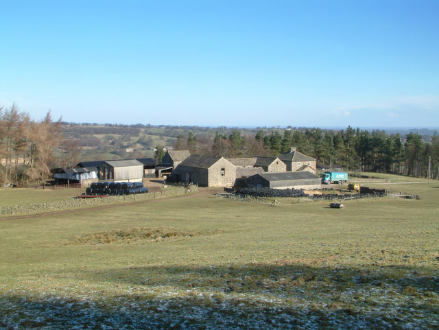
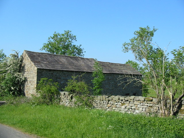
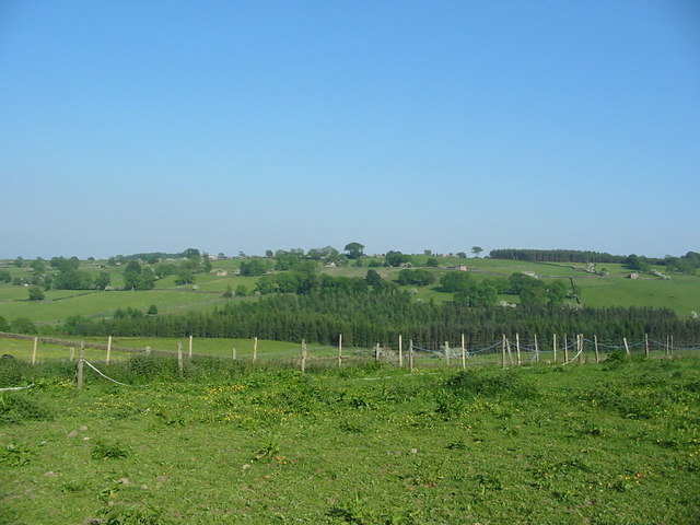
Sole Beck Plantation is a picturesque woodland located in Yorkshire, England. Nestled amidst the rolling hills and verdant landscapes, this forested area spans approximately 500 acres, making it a significant natural attraction in the region. The plantation mainly consists of a diverse range of deciduous trees, including oak, beech, and birch, which create a lush and vibrant environment throughout the year.

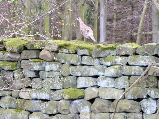
As visitors explore Sole Beck Plantation, they are greeted by a tranquil ambiance and a rich biodiversity. The woodland provides a habitat for various wildlife species, such as deer, foxes, and a plethora of bird species, making it a popular spot for nature enthusiasts and birdwatchers. The forest floor is also adorned with an array of wildflowers, adding bursts of color to the already picturesque surroundings.

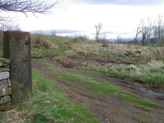
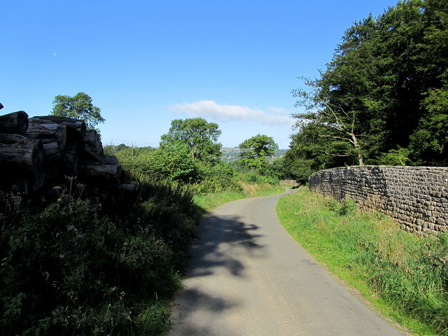
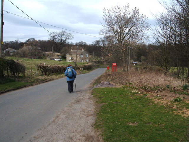
Several walking trails wind their way through the plantation, allowing visitors to immerse themselves in its natural beauty. These well-maintained paths provide an opportunity for leisurely strolls, jogging, or even cycling, catering to a wide range of outdoor enthusiasts. Additionally, the plantation offers designated picnic areas, encouraging visitors to take a break and enjoy a peaceful meal amidst the stunning scenery.

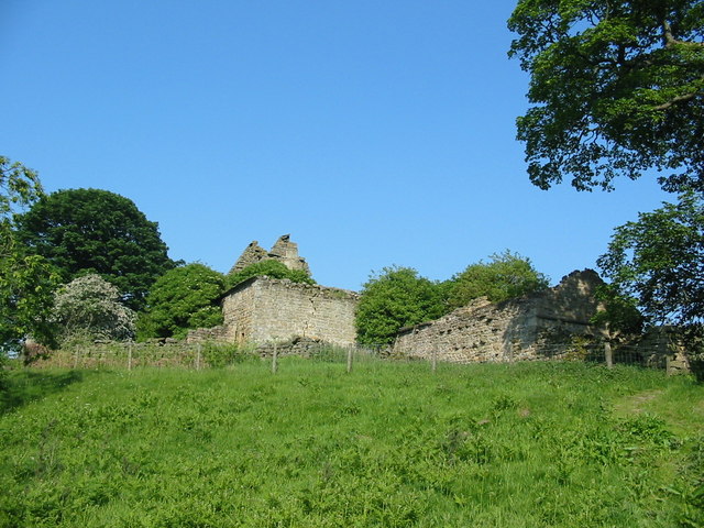
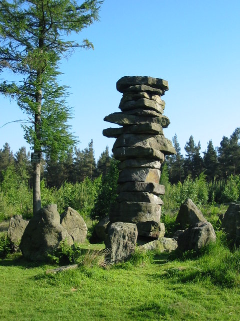
Sole Beck Plantation also holds historical significance, with ancient ruins of a medieval castle nestled within its boundaries. The remnants of the castle serve as a reminder of the area's rich heritage and add an element of intrigue to the overall experience.

Overall, Sole Beck Plantation is an enchanting woodland sanctuary that offers a serene escape from the hustle and bustle of everyday life. Whether it be for a leisurely walk, wildlife spotting, or a picnic amidst nature, this Yorkshire gem is sure to captivate visitors with its natural beauty and historical charm.

If you have any feedback on the listing, please let us know in the comments section below.

Sole Beck Plantation Images

Images are sourced within 2km of 54.201354/-1.7176307 or Grid Reference SE1878. Thanks to Geograph Open Source API. All images are credited.

Road junction near Ilton Straight on for Ilton and left for Cindra How.
Road junction near Ilton
Straight on for Ilton and left for Cindra How.
Post, Warrener Wood On the stone post is an Ordnance Survey bench mark.
Post, Warrener Wood
On the stone post is an Ordnance Survey bench mark.
Bench Mark, Warrener Wood At the base of the stone post is an Ordnance Survey bench mark.  For a view of the post <a href="https://www.geograph.org.uk/photo/2544030">SE2078 : Post, Warrener Wood</a> and for further information on the bench mark and others in the area <span class="nowrap"><a title="http://www.bench-marks.org.uk/bm39028" rel="nofollow ugc noopener" href="http://www.bench-marks.org.uk/bm39028">Link</a><img style="margin-left:2px;" alt="External link" title="External link - shift click to open in new window" src="https://s1.geograph.org.uk/img/external.png" width="10" height="10"/></span>
Bench Mark, Warrener Wood
At the base of the stone post is an Ordnance Survey bench mark. For a view of the post SE2078 : Post, Warrener Wood and for further information on the bench mark and others in the area LinkExternal link
Hen pheasant, Warrener Wood Among the most savoury of game birds, pheasants provide sport by flying strongly and directly over guns. When otherwise disturbed, they tend to run away rather than fly. Rearing and protecting them, organising shoots has become a major rural industry.

Pheasants, first recorded in England in 1059, are now widespread throughout Britain and Ireland. One theory is that they were introduced by the Romans from Asia. The common pheasant derives from the Chinese ring-necked, black-necked and Mongolian breeds, and accordingly varies in plumage. This has produced two forms - those with a white neck-ring and those without. 

Pheasants are ground dwelling birds, vulnerable to foxes, stoats, weasels and other predators. Due to the efforts of gamekeepers, who also supply winter feeding, pheasants survive in larger numbers than would be possible if they were left to fend for themselves.

The pheasant shooting season starts on October 1st, but in practice very few pheasants are shot before the end of October and indeed the size and quality can be poor during that month. The glut of birds tends to start about two weeks into November.
Hen pheasant, Warrener Wood
Among the most savoury of game birds, pheasants provide sport by flying strongly and directly over guns. When otherwise disturbed, they tend to run away rather than fly. Rearing and protecting them, organising shoots has become a major rural industry. Pheasants, first recorded in England in 1059, are now widespread throughout Britain and Ireland. One theory is that they were introduced by the Romans from Asia. The common pheasant derives from the Chinese ring-necked, black-necked and Mongolian breeds, and accordingly varies in plumage. This has produced two forms - those with a white neck-ring and those without. Pheasants are ground dwelling birds, vulnerable to foxes, stoats, weasels and other predators. Due to the efforts of gamekeepers, who also supply winter feeding, pheasants survive in larger numbers than would be possible if they were left to fend for themselves. The pheasant shooting season starts on October 1st, but in practice very few pheasants are shot before the end of October and indeed the size and quality can be poor during that month. The glut of birds tends to start about two weeks into November.
Pasture to the South of Swinton Park As seen from the lane outside the perimeter of Swinton Park
Pasture to the South of Swinton Park
As seen from the lane outside the perimeter of Swinton Park
Lane by the Perimeter of Swinton Park The park is surrounded by a very long perimeter wall, part of which is followed by this lane
Lane by the Perimeter of Swinton Park
The park is surrounded by a very long perimeter wall, part of which is followed by this lane
Minor road near Ilton Part of the network of minor roads to the west of Grewelthorpe. The road links scattered farms and settlements, and carries little traffic. Ilton Grange Farm in the distance.
Minor road near Ilton
Part of the network of minor roads to the west of Grewelthorpe. The road links scattered farms and settlements, and carries little traffic. Ilton Grange Farm in the distance.
Den Beck Tiny stream flowing off the moor and down to join the River Burn near Masham.
Den Beck
Tiny stream flowing off the moor and down to join the River Burn near Masham.
Druids Temple near Ilton. This folly was created by William Danby (1752 - 1833) to relieve some of the unemployment in the area.
Druids Temple near Ilton.
This folly was created by William Danby (1752 - 1833) to relieve some of the unemployment in the area.
Bridge near Swinton Park over looking the River Burn
Bridge near Swinton Park
over looking the River Burn
Near Ilton. A view looking north east along the pathway skirting the woods close to Ilton and below High Knowle.
Near Ilton.
A view looking north east along the pathway skirting the woods close to Ilton and below High Knowle.
Low Knowle Farm near Ilton.
"The Druids Temple" This folly was built in the 1820s.
"The Druids Temple"
This folly was built in the 1820s.
Bridge with castellations near Swinton Park Bridge with castellations near Swinton Park
Bridge with castellations near Swinton Park
The ruin of Lobley Hall
Farm buildings on roadside at SE186787
View south east from High Knowle
High stone pillar adjacent to the Druid's Temple near Ilton
Show me another place!

Sole Beck Plantation is located at Grid Ref: SE1878 (Lat: 54.201354, Lng: -1.7176307)

Division: North Riding

Administrative County: North Yorkshire

District: Harrogate

Police Authority: North Yorkshire

What 3 Words

///column.stolen.absorbs. Near Masham, North Yorkshire

Nearby Locations

Sole Beck Plantation Ilton

Related Wikis

Ilton, North Yorkshire

Ilton is a village in North Yorkshire, England, 3 miles south-west of Masham. It is the principal settlement in the civil parish of Ilton cum Pott, in...

Colsterdale Light Railway

The Colsterdale Light Railway (CLR) was a narrow-gauge railway line in Colsterdale, North Yorkshire, England. It was built between 1903 and 1905 to allow...

Healey, North Yorkshire

Healey is a small village and civil parish in the Harrogate district of North Yorkshire, England. It is situated in the valley of the River Burn, to the...

Warthermarske

Warthermarske is a hamlet in the Harrogate borough of North Yorkshire, England. It is near Swinton, about 1 mile (2 km) south-west of Masham. The village...

Leighton, North Yorkshire

Leighton is a hamlet in the civil parish of Healey in the Harrogate district of North Yorkshire, England. It is near Leighton Reservoir that provides for...

Swinton with Warthermarske

Swinton with Warthermarske is a civil parish in Harrogate district, North Yorkshire, England. The parish includes the village of Swinton and the hamlets...

Leighton Reservoir

Leighton Reservoir is a reservoir which drains via the River Burn to the River Ure in North Yorkshire, England. It neighbours Roundhill Reservoir and is...

Swinton Estate

The Swinton Estate is a large privately owned estate in North Yorkshire, England. It comprises some 20,000 acres (8,100 ha) of countryside in the Nidderdale...

Nearby Amenities

Located within 500m of 54.201354,-1.7176307
Building: yes
Lat/Long: 54.1996805/-1.7121071
Building: yes
Lat/Long: 54.1983949/-1.7159095
Building: yes
Lat/Long: 54.1995371/-1.7152657
Building: yes
Lat/Long: 54.2006543/-1.7118969
Place: farm
Lat/Long: 54.2010685/-1.7109313
Telephone
Booth: K6
Covered: booth
Lat/Long: 54.2005303/-1.7110724
The data included in this document is from www.openstreetmap.org. The data is made available under ODbL.

Have you been to Sole Beck Plantation?

Leave your review of Sole Beck Plantation below (or comments, questions and feedback).