Three Corner Copse

Wood, Forest in Gloucestershire Cotswold

England

Three Corner Copse

A large barley field A large barley field to the east of Aldsworth.
A large barley field Credit: Philip Halling

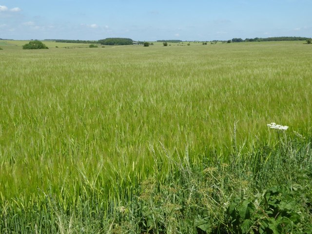
Three Corner Copse is a picturesque woodland located in Gloucestershire, England. Covering an area of approximately 50 acres, it is nestled within the beautiful Forest of Dean. The copse is renowned for its lush greenery, diverse wildlife, and tranquil atmosphere, attracting nature enthusiasts and visitors from near and far.

The woodland is predominantly composed of native deciduous trees, including oak, beech, and birch. These trees provide a dense canopy that filters sunlight, creating a cool and shaded environment. Underneath, a rich undergrowth thrives, consisting of ferns, bluebells, and wild garlic, adding to the copse's natural charm.

Three Corner Copse is home to a wide range of fauna. Birds such as woodpeckers, owls, and thrushes can be spotted flitting between the branches. Squirrels scurry along the forest floor, while foxes and badgers roam at dawn and dusk. The copse is also known for its diverse insect population, including butterflies, bees, and various beetles.

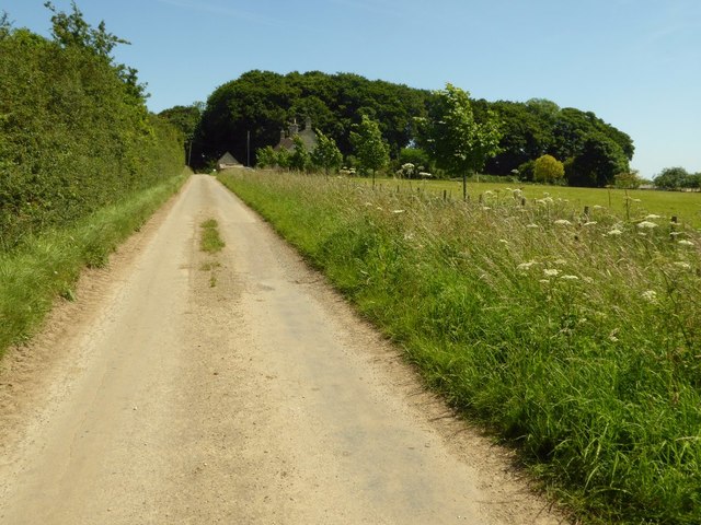
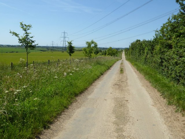
Visitors to Three Corner Copse can enjoy leisurely walks along the well-maintained footpaths that wind through the woodland. The copse is also a popular spot for picnics, with several designated areas providing picnic tables and benches. For those seeking a more immersive experience, camping facilities are available nearby, allowing visitors to spend a night under the stars while surrounded by the peaceful sounds of nature.

Overall, Three Corner Copse in Gloucestershire offers a serene and idyllic setting for individuals looking to escape the hustle and bustle of everyday life and immerse themselves in the beauty of nature.

If you have any feedback on the listing, please let us know in the comments section below.

Three Corner Copse Images

Images are sourced within 2km of 51.796711/-1.7427427 or Grid Reference SP1710. Thanks to Geograph Open Source API. All images are credited.

A large barley field A large barley field to the east of Aldsworth.
A large barley field
A large barley field to the east of Aldsworth.
Approaching Ladbarrow Farm Ladbarrow Farm is at the end of a no through road to the east of the village of Aldsworth.
Approaching Ladbarrow Farm
Ladbarrow Farm is at the end of a no through road to the east of the village of Aldsworth.
Power lines crossing the Cotswolds Power lines crossing the Cotswolds landscape and this no through road providing access to Ladbarrow Farm.
Power lines crossing the Cotswolds
Power lines crossing the Cotswolds landscape and this no through road providing access to Ladbarrow Farm.
Ladbarrow Farm
Ladbarrow Farm
Drive to Barrington Downs Farm
Lad Barrow long barrow Lad Barrow long barrow is visible in this photograph as a light yellow line in the middle of this field. "The barrow is orientated east-west but has been much distorted by previous cultivation and now appears almost circular in plan. The mound is 40 m long and 34 m wide at the centre where it reaches a maximum height of 0.7 m. Although no longer visible on the surface, quarry ditches will flank either side of the mound and will survive as buried features 3 m wide. Early reports record two earthfast stones at the east end of the mound which may have formed part of a terminal chamber or blind entrance, but these are no longer visible." <span class="nowrap"><a title="https://historicengland.org.uk/listing/the-list/list-entry/1018162" rel="nofollow ugc noopener" href="https://historicengland.org.uk/listing/the-list/list-entry/1018162">Link</a><img style="margin-left:2px;" alt="External link" title="External link - shift click to open in new window" src="https://s1.geograph.org.uk/img/external.png" width="10" height="10"/></span> <span class="nowrap"><a title="https://www.megalithic.co.uk/article.php?lat=51.78818&lon=-1.77149" rel="nofollow ugc noopener" href="https://www.megalithic.co.uk/article.php?lat=51.78818&lon=-1.77149">Link</a><img style="margin-left:2px;" alt="External link" title="External link - shift click to open in new window" src="https://s1.geograph.org.uk/img/external.png" width="10" height="10"/></span>
Lad Barrow long barrow
Lad Barrow long barrow is visible in this photograph as a light yellow line in the middle of this field. "The barrow is orientated east-west but has been much distorted by previous cultivation and now appears almost circular in plan. The mound is 40 m long and 34 m wide at the centre where it reaches a maximum height of 0.7 m. Although no longer visible on the surface, quarry ditches will flank either side of the mound and will survive as buried features 3 m wide. Early reports record two earthfast stones at the east end of the mound which may have formed part of a terminal chamber or blind entrance, but these are no longer visible." LinkExternal link LinkExternal link
Track leading east from Stone Barn, near Aldsworth There is a 151 metre spot height in the foreground. before the converted field barn became a wedding venue, it was called Blackpits Barn.
Track leading east from Stone Barn, near Aldsworth
There is a 151 metre spot height in the foreground. before the converted field barn became a wedding venue, it was called Blackpits Barn.
The B4425, Barrington
Field by the B4425, Barrington Downs
Old Milestone by the B4425, Aldsworth Parish Carved stone post by the B4425, in parish of ALDSWORTH (COTSWOLD District), East of Aldsworth, near disused quarry on North side of road. Bibury marker, erected by the Bibury & Dancy's Fancy turnpike trust in the 19th century. 

Inscription once read:-
(Burford)
(6)
(Cirencester)
(11) 
Carved bench mark and rivet on top.

Milestone Society National ID: GL_CIBF11.
Old Milestone by the B4425, Aldsworth Parish
Carved stone post by the B4425, in parish of ALDSWORTH (COTSWOLD District), East of Aldsworth, near disused quarry on North side of road. Bibury marker, erected by the Bibury & Dancy's Fancy turnpike trust in the 19th century. Inscription once read:- (Burford) (6) (Cirencester) (11) Carved bench mark and rivet on top. Milestone Society National ID: GL_CIBF11.
Old Milestone by the B4425, east of Aldsworth, Windrush parish Carved stone post by the B4425, in parish of WINDRUSH (COTSWOLD District), New Covert, by the North side of road, near lay-by. Bibury marker, erected by the Bibury & Dancy's Fancy turnpike trust in the 19th century. 

Inscription once read:-
(Cirencester)
(12)
(Burford)
(5) 

Milestone Society National ID: GL_CIBF12.
Old Milestone by the B4425, east of Aldsworth, Windrush parish
Carved stone post by the B4425, in parish of WINDRUSH (COTSWOLD District), New Covert, by the North side of road, near lay-by. Bibury marker, erected by the Bibury & Dancy's Fancy turnpike trust in the 19th century. Inscription once read:- (Cirencester) (12) (Burford) (5) Milestone Society National ID: GL_CIBF12.
Cotswold : The A40 Heading along the A40.
Cotswold : The A40
Heading along the A40.
Cotswold : Little Windrush Looking across to a development beside the A40.
Cotswold : Little Windrush
Looking across to a development beside the A40.
The B road to Aldsworth near Doves Cottages
Doves Cottages, near Barrington Downs Farm
Public bridleway towards Rangehill Copse
Barns near Rangehill Copse
Show me another place!

Three Corner Copse is located at Grid Ref: SP1710 (Lat: 51.796711, Lng: -1.7427427)

Administrative County: Gloucestershire

District: Cotswold

Police Authority: Gloucestershire

What 3 Words

///flinches.gums.driver. Near Northleach, Gloucestershire

Related Wikis

Windrush, Gloucestershire

Windrush is a village and civil parish in Gloucestershire, England, approximately five miles southeast of Northleach. It lies in the Cotswolds on the River...

RAF Windrush

Royal Air Force Windrush, or more simply RAF Windrush, is a former Royal Air Force satellite station near Windrush, Gloucestershire, England. It was opened...

Church of St Peter, Windrush

The Anglican Church of St Peter at Windrush in the Cotswold District of Gloucestershire, England was built in the 12th century. It is a grade I listed...

Church of St Bartholomew, Aldsworth

The Anglican Church of St Bartholomew at Aldsworth in the Cotswold District of Gloucestershire, England was built in the late 12th century. It is a grade...

Aldsworth

Aldsworth is a village and civil parish in the Cotswold district of Gloucestershire, about ten miles north-east of Cirencester. In 2010 its population...

Lodge Park and Sherborne Estate

Lodge Park was built as a grandstand in the Sherborne Estate near the villages of Sherborne, Aldsworth and Northleach in Gloucestershire, England. The...

Church of St Peter, Little Barrington

The Anglican Church of St Peter at Little Barrington in the civil parish of Barrington in the Cotswold District of Gloucestershire, England was built in...

Sherborne, Gloucestershire

Sherborne is a village and civil parish almost 3.5 miles (5.6 km) east of Northleach in Gloucestershire. Sherborne is a linear village, extending more...

Have you been to Three Corner Copse?

Leave your review of Three Corner Copse below (or comments, questions and feedback).