Thornley Wood

Wood, Forest in Durham

England

Thornley Wood

Monument at Gibside
Monument at Gibside Credit: Clive Nicholson

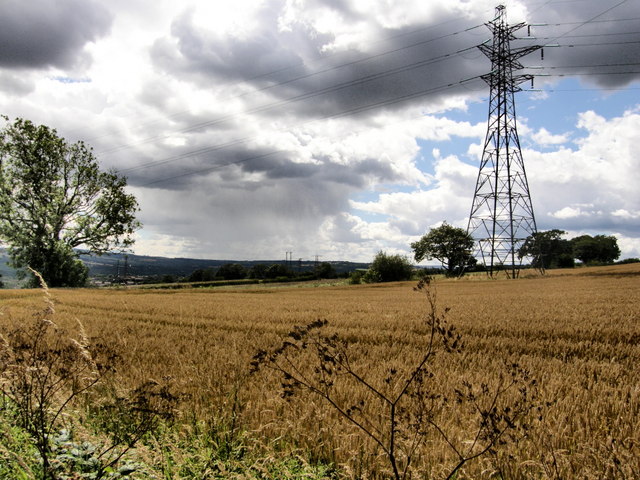
Thornley Wood is a picturesque forest located in Durham, England. Covering an area of approximately 100 acres, it is a haven for nature enthusiasts and hikers alike. The wood is situated near the village of Thornley, which adds to its charm and accessibility.

The forest is predominantly composed of broadleaf trees, including oak, ash, and beech, which create a beautiful canopy that provides shade during the summer months. The woodland floor is covered with a variety of wildflowers, ferns, and mosses, creating a vibrant and diverse ecosystem.

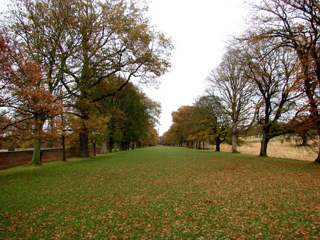
Thornley Wood is known for its well-maintained walking trails that wind through the forest, allowing visitors to explore its natural beauty. These trails cater to all levels of fitness and offer opportunities for leisurely strolls or more challenging hikes. The forest also features designated picnic areas, making it an ideal spot for families and friends to enjoy a day out in nature.

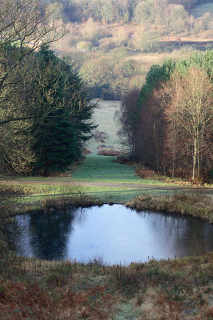
The wood is home to a wide range of wildlife, including deer, squirrels, and various bird species. It is a popular destination for birdwatchers, who can catch glimpses of woodpeckers, owls, and other avian species. The peaceful atmosphere and abundant wildlife make Thornley Wood an excellent location for photographers and nature enthusiasts.

Thornley Wood is easily accessible, with ample parking available nearby. It is open to the public year-round, and admission is free. Whether you are seeking tranquility, exercise, or a connection with nature, Thornley Wood offers a serene and beautiful environment to explore and enjoy.

If you have any feedback on the listing, please let us know in the comments section below.

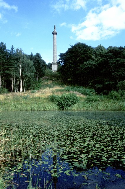
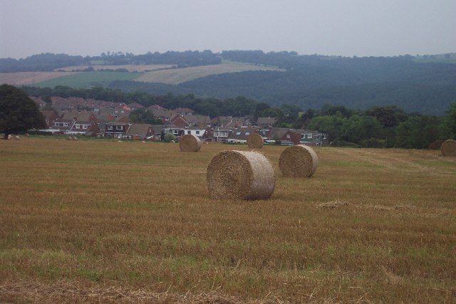
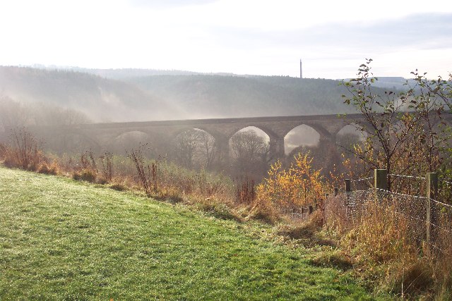
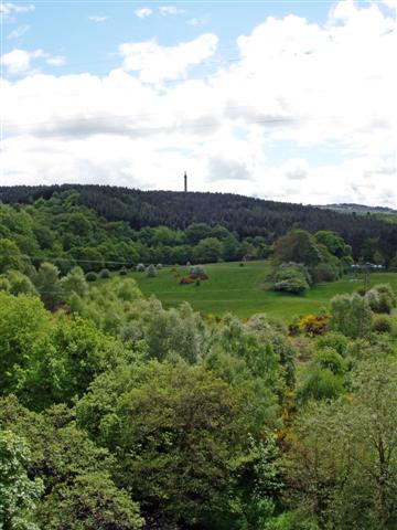
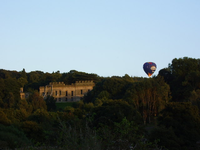
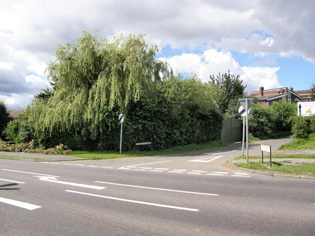
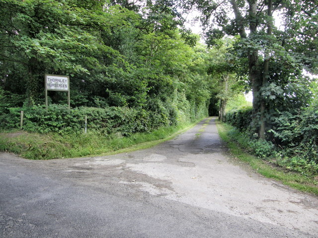
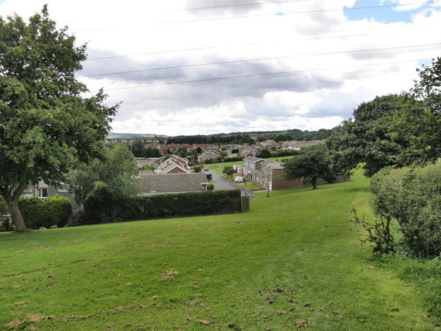
Thornley Wood Images

Images are sourced within 2km of 54.940237/-1.7231585 or Grid Reference NZ1760. Thanks to Geograph Open Source API. All images are credited.

Monument at Gibside
Monument at Gibside
Far Pastures A nature reserve home to newly released Red Kites
Far Pastures
A nature reserve home to newly released Red Kites
View to south over Lockhaugh Estate and toward Gibside Right on the rural-urban fringe. This typical cereal field was once four smaller fields. The stubble left behind after harvest is irresistible to a variety of birds.
View to south over Lockhaugh Estate and toward Gibside
Right on the rural-urban fringe. This typical cereal field was once four smaller fields. The stubble left behind after harvest is irresistible to a variety of birds.
Looking south to Nine Arches Viaduct from Goodshieldhaugh Hill Part of the Derwent Country Park. A not-so-little gem!
Looking south to Nine Arches Viaduct from Goodshieldhaugh Hill
Part of the Derwent Country Park. A not-so-little gem!
Snipes Dean Wood and Gibside Taken from the viaduct over the River Derwent on the Derwent Walk.  Sticking up on the horizon is the 'Monument to Liberty' (50m high) in the grounds of Gibside.
More info: <span class="nowrap"><a title="http://www.nationaltrust.org.uk/main/w-vh/w-visits/w-findaplace/w-gibside.htm" rel="nofollow ugc noopener" href="http://www.nationaltrust.org.uk/main/w-vh/w-visits/w-findaplace/w-gibside.htm">Link</a><img style="margin-left:2px;" alt="External link" title="External link - shift click to open in new window" src="https://s1.geograph.org.uk/img/external.png" width="10" height="10"/></span>
Snipes Dean Wood and Gibside
Taken from the viaduct over the River Derwent on the Derwent Walk. Sticking up on the horizon is the 'Monument to Liberty' (50m high) in the grounds of Gibside. More info: LinkExternal link
Gibside Estate Monument High point within this extensive National Trust property. Worth the climb.
<span class="nowrap"><a title="http://www.nationaltrust.org.uk/main/w-vh/w-visits/w-findaplace/w-gibside/" rel="nofollow ugc noopener" href="http://www.nationaltrust.org.uk/main/w-vh/w-visits/w-findaplace/w-gibside/">Link</a><img style="margin-left:2px;" alt="External link" title="External link - shift click to open in new window" src="https://s1.geograph.org.uk/img/external.png" width="10" height="10"/></span>
Gibside Estate Monument
High point within this extensive National Trust property. Worth the climb. LinkExternal link
Hot air balloon by Gibside Hall near Rowlands Gill on a September evening
Hot air balloon by Gibside Hall
near Rowlands Gill on a September evening
Swans at Far Pasture pond
Entrance to Hollinhill Lane
Sherburn Estate - Rowlands Gill
Entrance to Thornley Nurseries
Sherburn Estate - Rowlands Gill
Field and Pylon
Field and Pylon
Avenue of Trees, Gibside
Looking Down from the Column of Liberty to Lady Haugh Lady Haugh is the water meadow in the flood plain of the River Derwent.
Looking Down from the Column of Liberty to Lady Haugh
Lady Haugh is the water meadow in the flood plain of the River Derwent.
Wet Area at the North end of Lady Haugh
Riverside Path at Lady Haugh The footpath that follows the River Derwent through the water meadow known as Lady Haugh, part of the National Trust's Gibside estate.
Riverside Path at Lady Haugh
The footpath that follows the River Derwent through the water meadow known as Lady Haugh, part of the National Trust's Gibside estate.
Lady Haugh The name given to the water meadow alongside the River Derwent that was created as part of the vista for Gibside Hall. In the distance, outside this square, two of the nine arches of the viaduct over the river can be seen.
Lady Haugh
The name given to the water meadow alongside the River Derwent that was created as part of the vista for Gibside Hall. In the distance, outside this square, two of the nine arches of the viaduct over the river can be seen.
Show me another place!

Thornley Wood is located at Grid Ref: NZ1760 (Lat: 54.940237, Lng: -1.7231585)

Unitary Authority: Gateshead

Police Authority: Northumbria

What 3 Words

///boot.moss.panic. Near Rowlands Gill, Tyne & Wear

Related Wikis

Winlaton Mill

Winlaton Mill is a village in Tyne and Wear, North East England. It is not to be confused with Winlaton to the northwest which now comprises the southern...

Blaydon (UK Parliament constituency)

Blaydon is a constituency represented in the House of Commons since 2017 by Liz Twist of the Labour Party.The seat is due to be abolished for the next...

Derwent Park (Rowlands Gill)

Derwent Park is situated in Rowlands Gill, Tyne and Wear, England. The park is often incorrectly called Rowlands Gill Park as a result. The park has a...

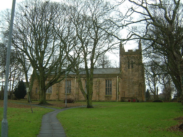
St Paul's Church, Winlaton

St Paul's Church is a 19th-century church in Winlaton, Tyne and Wear, England, dedicated to St Paul. It is a Grade II listed building. == History == The...

Nearby Amenities

Located within 500m of 54.940237,-1.7231585
Bus Stop
HOLLY AVENUE-W/B
Local Ref: W
Naptan AtcoCode: 410000013148
Naptan Bearing: W
Naptan CommonName: HOLLY AVENUE-W/B
Naptan Indicator: W
Naptan Landmark: OUTSIDE NO.68 HOLLY AVENUE
Naptan NaptanCode: twrawdma
Naptan PlusbusZoneRef: NWCSTLE
Naptan Street: HOLLY AVENUE
Naptan Verified: no
Source: naptan_import
Lat/Long: 54.9425578/-1.716765
Bus Stop
MUNDLE AVENUE-N/B
Local Ref: N
Naptan AtcoCode: 410000013149
Naptan Bearing: N
Naptan CommonName: MUNDLE AVENUE-N/B
Naptan Indicator: N
Naptan Landmark: JUNCTION WITH HOLLY AVENUE JUNCTION
Naptan NaptanCode: twrawdmd
Naptan PlusbusZoneRef: NWCSTLE
Naptan Street: MUNDLE AVENUE
Naptan Verified: no
Source: naptan_import
Lat/Long: 54.9428281/-1.7170753
Bus Stop
Lockhaugh Road-Glamis Crescent
Bus: yes
Local Ref: N
Naptan AtcoCode: 410000013170
Naptan Bearing: NE
Naptan Indicator: NE-Bound
Naptan Landmark: Opposite Thornley Woodland Centre Entrance
Naptan NaptanCode: twrawdtg
Naptan Street: A694
Naptan Verified: no
Public Transport: platform
Shelter: yes
Source: naptan_import
Lat/Long: 54.9382056/-1.7233981
Bus Stop
Lockhaugh Road-Glamis Crescent
Bench: no
Bus: yes
Local Ref: S
Naptan AtcoCode: 410000013171
Naptan Bearing: SW
Naptan Indicator: SW-Bound
Naptan Landmark: Outside Thornley Woodland Centre Entrance
Naptan NaptanCode: twrawdtj
Naptan Street: Lockhaugh Road
Naptan Verified: no
Public Transport: platform
Shelter: no
Source: naptan_import
Lat/Long: 54.9380792/-1.7231336
Bus Stop
THORNLEY WOODLAND CENTRE
Local Ref: S
Naptan AtcoCode: 410000060775
Naptan Bearing: S
Naptan CommonName: THORNLEY WOODLAND CENTRE
Naptan Indicator: S
Naptan Landmark: OUTSIDE VISITOR CENTRE
Naptan NaptanCode: twrgtmwa
Naptan Street: LOCKHAUGH ROAD
Naptan Verified: no
Source: naptan_import
Lat/Long: 54.9380696/-1.7228683
Power: tower
Lat/Long: 54.9442902/-1.7237441
Bench
Lat/Long: 54.9366792/-1.7203075
Bench
Lat/Long: 54.9382715/-1.7168487
Bench
Lat/Long: 54.9377289/-1.7192478
Power: tower
Lat/Long: 54.9442496/-1.7253672
Power: tower
Lat/Long: 54.9446439/-1.7224667
Barrier: motorcycle_barrier
Lat/Long: 54.943043/-1.720368
Thornley Wood feeding station and hide
Access: customers
Leisure: bird_hide
Note: Key hired from visitor centres
Lat/Long: 54.9389141/-1.7245015
Cafe
Thornley Woodlands Centre Cafe
Cuisine: cake;coffee_shop;tea
Lat/Long: 54.9380351/-1.7226975
Entrance: yes
Lat/Long: 54.9380856/-1.7227819
Toilets
Lat/Long: 54.9380635/-1.7227453
Tourism: viewpoint
Lat/Long: 54.9390243/-1.7173896
The data included in this document is from www.openstreetmap.org. The data is made available under ODbL.

Have you been to Thornley Wood?

Leave your review of Thornley Wood below (or comments, questions and feedback).